
Day 6 Lick Log Campsite to Warwoman Creek
More from this trailI'm walkin' back to Georgia
Today was the end of our hike on the Foothills Trail, though we wouldn't finish the FHT and weren't done with our hike. Polecat, Sasquatch, and I planned to leave the trail 8.2 miles short of its western terminus. Instead of completing those miles, we wanted to follow a 4.5-mile connecting trail leading to Russell Bridge.
Polecat and I intended to also hike the Blue Ridge Bartram Trail. Sasquatch already hiked it, so after leaving us, he will drive to Atlanta and spend time with his family. Sasquatch parked his car near the bridge on Day 1, and that happens to be the southern terminus of the Bartram.
The only downside of our plan was skipping part of the Foothills Trail. I'm sure we would have enjoyed hiking the whole trail, but following a continuous footpath for 200 miles was more appealing.
The only hiccup in our plan for the day happened first thing in the morning, and it didn't matter at all. Sasquatch woke up late because he forgot to set his alarm.
As it was, we didn't get a late start to the morning. He didn't need much time to pack his gear, and we left our campsite at 8 a.m. That was the same time as yesterday.

Getting lost in weeds
We only needed to walk a tenth of a mile from our campsite before turning onto the side trail to Russell Bridge. We didn't know much about this trail because it wasn't included in the FarOut app. We didn't know if the trail was used much and there was no way to tell if it was well-maintained.
That didn't look promising at first. As soon as we made the turn we found the trail overgrown with tall weeds and had to bushwhack our way through it. The weeds were so bad we lost the footpath for a short time.

Pigpen Falls
Or at least we thought we lost it. We might not have been on the footpath at all and could have been following an animal trail or a manway. At any rate, we didn't have to hack our way for long before we arrived at a waterfall.
Mistakes sometimes slip into the FarOut app, and I discovered one here. The app misidentified this waterfall as Lick Log Falls, but the correct name was Pigpen Falls. Lick Log Falls was nearby but not at this spot.

Walking across a footbridge
After crossing a small stream, we headed toward the Chattooga River. The trail was now clear and much easier to follow.

Lick Log Falls
Just before reaching the river, the trail took us past and above the true location of Lick Log Falls. This waterfall had two drops. The first flowed 30 feet down to a pool and the second was 50 feet tall. At the bottom of these, the creek emptied into the river.
The trail made a turn at the river and began following it. The terrain and foliage sometimes kept us from seeing the river the whole way, but we stayed more or less adjacent to it until we arrived at Russell Bridge.

Overgrown trail
A few campsites could be seen from the trail. They were next to the river and most were occupied. None of the campers there appeared to be leaving soon.
Even though we came upon a few places where the trail was overgrown, they were never as bad as before. We never lost sight of the footpath.

Chattooga River
Where the river could be seen, it was shallow and placid. It didn't look anything like the whitewater sections of the Chattooga familiar to anyone who has seen the film Deliverance.
Just before we got to the end of the connecting trail at Russell Bridge, we came upon a nasty obstacle. Three trees had fallen together across the trail. Crawling over them required the most effort I'd had to exert on this hike.

Polecat enters a coffee house
When we got to the trailhead and parking lot at 10:15 a.m., Sasquatch, Polecat, and I decided we were hungry. A Google search led us to a coffee shop that was surprisingly close by.
The coffee was good, but there wasn't much food sold there. With more googling, we found Trailhead Tavern, about 12 miles away in the town of Walhalla. The burgers, fries, and beer were a better match for the hunger built up after five days of hiking.

Sorting
Polecat and I left a box of food in Sasquatch's car on Day 1. It was our resupply for the Bartram Trail and was enough to get us from Russell Bridge to Franklin, North Carolina. We were conservative in planning our mileage and figured that part of the trail would take at least five days to walk.
Instead of trying to repack the food from the back of the car, we stopped on our way back to Russell Bridge to do that at a picnic area. As I loaded the new food into my pack, I wondered if I had overpacked. My pack weighed much more than I wanted to carry. Maybe we were too conservative in our mileage estimate.

Polecat, Sasquatch, and Gravity
We arrived at the bridge close to 3 p.m. and said goodbye to Sasquatch. Our few days of hiking with him were fun, and I was glad he made the trip from Colorado to join us.

Starting the Bartram Trail
Polecat and I walked across Highway 28 and began the next leg of our hike. The southern terminus of the Bartram Trail was just steps away from the parking lot at the bridge. From here, we began walking in Georgia.

A wide trail
The trail's full name is the Blue Ridge Bartram Trail. This differentiates the name from other trails that honor naturalist William Bartram in Alabama, Florida, and other southeastern states.
Bartram made a four-year trek to document plants and wildlife in what is now North and South Carolina, Georgia, Florida, Alabama, Mississippi, Louisiana, and Tennessee. During his walk starting in March 1773, he collected samples of many plants previously unknown to the scientific world. Some, like the Franklin tree (Franklinia alatamaha), would not exist today if he hadn't collected seeds from them during his journey.

West Fork Chattooga River
The first few miles of the trail followed a mostly flat route. Soon after we started, we crossed the shallow, placid West Fork Chattooga River, a tributary of the Chattooga.
We then turned to follow the river's main stem for most of the remainder of the day.
Tall trees
We passed through a mix of tall and slender hardwood trees, including beech, oak, sourwood, and maple. The leaves of only a few had changed into their fall colors.

A trail that used to be an old road
Much of the time, the trail took the path of an old road. It sometimes veered away from the river. Though out of view, the river continued to be close by.

Apples lying on the ground
From the size of the trees, I guessed the forest had been cleared sometime in the middle of the last century. Apples I noticed lying on the ground were a clue this area had been settled.
I confirmed my guess later when I found a report from a survey of this land conducted in 1903 and published in 1905.
The survey was conducted by a team from the U.S. Geological Survey to find potential sites for hydroelectric dams. The report said this immediate area known as Lone Bottom Ford contained "a few cultivated farms."

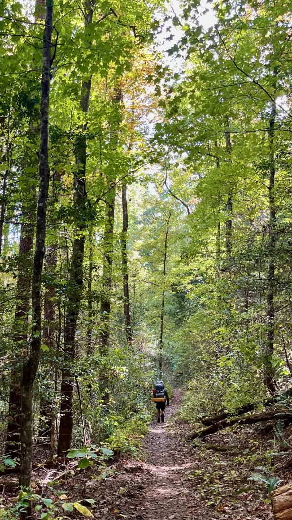
Polecat walks through a forest
Because we took such a long break when we went into town for lunch, Polecat and I didn't want to stop too early. We didn't have a FarOut trail guide for the Bartram to find a campsite, but I had downloaded a GPS track for the trail before I left home and loaded it into my Gaia app. It included waypoints for many campsites. We took a look at the track to find a site that was reachable before sunset.
One campsite was near a road at Warwoman Dell, and I’m always wary of those, especially on a Saturday. Sites like that sometimes attract weekend parties. We decided instead to head for a site on Warwoman Creek.

Polecat crosses Warwoman Creek
The campsite was on the other side of a long footbridge that crossed the creek. We intended to collect water from the creek when we got there, but couldn't find easy access to it. We decided to set up first, then try to find a better way down to the water.
Historians say Benjamin Hart and his wife Nancy lived in this area around the time of the American Revolution, and she may have been called "Wahatche" or "War Woman" by Cherokee Indians.
She was called a patriot and war hero for spying on British soldiers and perhaps killing some. Her legendary exploits are too numerous to describe here, but they can be found in this article.

Polecat looks up
The area surrounding the campsite was wide and flat, perfect for setting up our tents. We checked the trees first to make sure there were no dead trees or limbs that might fall in the night.
We also looked for a strong, high limb where we could hang our food. Bear scat was spotted on the trail leading to the campsite, and we took that as a clue that bears live in the area.
Sunlight was fading by the time we finished putting up our tents. Luckily, there was still enough light for us to find water, and we didn't have to climb down to the creek to retrieve it. We found a spring dripping from a rock ledge.
Collecting enough for dinner and to start the day tomorrow took several minutes, and we weren't able to cook dinner until well past sundown.
Only 36 miles of the Bartram Trail are in Georgia, and I hiked nearly 6.5 miles of that today. This trail has already been more enjoyable than the last time I hiked in Georgia, just five months ago. I haven’t had to dodge any cars or fend off loose dogs so far, and that’s always a plus.
I'm walkin' back to Georgia
And I hope she will take me back
Nothin' in my pockets
And all I own is upon my back
But she's the girl who said she loved me
On that hot dusty Macon road
And if she's still around, I'm gonna settle down
With that-a hard lovin' Georgia girl
This trail report was published