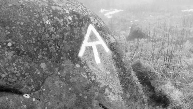
The Appalachian Trail is a brilliant idea that was born from a tragic moment. Nevertheless, the idea became much more than anyone could conceive.
The Appalachian Trail
The initial idea for the trail came to Benton MacKaye shortly after his wife committed suicide in 1921. MacKaye (pronounced mah-KYE) was a Harvard-trained forester. His grand plan was to construct a long trail traversing the spine of the Appalachian Mountains. It would be a place for city-dwellers to get away from the noise and pollution of the city. MacKaye wanted to construct a series of farms and work/study camps along the trail.
MacKaye and several enthusiastic supporters formed the Appalachian Trail Conference (ATC) in 1925. As many ideas do, however, this one took a while to catch hold. It wasn't until the early 1930s that the trail began to take shape, just as the vision for the trail was reshaped into a simpler idea of a long hiking path from Georgia to Maine.
Though the Great Depression would cause many projects to whither, the Appalachian Trail benefitted greatly during this time. The Civilian Conservation Corps (CCC) was enlisted to help with many construction projects, as were hiking clubs in every state the trail crossed. Sections of the trail, signs, and shelters were added at such an active pace that by 1937 the trail was declared completed.
It wasn't really completed, though, as there were some sections that traversed along roads or over private property. It would be decades before those problems were solved.
During this time, no one thought it would be possible to hike the entire trail from end to end, nor did they think anyone would want to undertake that challenge.
Large portions of the trail were severely damaged in 1938 by a hurricane, and when World War II hit, the AT suffered from neglect.
Interest in the AT was revived after the war by the audacious act of Earl V. Shaffer. He pieced together the trail through maps and guesswork to walk its entire distance. Shaffer was a veteran of the war, and he said he thru-hiked the AT to walk off the war.
Another notable milestone in the trail's history happened in 1968 when President Lyndon Johnson signed the National Trails System Act. The legislation named the Appalachian Trail the first national scenic trail and placed it under the jurisdiction of the national park system.
Now with the backing of the federal government, more land was acquired at a much greater pace. The last section of the trail was finally secured under permanent ownership in 2014.
Although the state and federal governments own most of the land, the trail remains the responsibility of the ATC, now called the Appalachian Trail Conservancy, and many local hiking clubs.
The length of the trail varies slightly from year to year as the footpath gets relocated and improved. It is generally said to be just under 2190 miles long. The AT runs across 14 states and over many of the tallest mountains in the Appalachian chain.
The southern terminus is on Springer Mountain, located in Amicalola Falls State Park, Georgia. The northern end is on Mount Katahdin, which is in Baxter State Park, Maine.
Thousands of people attempt to hike all of the AT each year, but only about 25 percent complete it in one year.
There is no official way to hike the AT. Hikers may start at one end or the other. They may also choose to start their hike from one location, then after they reach an end, "flip flop" back to their starting point and hike in the opposite direction.
A few people have hiked from one end to the other, then turned around and walked back to where they started. This is called a "yo-yo" hike.
A series of simple shelters have been constructed along the trail for hikers to stop for the night. Most shelters are made of a wooden platform with three sides and a slanted roof. They usually provide enough room for six to 12 hikers to have a dry space for sleeping. Shelters are often located near a spring or other water source, and they may have a privy and cables for hanging food away from bears and other forest animals.
Because the trail is mostly routed through remote wilderness areas and mountainous terrain, hikers are cut off from most of society until they stop in a nearby town for resupply and recuperation.
I completed a thru-hike of the AT in 2017. You can read all of my blog entries here.
Misted on rocky heights
Now we are feeling,
Nearing our clearer sight
Spiritual Being.
These clouds are vanishing
A crowd I see, moving,
Of sacred young men,
Freed from their earthly gloom,
Circling together,
Delighting again,
In the spring’s brighter bloom,
In higher air.
Let them together then,
Lead him on: risen,
Perfect, and there!
