
Day 8 Painter Branch to Cosby Knob Shelter
More from this trailWell, I ain't often right, but I've never been wrong
I spent hours planning my thru-hike of the Appalachian High Route. I studied every mile of the trails on maps and calculated distances for each day. Mostly, this was done to figure out resupply stops and how much food to carry between them.
All of the information was put into a spreadsheet. When Polecat agreed to join me on this hike, I adjusted the daily mileage and shared the spreadsheet with him.
So far, our hike has gone as planned despite a few minor changes we had to make along the way. The weather on Day 2 slowed us down, but we met my wife Kim as planned on Day 5. We got a slow start on Day 6, but by the end of today, we would be back on schedule with our first night in Great Smoky Mountains National Park. Yes, the plan was working well.
Then it all fell apart.

Returning to the AT
We left our campsite at 8 a.m.
According to the schedule laid out in my spreadsheet, Polecat and I planned to stay tonight at Cosby Knob Shelter. Even if we had stayed last night at Standing Bear Hostel as originally intended, we would still go to the shelter today.
Hiking the Appalachian Trail through the Smokies comes with a strict limitation on where to camp. Our thru-hiker permit requires us to sleep in shelters unless other hikers have a reservation to stay there. Besides Cosby Knob, the only options for us would be Davenport Gap Shelter, which we would reach too soon, or Tricorner Knob Shelter, which would add too many miles.
To be sure, the day would include a long, continuous climb of more than 3,600 feet in less than seven miles.

Gavel road leading to Standing Bear Hostel
We passed many northbound thru-hikers on our way to Standing Bear Hostel. Most slept there last night. The hostel was about a quarter-mile off the trail on a gravel road, and we arrived there at 9 a.m.

Standing Bear Hostel
Standing Bear was both charming and grungy. Several buildings in various states of upkeep and repair, including a bunkhouse, some cabins, and even a treehouse, were scattered around the site. Hikers were roaming the grounds or hanging out in common areas when we arrived. I couldn't tell if everyone was taking a zero day or simply in no hurry to get back on the trail.
Polecat and I found Maria, the hostel's owner, and paid her five dollars each for holding our resupply boxes. We then stayed for about an hour eating snacks and drinking coffee.
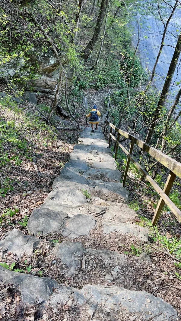
Descending a long flight of steps
Soon after walking back to the trail, we followed a long flight of steps down to a road. From there, we walked under Interstate Highway 40 and across the Pigeon River.

The Pigeon River
Bright sunshine glistened off the water when we crossed the river at 10:45 a.m. There were only a few clouds, but the sky didn't stay that way for long. More clouds began to move in within the next hour.
I lost track of Polecat soon after we reached the other side of the river on the way to Great Smoky Mountains National Park.

Yellow trillium
As usual, I would have been faster if I hadn't stopped several times to take photos. The first wildflowers I saw were yellow trillium. The flower sits directly on what looks like leaves but are called bracts.
Brachts aren't leaves because a trillium doesn't have a stem. Instead, the bracts and flower of the plant are an extension of its rhizome.

Foamflower
Foamflower, another plant that grows from a rhizome, was growing nearby. Like trillium, it prefers shady spots in the forest.
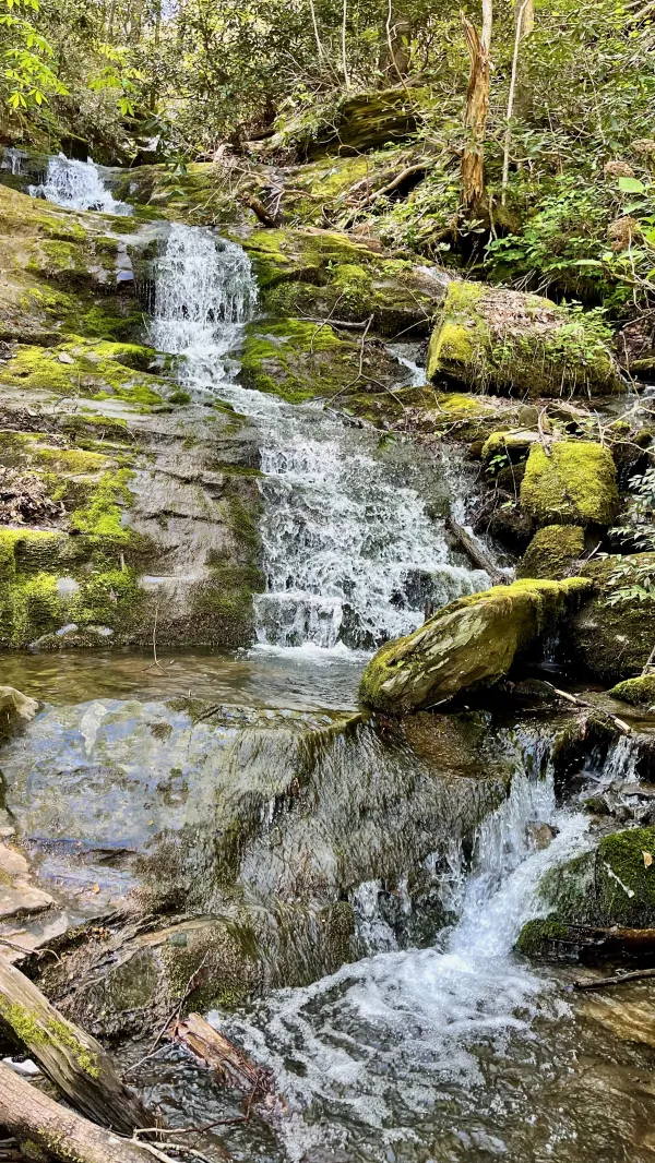
A cascade
I stopped again when I reached a cascade. Each time I paused to take a photo, I fell a little farther behind Polecat.
The temperature was rising. With a long climb up Mt. Cammerer ahead, I should have collected some extra water here, but I didn't.

dwarf crested iris
There were many more wildflowers to see and photograph, and I hadn't yet reached the park boundary. Among them were dwarf crested iris. These plants grow in dense clusters, and I found a large one next to the trail.
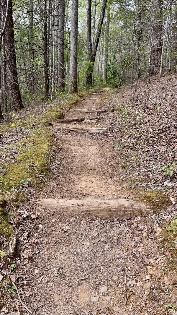
Steps ascending Mt. Cammerer
The climb was more strenuous after I entered GSMNP. The trail was wide and well-maintained for the large amount of traffic it receives. Frequently, there were steps and water bars cut into the trail to manage erosion.

Davenport Gap Shelter
When I reached a side trail to Davenport Gap Shelter, it had been at least an hour since I last saw Polecat. I wasn't sure if he stopped at the shelter, but I wanted to go there anyway because I needed a break. I was tired, hungry, and running low on water.
He wasn't there, and no one else showed up while I was at the shelter. I stayed for nearly an hour.
Davenport Gap Shelter is an oddity among shelters in the Smokies. Until about 10 years ago, the shelters in the park had a chain link fence across the front. When they were rebuilt, all of the fences were removed except at this shelter.
The fences were supposed to protect hikers from bears, but they were removed when park rangers realized hikers were feeding bears through them. I'm unsure why this shelter's fence wasn't removed.
The shelter is occasionally closed because of bear activity.

A view looking down from Mt. Cammerer
The climb continued after I left the shelter. It was a few miles before I reached an elevation high enough to see distant views between the trees. Clouds now filled much of the sky. This was the first time that had happened since the rain stopped near the end of Day 3.
The recent warm, sunny days brought out leaves on many of the trees at lower elevations, but that hadn't happened yet higher up the mountain.
I finally caught up to Polecat at 3:45 p.m. when he stopped at the junction of the AT and Lower Cammerer Trail. We both needed water by this time and hoped to find some at a spring labeled in FarOut as "seasonal." We shouldn't have been concerned about that because a steady stream was pouring from rocks next to the trail when we arrived. The recent rainfall must have helped.

Trout lily
The climb was a hard pull, especially with a pack full of food. I was carrying a lot because we didn't intend to stop again to resupply until we reached Cherokee, N.C.
I took another breather when I saw some trout lily blossoms to photograph, and I stopped again to chat with Big Tex and Gray Mare, two hikers from Houston.
I also met a hiker named Dingo, who was from Massachusetts but now living in Australia. While he explained he was trying to complete a thru-hike he began last year, I realized his story sounded familiar.
"Did I hear you on a podcast?" I asked.
I was right. He was interviewed last year on the Mighty Blue on the Appalachian Trail podcast.

Rain clouds in the distance
By 5 p.m., dark clouds were forming overhead. I could see rain falling in the distance on the Tennessee side of the mountain ridge.
Needing water again, I checked with a hiker who said I would find some a short distance ahead. It was just before a side trail that led to a lookout tower at the summit of Mt. Cammerer.

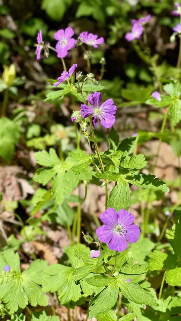
Wildflowers at Low Gap
That hiker was the last one Polecat and I passed on the descent from Mt. Cammerer. When we approached Low Gap, where a trail connected the AT with Cosby Campground, the ground was covered in white flowers.

fringed phacella
The wildflowers were called fringed phacella, and they were flowering everywhere. The ground looked like it was covered in snow. Although they grow on mountain ridges from Virginia to Alabama, GSMNP is one of the places where they are most plentiful in the spring.
Fringed phacella plants are annuals. They die after blooming, and their seeds are left to germinate the next spring and grow into new flowers.

A ridgerunner named Chris
Polecat and I arrived at Cosby Knob Shelter at about 5:45 p.m. The shelter was full of AT thru-hikers, and the few flat spots for tents were already taken.
We were greeted by a ridgerunner named Chris, who was older than other ridgerunners I've met on the AT. Chris had a personable, engaging personality, and we chatted for several minutes. He told us he was a retired attorney from Memphis and planned to work along another section of the AT when his stint here was done.
He asked where we were heading tomorrow, and when I answered, "Icewater Springs," he seemed surprised.
"That’s a long way," he said.
Chris then told us about a secondary, little-known campsite not far up the trail. He said we could camp there. I had hiked this part of the AT several times and was surprised to learn this spot existed.
Polecat and I had purchased thru-hiker backcountry permits like the other AT thru-hikers. The permit is intended for hikers who start at least 50 miles before the Smokies and hike at least 50 miles past it, and we qualified for that.

Tents at a campsite near Cosby Knob Shelter
The site was mostly hidden from the trail, and when we got there we discovered it was large and mostly flat. There was flowing water and there were even bear bag cables nearby for hanging our food. Although I don't know this with certainty, I suspected this site isn't just used as an overflow area for the shelter. I'm guessing that trail maintenance crews also camp here.
After Polecat and I set up our tents, collected water, and began preparing our dinner, I looked at the map on FarOut. The more I thought about Chris's comment about Icewater Spring Shelter, the more it bugged me. It couldn't be as far away as he suggested, I thought. Each stop on this hike was carefully calculated on a spreadsheet.
But when I checked, I discovered Chris was right. The shelter was 20.3 miles away, and that was troubling. Polecat made it clear he wasn't up to hiking that far, and I wasn't enthusiastic about it either.
We didn't understand how the miscalculation slipped into our spreadsheet. More importantly, though, we needed to figure out how to adjust our plan and stay on track. Our biggest obstacle was how campsites and shelters were spaced apart in GSMNP, including those we planned to use after we turned to follow the Mountains-to-Sea Trail. It's not legal to camp anywhere except in those designated places.
A solution we figured out was a little complicated but included an intriguing opportunity. For starters, we will backtrack tomorrow to Low Gap, which we passed earlier today. We'll then follow a side trail down to Cosby Campground. We'll ask Polecat's wife to pick us up and take us home.
After a night at home, we'll ask my wife to drive us to Clingman's Dome. The MST section of the AHR starts there.
This new plan will require us to skip the rest of the AT included in the AHR, but that will be temporary. Polecat has wanted to hike in the Smokies in the winter, and this now looked like his chance. We could return later this year to hike the remaining section from Cosby Knob to Clingman's Dome.
One way or another, I intend to finish the AHR. No foolish scheduling screw-up is going to stop me.
Well, I ain't often right, but I've never been wrong
It seldom turns out the way it does in the song
Once in a while, you get shown the light
In the strangest of places if you look at it right
This trail report was published