
Day 15 Sassafras Gap Shelter to Nantahala Outdoor Center
More from this trailWith trunks of memories still to come
Although Polecat and I finished hiking all of the FAB (Foothills and Bartram) Trail, we couldn't end our hike until we descended Cheoah Bald to where we left his truck at Nantahala Outdoor Center. I knew before starting these trails that today would be a pleasant way to end the trip.
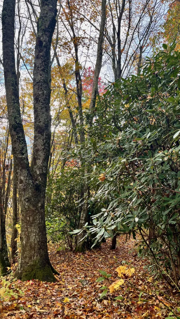
This section would be enjoyable because I've hiked it many times before. Or at least I assumed it would be enjoyable if the weather cooperated, and it did. Going up, the trail is strenuous, but for us today, the route was under seven miles and nearly all downhill.
Sleeping last night in the shelter worked well. There are several reasons why I don't prefer to sleep in AT shelters. To name a couple, I don't like being visited by mice and don't want to risk a leaky roof during a rainstorm. As it turned out, neither of those was a problem last night.
Then this morning, we enjoyed a benefit of sleeping in the shelter: We didn't need to pack up wet tents. However, the convenience of staying dry didn't help us get started any sooner. We didn't leave the shelter until 8:10 a.m.

Leaving Sassafras Gap Shelter
Sassafras Gap Shelter sits at 4,330 feet in elevation. The storm moved out in the early morning hours, but low clouds kept the mountain air damp. We had low visibility for much of the morning.
The sky seemed to be clearing
In the next hour, it seemed that the clouds were clearing. We had hiked below the cloud layer, and I thought pockets of blue sky were beginning to form. This may have been true, but the sky didn't clear much before becoming overcast again.
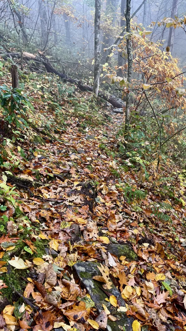
Wet leaves made the trail slippery
As the descent continued, we entered another layer of clouds. Without sunshine, the trail remained wet. Combined with a thick mat of leaves, I had to stay alert and cautious about slipping.
There are a couple of spots on the trail that provide a viewpoint on a clear day. One of these is called the Jump Up. It's possible to see a long ways down the Nantahala River gorge from there when the conditions are right. No views were available for us today because we were in that second layer of clouds when we walked by.

The Nanatahala River seen from the trail
The river finally came into view at 11:45 a.m., but by that time, we were nearly on top of it.

The N.O.C. is quiet
In another five minutes, we arrived at Nantahala Outdoor Center. If we had been here yesterday, a weekend day, there would have been hundreds of paddlers preparing to leave for or just returning from a trip down the river. No one was here today.

The bridge over the Nantahala River at N.O.C.
After crossing the river on a footbridge and then U.S. Highway 19, we arrived where we had parked Polecat's truck the day before starting this hike. NOC did not charge anything for us to leave the vehicle there.
After William Bartram completed his exploratory journey in January 1777, he returned to his home in Philadelphia. He didn't finish writing and publishing a journal of his walk until 14 years later. I can relate to this. I am also slow to write about my hikes.
I like it this way. Writing my blog posts months later allows me to relive my time on the trail.
One thing I found enjoyable about this hike of the Foothills and Bartram trails was bringng back memories of other hikes. While on the Foothills Trail, Polecat and I were joined by Sasquatch. I met him on the Benton MacKaye Trail, and hiked with him on sections of the Continental Divide Trail. We had time to reminisce about those hikes while hiking together on the first part of this hike.
Polecat, of course, is someone I've hiked with for years. He's a good hiking partner and a wonderful friend. Anytime we're together, one of our hikes is bound to come up in conversation.
Hiking short sections of the AT again brought back many memories, but they also did something else. They convinced me to hike more of the AT. Thankfully, I don't live far from the trail. In fact, I will be coming back to the AT for my next hike in the spring of 2023.
Similar to how I strung together the Foothills and Bartram trails, I'll be hiking a portion of the AT that is connected to a portion of the Mountains-to-Sea Trail. Adding short trails and road-walking through Burnsville, N.C., the full hike will be a loop of 330 miles. Tying these sections together was the brainchild of Jennifer Pharr Davis. She calls it the Appalachian High Route (AHR). I met her last August to learn about the AHR and get some maps.
So let this be a warning. More nostalgia-filled posts are ahead. Just don't count on me writing them quickly.
We've been through some things together
With trunks of memories still to come
We found things to do in stormy weather
Long may you run
Long may you run, long may you run
Although these changes have come
With your chrome heart shining in the sun
Long may you run
This trail report was published