
Day 64 Huston Park Wilderness to Trail Creek
More from this trailIn through the out door
So far, the expectations we had about flipping to Wyoming and walking south were holding true. We figured starting in the Great Divide Basin would give enough time for a lot of the snow in Colorado to melt. Though it wasn't completely gone, no section of the trail has been dangerous or required extra gear.
We haven't yet seen any snow below 10,000 feet. Where it has appeared above that depended on where the trail went. Southern exposures and clearings have been mostly clear.
The real test of our effort to avoid snow will come when the trail climbs above 11,000 feet. That will happen the day after tomorrow when we go over Lost Ranger Peak.
In the meantime, today and tomorrow will give more time for melting to occur. As warm as the temperatures have been lately, that's been happening quickly.

The CDT south of Huston Park Wilderness
None of us were crushed by a falling dead tree overnight. Top O', OldTimer, and I were on the trail well before 7 a.m.

Downed trees cut to clear the trail
I could tell as soon we left we were no longer in Huston Park Wilderness. A trail maintenance crew had been through here recently to clear the trail. Fresh sawdust was piled near the cuts they made on fallen trees. I could tell the trees were cut with chainsaws, which are prohibited in wilderness areas.
The trail soon led us past a road junction, which was another indication we were no longer in Huston Park. Wilderness areas are required to be roadless.

A view of Hog Park Reservoir
After crossing the road, the trail went up to an elevation of 9,846 feet. That was a 715-foot climb in 1.7 miles. On the way up, we got another look at Hog Park Reservoir.

Top O' and OldTimer follow the trail through a forest
We were glad to see this section of the trail had been cleared. There was at least one downside of flippling to hike south. We were walking through some sections before a maintenance crew had been able to get there to remove all of the downed trees. We are among the first thru-hikers to be this far north and walking in either direction this season.

OldTimer crosses a soggy meadow
Though there was no need to contend with blowdowns this morning, we did have to walk through another park that was saturated from snowmelt and an overflowing stream.

A blaze has been cut in a tree
We didn't have any trouble finding our way in the morning. The footpath was usually obvious and easy to follow. It was occasionally marked with a CDT emblem. I also saw a couple of old-school blazes cut into trees.
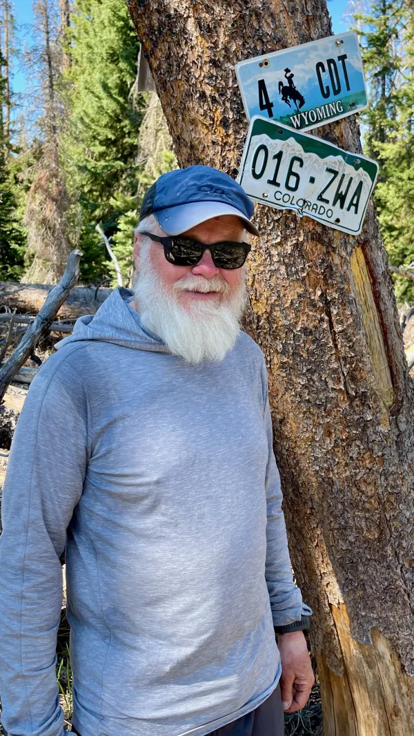
Gravity standing at the line between Wyoming and Colorado
We arrived at the state line after walking for 2.5 hours. The time seemed to go by faster than that, and I was surprised when I saw Top O' and OldTimer stopped by a tree with Wyoming and Colorado license plates nailed to it. Rocks placed in a line across the trail also marked the border.
I was glad to be back in Colorado. Still, being here at this time felt a little disorienting. I was entering the state where I thought I would be leaving.
A February snowstorm dumped about two feet of snow in the San Juan Mountains, and that's what ultimately led me to this border a month earlier than expected and walking south instead of north.
Standing here now made me feel out of sync with what I thought this hike would be like. Still, I should be used to that because I also flip-flopped sections of the AT and PCT. Though I'm hiking every mile of the trail, I'm not hiking in a single, linear direction. My brain has had to adjust when I leap to a new state and change course.
To be clear, I don't feel as though my hike is lesser than anyone else's hike. The only thing different about mine is I've chosen to hike where the weather is better. That seems like a worthy tradeoff.

A spring flows at the base of a toppled tree
The temperature had been quickly rising since we left camp, and by the time we reached the state line, we needed water. Our Guthook app showed a pond located a short distance off the trail, but we never saw it. This led to a moment of concern until we walked a little farther.
We found water running across the trail. It flowed from a small spring where a tree had blown over. Collecting water took extra time because the flow was just a trickle, but at least we got what we needed.
The trail begins a steep climb
About a mile past the state line, the trail began the first of two long and steep climbs. This one was on a rugged Jeep road.

A road stretches far ahead
The descent from the top was more gradual than the ascent, but it was exposed to the sun. The temperature felt hotter than any time I spent in the New Mexico desert.
The long, rough road became an endurance test. I walked and listened to podcasts while trying not to focus on the heat.

A road makes many small curves
After a lunch break in some much-needed shade, we continued down the dirt road. The only break we took in the afternoon was to stop at another spring to collect more water.
About 13 miles into our day, the trail reached the boundary of Mt. Zirkel Wilderness. It didn't cross into the wilderness area here, however. Instead, the footpath stayed on a road that marked the boundary.

A view looking north to a valley
Two miles farther, the trail began another hot and tiring climb. This one was steeper and longer than the last, going up about 800 feet in two miles.
The pain caused by this climb was redeemed by some beautiful views. The first big view was looking north across a deep valley.

A wide valley with Big Agnes, Little Agnes, and Lost Ranger Peak on the other side
About an hour later, after the trail crested the top of the climb and began a gradual descent, a more dramatic view appeared. Big Agnes and Little Agnes caught my attention first on the left side of a broad valley. Then I saw Lost Ranger Peak, which stood 15.4 miles away straight ahead. To get there by trail, I will have to walk just over 23 miles more, and we will get there the day after tomorrow.
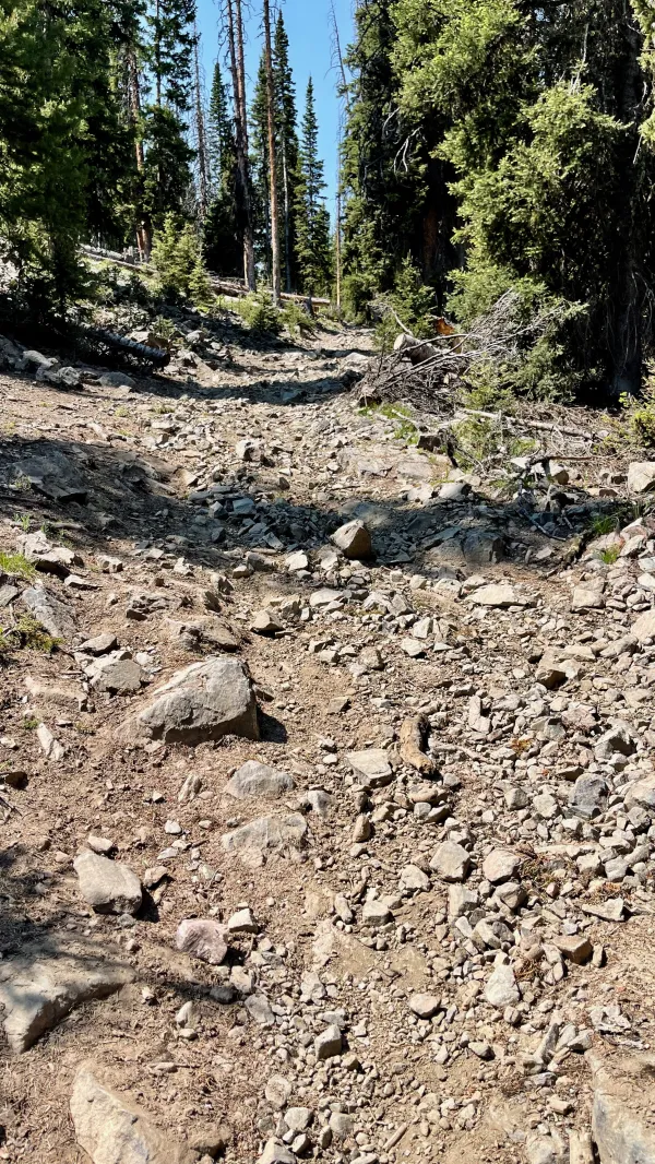
The trail was no longer following a road. It was on a well-worn footpath that was strewn with rocks.

OldTimer crosses Trail Creek
It descended into the valley, where we found Trail Creek flowing through the middle. We arrived there shortly after 6 p.m. The stream was wide and shallow. No rocks were available to hop across, so we had to ford the frigid water.
Before continuing, we intended to collect water from the creek. A more vital step was required first, however. We had to apply mosquito repellent because a full contingent of the thirsty bugs had descended upon us.
When we had enough water collected and filtered for tonight and tomorrow morning, we followed the trail as it continued along the creek. We walked about one more mile before finding a suitable place to camp in some trees.
The mosquitoes continued to swarm and attack us at every opportunity, so as soon as we could, we dived into our tents and stayed there for the rest of the night.
Sibilance,
Mic check for the deviants.
Why is grace now civil disobedience?
Lights on,
Mercy for an encore
They're coming in,
In through the out door
This trail report was published