
Day 65 Trail Creek to North Lake
More from this trailTime may change me, but I can't trace time
The Triple-Crown-in-a-week stunt I wrote about on Day 58 wasn't the first or only time I had been on the CDT before this thru-hike attempt. I hiked a portion of this trail in 2002.
In July of that year, I spent a week in Mt. Zirkel Wilderness with my sons' Boy Scout troop. I was one of the troop's assistant scoutmasters.
Our trip was planned to be a hike in the Chicago Basin area of Weminuche Wilderness, but we were forced to make a last-minute change in the destination. Just days before we departed for Colorado, a massive wildfire north of Durango prompted the National Forest Service to cancel all backpacking permits. Mt. Zirkel was not affected by fires, and we were able to change our plans to go there.
As I crossed into Colorado and walked toward Mt. Zirkel Wilderness on this hike, I began to recall memories of that trip 19 years ago. I remembered we hiked a section of the CDT that took us over Lost Ranger Peak. At the time, that was the highest mountain I had ever climbed.
More memories came back to me today. As they did, I began to reflect on all that has happened to my family and to me since then.

Morning in Colorado on the CDT
OldTimer and Top O' were better organized than I was this morning. They were ready to leave at 6:30 a.m. I needed close to 30 minutes more before I left our campsite.
The trail continued to go in the same direction as Trail Creek, though the footpath never crossed the stream again and was sometimes far from it.

A view through burned trees
After walking about three miles, I passed an area of dead trees. These weren't killed by beetles, though. They were burned in the Hinman fire, which happened just weeks after the Boy Scout troop trip ended in 2002. That was a horrible year for fires in Colorado.
With no tall trees to block my view, I could see Little Agnes Mountain. The sky was hazy, though not like the dusty haze I saw a few days ago in Wyoming. This looked more like smoke.

A sign says the trail ahead is closed
I arrived at a sign at 8 a.m., which warned that a bridge farther ahead was out. Footprints on the ground appeared to lead past the sign and down the trail. I wondered if Top O' and OT left those footprints, and thought my friends may have decided to take the trail despite the warning.
Unsure which direction to take, I checked the Guthook app to see what other hikers said about the detour. The consensus was to walk on the road and not the trail.
I followed the road, and I soon came to a stream. This confused me for a moment because I wondered if this was the location of the washed-out bridge. The water didn't seem deep enough to warrant a bridge, at least not today, and I decided I was on the detour. I forded across the stream without a problem.

A road and North Fork Elk Creek.
The detour remained on the west side of North Fork Elk Creek. The road was easier to walk on than the rough trail earlier. The road appeared to be maintained.

On a bridge over North Fork Elk Creek
The road detour crossed North Fork Elk Creek on a large, solid bridge, where I reconnected with the trail.
I met a day hiker a few minutes later, so I asked her if she had seen OldTimer and Top O'. She said she hadn't, which surprised me. They started walking no more than 30-minutes before me. Even with the detour, they shouldn't have been much more than a mile ahead of me.

Walking through aspen trees
The trail continued along the other side of the creek for the next 3.7 miles. The stream wasn't always visible, particularly where it entered a grove of aspen trees. They provided a pleasant amount of shade.

Corn lily
The cool air and moist soil are favorable for corn lily plants, which lined the trail. This plant might look like a corn stalk, but it is extremely toxic to eat.
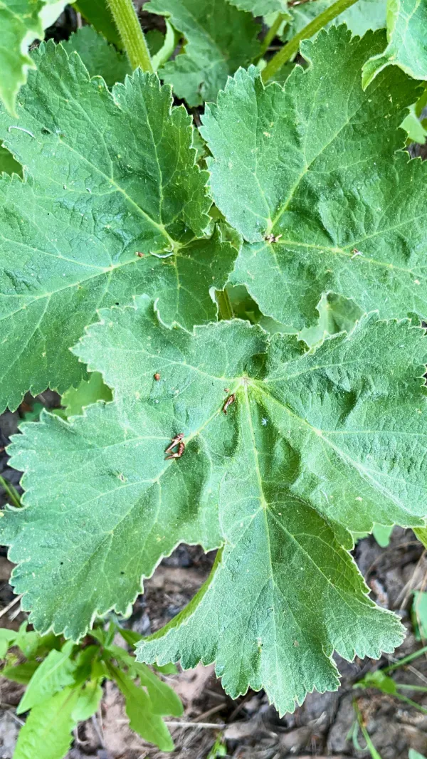
Common cow parsnip
Another plant growing well in the aspen forest was cow parsnip. As you might expect by the name, this is a plant that cattle eat, as do sheep and goats. Many wild animals also eat it, including bears.
Top O', OT, and I heard some odd noises last night near our camp that probably came from some kind of wildlife, perhaps elk. So far, I hadn't seen any signs of bears since we began hiking south.
People have also sometimes eaten cow parsnip. When the stalks are peeled, they resemble celery and are often called "Indian celery." The outer skin must be removed carefully, however, because the plant's sap can cause a rash.

English Creek
The trail crossed Lost Dog Creek, and later, English Creek. Both of these were small, feeder streams to North Fork Elk Creek.
I stopped at the second stream crossing to rest and filter water. My break was longer than I first planned because I began to wonder if I should wait for Top O' and OT. Did they stay on the trail instead of the detour, then discovered they couldn't cross the creek and had to backtrack? If so, I thought, maybe I was now ahead of him.
After waiting 30 minutes, I decided I was wrong. They weren't behind me, and now I was worried I had fallen farther behind them.

White and lavender columbine
The woods surrounding the trail began to thin out, which opened more sunlight for wildflowers. I saw the first columbine flowers since I crossed the state line. The white and lavender variety is Colorado's state flower. Since 1925, it has been illegal to dig or uproot columbine on public lands in the state.

Top O' and OldTimer
The trail next joined a gravel road, and as I began walking on it, I noticed footprints. Perhaps OT and Top O' were ahead of me, I thought, but how far ahead?
That question was answered minutes later when I saw them stopped at the Middle Fork Elk River to collect water. They told me they had just arrived there.
Somehow, and I still don't fully understand where this happened, they took the wrong trail. I may have gotten ahead of them as they walked the wrong way. Later, they made a second mistake and had to loop back this way. Apparently in doing that, they got ahead of me again but just in minutes.
The time was now 11:45 a.m. We decided we weren't ready for lunch, so we continued walking together.

Rock clematis
The trail began a climb up a ridge. There wasn't much shade here, and the temperature was extremely warm. We learned later Colorado was in an early heat wave.
On the climb, we passed some rock clematis, which are native to a wide section of the western U.S. Their petals have a distinctive flair, and often tilt down to look like lanterns. Later in the season, the flowers will become fluffy, plumed seedheads.

Looking up the river valley
The heat made the climb energy-sapping, but we kept going until we reached the top of the ridge. We stopped for lunch at 1:15 p.m. when we found some shade and logs to sit on.
Our lunch spot offered a good view of the valley below us. Elk River ran at the bottom where glaciers once carved the landscape.

Looking toward Lost Ranger Peak
The trail crossed over the ridge and began a descent to the other side. Before starting down, more mountains came into view. This time, we were looking ahead to where we were going.

Entering Mt. Zirkel Wilderness
After reaching the bottom, the trail turned onto a road. Thanks to this, there wasn't much tree cover, and I was feeling cooked by the heat.
I was relieved to see a stream crossing about halfway down the road and stopped to pour water on my head.
Where the road came to a dead-end, the trail continued on a single-track footpath. Until now, we had been hiking near or on the boundary of Mt. Zirkel Wilderness. Finally, we entered it.
This area was among the first lands granted special protections in the Wilderness Act of 1964. Two expansions since then have increased Mt. Zirkel's size to 160,648 acres. Within it are 15 peaks standing more than 12,000 feet high.

Cleared trail
Another climb began soon after we left the road. This was a continuous ascent with not even the slightest flat section. For the next 3.9 miles, we had to climb more than 1,800 feet.
Starting up, the trail was clear. It appeared that a crew had come through recently. Many large, downed trees had to be cut without the use of power tools. It must have been slow and difficult work.
We met two hikers coming down the other direction. One was a SOBO (southbound) LASH (long-ass-section hiker) and the other was a flip-flop thru-hiker. They told us what we expected but didn't want to hear: There was still a lot of snow at the top.

Dead trees
Higher up the climb, we walked where none of the trees were alive. They had all succumbed to the mountain pine beetle infestation.
Through the dead trees that remained standing, I could see the mountains where we were heading. The amount of snow I saw seemed to confirm what the two hikers we met earlier had said.

Blowdowns across the trail
Before long, the section of cleared trail ended. We had to climb over and around many blowdowns for the last couple of miles. The trail became an obstacle course.
A little more than a half-mile before reaching North Lake, I cut my leg while trying to climb over one of the fallen trees. Fortunately, a stream was nearby, so I stopped there to wash off the blood trickling down my leg.
While at the stream, I also collected and filtered some water. The temperature was still so hot I didn't want to run out before I got to North Lake.
Another SOBO LASH hiker passed me while I was at the stream. His trail name was Knucklehead.

North Lake
I arrived at North Lake at 6 p.m. OldTimer, Top O', and I spent several minutes looking for the best spots to pitch our tents. We didn't want to be too close to the water or in a grassy area because that would increase the probability of condensation forming overnight.
Still, we didn't want to waste time looking and be too picky about it. The mosquitoes were as bad here as they had been last night.

Landon at North Lake in 2002
While looking around for a spot to set up, I realized I had been here before. I camped at this lake with my younger son, Landon, and the other members of our crew of scouts and leaders during our 2002 trip.

Logan in Mt. Zirkel in 2002
My other son, Logan, was in a crew of older scouts on that trip. They took a different route through Mt. Zirkel and climbed some of the high peaks.
It's funny, but bringing up a few memories like these sent me into deep contemplation about the changes in my life over the last 19 years. I realized Landon was just 12 years old and Logan was 15 when we were here. Now they're in their 30s, married, and have successful careers. They were kids then, and now they're adults. So much has happened in between.
For myself, that 2002 trip was the first time since I was 15 years old that I had hiked for a week in a western state and above 10,000 feet. Now, all this time later, I'm trying to walk the entire length of the CDT and complete the Triple Crown. How did that happen?
I tried to trace my memories back to that week here in Mt. Zirkel to see if it was a pivotable moment in my journey to become a thru-hiker. It doesn't feel like it, at least not the same way as other events in my life. My first backpacking trip, which I wrote about here, was a more impactful influence. Still, there's no doubt my time here 19 years ago helped to shape the long journey that led me here again.
Ch-ch-ch-ch-changes (Turn and face the strange)
Ch-ch-changes, don't tell them to grow up and out of it
Ch-ch-ch-ch-changes (Turn and face the strange, )
Ch-ch-changes, where's your shame?
You've left us up to our necks in it
Time may change me
But I can't trace time
This trail report was published