

Day 36 near White Canyon Wilderness to Gila River Canyon
More from this trailDrinking muddy water
When I woke up this morning, I was surprised to find my quilt was damp from condensation. It wasn’t the first time this has happened on the Arizona Trail, yet it was still unexpected.
I always assumed the desert air would keep all of my gear dry. Condensation is common inside a single-wall tent, especially when the air is still and damp, but I wasn’t in a tent. I camped under the stars last night.
Then why did my quilt get wet? The answer was simple and obvious, though initially, I failed to consider it: the dew point.
If you’ve always wondered why TV meteorologists talk about the dew point in their nightly forecasts, here’s the answer. Warm air can contain more water vapor than cold air. When the temperature drops to or below the dew point, whatever it may be at that location on that day, the air becomes saturated. The air has reached a relative humidity of 100 percent, and the water condenses to become liquid droplets.
Here in Arizona in late October, the dew point is usually between the mid-30s and mid-40s, measured in degrees Fahrenheit. The temperature dropped this morning into that range, and the air lost its ability to hold moisture. That’s why water droplets formed on my quilt.

A crescent moon appears at dawn
I made a mental note to dry out my quilt when I stopped for lunch. It wasn’t going to dry while I prepared to hike because the sun hadn’t risen yet. There was just a hint of color in the sky. There were no clouds, and a sliver of a crescent moon hung low.

Just before sunrise
After I left my campsite, the trail followed a path so curvy that for the first mile, I was never more than a quarter mile away from where I started.
I walked two miles before stopping to eat breakfast. I often do this because it’s an efficient way to start the day. I can get packed and leave camp sooner. Sometimes, however, there’s a slight flaw in this plan. I get hungry and end up stopping earlier than I intended.

The Gila River
The elevation of last night’s campsite was 3,200 feet. The first six miles of today’s hike dropped more than 1,500 feet down to the Gila River. I arrived there at 10:15 a.m. after leaving the AZT and following a short side trail.
This was the same river that I crossed many times early in my Continental Divide Trail thru-hike. There was a big difference in the way it looked here. The water had become brown and turbid since leaving its source in southwestern New Mexico.
About 650 miles long, the Gila is one of the longest rivers in the western states. Its flow has been dammed and diverted in many places. Though it looked stagnant here, it was flowing. In the next 300 miles, however, nearly all of the water is diverted for irrigation. Except following large storms, hardly a drop will reach its confluence with the Colorado River.
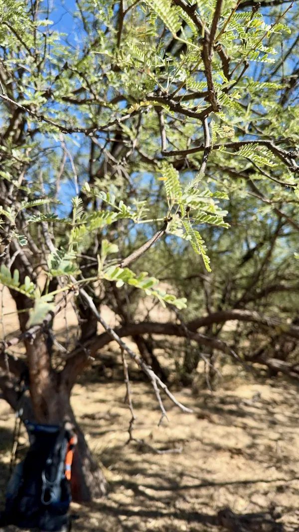
A mesquite tree
An open-pit copper mine is located just upstream from where I collected water. More than a decade ago, the state released a report about hazardous substances from the mine, including PCBs, selenium, and lead, that were found in the river.
It’s hard to say if those pollutants remain in the water. There doesn’t appear to be a follow-up report. At the very least, the water was unpleasant. When I arrived at the river to collect water, I could tell cattle and wildlife were using the river as a bathtub and as a toilet.
Still, I had little choice but to use this water. It was the only accessible source for the next 13 miles. I would not be able to safely continue walking without it.
I collected three liters of water, then took it under the shade of a mesquite tree to filter it. Though the water looked like chocolate milk, I tried not to think about what was in it.
Silt caused my filter to slow to a trickle, and it took several minutes to finish all three liters.

A metal sign marks the AZT's lowest point
Soon after I returned to the trail and started walking again, I passed a trail sign that marked the official lowest point of the Arizona Trail. The plaque didn’t mention I would soon have to start a climb of more than 6,000 feet. Fortunately, that was going to be stretched across several days.

No cover for shade on the trail
Today was a little warmer than yesterday. As usual, shady spots were hard to find. When I spotted a small grove of mesquite trees at 11:45 a.m., I stopped for lunch. It seemed a little early for that, but I couldn’t count on finding another place to get out of the sun.

The trail climbs above the Gila River
The first six miles after passing the low point sign remained close to the river. Then the trail began to climb a ledge while continuing to follow the river; only now, I was walking high above it.
I stopped for another break at 3 p.m. There was no shade this time, but a flat rock made a good bench to sit and rest for a few minutes. While I was stopped, I noticed that wispy clouds were moving in. That gave me some hope that the temperature would cool a little.
Soon after I started hiking again, I realized I had forgotten to dry out my quilt. It was too late for that now. I had already taken a break, and I didn't want to take another this late in the day.

Cowboy camping
Shortly before 5 p.m., I discovered a large, flat campsite next to the trail. Like my lunch spot, I found it earlier than I planned to stop, but it was too good to pass up. I had intended to stop where the trail dropped back down to the river, though I now felt I had walked far enough on this hot and tiring day. This site seemed like a better place to camp because the higher ground was likely to be drier and warmer.
I don't have a lot of water left from what I collected from the river this morning, and I'll have to walk nearly six miles to the next source. That's the bad news about tomorrow. The good news is it won't be polluted river water.
Drinking muddy water
I don't know how long for
I been drinking muddy water
I don't know how long for
Since I been running, babe
I been treating you like a dog
This trail report was published