
Days 27-28 Commissary Hill to Burnsville
More from this trailCome on, baby, finish what you started
I knew enough about the trail ahead to know it wouldn't be easy. After climbing to the top of Mount Mitchell, I would have to leave the Mountains-to-Sea Trail and follow the Black Mountain Crest Trail. That would take me over or near the summit of several more peaks that stood above 6,000 feet.
I'd read this route would be exceptionally steep, rugged, and sometimes technical as it traversed the top of a narrow ridge. It would be a strenuous hike, but I had to keep a sufficient pace so I didn't reach town after dark. My wife would be waiting for me at the end in Burnsville, and I didn't want to keep her waiting.
Knowing all of this didn't make me apprehensive or question my ability to finish it. Not finishing wasn't an option, though admittedly, I already had a backup option if I couldn't complete it today.
If it looked like I was unable to reach Burnsville before dark, Kim could pick me up at a trailhead about four miles out of town. We planned to stay there overnight, so it wouldn't be a problem for me to finish those miles tomorrow.
The truth is, I was looking forward to hiking this part of the Appalachian High Route, and not just because it was the end of a hike I started nearly a year ago. I had anticipated the section over Mount Mitchell and the Black Mountain Crest trail since I started planning for the AHR. I was enthusiastic about today's challenge, even if it would be one of the most difficult days of hiking I've done in several years.
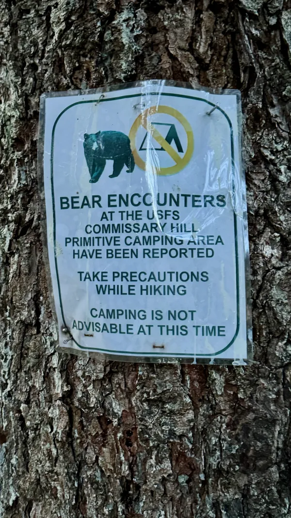
A sign warns about bears near Commissary Hill
The temperature dropped overnight, and the wind picked up early this morning. I woke up when my tent shuddered and shaked with each gust, but soon fell back to sleep.
I'd set my alarm a little earlier than usual to help me get on the trail by 7:30 a.m. As I was leaving the campsite at Commissary Hill, I passed a sign nailed to a tree. I hadn't noticed it when I arrived yesterday evening.
The sign said, "CAMPING IS NOT ADVISABLE AT THIS TIME." I shrugged and started walking.

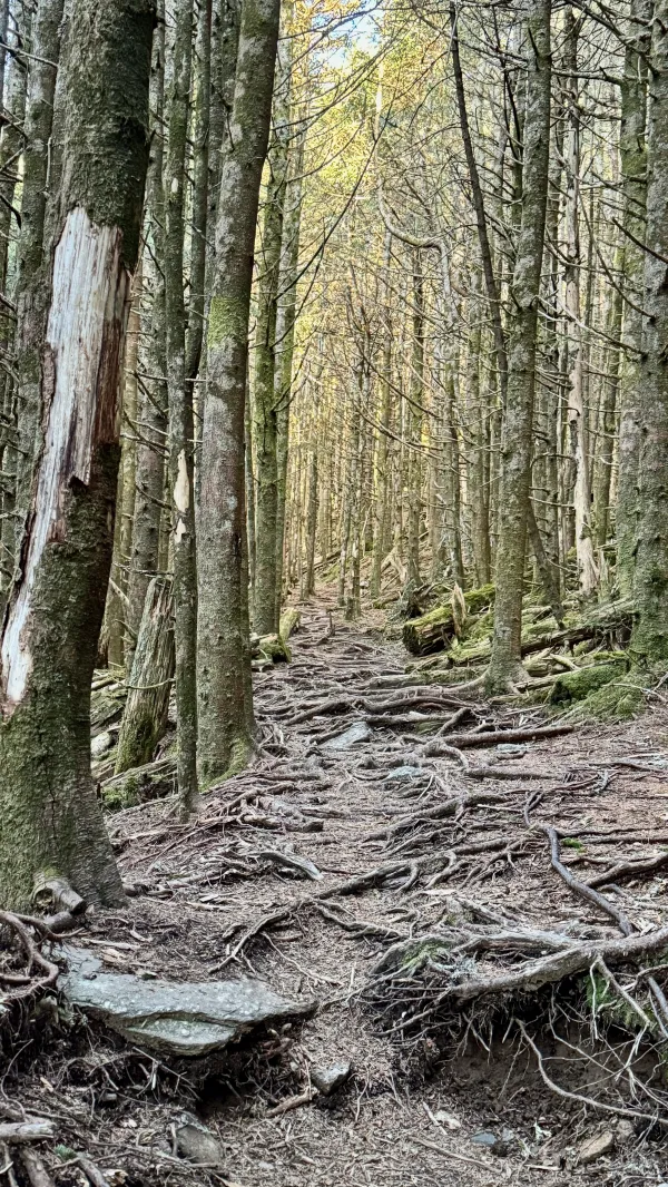
The trail follows an old railroad bed
To get to the top of Mount Mitchell, I first had to retrace my steps on the same old railroad grade I followed yesterday to Commissary Hill. This took me back to the Mountains-to-Sea Trail.
The sky was clear, and the temperature remained chilly in the morning. There were a few spots on the railroad bed with ice, but none caused me any trouble.

The trail climbs near the site of Camp Alice
It took about 30 minutes to reach the MST. The trail immediately began a steep climb to the summit of Mount Mitchell. Initially, the footpath was littered with large boulders, and I sometimes had to take big steps to push myself upward.
Before long, I passed near a spot called Camp Alice. This had been the site of a logging camp for Mount Mitchell Lumber Company, which was used for a couple of years before the land became North Carolina's first state park.
Dickey & Campbell Logging Company began logging in this area in 1905, but it took crews years to work their way up the mountain, cutting every large tree they could. Around 1912, the company was reorganized as Mount Mitchell Lumber Company, about the time Camp Alice was established.
The logging railroad that started in the South Toe River valley terminated at Camp Alice. The train and the camp were first used by loggers, cooks, and tool maintenance crews. The camp's name may have come from a company executive's family member or perhaps a cook. Records are unclear, and sources vary in their accounts.
In 1915, the railroad was converted for use as a passenger train. Tourists were hauled up to Camp Alice, where they could make a short walk to the mountain's summit. The $2.50 round-trip train ride was promoted as "America’s Greatest Scenic Trip."
Camp Alice quickly grew, adding a 250-person dining hall, a lunch counter, and a souvenir stand built to accommodate the sightseers. Cabins and tents were provided for those who wished to stay overnight.
But in 1919, the owners decided to prioritize logging, and they shut down the passenger service. Nearly every living tree had been removed from the mountain by 1921, and the railroad's tracks and ties were taken up shortly after.
For a time, a one-way toll road was operated on the former railroad bed. For $1 per person or $3 per car, motorists could drive to Camp Alice from 8 a.m. to 1 p.m. After sightseeing at the mountain, they could return down the road from 3:30 to 5:30 p.m. Safety patrols traveled between 1:00 and 3:00 to look for disabled cars.
Camp Alice was later transitioned to a park ranger outpost and a camp for Civilian Conservation Corps crews. It fell into disuse after the Blue Ridge Parkway was completed and a better road was opened to the top of Mount Mitchell. None of Camp Alice's buildings remain standing today.
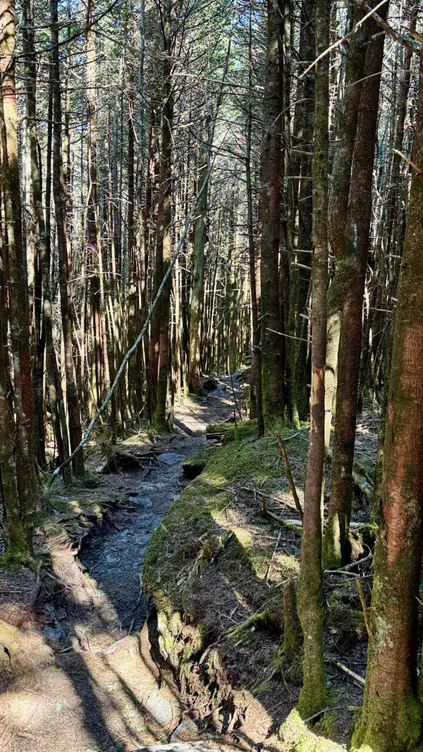
The trail is covered in roots
Turning away from the Camp Alice area and continuing the climb, the trail was no longer covered in large boulders. Tree roots were the new obstacle to negotiate.
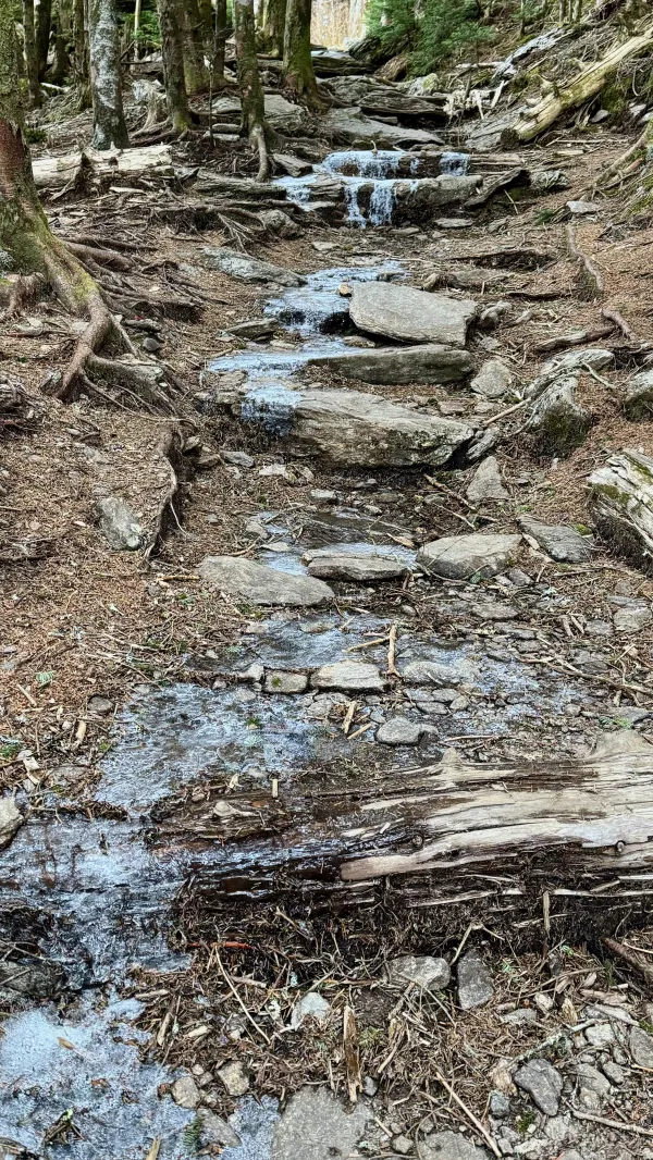
Ice on the trail
Within a few minutes, I was back to stepping over rocks, but now, there was also ice. Because of the steep climb, I was glad my legs were fresh and the air was refreshingly brisk.

A viewing platform at the summit of Mount Mitchell
I reached the summit of Mount Mitchell at 8:45 a.m. A path led to a round, stone viewing platform. Next to the platform's base was the burial site of Dr. Elisha Mitchell, the mountain's namesake.
Mitchell was a professor at the University of North Carolina. After conducting a geological survey in 1828 of the mountain known then as Black Knob, Mitchell reported his measurements proved it was the highest peak in the state.
His findings led to a long-running dispute with Thomas Clingman, a Civil War general and U.S. senator. Clingman argued that Clingman's Dome, the mountain named in his honor (now called Kuwohi), was the tallest peak east of the Mississippi River. Mitchell insisted Black Knob was higher, and he climbed it several more times to measure and prove his claim.
One of the trips Mitchell made in 1857 led to his death. It is believed he was hastily descending the mountain to avoid an approaching storm when he perished. The debate about which mountain was highest lingered for many more years after his death until additional measurements proved that Mitchell's were more accurate.
To bolster Mitchell's claim, his supporters moved his body in 1858 from an Asheville cemetery to the top of the mountain. The mountain was named in his honor 30 years later.

A view from the Mount Mitchell viewing platform
When I reached the top of the viewing platform, I didn't linger there because of the cold temperature. I also wanted to stay mindful of the trail ahead. The next few miles would be tough, and I knew I couldn't hike fast in those conditions.

A flat section of trail
From the summit, I left the Mountains-to-Sea Trail, crossed a parking lot, and found the start of the Black Mountain Crest Trail. That trail's path was flat and smooth at first, but I knew it wouldn't remain that way for long.

Climbing to Mount Craig
I was right.
Within five minutes, the BMCT began its first climb, which took me directly over the top of Mount Craig. The mountain now bears the name of Locke Craig, the North Carolina governor who signed the law establishing Mount Mitchell State Park. Before it was given that name, it was called Black Brother because it was so close to Black Dome (Mount Mitchell).
This part of the trail along the Black Mountains was littered with trunks of dead fir trees, though the forest was regenerating with fir saplings. The area suffered significant damage from an adelgid kill. This was one of the first forests in the southeast where the tiny, sap-sucking insects attacked Fraser firs. That happened in the 1960s and 1970s. Since then, regrowth has been slow because of the harsh environment at this high elevation.

A view from Mount Craig
At 6,647 feet above sea level, Mount Craig is just 37 feet shorter than Mount Mitchell, making it the second-highest peak of the Appalachian Mountains.
I met a day hiker with his dog on the climb up Mount Craig. After stopping to chat with him, it didn't take me long to reach the granite outcropping at the top. It was only about one mile from the taller mountain's peak, though getting there required descending about 300 feet and then climbing nearly the same amount.

Descending with help from a rope
The next mountain, Big Tom (6,580 feet), was just a quarter-mile to the north. It is a sub-peak of Mount Craig and bears the name of Thomas D. (Big Tom) Wilson. He was a hunter and mountain guide who spent most of his life in these mountains.
Wilson is credited with finding the body of Dr. Elisha Mitchell in a pool at the base of a waterfall on a nearby mountain.
The descent from Big Tom was extremely steep. A rope was provided there to assist hikers in making the climb or drop. Truthfully, I didn't feel the descent was any worse than many I've had to make on the Appalachian Trail, and nearly all of those didn't have a rope.

The top of Balsam Cone, covered in trees
I met another hiker coming down from Balsam Cone as I began to climb it. Standing at 6,597 feet, this mountain was about one mile from Big Tom. It's another of the top ten highest peaks in the eastern U.S., but it didn't seem noteworthy. The summit was mostly covered in a thick tangle of rhododendrons.
A narrow section of the trail
Continuing about a half-mile farther north, the Black Mountain Crest Trail left Mount Mitchell State Park's boundary. The trail didn't cross the summit of the next tall mountain, Cattail Peak (6,585 feet). Instead, it stayed about 50 feet below it, which was somewhat surprising. Until now, the trail had consistently traversed the top of every knob and peak on the ridge.
The trail was built as a fire line corridor by a CCC crew in the 1930s. It was also used by forest rangers as a foot patrol route. Forest Service crews enhanced the trail in later years, and it was blazed in the 1970s to be a hiking trail. The same thing was done to a couple of access trails that climb to the Black Mountain Crest Trail.

A view from Potato Hill
Next was an especially steep climb up to the summit of Potato Hill. It's unclear why this mountain is called a hill. At 6,467 feet above sea level, this is by no means the shortest peak on the Black Mountain Crest.
I stopped to eat a snack before making the climb because I knew I would need an extra boost of calories. I also stopped about halfway up when I met two backpackers coming down the other direction. They told me they were hiking a short loop, and they asked me questions about camping at Commissary Hill.
There was a splendid view at the top of Potato Hill, the best since leaving Big Tom. From there, the trail dropped to Deep Gap, and I arrived there at 12:15 p.m. So far, I had only walked 5.4 miles, but I wasn't dissatisfied with my progress. The difficulty of this trail was living up to its reputation.

A view of a rock quarry near Spruce Pine, N.C.
Deep Gap is the only spot where camping is allowed along the Black Mountain Crest Trail. During my initial planning for hiking the Appalachian High Route, I considered staying here. There was no need for that now, but I took a short break to eat lunch before beginning the next climb.
The top of that climb was the summit of Winter Star Mountain (6,208 feet). While standing at another viewpoint on the other side of the summit, I noticed a large patch of white far in the distance.
I guessed it was a rock quarry, but didn't know that for sure until I looked at a Google map. What I had seen from the mountain was a quarry where quartz and feldspar were extracted. It was about 12 miles from Winter Star Mountain.
According to Ron Tagliapietra in his book, The Southern Sixers, the mountain's name comes from ice crystals that form on a waterfall on its slope, which are said to sparkle like stars.

A view from a rock outcropping near Gibbs Mountain
There were other rock outcroppings on the way to the next 6k mountain on the Black Mountain ridge, Gibbs Mountain (6,241 feet). The views and the weather were so enjoyable that I wished I could have stayed there for several minutes. Unfortunately, the time was now past 2 p.m. and I still had several miles to go.
Another rope was provided to assist on one of the climbs up the approach to Gibbs Mountain. The trail did not directly cross the mountain's summit. Instead, it skirted around the top, staying slightly below it and the next mountain, Horse Rock. That mountain is also known as Percys Peak (6,228 feet).

A view of the ridge of Black Mountains from near Celo Knob
The last mountain 6,000 feet or higher along the BMCT was Celo Knob (6,329 feet). This was the mountain I saw yesterday from several miles away. Celo Knob's name is from the Cherokee word for corn.
Again, the trail didn't cross the summit, but instead, rounded it on the west side. Celo Knob's slope was covered in tall grass and scrubby trees.
Looking back from there, I could see across the entire range of the Black Mountains. Horse Rock was the closest mountain, followed by Gibbs Mountain. Beyond it were White Star Mountain, Potato Hill, Cattail Peak, Balsam Cone, and Big Tom/Mount Craig. The only mountain I couldn't see well was Mount Mitchell at the farthest end of the ridge, which was mostly blocked in my view by Big Tom and Mount Craig.

The Black Mountain Crest Trail begins a descent to Bowlens Creek
A short distance beyond where the trail passed Celo Knob, it began a long and steady drop. The time was around 3:45 p.m., and at last, I was heading down to the trailhead. Getting there would require descending more than 3,000 feet.
The trail to the valley was wide and must have been an old logging road. The footpath wasn't always clear and easy to walk, but it wasn't steep. The steady descent allowed me to walk faster than before.
I knew by now I wasn't going to make it into Burnsville before dark. The solution was easy. I would use my backup plan to stop at the Bowlens Creek Trailhead.
I called my wife to let her know about the change in plans and arrange a time for her to pick me up.

A ramshackle bridge over Bowlens Creek
The trail crossed Bowlens Creek less than a mile before the trailhead. I was taken aback when I saw the condition of the bridge over the creek. I was supposed to cross this ramshackle old thing?
The bridge looked like no maintenance had been done to it since logging days. It was in such a poor condition that someone had placed large tree branches to close gaps between its rotting deck planks. I carefully made my way across, watching where I took each step to make sure I stepped on a firm, unbroken plank.
Kim picked me up soon after I arrived at the trailhead, and we stayed overnight in town. I wasn't done yet, but I was oh so close.
Sunday was another sunny day and slightly warmer than yesterday, making perfect conditions for me to finish my hike of the Appalachian High Route. It was by far the easiest day of hiking on the whole route.
The Black Mountain Crest Trail didn't turn out to be quite as difficult as I anticipated yesterday, but it was strenuous enough that I was glad I didn't have another day like it today.

Kim drives away from the Bowlens Creek Trailhead
We waited until nearly 11 a.m. before Kim drove me back to the Bowlens Creek Trailhead. I only needed to walk four miles back to Burnsville, so there was no need to hurry. The extra time also allowed the sun to take most of the chill off the morning.

Bowlens Creek Road
The route was all on roads, and for the most part, they had no shoulders to walk on. Thankfully, there wasn't much traffic on this Sunday morning.
The route followed Bowlens Creek Road for 2.4 miles to State Highway 197, passing a couple of churches along the way. Today was Easter Sunday, and their parking lots were full of cars.

U.S. 19 E at State Highway 197
After another half-mile, I had to cross U.S. 19 E. I was glad to find a traffic light here, because crossing four lanes of traffic without one is not fun. I know this because on my first day on the AHR, I had to cross this same highway where there wasn't a traffic light.
The rest of the way went through the town of Burnsville, and much of it was on a sidewalk. My wife met me as I arrived there, and we walked the rest of the distance together.

A park in the center of Burnsville, N.C.
The town was named for Captain Otway Burns, a privateer during the War of 1812 and later a North Carolina politician.
Burns never spent time in Western North Carolina, but his name was taken for the town because he advocated the creation of western counties during his time in the state legislature. Burns was later voted out of office. He was so destitute when he died, local citizens of his coastal town had to pay for his funeral.
Kim and I walked past a statue of Burns that stood in a park in the middle of town. It depicts him in a naval uniform and was erected in 1909, 59 years after his death.

Downtown Burnsville is nearly deserted on a Sunday afternoon
According to the 2020 census, Burnsville has slightly more than 1,600 residents. There weren't many people in the commercial area as we walked through it at 12:30 on this Easter Sunday afternoon.

Burnsville Visitor Center
My walk ended at the Visitor Center, the same spot where I started the loop of the Appalachian High Route last year.
It had been a demanding journey, but that was largely because of complicated logistics. It was impractical or illegal to camp in several long sections of the trail. Finding water and resupplying were also sometimes challenging. I was fortunate to have family members who lived nearby because they helped me solve some of the difficulties.
Despite the troubles, I enjoyed hiking the AHR. One reason for that was because it included some of my favorite parts of the AT and other places I had previously hiked. All of the route was 1.5 to 3.5 hours driving distance from my house, and that made it convenient to reach.
I liked the AHR enough that I might consider hiking it again, but that won't happen soon. I have a long list of other trails I want to hike. The first one on the list is entirely different from what I experienced in Tennessee and North Carolina.
I got the tools to satisfy
Just walk away, if I fall shy at all
Come on, baby, finish what you started
I'm incomplete
That ain't no way to treat the broken-hearted
I need some sympathy
This trail report was published