
Day 21 Pigeon Gap to Fryingpan Mountain
More from this trailDon't be scared to walk alone, don't be scared to like it
There aren't many rules of thru-hiking. There's no official guidebook to spell out the correct way to complete a long-distance hike. Purists might claim a set of standards must be followed, but most hikers do well just to live by the old trail maxim, "Hike your own hike."
The closest we have to thru-hiking rules are the Leave No Trace principles. Federal agencies and trail organizations adopted them to protect the outdoors and ensure everyone can enjoy it safely.
Other than these, I can think of only one generally accepted rule for thru-hiking, and really, it's just a way to define the term. The Appalachian Trail Conservancy and some other trail organizations say a thru-hike is a hike of the whole trail in 12 months or less. If your hike takes longer than that to finish or you don't intend to hike all of it, you're not a thru-hiker. You're a section hiker.
When I started hiking the Appalachian High Route on April 6, 2023, I intended to thru-hike it in one go. I knew Polecat didn't want to hike all of it, but I didn't mind. In particular, he was unenthusiastic from the beginning about hiking the road sections in and out of Burnsville, and I couldn't blame him for that. I was content to hike alone where he didn't want to hike. That included my first day, when I hiked by myself out of Burnsville, N.C.
By Day 8, we had to make a change in plans. An error in calculating the distance between shelters in Great Smoky Mountains National Park forced us to skip a section to stay on schedule. We returned last fall to complete those missing miles.
We also got off the trail on Day 17, this time because of various factors, including weather.
Since then, Polecat and I have been unable to find a suitable time to finish the AHR together. With 85 miles to go, I decided to finish the route alone. This has already been a hike that has strayed far from what I thought it would be, and it will continue to be different. Nevertheless, if I can complete the remaining miles in the next few days, I will still achieve my goal of thru-hiking the entire route.

A trail marker at Pigeon Gap
To make sure my footsteps were connected for every mile, I returned today to Pigeon Gap. That was the same spot on the Blue Ridge Parkway where Logan, Polecat, and I left the trail last April.
My wife, Kim, dropped me off shortly after 5 p.m. The starting time may seem unusually late in the day, but it was on purpose. According to the FarOut app, only two identified campsites were reachable from the gap in one day or less. One potential site was 1.4 miles away, and the other was just four miles from the gap.
Beyond those two, the app didn't show another campsite for another 70 miles.
The campsites the app listed near Pigeon Gap were located outside the parkway's boundary. Camping isn't allowed inside the boundary. Though I might be able to find a stealth site along the way, I didn't want to deal with an unknown like that today. So far on the Mountains-to-Sea Trail, there have been almost no stealth sites, and I couldn't be sure to ever find one.
As soon as I took my first steps at Pigeon Gap, I ran into some confusion. The trail appeared to go where a trail marker was pointing, but it went instead to a parking area. I had to stop and check the FarOut app, then discovered that the trail I needed went down a steep slope.

A line is cut through trees for a powerline
The trail's descent took me through a cut made in the trees for a power line. This opened the only view of the day, and I could see the nearby mountains.
I knew that the sun would set at 7:46 p.m. and assumed I would have all the daylight I needed to reach the campsite. Even if the trail was difficult, I thought I could get there before dark.
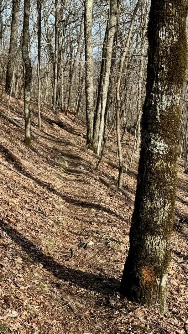
A section of smooth footpath
The trail didn't turn out to be difficult at all. The drop at the start didn't stay steep for long. It soon became a much more gradual descent that continued for about two more miles. In that distance, the trail lost 800 feet of elevation.
Early in the descent, the trail crossed U.S. Highway 276, which is known locally as Pisgah Highway.

A footbridge over a small stream
I crossed at least four small streams on this short hike. A footbridge at the first stream was incorrectly labeled in FarOut as a log bridge.
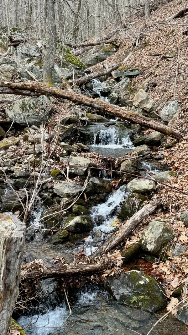
A narrow stream cascades down the side of a mountain
FarOut said the first available campsite was located at the second stream. I looked around but didn't find a spot that looked suitable to pitch a tent. I hoped the site I was heading to would be much better.

Mountain laurel branches make a canopy over the trail
The trail occasionally passed through thickets of mountain laurel. The shadows underneath these and the fading sunlight made the hour seem later than it was.
When the trail crossed a third stream, it joined the Barnett Branch Trail to follow the same footpath for a short distance. After they split, the Mountains-to-Sea Trail began a gradual climb.

A tree has been blackened by a fire
Early into the climb, I noticed some trees were partially blackened. I didn't know how they were burnt, but given the general health of the forest, I guessed it happened in a prescribed burn and not a wildfire.

Water streams over the trail
I stopped to collect two liters of water when I reached Poplar Creek, the last stream before the campsite. That would be enough to cook dinner and carry me through the first part of tomorrow.
Remarkably, no water sources were shown in FarOut past this stream for the next 14 miles. That would have been an alarming distance if I had only discovered it today. Fortunately, I noticed the long dry stretch while planning for my hike and was able to solve this problem without a need to carry water that far. On the way to Pigeon Gap today, I left a cache of water near a car pullout on the parkway. I'll reach it and collect the water tomorrow.

Gravity's tent stands in a campsite
Before setting up my tent, I called Kim to let her know I had stopped for the night. She was still driving home, but was almost there. She told me she saw a bear soon after she dropped me off at Pigeon Gap. A short distance away, she saw a couple picnicking at the side of the Blue Ridge Parkway, and she wondered if the bear was about to invite itself to the picnic.
This was good information to have. I hadn't seen any bear scat on the trail. It was reasonable to assume bears lived in the area, but Kim's sighting told me at least one wasn't far from here. Bears often travel several miles in a day as they search for food.
After talking to Kim, I had no one else to talk to while I ate my dinner. It seemed weirdly quiet because I usually camp with at least one other person on a thru-hike.
Some people go backpacking to get away from others, but I appreciate sharing a campsite to swap stories and get to know my campmates. At the same time, I have never felt uncomfortable about being alone. I've done that enough to appreciate the feeling of independence. It's liberating to be concerned only for myself.
It's a good thing I feel that way. Except for when I will stop a couple of days from now to see my family in Asheville, all of my remaining miles on the Appalachian High Route will be hiked by myself.
Don't be scared to walk alone
Don't be scared to like it
There's no time that you must be home
So sleep where your darkness falls
This trail report was published