
Day 18 Fork Ridge Trail to Icewater Spring Shelter
More from this trailIf the summer change to winter, yours is no disgrace
I should have known our hiking plan for the Appalachian High Route would be unworkable. I've hiked enough long-distance trails to know better. A schedule with too many details never works. Weather, terrain, sickness, injury, or another unexpected circumstance is bound to happen, forcing a small or large adjustment.
Admittedly, Polecat and I had good intentions when we put together our plan for this hike. We intended to limit our daily mileage and keep the distances between resupply stops short. We also had several logistical challenges imposed by the trail itself. Namely, there were limited places to camp in Great Smoky Mountains National Park and along the Blue Ridge Parkway.
When we left the trail in April, we'd completed all but about 100 miles. We still had to complete a section of the Appalachian Trail in Great Smoky Mountains National Park and a long stretch of the Mountains-to-Sea Trail in North Carolina.
I had other travel plans over the summer, and Polecat was busy too. It wasn't until the weather began to turn cool that we started planning to hike the remaining parts of the trail. We picked a section of the Mountains-to-Sea Trail.
Our idea was to park a vehicle at each end of where we wanted to hike. We also looked for a place to stash water and food so we wouldn't have to go off the trail to resupply.
This plan fell apart before it started.
While driving to where we intended to leave our cache, my guidance GPS suddenly said we couldn't get there. The Blue Ridge Parkway was closed.
The National Park Service closed the road because some idiot tourists fed and reportedly attempted to hold bear cubs. This made it impossible to reach our cache location near Craggy Gardens. Driving in separate vehicles required some coordination to figure out a new plan.
First, we found a café in a grocery store where we could stop, look at maps, and consider our options. We concluded that the only good alternative was to turn around and go to the Smokies. Before heading that way, we made reservations for Icewater Spring and Tricorner Knob shelters on the section of the AT we still needed to hike.
Our hike was now going to be shorter than we intended, but I was satisfied with the change. It accomplished our goal of connecting a missing piece of the Appalachian High Route. We were also still on track to complete the AHR in one year.

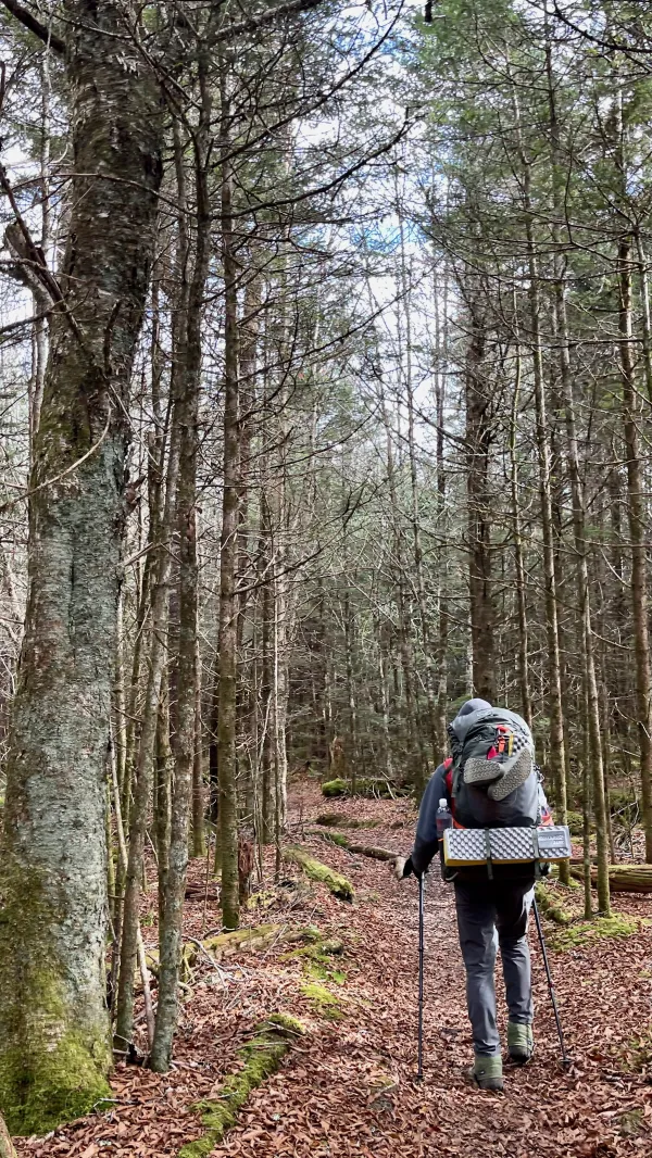
Polecat walks on a trail in the Smokies
After nearly two more hours of driving to drop off Polecat's truck at Cosby Knob Campground, we were on our way to Clingman's Dome. That was another 90 minutes of driving.
We were nearly there before we remembered that we didn't have to go all the way. After Kim dropped us off on Day 9, we hiked from Clingman's Dome to the start of the Fork Ridge Trail. There was no need to hike that section again, so we found a parking space where the trail crossed the access road and left my truck there.
At last, we arrived at the AT and started hiking the section we missed in April. The time was just after 1 p.m.
The Appalachian Trail in the Smokies
The AT descended a slope of Mt. Collins. I've hiked this section many times and was pleased to be here again. The forest was thick with spruce and fir trees, and the footpath was well-worn. The air was cooler than I had expected.
Most of the AT in GSMNP was constructed in the 1930s by crews from the Civilian Conservation Corps (CCC). The first CCC camps in the park were opened soon after the park was established. The section of the AT in the park was completed by 1936.

A large tree is lying on its side with its roots spread upward
We followed a rocky spine of mountains. The soil was shallow here, so the trees were forced to spread their roots wide and cling to rocks. If a tree grew too high, it was vulnerable to toppling over in a wind storm. We passed more than one that had done that. Their large spread of roots was upended.

Broken clouds above Indian Gap
We walked quickly and arrived at Indian Gap at 2:30 p.m. Clouds above us were beginning to break up. Despite a small amount of sun that was able to filter through, the temperature wasn't rising much.
Before Newfound Gap was discovered to be the lowest spot for travelers to pass over the mountain range, Indian Gap was the primary route through the mountains used by Cherokee Indians and early White settlers. A toll road called the Oconaluftee Turnpike was completed in 1839, which used this gap to cross the Smokies.

An enclosure to keep non-native wild boars away from native plants and trees
The trail crossed a fenced enclosure, one of several in the park designed to protect native plants like beech trees from non-native wild boars. This protection program began in 1984. Park staff also actively manage the boar population through trapping and hunting.
Wild boars, originally from Europe, were introduced to North Carolina in April 1912 for a game preserve. Within 10 years, 100 boars had escaped into the mountains, and their population now numbers in the thousands.

Polecat walks across Newfound Gap
We arrived at Newfound Gap at 3:40 p.m. The temperature was beginning to drop. Low clouds made the air hazy and damp.
There weren't many cars in the large parking lot, which I was a little surprised to see. Admittedly, though, this wasn't a weekend or summer day, when this parking lot and many others in the park would be jammed full.

Large boulders stand on the trail
We passed a few day hikers who were heading back to their cars in Newfound Gap.
I've also hiked this part of the AT after Newfound Gap several times before. Although the trail is wide in several places, I had forgotten that it also has rugged, narrow sections filled with large boulders.

Low clouds circle Mt. LeConte
Newfound Gap was the low spot of the trail for today. A long climb started there, going up 1,100 feet in the next 2.5 miles. The clouds that we passed through at the gap were now below us, but I didn't realize that until I looked to the north in the direction of Mt. LeConte. The peak was circled by low clouds.

Near where the Boulevard Trail intersected with the AT
When I passed where the Boulevard Trail intersected with the AT, I was reminded of a time I stopped there to eat a snack on a day hike around Christmas time in 2005. Two or three inches of snow was on the ground.
My back was turned to the AT, and I was startled to hear a hiker approaching from the north. The hiker sped by me. The crampons attached to his pack clinked together as he trudged by in the snow. The hiker uttered a short "Hello" to me and was soon out of my site.
It took me a moment to recognized who the hiker was. It was Matthew "Squeaky" Hazley. When I realize that, I understood why he didn't stop to talk.
Squeaky had already hiked all of the Pacific Crest Trail and the Continental Divide Trail when he passed me. He was just days away from completing a thru-hike of the Appalachian Trail and would reach Springer Mountain in Georgia before New Year's Eve.
There is a significant difference, however, in Squeaky's accomplishment of hiking all of the Triple Crown compared to mine, which I finished 16 years later. He did it all in one calendar year. He was just the second person to do this.
What's more, he was the first person to hike a Calendar Year Triple Crown without flip-flopping. He hiked each trail continuously from one end to the other without switching to another trail to take advantage of better weather.
To achieve this, Squeaky hiked more than 7,500 miles in 240 days. That was an average of 40-45 miles per day. It was no wonder he didn't stop to chat with me.

Icewater Spring Shelter
Polecat and I arrived at Icewater Spring Shelter at 5:15 p.m. It sleeps 12, but there was only one other backpacker besides us. He told us his trail name was Lux, and he started from Amicolola Falls a month ago. He planned to end his hike tomorrow.
When I asked Lux about his unusual trail name, he said it was given to him by an employee at Mountain Crossings in Georgia. The employee was giving him a shakedown, the process of an experienced hiker reviewing a newbie's gear and suggesting ways to lessen the pack weight. Lux got his name because the employee noticed all of his gear was deluxe.
The three-sided shelter had dormer windows and a loose stone retaining wall. A heavy, large tarp was draped across the opening, which did a good job of keeping out the wind.
The temperature steadily dropped as Polecat and I prepared dinner, and by the time the sun set at 6:43 p.m., it had become downright cold. I was glad I brought along extra insulating layers and didn't waste any time getting ready for bed.set
Before our plans changed today, Polecat said he wanted to hike this section of the Smokies in the winter. Even though today was the last day of October, we were about to discover that winter comes early around here.
Yesterday a morning came, a smile upon your face
Caesar's palace, morning glory, silly human, silly human, silly human race
On a sailing ship to nowhere, leaving any place
If the summer change to winter, yours is no
Yours is no disgrace
Yours is no disgrace
Yours is no disgrace
This trail report was published