Although the temperature yesterday morning was forecast to be below freezing, I don't think it dropped that far. It definitely did this morning.
When I woke up, the inside of my tent was frosty.

Wednesday, September 11, 2019
Although the temperature yesterday morning was forecast to be below freezing, I don't think it dropped that far. It definitely did this morning.
When I woke up, the inside of my tent was frosty.
| Weather | Mostly clear sky; frosty, below-freezing temperatures in the morning, then warming to the mid 60s |
| Trail Conditions | One modest climb, then a long and easy descent |
| Today's Miles | 19.2 miles |
| Trip Miles | 1,917.2 miles |
I remembered last night to put my water filter in a ziplock bag and then inside my sleeping quilt so it would not freeze. If it were to freeze, it would no longer be effective in removing microscopic parasites like giardia.
Then I kept the filter in my pocket this morning because the risk of it freezing remained for a couple of hours. I will need to take these precautions for most of the way to the finish of my hike.
To get on the trail sooner in the chilly morning, I only ate a quick snack as I packed to leave. I was hiking a little after 7 a.m., again with spare socks on my hands to help keep them warm.
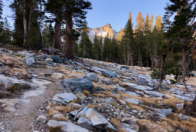
From our campsite near Rush Creek, the trail began a climb. It wasn't steep at the start but soon became so as it climbed to above 10,000 feet.
Ahead, I could see many of the same mountains I saw when I crested Donohue Pass yesterday. The sun was just beginning to hit the peaks.
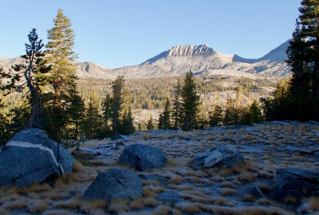
The 1.3-mile climb was not as difficult as I expected. Perhaps the chilly air was a motivator to keep me going up the steep section.

Grass and shrubs were still covered in frost as I made my way to Island Pass. Purple mountain heath flowers near the top were too.

As I arrived at the pass, I was paying attention to my view of Banner Peak and didn't realize I was approachng a pond.

Then the pond caught my eye, and I saw in it a glassy smooth, perfect mirror image of the mountains I had seen first. On the right of Banner Peak was Mt. Davis. Directly behind it was Mt. Ritter.
After spending a few minutes taking in this view and taking photos, I decided to stay here longer. I set up my stove to make coffee with breakfast and laid out my quilt to dry it in the sun. Then I discovered I could receive a cell signal here, so I downloaded some podcasts. I ended up staying for about an hour.

Outstanding views like what I saw at Island Pass continued when I resumed hiking. Thousand Island Lake was another beautiful spot, which was about 1.7 miles down the trail and about 380 feet lower in elevation.
I saw several northbound hikers as I walked toward the lake, but not nearly as many after I passed it. John Muir Trail split from the PCT at the lake, and most people I had been seeing to that point were hiking the JMT.
The two trails took separate paths for about 13 miles. By the end of my hike today, I would start seeing JMT hikers again when the trails rejoined.
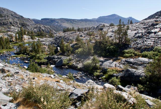
After leaving the lake, the PCT followed the Middle Fork of the San Joaquin River for a short distance. This river is the longest in Central California and the Middle Fork is the largest of its three forks.

The trail then turned away from the river to follow a path on the slope of San Joaquin Mountain. This route was parallel to the river but remained well above it. Though I could see the edge of the river's gorge, the river was soon out of sight.
The mountain and the river were named San Joaquin by the Mexican soldier and explorer, Gabriel Moraga. San Joaquin is the Spanish name for Saint Joachim, who in Christian tradition is the father of the Virgin Mary.
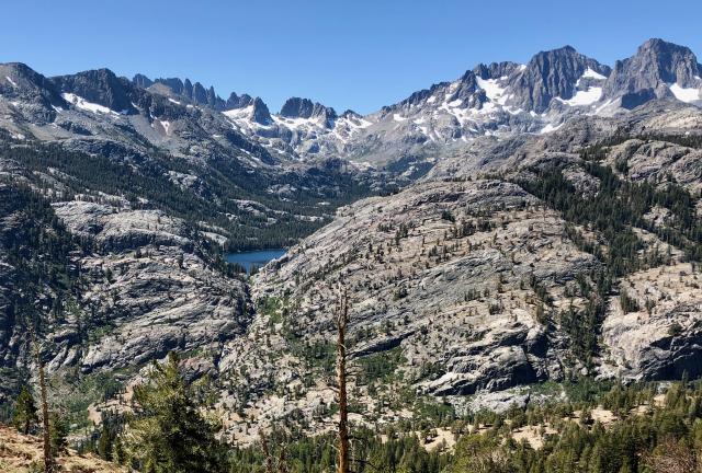
The Minarets stood about five miles away on the other side of the valley where the river flowed. There were 17 jagged peaks in this range, which have been given unofficial names of climbers who first climbed them.
When the Wilderness Act in 1964 was signed into law, this area was named for these peaks. As I've already mentioned, the wilderness is now named to honor Ansel Adams.
Shadow Lake appeared at the foot of the Minarets.

The trail was mostly easy to walk for the rest of the day. The frosty cold of the morning was long forgotten as the temperature rose into the 60s under a clear sky.
With a wide-open landscape, I could still see Mt. Ritter and Banner Peak behind me and now more than six miles away.
The trail continued along the ridge above the river for seven miles. It then followed several switchbacks down to a developed area called Agnew Meadow. With a hiker and horse rider parking lot, this was not part of Ansel Adams Wilderness.
I continued a short distance past the road to where the trail re-entered the wilderness area, then stopped at a stream for lunch.

After leaving my lunch spot, the trail descended with more switchbacks to meet the Middle Fork of the San Joaquin River again. I followed the trail along the river for 2.5 miles to where it crossed the river and continued downstream on the other side.
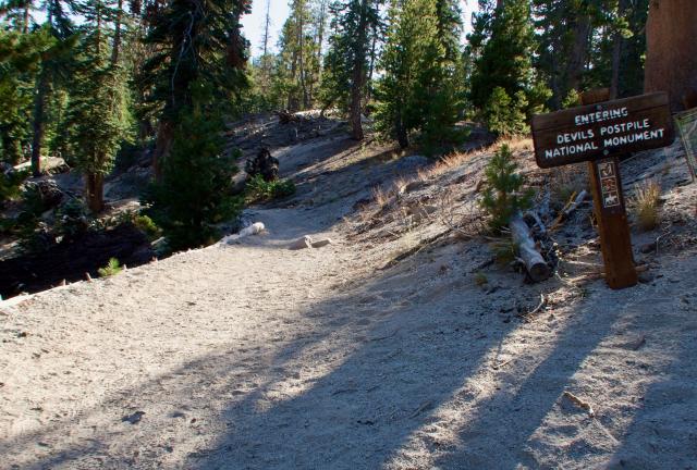
When I saw a sign marking the border of Devils Postpile National Monument, I was a little surprised. I was only vaguely familiar with this geologic feature and hadn't realized the trail passed through the park.
The park is small, covering just 798 acres, and was created in 1911 by U.S. President William Howard Taft. By making this area a national monument, Taft halted a plan to blast the postpile and use the rock in the construction of a dam.
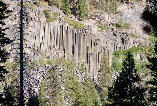
The postpile was on the other side of the river, so I could only view it from a distance.
Geologists say its formation started when a vent of basaltic lava flowed from a spot a few miles north of here until it hit a natural dam. A lake of hot lava 400 feet deep formed at the dam. As the lava gradually cooled, an unusually-thick slab of rock formed.
The cooling caused the rock to contract and crack, creating columns between the cracks. Freezing and thawing over many centuries then began to break up the columns. Earthquakes, erosion by the river, and especially glaciers, exposed and knocked down some of the columns to leave behind a wall of columns.

I crossed the river again at 5:15 p.m. From there, the trail made a six-tenths of a mile climb to a side trail leading to Red's Meadow Resort and Pack Station.
This area was named for Red Sotcher, a sheepherder with a red beard. Sotcher intended to graze sheep here in 1879, but before long was raising vegetables when he realized he could make more money that way.
A pack station has operated here since the 1940s.
The resort had a general store, restaurant, cabins, stables, and a building with showers and laundry facilities. A resupply box was waiting for me at the store, but first, I went to the restaurant. Bluejay was there and had just finished her meal.
After my meal, Bluejay and I walked to the store and picked up our food shipments. We also got coins to use in the coin-operated showers.
The camping area for hikers was about three-tenths of a mile from the resort and wasn't operated by the resort owners. Before heading that way, Bluejay and I loaded our dirty clothes into a washer before walking to the campground.
Later, Bluejay returned to put the clothes in a dryer, then I went back to get them when it was done.
The temperature was not nearly as cold tonight as it had been the last couple of nights. Better still, I knew I was able to get an extra hour of sleep. That's because the restaurant didn’t open until 7 a.m. tomorrow for breakfast.
Mirror shatters
In formless reflections of matter
Glass hand dissolving
To ice petal flowers revolving
Lady in velvet
Recedes in the nights of goodbye
Shall we go, you and I, while we can
Through the transitive nightfall of diamonds?
This trail report was published on