
Day 124 Wilma Lake to Tentsite near Volunteer Peak
More from this trailWondering where the nuthatch winters
I often say thru-hiking is difficult enough. There's no need to make it more difficult by adding unnecessary risks. That's why I wanted to skip the Sierra when I finished the desert in May and hike it later after the snow melts.
With several feet of snow on the ground, hiking conditions in the Sierra can be brutal. Wayfinding becomes difficult because the trail is buried. As the snow softens, postholing usually results and that slows you down. Streams swell to raging torrents with melted snow water, and drownings can happen during crossings. Frostbite is a common reason hikers end their hike in these conditions.
It's true some hikers made it through the Sierra this summer, but many failed. My chance of successfully finishing is significantly better because I'm hiking the Sierra now.
All of that is true, but I sometimes wish I were here when everything is covered in snow. I wonder what this place looks like.
I look at the trees and imagine how high the snow reaches their branches. I picture how smaller ones are completely covered. When I see trees with curved trunks, I know heavy snow bent them that way.
I also think about the streams in snowy conditions. Today I can easily cross most of them without getting my feet wet. Where there are no rocks or logs to hop across, the water level rarely reaches above my knee.
That would be much different with a lot of snow on the ground. I wonder what the streams are like when they're running with fast-moving, frigid water that had been ice and snow a day earlier.
These questions don't make me want to risk frostbite, drowning, or sliding off a mountain, but I'm still curious about them.

Wilma Lake in the morning
I didn't see any sign of a bear crashing through our campsite last night, but I also didn't see a large, fallen tree branch, which might have also caused the sound I heard.
Wilma Lake was a glassy mirror this morning as the sun came up. Some signs and maps refer to this lake as Wilmer Lake, and I discovered a purported explanation for that discrepancy.
As the story goes, a cartographer mapping the park in 1912 told his assistant the lake should be named after Clyde Seavey's new daughter, Wilma. Seavey was a member of the Sierra Club and an influential member of the California Assembly at the time. Supposedly, the cartographer's assistant wrote down "Wilmer" instead of "Wilma" because of the way the cartographer said the name in his New England accent.
The lake's name remained "Wilmer" until a letter-writing campaign by the Seavey family convinced park officials in 1956 to correct the error.
A short climb up Bailey Ridge on the PCT
Leaving our campsite by the lake, the trail immediately got my blood circulating with a steep climb up Bailey Ridge. Considering how modest yesterday's elevation changes were, including a long section that descended so gradually it seemed to be flat, this was a Sierra wake-up call.

A pond on Bailey Ridge
The climb started with a one-mile ascent to what appeared to be the top. That turned out to be just a mile-long respite that included a small pond of murky water.

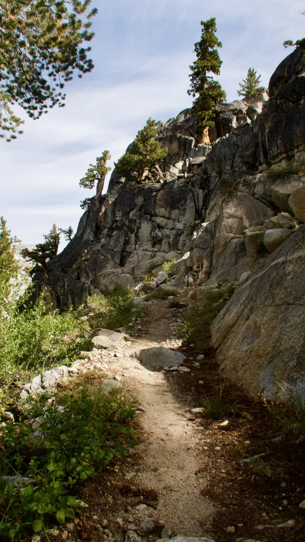
A steep and rocky climb on the PCT in Yosemite
The trail then continued the climb, going nearly straight up for eight-tenths of a mile. This climb left no doubt I was in the Sierra. The trail crested at just above 8,900 feet.

A view of Stubblefield Canyon in Yosemite
From there, the trail immediately began a drop to Stubblefield Canyon. On the way down, I could see Price Peak, which was about 4.4 miles away. To the right was Piute Mountain, about 3.8 miles away.

A shallow stream in Stubblefield Canyon in Yosemite
A creek at the bottom of the canyon was shallow. Before crossing it, I stopped to swap my dry socks for the ones I wore yesterday. They were still wet from a stream crossing near Wilma Lake and muddy sections of the trail. I decided I'd like to keep one pair dry if possible.
The steepest climb on the PCT in California
As soon as I crossed the creek, the trail began to climb again. This ascent is said to be the third steepest climb on the PCT and the steepest in California. It went up 900 feet in one mile.
For what it's worth, the climb was minor compared to some of the climbs I did on the Appalachian Trail, and especially the 1000-foot climb in one-half mile going up Wildcat Mountain.

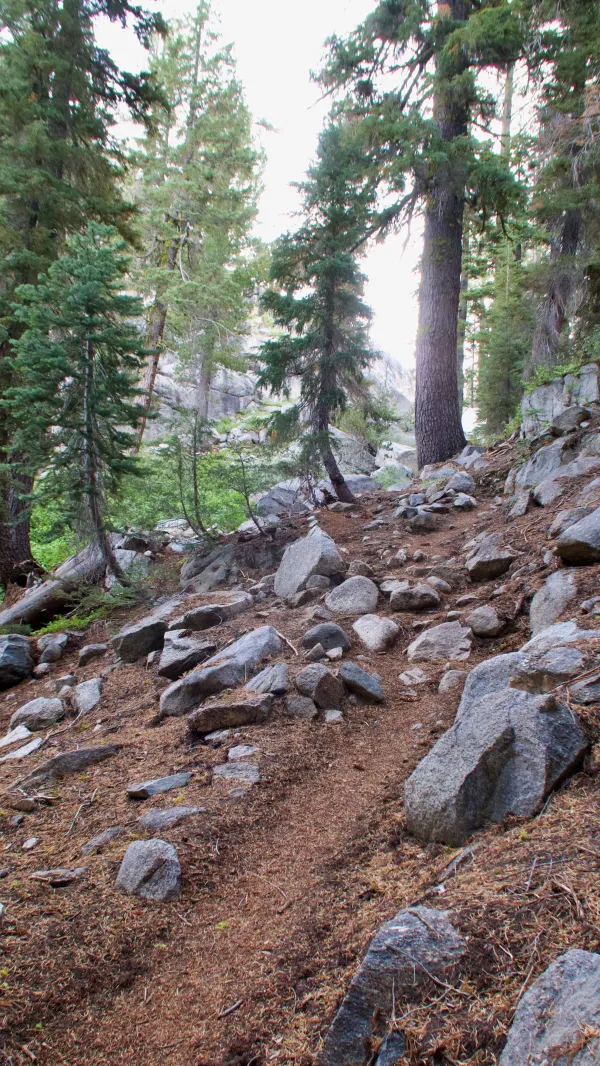
Bare rock on Macomb Ridge in Yosemite
Then again, the climb up Wildcat ended at only 4,050 feet above sea level. All of today's climbs reached above 8,700 feet, where the air becomes noticeably thinner.
Descending Macomb Ridge in Yosemite
After reaching the top, I took a break to catch my breath and watch a red-breasted nuthatch peck at a log in search of insects. Then I began heading down the other side of the ridge.

A trail mileage marker in Yosemite
I reached the bottom of the second descent at noon. This was in Kerrick Canyon, with Rancheria Creek flowing through it.
While I was stopped at the creek to filter water, a mule deer ran by. It seemed to be in a hurry, but I couldn't see if there was a reason it felt threatened.
After talking to a couple of section hikers, I finished my break and left. The trail crossed the creek, which was an easy hop across on rocks. The Guthooks app said this creek was difficult to cross in heavy snow years.

A eakirts blue butterfly on velvety goldenrod
The trail then followed the creek upstream and made a steady climb of 1,100 feet. The canyon varied in width.
Where it was wide enough for all-day sun, I found a large patch of threenerve goldenrod, also called velvety goldenrod. A reakirts blue butterfly seemed to enjoy this sunny spot.

Flat trail in Kerrick Canyon
The trail in the wide part of the canyon was smooth, flat, and easy to walk. That wasn't always the case, however.

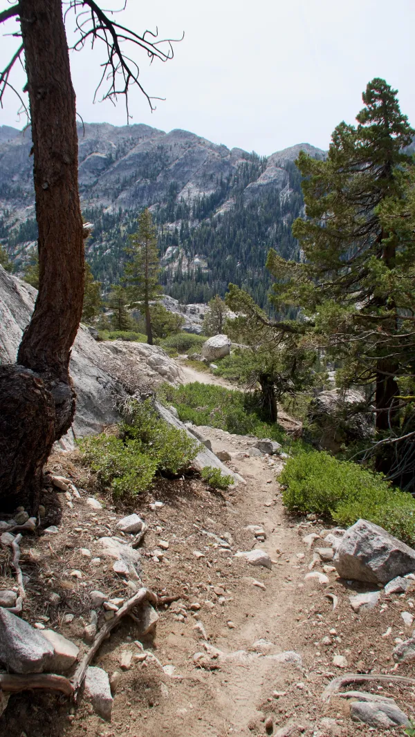
The PCT along Rancheria Creek
After following the creek for more than three miles, the canyon became more narrow and the trail became rocky.
This narrow section was just before Buckey Pass, where the trail made a sharp right turn. The trail then became steeper, but only for about a half mile as it climbed to Seavey Pass.

A pond in Yosemite National Park
Seavey Pass was at 9,129 feet. From there, the trail passed some small ponds before beginning a long descent.
On the way down, I met some hikers who were section-hiking in the Sierra. Although I had a good idea the answer was no, I asked them about the trail and if I would need microspikes. They confirmed I would not.
I asked this because I had asked Kim several days ago to mail my microspikes to me. I asked her to put them in a separate box and mail them to the post office at Tuolumne Meadow. I figured I might not need them but didn't want to risk not having them if I did.
Knowing now microspikes will be unnecessary, I will tell the postal clerk to send them back home. And if I don't open the box, they can be marked "return to sender" and there won't be another postage fee.

Volunteer Peak and Double Peak
The day's steep ups and downs weren't over yet. After leaving the ponds, the trail dropped 1,400 feet in 2.3 miles.
Much of the way down, two mountains came into view. One was Volunteer Peak, standing only 2.5 miles away in a straight line.
The other mountain was closer to me and had twin peaks. No map I found identified it by name, but I've seen it called Double Peak.

Piute Creek in Yosemite National Park
Piute Creek was at the bottom of the descent. It was another one that was shallow now but can be deep when snow is melting.
A hiker was filtering water when I reached the creek. He told me the next climb was especially tough. When I told him I was planning to go another four miles today, he seemed skeptical I could get there before sunset, though that was still three hours away. Maybe he was over-estimating the difficulty of the climb or making false assumptions based on my age, but I was startled by this.
Bluejay and I are figuring we will need to dial down our daily mileage a little because the terrain was becoming more difficult. We planned on going 18 miles today instead of at least 20, as we have been trying to hike each day.
When I left the hiker and began the climb, I felt confident I would have no problem hiking those four miles in about two hours, not three. At the same time, I knew there was a campsite two miles up the climb and hoped Bluejay had decided to stop there.
An hour after I left the creek, I found the first campsite, and Bluejay was there. I could have gone two more miles but didn't complain about the chance to stop an hour early.

Volunteer Peak glows orange
As of today, there are just 800 miles to go for me to finish all of the PCT. That's still a lot of hiking, but the end is starting to feel a little more in reach.
Just before crawling into my tent, I looked up from our campsite and noticed Volunteer Peak's summit. It glowed orange like a beacon as it caught the last sunlight of the day.
Right outside this lazy summer home
You ain't got time to call your soul a critic, no
Right outside the lazy gate
Of winter's summer home
Wondering where the nuthatch winters
Wings a mile long
Just carried the bird away
This trail report was published