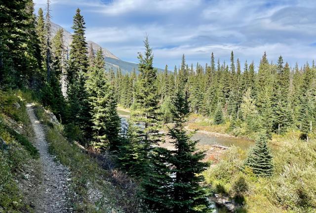
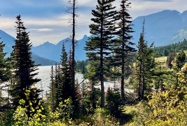
Sunset on Cosley Lake

When the last bolt of sunshine hits the mountain

Day 158, Many Glacier Campground to Cosley Lake Campsite

Friday, September 17, 2021

I like the word "penultimate." I know a big word like that isn't needed when something simple like "next to last" will suffice, but the fancier word is a better fit for today. It's appropriate because it includes "ultimate," and that word clearly applies to the day.

Today is the next to last day of my CDT thru-hike. More significantly, it's the penultimate day for me to complete long-distance hiking's Triple Crown.

It is a day of excitement and anticipation.

And of course, a day of hiking in Glacier National Park is always going to be filled with spectacular views and a few physical challenges.

Weather Partly cloudy and windy; temperatures from upper-30s to low-50s
Trail Conditions Long climb and descent, then mostly flat
Today's Miles 14.8 miles
Trip Miles 2,350.8 miles

Today started with an unknown, however. We didn't know for sure how far we needed to walk to get to our next campsite. We guessed it was around 15 miles, which was very doable. The exact distance was uncertain because we didn't intend to follow the CDT. The route we chose wasn't shown in the Guthook app, so we could only guess the mileage.

Our route was set when we made our backcountry camping reservations at the start of our hike through Glacier. We decided then to finish at Chief Mountain, not Waterton Lakes. This gave us an opportunity to go through the historic Ptarmigan Tunnel, a unique feature of the park.

Lone Wolf, Beer Goddess, and Butters

Lone Wolf, Beer Goddess, and Butters were finishing breakfast when Top O' and I were ready to leave camp this morning. I knew they would catch up to us soon.

After leaving at 8 a.m., we walked through the empty campground to Many Glacier Road. The CDT followed the road a short distance, then joined a park trail.

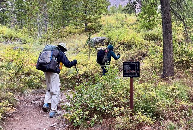
Beer Goddess and Top O' begin a climb

This trailhead was where we parted from the official route one last time. Thru-hikers choosing to go to Chief Mountain often follow an alternate route that leaves the Many Glacier area in the opposite direction. Getting to Ptarmigan Tunnel required a different trail. It was an alternate of the alternate if you will.

Beer Goddess caught up to Top O' and me after we had gone about a half-mile. Butters and Lone Wolf were a little farther behind her.

Today's hike started with yet another long climb, but it was also the last one for us on the CDT. We will have no big climbs tomorrow on our way to Chief Mountain. I knew that when I called Kim the day before yesterday. I figured if we moved up the time for her to meet us, we could walk faster on the easier terrain.

I was concerned then about the forecast that predicted rain for late tomorrow morning or early afternoon. That may have changed by now, but I didn't have cell service this morning to get an update.

Top O' and Beer Goddess continue the climb

After the first mile of the 5.7-mile climb, Mt. Wilbur (9,321 feet) and Iceberg Peak (9,146 feet) came into view. What looked like a domed mountain in front of them was a ridge that extended from Mt. Wilbur's peak.

As I continued up the trail and could see more of Mt. Wilbur, it became clear why the Blackfeet Indians called it "Heavy Shield." The side facing east was a tall, flat, and nearly vertical wall.

To the north of that mountain was Iceberg Peak, and together, they formed a cirque. Iceberg Lake was at the bottom of the cirque, more than 2,000 feet below Iceberg Peak's top. I couldn't be seen from the trail.

Iceberg Peak gets its name from the lake instead of the other way around, as is usually the case. The lake has large chunks of ice floating in it after it begins to thaw in the summer.

Top O' told me later he saw a mother grizzly bear and her two cubs on the climb. I never saw them.

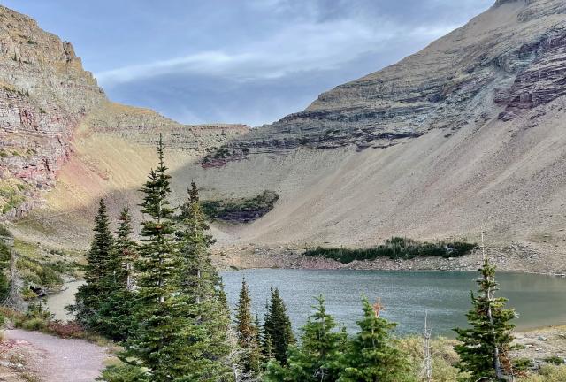
Ptarmigan Lake

It took two hours to reach Ptarmigan Lake, which appeared just before the last of the climb. Ahead of me was a wall, appropriately named Ptarmigan Wall. I thought I would be able to see the tunnel by now. It was in the wall somewhere, but I couldn't pick it out among the rugged rock of the steep cliff.

The temperature had gradually dropped on the way to the lake, and the wind became gusty. The time was now 10 a.m., but much of the valley was still in the shadow of Crowfeet Mountain (8,914 feet).

Looking toward Ptarmigan Lake and Mt. Wilbur

Past the lake, I still had 600 feet of climbing before getting to the tunnel. The trail left the timberline at the lake and went up a slope on the west side. The trail made two wide-sweeping switchbacks on the way up.

Butters and Beer Goddess climb to Ptarmigan Tunnel

Just before arriving at the tunnel opening, I looked down and saw Butters and Beer Goddess. They had just made the turn at the first switchback on the shale slope. Top O' and Lone Wolf were ahead of me and had already crossed through the tunnel to the other side.

Ptarmigan Tunnel

The tunnel's opening was smaller than I expected, which explains why I didn't see it from below. It was barely tall and wide enough for a saddle horse to pass through, and that was its purpose. It was built by a Civilian Conservation Corps (CCC) crew in the 1930s for horse tours of the park. Two groups of men using compressor-run jackhammers and dynamite charges cut the 240-foot-long tunnel in less than three months.

Steel doors were installed at each opening in 1975 so that park rangers could close the tunnel for the winter.

Butters and Beer Goddess enter Ptarmigan Tunnel

I walked through the tunnel, then waited for Beer Goddess and Butters to catch up. When they entered the dark tunnel, their silhouettes looked like spooky apparitions coming for me.

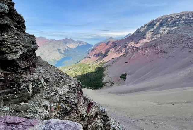
A view of Elizabeth Lake

From a landing area at the north opening, I could see far down into a valley. Elizabeth Lake was in the middle. It was named by a surveyor for one of his daughters. There is also a Helen Lake in Glacier, which is named after his other daughter. Being a surveyor in unmapped territory apparently has its privileges.

Descending from Ptarmigan Tunnel

In addition to the tunnel, the CCC crew cut a trail out of a steep rock wall on the east side of the valley. They also built a retaining wall without mortar using rock removed when the tunnel was dug.

This side of the pass was even windier. I estimated the wind was at least 30 mph, which made the temperature feel colder. My hands hurt so much from the cold I had to stop and put on mittens.

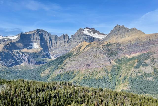
Mount Merritt and Old Sun Glacier

The descent wasn't difficult because the trail was gradual and well-maintained. Nevertheless, it took a long time before I got out of the wind and warm enough to take off my mittens.

Three tall peaks stood on the other side of the glacially carved valley. They were from left to right, Ipasha Peak (9,577 feet), Mount Merritt (10,004 feet), and Natoas Peak (9360 feet).

Old Sun Glacier extended to the right of Mount Merritt. Its name comes from a Blackfeet Indian sun priest, Ntas, which is translated to mean Old Sun.

Fall colors in Glacier National Park

The descent had begun to level out before noon, and the trail then started a slight elevation gain. Now that I was back below the treeline, I noticed how brilliant the fall colors were on the shrubs and grasses.

My route today was part of the North Circle Tourist Trail, one of three developed in the early years of the park by the Glacier Park Hotel Company, a subsidiary of the Great Northern Railway. The trails included a network of hotels, chalets, and campgrounds that allowed tourists to get a multi-day experience in the park.

Cosley Lake, where I was heading, and the Many Glacier area were primary stops on the 163-mile North Circle trail. The campsite at Cosley Lake, as well as one of the campsites at Red Eagle Lake where we camped on Day 155, were developed for the tourist trail as well-appointed campgrounds.

A description of the Cosley Lake campground makes it sound like a modern "glamping" resort of today. The site could handle up to 180 people and 200 horses. Campers slept in 10' by 12' tents that contained a small wood stove, two beds, a screen door, a washstand, and a chamber pot.

The operators of the three tourist trails struggled to keep them going during the Great Depression. The completion of the Going-to-the-Sun Road also diminished the trails' popularity. Curtailments during World War II were the final blow to the trail system. The National Park Service redesigned the facilities as park management practices evolved.

Butters and Beer Goddess stop for lunch

Butters and Beer Goddess passed me on the descent. When I got to a small waterfall, I saw they had stopped there for lunch. This seemed like a good spot and time for that, so I joined them.

A short distance after our lunch stop was a trail junction. This was where the Chief Mountain Alternate connected with our route. I wouldn't be on the alternate for long, however. It turned away less than four miles ahead. I needed to go another way to get to Cosley Lake.

Elizabeth Lake

The slight climb past Elizabeth Lake provided another view after lunch of the lake.

I noticed the sky when I looked back from there. It wasn't quite cloudy yet wasn't clear. It was half overcast with clouds, half hazy, and maybe also smokey. It didn't seem like any of the clouds I saw looked like rain would come from them, but I was most concerned about tomorrow. I didn't want rain to dampen our finish at the border.

A bridge over Belly River

I arrived at a suspension bridge on the Belly River at 1:35 p.m. These bridges were by now very familiar.

If the name of the river seems odd, it helps to know that the Blackfeet Indians often named geographic features after body parts. Sometimes, the names referred to the body of Napi or Old Man. Although Napi was foolish and a troublemaker, he was a character used by Blackfeet storytellers to share important tribal knowledge.

A map of 1865 labeled this as Oldman River, which connects to the Napi stories. Maps of just a few years later showed it as the Belly River.

Top O', Lone Wolf, Beer Goddess, and Butters on the Belly River

I only got about halfway across the bridge before I noticed Top O', Lone Wolf, Beer Goddess, and Butters were all sitting on a small sandy spot along the river. This was near the outlet of Elizabeth Lake.

The wind was blowing hard across the lake, but the beach provided some shelter. I joined them there, and we spent an enjoyable time in the sun, skipping stones in the water, and just relaxing. It felt nice to feel no pressure. We had already completed 10 miles and had plenty of time to reach our campsite well before dark.

Belly River waterfall

The trail more or less followed the river for the next three miles. The terrain was relatively flat, so I didn't expect to see a large waterfall when the trail went past it.

The trail goes along the Belly River

After hiking through some of the most spectacular scenery in North America, the trail along the river and after seemed like a letdown. The best thing to be said was, it didn't have any steep climbs or descents.

There were a couple of times when I had to stop at a trail junction to make sure I was going the correct way, but that was the extent of my challenges until I reached Cosley Lake.

Cosley Lake

I arrived at the east tip of the lake at 3:45 p.m. Our campsite was on this lake but nearly a mile away.

Mokowanis River flowed from the lake and I had to cross it to get to the campsite. I expected to find another suspension bridge there, yet there wasn't one. For a moment, I wondered if maybe I had gone off trail. That's how used to finding them in Glacier I'd become.

Though not optimistic, I checked to see if I had cell service before I crossed the river and was shocked to find there was one bar. It was enough to receive a text message from Kim telling me she had landed safely and on time in Kalispell. She was set to meet us tomorrow at Chief Mountain.

The strong wind we had all day was now blowing at me from across the lake. That made crossing the river surprisingly treacherous. The water was above my knees, and though there wasn't much of a current, the wind kept me unsteady until I made it across.

Cosley Lake Campsite

The campsites were dispersed and private. Top O' selected one that had enough trees to get some protection from the wind. Beer Goddess, Butters, and Lone Wolf, plus a couple who said they hiked AT in 2015, were in the other spaces for tents.

Mountains and Cosley Lake

I walked down to the lake after dinner, stood on the shore, and looked west toward the setting sun. Its rays filtered through clouds and smoke, making this view one of the most beautiful sights I've seen on any of my hikes. Despite a cold wind blowing in my face, I stared at the view for several minutes without much contemplation.

There wasn't that much to think about, really. Just nine more miles remained before my thru-hike of the CDT and the Triple Crown were completed. Now was too early to ponder what that meant to me. I will need some time to pass before I can fully appreciate what I've done.

All I wanted to do for now was get a good night's rest. Tomorrow I will see my wife for the first time in more than five months.

When the last bolt of sunshine hits the mountain
And the stars seem to splatter in the sky
When the moon splits the southwest horizon
And scream of an eagle on the fly

I will walk alone by the black muddy river
And listen to the ripples as they moan
I will walk alone by the black muddy river
Sing me a song of my own

This trail report was published on