
Day 157 Reynolds Creek Campsite to Many Glacier Campground
More from this trailRam on
The CDT is my fourth long-distance thru-hike. By the time I finish this one, I will have spent more than 530 days on trails in five years. That seems like enough time to experience just about everything a long hike can throw at you.
I know every moment of every day won't be enjoyable, but there is almost always something that happens each day to make it a rewarding day. There's bound to be outstanding scenery or gorgeous weather to lift my spirits. Or perhaps the day is made memorable by unexpected trail magic or an encounter with wildlife. And every day seems to be a good day when I'm hiking with friends.
I'm satisfied with one or two of those things happening in a day. They are the reasons I hike.
So what would a day feel like if it had outstanding scenery and gorgeous weather and trail magic and an encounter with wildlife and I was hiking with friends? And what if I saw not one but two animals I had never seen in the wild before? What if there wasn't just a little trail magic, but lots of it, and it was shared with hiker friends I've known for months?
That would be an extraordinary day.
That would be today.

Reynolds Creek
The day started with uncertainty. A cold rain continued off and on through the night, usually in brief spurts. I thought the rain would continue this way indefinitely. Then it stopped for good shortly before it was time to get up and prepare for the day.
I left our campsite at 8:20 a.m., just a couple of minutes after Top O', Beer Goddess, Butters, and Lone Wolf. First, we had to cross the same footbridge over Reynolds Creek we crossed yesterday, then make a one-mile climb. The trail went up 650 feet to Going-to-the-Sun Road.

Snow on Mount Jackson
On the climb, I happened to glance through an opening in some trees and saw something I didn't expect. The top of Mt. Jackson (10,052 feet) was dusted white with snow. I knew the morning was chilly, but I didn't realize until now how fortunate we were to have camped at 4,675 feet.
Mt. Jackson is one of six peaks in Glacier National Park that are taller than 10,000 feet in elevation. Jackson Glacier lies just below the summit on the mountain's southern flank, but I couldn't see it from the trail.
The glacier is shrinking, as are all the others in the park. The National Park Service says it was 316 acres in size in 1966. When it was measured in 2015, it had shrunk to 187 acres.
In 1850, 150 glaciers were counted in the park. There are just 25 today. Glaciologists think that by 2030, Glacier National Park will no longer have any glaciers.

Top O', Lone Wolf, Beer Goddess, and Butters
I caught up to everyone when they stopped at the road. They were warming up in the sun, which seemed appropriate considering the road's name.
Going-to-the-Sun Road is the main road through the park. The road is usually only open from early June to mid-October because of the difficulty of removing the winter's heavy snowfall.
The park's regular bus service on the road had ended on Labor Day. The number of cars allowed on the road each day is limited by a permit system, and that was also done for the season.

Climbing Going-to-the-Sun Mountain
When we crossed the road to continue on the CDT, we discovered the trail wasn't marked clearly. We had some trouble finding where it continued on the other side.
Yesterday's hike didn't include much climbing, but we made up for that today. From the road, the trail added 2,300 more feet of elevation in the next 4.6 miles. In other words, the day started with nearly 3,000 feet of continuous climbing.
The climb was going to Piegan Pass and was steeper than I expected. The first half-mile or so was also overgrown. It started by going up the shoulder of Going-to-the-Sun Mountain (9,642 feet), the mountain that lent its name to the road.
If that name seems unusually long for a mountain, just be glad geographers didn't choose the Blackfeet Indian name for it, which apparently translates to The-Face-of-Sour-Spirit-Who-Went-Back-to-the-Sun-After-His-Work-was-Done Mountain.

Snow on Mt. Siyeh
About halfway up, the trail crossed Siyeh Creek, then entered a valley meadow called Preston Park. Mt. Siyeh was to my right as I continued the climb. Standing at 10,014 feet above sea level, it is the fifth highest peak in Glacier. Like Mt. Jackson, it was lightly topped with snow this morning.

A view of Jackson Glacier
After about three miles, the trail emerged above the timberline, and I was able to take a sweeping look back toward Mt. Jackson. I could now clearly see Jackson Glacier.

Climbing to Piegan Pass
The climbing was steady. I met some day hikers along the way, and they told me they met Polecat yesterday at Ptarmigan Tunnel. I knew his backpacking route would take him through the tunnel, and it was fun to get a report about him.
Some hikers said they saw a grizzly bear, but I never saw it.

A ram grazing on a mountainside
When I was almost up to the pass, I noticed the day hikers ahead of me had stopped and were looking up toward an area of low alpine shrubs and grass. I figured some wildlife had caught their attention, but it took me a moment to see what it was.
It was a large, male bighorn sheep.

A ram grazing on a mountainside
The ram stood calmly on the slope while he ate his lunch of grass and wildflowers, and occasionally lifted his head to gaze at his surroundings. He showed no concern that we were standing about 100 feet away. Perhaps his large horns provided an abundance of self-confidence.
The scene felt surreal. I had never seen a bighorn sheep in the wild. It looked as if the park service had hired him to stand near the trail so we could gawk at him.

A yard sale and lunch at Piegan Pass
Top O', Lone Wolf, Butters, and Beer Goddess were at the top of Piegan Pass when I arrived. They had spread their gear out to dry while they ate lunch, and I did the same. With hardly any clouds in the sky, there was plenty of sun to do that.
Still, it was cold at an elevation of 7,575 feet, and we had to place rocks on our stuff to keep it from blowing away.
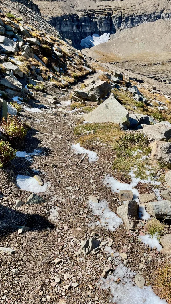
Snow on the trail
The rest of the group left the pass before I did. I stayed at the top for a few more minutes to make sure my tent and quilt were dry before I packed them back into my pack.
The first part of the descent was just as cold and windy as the top of the pass. Small patches of icy snow were on the trail as I began walking.
I didn't expect there would still be snow on the ground at 1 p.m. on this sunny day. Apparently, the temperature was colder than I realized.

Descending from Piegan Pass
The dramatic views didn't end after I went over the pass and into the valley. If anything, they were even more breathtaking. Mountains with strata of sedimentary rock stood tall on both sides with near-vertical walls. Jagged, broken peaks lifted to the bright blue sky.
Last remnants of glaciers clung to the mountains on the left. Depending on where you looked, the scene might include a deep-blue lake or trickling cascade.
Glacier National Park has more than 700 lakes, though fewer than 200 have been given names.

A ptarmigan
Just a few hundred yards into the valley, I found more wildlife I had not seen before. A bird was taking its time to cross the trail in front of me. It had the coloring of a ruffled grouse yet was smaller. It had feathers on its feet.
It was a ptarmigan. Unlike grouses, ptarmigans prefer to live in alpine terrain. This one will soon lose its mixed brown feathers and turn snow-white to blend into the winter terrain. Ptarmigans are the only North American birds that live their entire life cycle above the treeline.

A waterfall at the side of a valley
The trail was generally in good shape, and I could have walked faster as I descended into the valley, but I kept stopping to take more pictures. I would sometimes take one, walk a few more steps, and then take another one in the same direction. The changed perspective made the view even better.

Another waterfall in Glacier National Park
And so it went for the entire six miles of the descent before reaching the bottom.
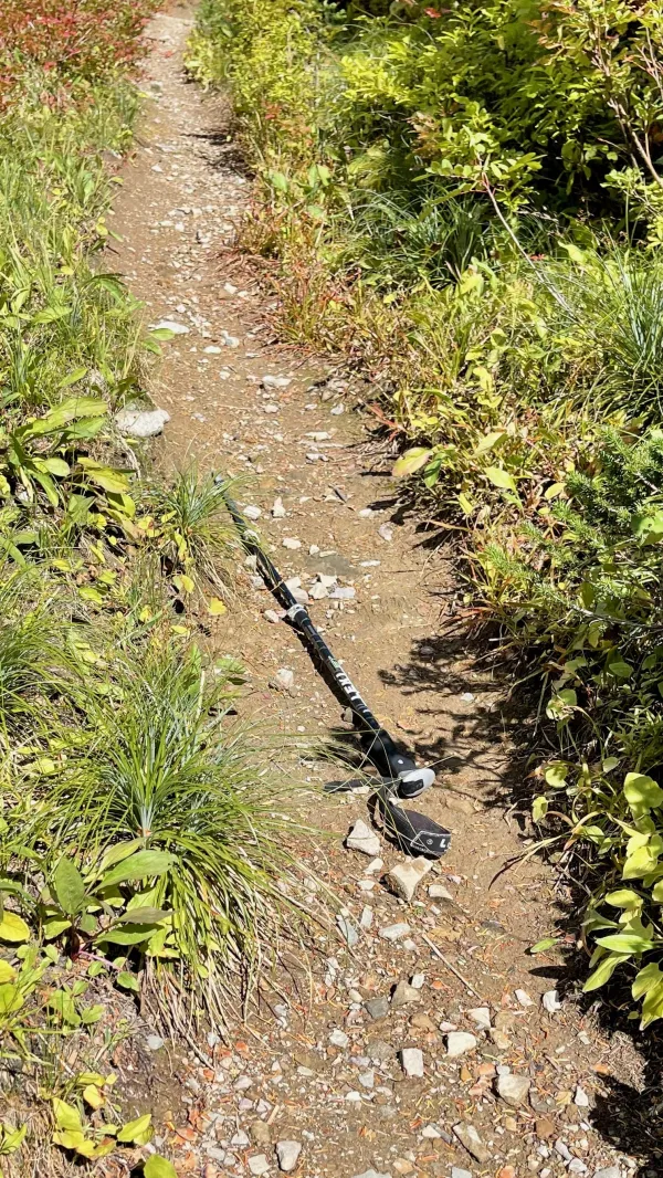
A trekking pole lying on the trail
I was mesmerized by the exquisite views and didn't care that I was hiking slowly. The scenery did cause me some trouble, however.
After one of my photo stops, I put my phone back in its holster on my shoulder strap, then continued to walk without noticing that one of my trekking poles slipped from my hand. I continued for 50 yards or so before realizing I was missing a pole
I had to backtrack to where I found it in the middle of the trail.

Cascades trickle down a valley
About halfway down to the bottom, the trail made a series of wide switchbacks. Two streams were cascading nearby. The wider of the two was Cataract Creek. They joined a little farther down the valley, and the trail crossed the creek a couple of times.

A sign says a trail is closed
I reached the bottom of the descent at about 4 p.m. There were a variety of trails in the area, some for horses, that led to two lakes. When Spamcake hiked this way yesterday, she left a comment in the Guthook app to suggest following one of the trails to Grinnell Lake.
A sign stretched across one of the trails got my attention when I was close enough to read it. It said the trail was closed because of bear activity in the area.
There was a lot of thick foliage between the two lakes, which I knew would make it harder to see a bear. As a precaution, I called out, "Hey bear!" a few times until the trail was less overgrown.

Lake Josephine
I was unsure which trail Top O' and the others had taken. I was starting to get weary, so I chose the trail that went around the west side of Lake Josephine. It was slightly shorter.
It would have been possible to take a tourist excursion boat across the lake if it were running, but it was now docked for the season.

Swiftcurrent Creek
The park begins to shut down many of its facilities after Labor Day. Swiftcurrent Motor Inn and Cabins, which were near the lake, were already closed.
Still, I saw several tourists as I walked along Lake Josephine. The trail then continued to Swiftcurrent Lake before crossing Swiftcurrent Creek.

Trevor, Anthea, and Tim
Three people stopped me to ask about my hike, and then we walked together for the rest of the way to a road. They told me they run a camping van rental company in Jackson, Wyoming.
When they reached their van parked on the road, they offered me a couple of beers. I told them I would share one with my hiking partner.
That was the first trail magic I received on this trail in a long time. I thanked Trevor, Anthea, and Tim for their kindness, then continued another quarter mile to Many Glacier Campground. I had no way to know there was more trail magic to come.
The campground was large and spread out, with about 100 sites. Most could accommodate large trailers and RVs. Like Two Medicine Campground, it had running water, flush toilets, and picnic tables.
Although the campground was closed for the winter, the walk-in sites for hikers and bicyclists were still open. Unfortunately, the restrooms were locked, and finding a working water faucet took some effort. The camp store across the road at Swiftcurrent Motor Inn was also closed.
The campground was so empty that Beer Goddess said the place looked like a “zombie apocalypse.”

Rick and Imay bring trail magic
That was about to change. It seemed that each one of our group had met someone today who offered trail magic. They said they would come by our site in the campground tonight, but I was a little skeptical of that. The temperature was dropping and the sun was starting to sink below the mountains.
But it wasn't long before a trail magic parade began. First, Rick and Imay arrived with a bottle of wine. They were both ending their seasonal jobs at Swiftcurrent Motor Inn. He worked security, and she was in housekeeping.

Kaitlyn brings trail magic
No sooner did they leave than Kaitlyn arrived. She was an interpretive ranger in the park and brought a pan of vegetables and noodles she had just cooked.

Jenna brings trail magic
Before Kaitlyn left, Jenna arrived with some beer. She didn't work at Glacier, she was touring the park and doing some day hiking. She was excited to talk to thru-hikers because she wanted to hike a long-distance trail.
As if all of this generosity wasn't enough, Jenna then offered to meet us Saturday when we finish at Chief Mountain Border Station. Kim will be meeting us too, but her rental car won't be big enough for all of us. Jenna's offer instantly solved that problem.
This was one of the most remarkable days I've had on any thru-hike. And this hike is almost done.
Unless the trail to the border is closed or I get eaten by a grizzly, I will finish my hike the day after tomorrow. After tonight, there is only one night left on the trail.
This trail report was published