
Day 105 Shadow Lake to between North Fork Lake and Valley Lake
More from this trailA soldier from the looks of him who came through many fights
Wind River Range makes a diagonal cut across Wyoming, stretching between the towns of South Pass City to Jackson. Top O' and I will continue our walk in that direction until we reach the border of Yellowstone National Park. That won't happen for nearly two more weeks. We will need to make a couple of resupply stops before then.
We camped last night less than 3.5 miles from the end of the Cirque of the Towers Alternate. We followed this trail for the last two days through the Winds' most spectacular section.
I'm not surprised hiker surveys show this is one of the most traveled alternates. The Gila River Alternate is the only one that's more popular.
While we were packing our gear and preparing to leave camp this morning, I happened to glance down at my leg. The sight was startling. My leg was covered in scratches. I turned to Top O' and said, “It looks like I've been in a knife fight.”
I knew my leg was scratched, but until now I paid no attention to it. Some of the scratches might have come from when I fell coming down from Texas Pass yesterday afternoon. Otherwise, they were all the result of two difficult days scrambling over downed trees.
At any rate, I hadn't paid much attention to the scratches, as gruesome as they were. I was too tired to notice them. Each evening after a strenuous day of hiking, all I wanted to do was go to sleep.
Steep terrain going over passes, plus miles and miles of downed trees, had left me exhausted. Now I realized these conditions also left me wounded.

A campsite on Shadow Lake
I decided I must not be getting enough rest at night to fully recover. A clue to this was this morning when I left our campsite, which was tucked between boulders and trees next to Shadow Lake. My legs lacked energy. My whole body felt sluggish.
Other times when this happened to me, I attributed the condition to not consuming enough calories. Feeling that way early today was different. I think adrenaline sustained me yesterday while hiking through the Cirque of the Towers. Now I was depleted.

The Cirque of the Towers Alternate
I needed a footpath today that was a little tamer for a chance to recover. Thankfully, that was very much what I got it. The trail was nothing like it had been the last few days.

Alpenglow on nearby mountains
The route still included pretty mountains to look at, especially early this morning when the rising sun was first striking them. They just weren't as tall with dramatic peaks and spires as yesterday. Then again, the Cirque of the Towers is a classic route with no duplicate.
What made the trail so forgiving today was how much flatter it was. That's not to say it was entirely flat. Still, the difference between the highest point to the lowest point was just 800 feet.

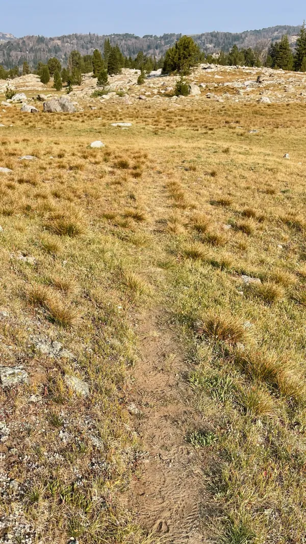
The trail extends along a wide park
The route never went far from a creek or lake. There was no time when water was a problem.
We started this morning by following the trail along Washakie Creek, which flowed from Shadow Lake near our campsite.

A view of the backside of the Cirque of the Towers
A few minutes after I started walking, I turned to look back in the direction of the Cirque of the Towers. This view was much different than the one in front of me.
Ahead of me was a wide and nearly flat park. Behind me were the mountains that formed the backside of the cirque. They towered tall in a jagged silhouette against the morning sky.

A view of Mount Geikie
After the first mile, the trail crossed the creek to continue north along the other side of the grass-covered park.
Soon, Mount Geikie came into view. This was the first mountain to see looking north.
Mount Geikie is 12,378 feet high with a 1,078-foot prominence. It is one of three mountains given that name. The others are in British Columbia, Canada and Tasmania, Australia. They are named for a Scottish geologist, Sir Archibald Geikie. This one in Wyoming is the tallest of the three.

Reconnecting with the CDT
After about an hour, I reached the junction where the alternate trail reconnected with the official route of the CDT. It was 3.2 miles from our campsite.
Despite feeling sluggish, an hour was an excellent time to walk that distance. I should have been able to keep up with Top O', except I made several short stops to take photos.

Washakie Creek turns north
Washakie Creek turned north to flow away from the trail.
Top O' extended his lead and I no longer saw him walking ahead. The trail was poorly marked, but that didn't usually hinder me. Top O' was like a scouting party for me. When he saw a confusing spot on the trail, he drew an arrow in the dirt with his trekking pole. This pointed me in the right direction.
I failed to see one of his arrows and crossed a creek in the wrong spot. It was only confusing to me for a second or two because I quickly realized my mistake. When I backtracked, I saw the arrow Top O' had left.
The trail disappears
More than once, the trail faded to nothing. I'm unsure how that happens when every hiker is hiking on the same route. When the trail disappeared under my feet, I had to stop and scan the terrain ahead to find where the trail continued.

A stream crossing
Two hours into today's hike, the trail crossed East Fork River. There were no rocks to hop across here, but the water wasn't deep. It didn't even come up to my knees.

A range of mountains can be seen in the distance
After walking nearly six miles, I turned around to see if the backside of the Cirque of the Towers was still in view. It was, despite the smoke in the air, which was thicker today than yesterday.
I could now see Temple Peak, the mountain near our campsite the night before last. It was barely visible through the smoke on the far right side of the mountain range. From where I stood, it was now 16.2 trail miles away or 10.8 miles away if measured in a straight line.
Though I had gotten off to a good start, I was now sensing I was slowing down. I shouldn't have been. The terrain wasn't any more difficult. I wondered if fatigue was catching up to me.

The first pond next to the trail
Soon after I turned back to continue north, the trail took me past a small pond. This was just the first of many. There would be dozens of lakes and ponds near my route for several more days.
I stopped at 10:30 a.m. to filter water from a stream and take a short break. While there, I decided to calculate my mileage to confirm I was slowing down and was shocked by the result. It seemed I had only walked 6.6 miles in four hours.
I knew I was tired but that was miserably slow. I should have realized immediately the problem wasn't my speed. I had incorrectly measured the distance on the map. The terrain was not difficult, and there was no way I was that slow. When I recalculated the miles, it was a reasonable pace, though still slower than when I started.
It was a relief to know I wasn't that slow. At the same time, I found something that was much slower than usual. It was my water filter. Filtering one liter of water took five minutes.
Although the water from the stream was clear, the murky water we had to drink in the Great Basin caused crud to accumulate in the filter. I tried to flush it in the usual way, but it seemed to be beyond help.
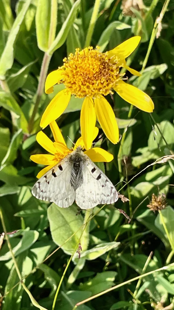
Rocky Mountain parnassian butterflies
The abundance of lakes and ponds along the route provided a perfect environment for wildflowers. In turn, they attracted butterflies. I soon began to see hundreds of Rocky Mountain parnassian butterflies flying in every direction.
These butterflies are recognizable by their white to pale yellow-brown coloring and the red and black markings on their wings. Entomologists say the dark spots deter predators.

A flat section of trail
Although small mountains stood ahead on the horizon, they were barely visible. The sky appeared to become smokier as the day wore on.
No hikers had passed me so far today. I expected to see other northbound thru-hikers, but none came by. The first people I met were some section hikers heading south.

Raid Lake
When I reached Raid Lake at 12:45 p.m., it looked like a pleasant spot for lunch, so I stopped to eat by myself. This may have looked like an agreeable place today, but it was the site of a horrible incident many years ago.
Ron Adkison explains in his book, Hiking Wyoming's Wind River Range, how the lake got its name. Some sheep herders were camped near here in 1885 when they were attacked by cattlemen in a dispute over grazing territory. After bounding the herders, the cattlemen clubbed the sheep to death.
Raid Peak and Ambush Peak are nearby, with names also associated with the gruesome attack.
While I eating lunch, I filtered more water. My filter wasn't any faster than the last time I used it, and I decided I should try to buy a new one when I got to Pinedale.
Though it might be possible to get to town tomorrow, that would depend on how far we walked today. Even then, it would be a stretch to make it there tomorrow. We will have to walk about 10 miles off the CDT to reach a trailhead, then hitch 15 miles into town.

South Fork Boulder Creek
The trail crossed South Fork Boulder Creek on the north end of the lake. Again, there were no rocks to hop across, but the water wasn't deep here either.
Besides, on a warm and dry day like today, there was no need to take off my shoes for each crossing. I just walked across while wearing them. My shoes were dry within an hour.

A small section of trees
Trees dotted the landscape here and there. Except for a few small clusters of trees that appeared from time to time, the trail never passed through anything resembling a forest.
I met another section hiker while walking through one of the few wooded areas on the trail. It was between Bobs Lake and Sandpoint Lake. The hiker was carrying an ice axe, which he sheepishly admitted was unnecessary.
He confirmed that the smoke in the air was from the fires on the Montana/Idaho border. Those were the ones we saw reports about that forced the closure of the CDT and required a long road walk.
I knew now this was one more thing we would have to deal with when we reached Pinedale. We needed to look at options for a road walk or an alternate trail.

A sandy beach on Sandpoint Lake
Coming out of the woods, I arrived at Sandpoint Lake. It was correctly named because it had a wide, sandy beach. If this lake were accessible by car, it would be filled with swimmers, but today no one was there.

A wide stream to ford
The lake was nearly a mile long. When I got to the north end, the trail crossed another shallow creek. This one was especially wide. Boulders had been placed in a line to show where the trail crossed to the other side.
Seeing the rocks made me laugh. Maybe Top O' set them up there to be sure I found my way across, I joked to myself.
Perhaps it was because of all the stream crossings, or maybe I was getting a second wind, but my legs were finally feeling strong. When I realized this, I decided now was a good time to put my brain in neutral and knock off more miles as quickly as possible.

The trail descends toward Halls Butte
The trail now followed Halls Creek, though not closely. The terrain was also hillier as I headed toward Halls Butte. Compared to the mountains I saw yesterday, this one was underwhelming.

Halls Creek
At another crossing of Halls Creek, the water was so shallow it was possible to step on rocks the whole way across. I didn't bother doing that because walking through the water was faster.

The trail passed a marshy pond
The trail went through a sparse section of trees. Many showed signs of being killed by mountain pine beetles.
A dead tree was lying across the trail here. Thankfully, there weren't any others. I was in no mood to navigate through miles of blowdowns like we did when we entered the Winds on Day 102 and Day 103.

The trail passes between two lakes
Pipestone Lake came next, which really was two lakes connected by a stream. The trail crossed the stream between them.
The time was getting close to 6 p.m. now, and I figured I had about another hour of walking before I found where Top O' stopped to set up camp. North Lake seemed a likely spot for that because it was about 20 miles from where we camped last night.

A boulder lies on the trail
I soon came upon a large boulder lying across the trail. It was only a little more of an obstacle than the blowdown I crossed earlier.
Then after going about a mile farther, I found Top O' setting up in a small campsite near the trail. This was a mile before North Lake, so I hadn't expected to see him yet.
He told me made it to the lake but discovered the mosquitoes were bad. To get away from them, he backtracked to where he remembered passing as a campsite.
The campsite was on a short ridge between North Lake and Valley Lake. The slightly higher elevation offered a chance for a breeze to keep away mosquitoes. There was no water source nearby, but once again, Top O' helped his ol' pal Gravity. He brought back an extra two liters of water from the lake so I wouldn't have to go down there to fetch some.
Shortly after we finished dinner and crawled into our tents, the first two thru-hikers of the day walked by. They were Sprout and Puddles. We warned them about the mosquitoes ahead, but they decided they wanted to add more mileage to their day.
I looked at the map while lying in my tent. We had about 15 more miles to go before getting to the junction of the trail that will take us to the trailhead at Elkhart Park. From there we can hitch into Pinedale.
It seemed impractical now to reach town tomorrow, but that wasn't a problem for us. We had plenty of food for another night on the trail. We can go to town Wednesday morning and that will make it a nero day. We will have plenty of time for chores and trail planning.
I'm looking forward to that. Pinedale will be our first town stay since we started hiking north in Wyoming a week ago, and it has a reputation for being one of the best trail towns on the CDT.
Shadows of a sailor forming winds both foul and fair, all swarm
Down in Carlisle, he loved a lady many years ago
Here beside him stands a man, a soldier from the looks of him
Who came through many fights, but lost at love
This trail report was published