
Day 103 Sweetwater Guard Station Campground to Lake 10839
More from this trailWatch each card you play and play it slow
Thru-hiking is hard.
Yes, I know that is an obvious statement to make. I doubt many people believe walking hundreds or thousands of miles is easy. I'm not saying this to suggest that when I hike I'm doing something particularly extraordinary. Many people can do what I'm doing. There are several hundred of us on the CDT right now, and thousands more are on many other long trails.
Many aspects of thru-hiking make this activity difficult, and each one can be a reason someone fails to finish their hike. None of these potential reasons for quitting is easy to overcome, but one is particularly random and troublesome. That is injury.
I've known many people who were forced to take time off or end their hike because of an injury. For some, repetitive stress on a joint required them to take some time off. For others, just a simple step in the wrong place or at the wrong angle caused an immediate end of the hike.
I recall all too well how much I struggled with a sprained ankle on the Appalachian Trail. On my second day, I planted my right foot wrong and instantly felt a sharp pain shoot up from my foot to the middle of my leg. It was so jolting it took my breath away. I immediately feared I had caused serious damage, but I was able to continue walking after resting for several minutes.
At one moment, I was walking while enjoying the trail. The next, I had a high ankle sprain. Until I finished six months later, it continued to cause occasional pain. I even quit my hike because of the sprain, though I changed my mind within 20 minutes and continued to complete the trail.
Perhaps I'm now gun-shy from that first experience with a potentially hike-ending injury. I've never been a fast hiker, but especially since the injury, I slow down even more when the trail becomes treacherous. Walking deliberately is the only way I know to avoid getting hurt.

Top O' walks on a gravel road
Nearly all of the thru-hikers camped last night at Sweetwater Guard Station left the campground this morning at 6:30. We decided to walk out on a gravel road instead of crossing the river again to the trail. The road would lead us north and eventually reconnect with the trail.
We did this hoping we could avoid as many blowdowns as possible. We knew plenty of that was ahead, and we expected the road would be clear. The distance on the road was about the same as the trail, but going this way gained us the time we knew would be lost when we got into blowdown debris.

Larsen Creek
Near where Sweetwater River veered to the northeast, the road continued north to follow Larsen Creek.
After two miles, we rejoined the trail and entered Bridger Wilderness. The next 80 miles of the CDT will continue north through this protected land. Top O' and I won't stay on the trail the whole distance, however. Most thru-hikers follow the Cirque of the Towers Alternate, and we wanted to do the same because it goes through the heart of the Winds and past some jaw-dropping scenery.
The scenery was already beautiful as we followed the creek, which meandered through a flat valley. With no tall trees knocked over in last September's storm, we were able to cruise without obstacles.

purple monkey-flower
Another couple of miles into the hike, I noticed some showy wildflowers. They had an unusual name, purple monkey-flower. Their genus name is mimulus lewisii, which honors Meriwether Lewis. He documented this and many other plants during his exploration of the American West.
The diminutive of the Latin word mimulus is mimus, as in a mimic, mime, or farce. The flowers are thought by some to mimic a monkey's face.
Purple monkey-flowers are lovely but they are unlikely to be found in a home garden. They require high elevations with snow and cool temperatures, plus plenty of water.

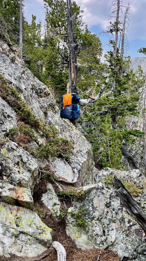
The first of many blowdowns
The first of the downed trees I had been dreading since yesterday appeared at 10 a.m. They were bad right from the start. The trail was a massive, continuous pile of broken tree trunks and branches for most of the next five miles. Guthook comments said the trail wouldn't be clear until we passed the junction of the Cirque of the Towers Alternate.

Little Sandy Lake can be seen through trees
Soon after entering the blowdown section, I began to catch glimpses of Little Sandy Lake. This was a tantalizing view because I knew the blowdowns would end after I got past the lake. Getting there took much longer than I hoped.
Top O' and the other hikers had already left me behind when I stopped to take photos. Now I was falling farther behind.
I couldn't keep up with Top O' in these conditions because his legs were longer than mine. The other hikers were also long gone because they were much younger and more agile than me. There was nothing I could do about my situation except stay focused on where I was going. I continued to take deliberate steps and stop whenever I was unsure where the trail went next.

Little Sandy Creek
A couple of times along this hot and tiring route, I became confused about where the trail went. It was hidden under the piles of tree trunks and limbs, and I needed extra time to figure out the correct direction.
I cautiously followed the trail as best I could down to Little Sandy Creek, which flowed from the lake. The alternate began immediately on the other side.
Top O' was sitting on the other side of the creek when I arrived there at noon. He claimed he had been waiting for two hours. Though that may have been an exaggeration, I knew he had waited a long time. And honestly, I didn't expect to see him there.
I couldn't have blamed Top O' if he chose to keep walking, but he stopped because he knew I would have trouble getting through the blowdowns. I've known since we started hiking together that he is kind and generous. Still, waiting for such a long time was especially thoughtful.

Top O' follows the trail from Little Sandy Creek
Top O' continued to wait for me while I ate my lunch and filtered water. Then we started following the alternate route.

Blowdowns on the alternate trail
As expected, the blowdowns continued past the creek when we started walking on the alternate. They weren't quite as bad to navigate over as before, but now the trail made some steep climbs. Again, I had to slow down but didn't fall too far behind Top O' at first.

A meadow near Little Sandy Lake
The trail took us through a flat meadow and then back to the creek. We were now north of Little Sandy Lake. I stopped at the creek to get more water, and Top O' continued walking.
A hiker named Tokyo was also at the creek, and we left at about the same time. We didn't talk much because Tokyo was from Japan and seemed insecure about her English.

A pond on Little Sandy Creek
From the moment I decided to thru-hike the CDT, I knew I would take the Cirque of the Towers Alternate instead of staying on the main trail. I intended this because I spent a week in Wind River Range in 2010 and remembered how beautiful it was.
The views weren't as spectacular at first as I remembered them, but that changed when the trail went around a small pond. Massive rock walls towered above me. Suddenly, I felt like I was walking along a wide boulevard lined by majestic cathedrals.
Tokyo scrambles over rocks
Just north of the pond, I followed what I thought was the trail. It looked like a path, anyway, which climbed up a wall of the canyon. The route became increasingly precarious, and I had to scramble over some large boulders blocking what seemed to be the correct way.
Conditions were now noticeably worse, but it still took me a couple more minutes before I began to doubt I was going the right way.
Every time I checked my navigation app, it showed I wasn't far off the trail. I figured the slight difference was due to a tracking error. Then the way I was going started to become sketchy, with only a narrow ledge to walk. I was finally convinced I wasn't on the trail.
When I looked down from the ledge to the valley floor I could see a lovely, flat footpath directly below me. I couldn't descend from there to it. The drop was too steep, and I had to backtrack much of the way I came.
I saw Tokyo on my way back to the trail. She told me she made the same mistake. I also discovered in some Guthook comments we weren't the only ones to do that.

At the bottom of a deep canyon
Back in the beautiful canyon, the trail was much easier to walk. Nevertheless, I had to stop a couple more times to check for the correct direction of the trail.

The trail fades out
The footpath sometimes just faded to nothing, and because this was a wilderness area, there were no trail markers to point the way.
I knew I had fallen far behind Top O' again. There was nothing to be done about it except to keep walking. Because I was walking on an irregular trail with many rocks, I didn't feel comfortable trying to pick up my speed.

yellow wildflowers
Instead, I decided to enjoy my walk and make frequent stops for photos of the scenery.
This section was loaded with wildflowers. Some were varieties I had seen before, including many bright yellow arnicas.
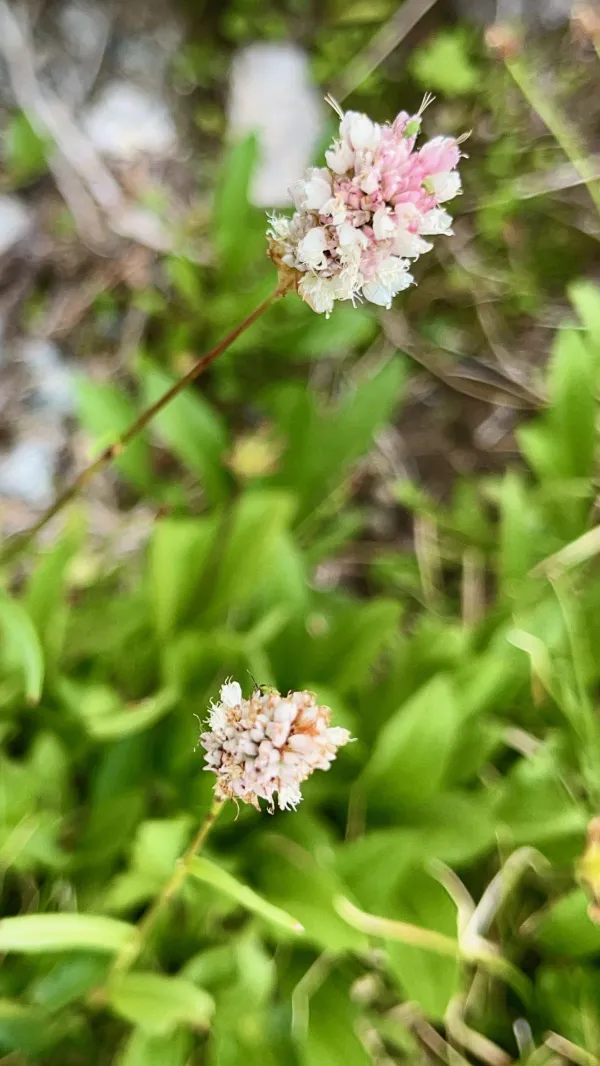
diamondleaf saxifrage
One wildflower was unfamiliar to me. It was diamondleaf saxifrage, a delicate plant with a small cluster of white cupped flowers.
The word "saxifrage" comes from a Latin word that means "rock breaker." These flowers looked at home among the rocks.

Little Sandy Creek
The trail continued to gradually climb as it went upstream along Little Sandy Creek. It also crossed the creek a couple of times.

Jagged peaks stand above the canyon
When I got within 1.5 miles of the cirque below Temple Peak, the canyon opened wider. It was flanked by more jagged spires and steep walls of rock.
The time was now 5:30 p.m., and I was getting tired. Not knowing how far Top O' wanted to go, I wasn't sure if he stopped in the cirque at the bottom of Temple Peak or continued over the pass.

A field of many wildflowers
For the rest of the way up to the cirque, I wrestled with what I would do if he wasn't there. Did I have enough energy to make the climb over the pass? Was I better off stopping before the pass and making the climb in the morning?

Temple Peak
My pace was starting to become ponderous. When got close enough to see the pass to the right of Temple Peak, the idea of climbing the wall up to it seemed much less likely. That would be a 700-foot climb.
From the southern approach, the mountain looked every bit like an ancient temple or Renaissance cathedral.

Two tents standing in the cirque at the foot of Temple Peak
Thankfully, the question of making the climb or not wasn't necessary. When I arrived at the lake, I saw Top O' had already pitched his tent on an exposed but flat rise away from the lake.
The lake was identified on the map as Lake 10839. I had to think about that odd name a moment before realizing the number was the elevation. Temple Peak rose straight up behind the lake more than 2,100 feet above that.
I set up my tent and collected water before preparing my dinner. Fire Hazard and a friend who had joined her for the hike through Wind River Range arrived about that time. Lone Wolf and Tobey showed up a little later.
It was enjoyable to see these hikers again whom I met in New Mexico and Colorado. We didn't spend much time being sociable, though. Everyone was exhausted, and mosquitoes were becoming bothersome. I quickly retreated to my tent.
I had been apprehensive about this day for the last couple of days. Now it is over, and I can prepare for tomorrow. And that is a day I have hoped for the last 11 years would come.
Since it cost a lot to win
And even more to lose
You and me bound to spend some time
Wondering what to choose
Goes to show, you don't ever know
Watch each card you play and play it slow
Wait until that deal come round
Don't you let that deal go down, no, no
This trail report was published