
Day 24 Whiterock Mesa to Red Hills
More from this trailSurprise! Surprise! Surprise!
No matter how many maps, trail guides, blogs, and YouTube videos you study, there's no way to know everything about a trail. There are bound to be a few surprises along the way.
Today was filled with many.
The first surprise happened overnight, and it wasn’t a pleasant one. I woke up in the middle of the night, then had trouble falling back asleep. Bored, I turned on my phone to check for messages.
That’s when I discovered my order for a pair of shoes, which were supposed to be delivered to a hotel in Payson, had been canceled. Even though I confirmed the hotel would accept the package before I placed the order, they refused to take the delivery.
This disturbing news kept me awake. It took several minutes to figure out what happened.
I hadn’t yet made a reservation to stay at the hotel. It was no wonder the hotel didn’t accept the package. I had made a foolish mistake.
It was now too late to order another pair for delivery to Payson. I'll need to figure out another spot to send them. In the meantime, I’ll have to hope the shoes I’m wearing hold out that long.

Clouds at dawn
Right after my alarm woke me up at 5:30 a.m., a flash of light lit up the sky. I didn't hear any thunder then, so I couldn't tell the direction of the storm. The rumbles of thunder I heard a few minutes later sounded nearby.
I hadn't expected a thunderstorm. The sky was clear when I went to bed last night. There was no way to know now if the storm was heading in my direction, but I didn’t want to take a chance. I quickly packed up and was on the trail in 35 minutes.
Five minutes after I left, I began to wonder if I had been too hasty. The sky was still dark, and I didn't check my campsite thoroughly. Did I leave something behind?
Knowing this was the kind of worry that would nag me for hours, I quickly turned around and walked back to my campsite. Nothing was left behind, but at least now I knew that for sure.

The trail crosses Whiterock Mesa
Continuing again along Whiterock Mesa, the sun was now beginning to rise. This allowed me to get a better view of how the mesa got its name. The ground really was white.
There wasn’t much soil or sand on the footpath. The pale, chalky-white color came from felsic volcanic material, mostly feldspar and granite. The rock was weathered, making it loose, irregular, and gravelly.

A galvanized metal trough of water
After completing the first 1.25 miles, I started a steep descent from Whiterock Mesa. Light rain had begun to fall on the way down the slope.
Soon, I approached a galvanized metal trough. The trough was filled with water from Whiterock Spring. I didn't filter water for long before I had to stop for a moment and put on my rain gear. The rain was now falling much harder.
I knew the trail would cross the East Verde River in less than four miles. One liter probably would have been enough for now, but I filtered two. You can never have too much water in the desert.

Rain falls on North Peak
When I left the spring, the trail continued a steady descent for the next 2.5 miles.
Rain was still falling on me, and in the distance, it looked like rain was falling on North Peak (7,449 feet). The mountain stood about 8.5 miles away. It is the second-tallest mountain in the Mazatzals.

Mud caked to the bottom of a shoe
Before long, the downpour made the trail a muddy mess. It stuck to the soles of my shoes and the tips of my trekking poles. The mud was caked so thick on my shoes that they felt as if they weighed five pounds each.

A patch of blue sky
By 8:30 a.m., patches of blue began to appear ahead, but the storm didn’t let up for another 45 minutes. The wind was still blowing when I removed my rain jacket, so I put on my wind shirt.

Looking down toward the East Verde River
The next 1.2 miles made a steeper drop into a canyon. The East Verde River flowed at the bottom. Sycamore and cottonwood trees lined its banks.
Somewhere in the canyon, perhaps where the Arizona Trail crosses the river, was also part of the route of the Yavapai Exodus of 1875. This was another chapter in the cruel treatment of Native Americans, similar to the Trail of Tears resettlement the Cherokee and the Long Walk of the Navajo Nation.
About 1,500 Yavapai and Tonto Apache people were forced from their homes in the winter of 1875 by the the U.S. Army and marched 180 miles. Conditions were so brutal that more than 100 people died on their way to a new reservation. The Army would not let the Indians perform burial rites, and the bodies of the dead had to be left along the route.

The East Verde River
I had already crossed the East Verde River once before, except then, it was only a small trickle. I crossed the river near its headwaters on Day 21. That was the day I descended from the Mogollon Rim.
The river is also connected to East Clear Creek, though in an unexpected way. I crossed the creek on Day 20, just before going up Battleground Ridge. The creek was dry then. If there had been water in it, the water would have flowed into the C.C. Cragin Reservoir.
During periods of drought, water is diverted from the reservoir to a tunnel and a pumping station. It then flows through pipes to a small hydropower plant on the East Verde River near Washington Park. Another pipeline takes the water to a treatment plant near Payson, providing the town with a reliable water supply.
When I arrived at the Washington Park trailhead, I had no idea such an elaborate water system was nearby.
Before I crossed the shallow East Verde River this time, I stopped to collect another liter of water. I still had some from Whiterock Spring, but I knew a long climb would begin soon after I crossed the river. I also knew the next water source was more than six miles away.

K Boog
While filtering water, I was startled to see K Boog approaching from the other side of the river. I had not seen him since Pine, and didn't expect to see him now.
K Boog was much younger than me, and his long legs should have made him a fast hiker. I didn't know when he left Pine, but it seemed like he should have been much farther ahead of me by now.
Also unexpected was seeing K Boog walk toward me from the other side of the river. He explained that he crossed the river last night, then camped a short distance away. He waited out the storm this morning before coming back this way to get some water.
K Boog told me he wanted to collect the water from a small stream instead of the river. He claimed the river water tasted like cow. I hadn't noticed the smell while filling my bottle, but I caught a whiff of it when I crossed the river a few minutes later. By then, I had already filtered what I needed and didn't want to dump it.
I’ve tried to overlook the smell of cow water. It’s unpleasant, but it's an unavoidable part of the desert hiking experience.

Mountains loom ahead
I didn’t bother to take off my shoes when I crossed the river. They were still wet from the rainfall. They would dry as soon as the sun came out. Besides, the river washed off the remaining mud from my shoes.
I hoped the sun would come out soon after I began the climb that went through Bullfrog Canyon. Though the sky brightened, it didn’t clear completely.

Looking across to a ridge
I found a shady spot for lunch partway up the climb. The clouds returned while I was eating. I had to quickly finish my meal because a breeze made it too chilly to stay there.
While preparing to leave, K Boog passed me. About that same time, a light rain began to fall.
Then, just before I started hiking again, Charlie and Bubble Wrap showed up. I don't know how I managed to pass them without seeing them. They were ahead of me last night, so they must have stopped for the rainstorm, as K Boog did.

Clouds are breaking up
The climb was sometimes very steep, though there were a few short descents to break up the ascents.
Two positive things happened along the way to make up for some of the misery of the steep climb. First, the rain stopped and the clouds began to part again. This time, large expanses of blue sky and sunshine appeared.
Also, I figured out another way to replace my shoes. I realized the marina at Roosevelt Lake might accept and hold a package, so I called to confirm that. I then immediately placed an order on Amazon.
My new shoes will arrive at Roosevelt Lake Marina before I do, which should be in about six days. I think my old shoes can hold out that long.

Rolling hills
Starting from the East Verde River, the total elevation gain of the afternoon was nearly 2,700 feet. That total didn’t include all of the descents thrown into the climb.
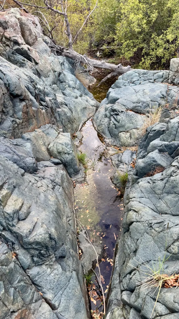
Water was pooled in a seam of a large boulder
I arrived at Brush Spring at 4 p.m. It would have been difficult to find if someone hadn't marked the route with some surveyor's tape.
The water was pooled in a seam of a large boulder. I scooped two liters of water but didn’t filter it. I decided to wait until I reached the next available campsite, which the FarOut app said was less than 1.5 miles away.

Aspen trees in a campsite
Although there was a nice campsite near the spring, there was still more than an hour of sunlight left in the day, and I wanted to keep going.

The sun is beginning to set
I climbed for another 700 feet after leaving the spring. On the way up, the temperature quickly turned colder.

Gravity's tent
I found the campsite mentioned in FarOut at 5:20 p.m. It was a flat spot tucked among manzanita, small junipers and pine trees, and agave.
Because several large clouds remained in the sky, I decided to play it safe and set up my tent. This was the first time I’d slept in it on this hike.
As I usually do when I'm in camp, I looked at the map this evening to check my progress. I also calculated how far I need to go to reach the next town. In this case, that was Payson, and I was a little concerned about how far away it was.
Getting to Payson was complicated. It required a hitchhike from a spot on State Highway 87 where a driver could safely pick up a hiker. Hiking a 7/10-mile side trail was necessary to get there. I was now 43 miles away from the side trail.
I always try to get into town early so I will have time for laundry and shopping. Doing that this time will require hiking more miles in the next two days than I have for the last few days. I'm unsure right now if that's possible.
The trail has been challenging lately. Today’s weather made it worse. Still, the trail also gave me a few surprises today. Maybe it will give me another one tomorrow.
Pvt. Gomer Pyle (Jim Nabors): Well, hey, Sergeant. Now, can I say something?
Sgt. Vince Carter (Frank Sutton): What, Pyle?
Pyle: Surprise! Surprise! Surprise!
This trail report was published