
Day 123 Bennington to Kid Gore Shelter
More from this trailTrouble ahead, the lady in red
Several businesses along the trail have gained a reputation for being “hiker friendly.” Admittedly, that is a vague term. The owners of businesses known for this provide services that make a hike easier and more comfortable.
Catamount Motel in Bennington is such a business. It is more than five miles off the trail, and the owners know that to attract hikers, services like low-cost laundry and rides to and from the trail are needed.
Being truly hiker friendly means more than that, though. There is an attitude of care and concern, and I found that at the motel as well.
I walked down to the motel office this morning to see if I could buy a postage stamp. I wanted to mail my wife a birthday card. The owner gave me a stamp and refused my attempt to pay for it. That's an example of what I'm talking about.
After returning to my room to finish packing, I discovered that I had forgotten to charge my backup battery the whole time I was staying here. It was foolish mistake, considering I had been here for two nights.
The best I could do was plug it in and hope it charged up enough to get me by until another electrical outlet was available. I hadn’t run out of power so far on this hike, but the next few days will be a test to see how long I can stretch the power I used for my phone and camera.
I think I will have enough, though, because we intend to stop in Manchester Center in three days.

Steel bridge
When we were delivered back to the trailhead shortly after 8 a.m., we were a hiking crew of three. Stick's daughter Becky was now hiking with us.
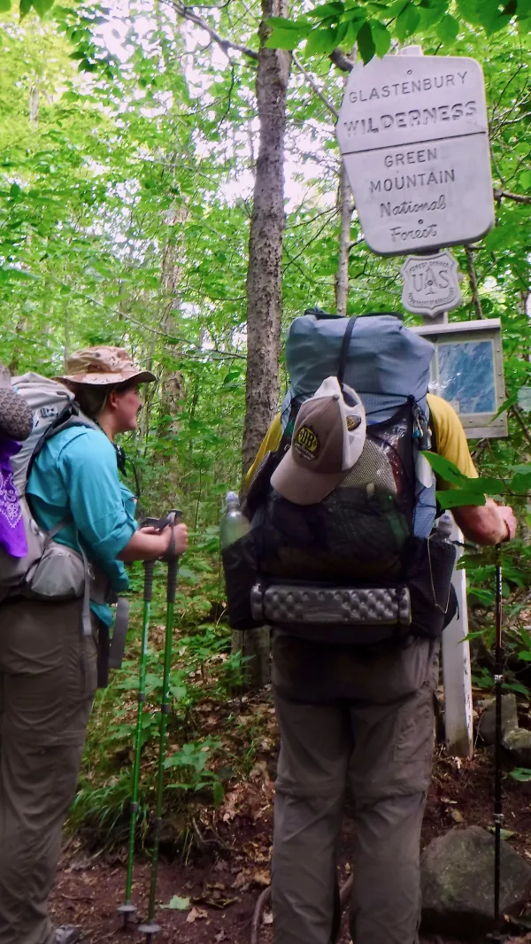
Entering Glastenbury Wilderness Area
After walking for a little more than an hour, we entered Glastenbury Wilderness. It was designated as a wilderness area in 2006 and is just under 22,500 acres in size.
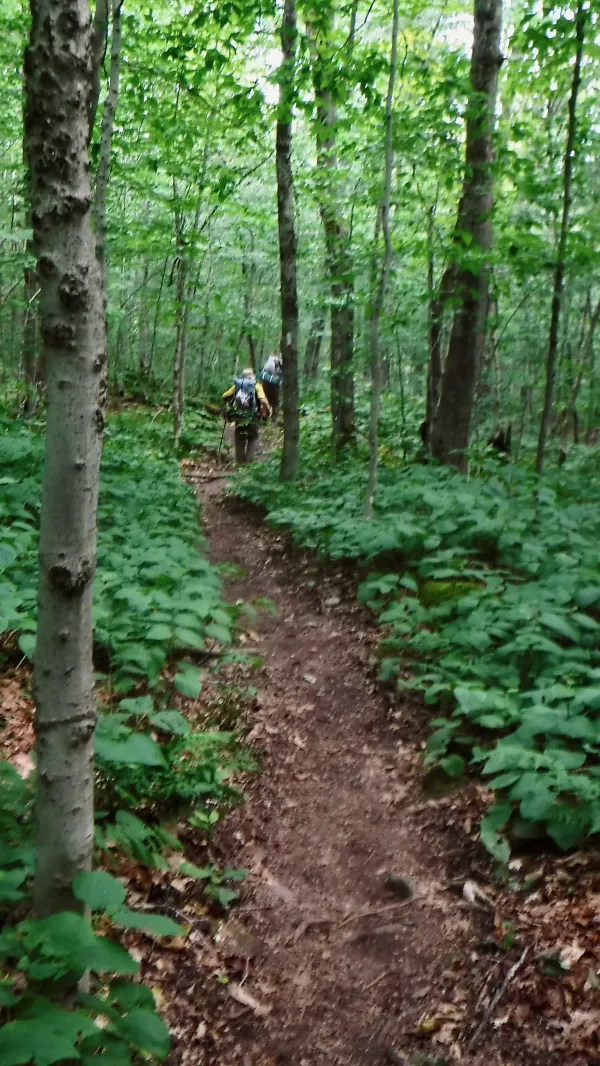
Smooth trail
A few days ago, Stick and I looked ahead at the profile for this section of trail. We wondered how difficult it might be for Becky. She didn’t have the experience we had of hiking more than 1,600 miles.
What we saw looked like a long and sometimes difficult climb. Thankfully, it didn’t turn out to be as difficult as expected. It was sometimes rocky and covered in roots, but for a climb of more than 2,400 feet, it wasn't bad. It was helpful that the climb was stretched out over more than 10 miles of trail.
This is why I tend to ignore trail profile views of maps. They can deceive you into thinking a trail is easier or more difficult than it really is. Of course, physical conditioning has something to do with the difficulty or ease of walking a particular section.
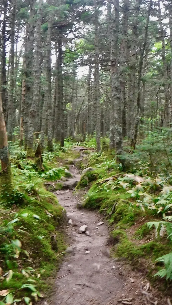
Mossy trail near top of Glastenbury Mountain
The last part of the climb to the top of Glastenbury Mountain was also pleasant. The trail near the summit was well groomed and lined with thick moss.
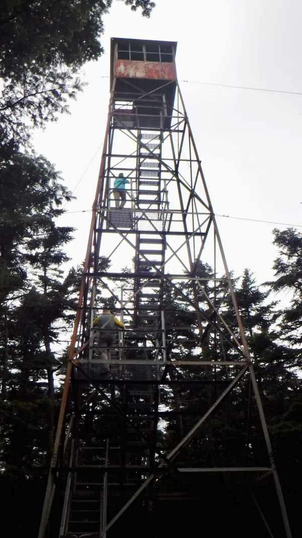
Glastenbury Mountain fire tower
A fire tower stood at the top. Towers like this were made obsolete years ago by improved communication and modern methods for tracking fires, and it was nice to see this one was still standing.

View from Glastenbury Mountain fire tower
We climbed the tower, and though it was a cloudy and somewhat rainy day, we found good visibility from the top.
Several people have vanished in and around this mountain; so many in fact, the area has become known as the Bennington Triangle.
I'm not making this up.
One of the most interesting of the stories about missing people happened on December 1, 1946, when an 18-year-old Bennington College student named Paula Welden disappeared while hiking on this trail.
Several people had reported seeing her that day wearing a bright red coat. When she didn’t show up for classes the next Monday, a search party was formed to look for her. Students, faculty, and local residents eventually mounted a massive search effort, the size of which was probably because Paula Welden's father was a well-known industrial engineer, architect and designer. Bloodhounds, helicopters, and even a clairvoyant were used in the attempt to locate her.
She was never found.
To this day, there are people who say it’s bad luck to wear red while hiking on this mountain.
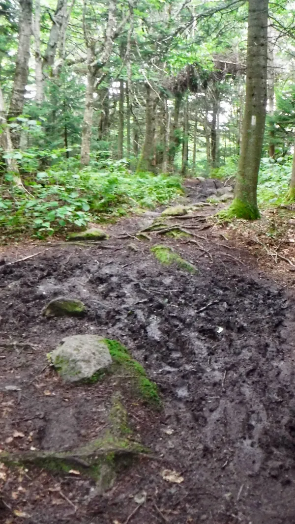
Vermont mud
From the top of the mountain, we had only four more miles to reach Kid Gore Shelter. The hike from the summit was slowed, though, by some of Vermont’s famous mud.
We arrived at 6:30 p.m. and found a spot to pitch our tents on a ledge near the shelter. For a climb like we did today in sometimes sloppy conditions, going nearly 14.5 miles made for a good day.
Rain began again at 10:15 p.m. I’m going to take a wild guess and say there will be mud on the trail again tomorrow.
Trouble ahead, the lady in red
Take my advice you'd be better off dead
Switchman's sleeping, train Hundred and Two
Is on the wrong track and headed for you
This trail report was published