
Day 4 Shelton Gravesite to near Log Cabin Road
More from this trailI'm a loser
If I were hiking a typical thru-hike, I wouldn't usually have a strict schedule to follow. There would be no need to hit a town on a certain day. What makes this thru-hike atypical from others is the trail is near my house. I like this because I can plan to meet my wife along the way.
Still, coordinating meeting places and times requires a lot of guesswork. I first discovered this on my first thru-hike in 2017. My wife visited me five times during the first half of the AT. Trying to keep on schedule for each visit added stress. Kim was still a full-time teacher then, so weekends and holidays were the only days we could meet.
Now I'm finding a similar problem on the Appalachian High Route. The trails used for the AHR are never more than three hours from our home. They're also only about an hour from where my older son and his wife live in Asheville.
While planning for this hike, I saw some opportunities to make resupply stops with the help of my family. My wife could pick up Polecat and me, then drive us to Asheville. Of course, this plan depended on my family agreeing to it, and they did without hesitation.
The first of these stops is planned for tomorrow when my wife picks up Polecat and me in Hot Springs and then drives us to Asheville for the night. We hope to repeat this when Polecat and I are near Mt. Pisgah on the Mountains-to-Sea Trail.
For plans like this to work, everyone has to stick to the schedule, and Polecat and I are having trouble doing that. We couldn't walk as far as we expected on Day 2, and that now puts pressure on us to hike more miles in less time.
Polecat prefers to limit his mileage, generally around 12 to 15 miles per day. We hiked more than that yesterday and doing so made up much of what we lost.

Sunrise through trees
Although last night was very chilly, the temperature didn't drop below freezing as I thought it might. When I woke up this morning, there was no frost on my tent.
I was up shortly before the sun rose, and when I looked at the sky, I was pleased to see it was clear. The two days of nearly continuous rainfall appeared to be over.
Most importantly, the sunshine meant we could stop and dry our wet gear today. I knew that Jerry Cabin Shelter was less than four miles away and would be a good spot for that. The area around the shelter had plenty of room for us to spread everything out in the sun.

Hiking on the Appalachian Trail
Taking down my tent and packing shouldn’t have taken as long as it did, but I'm always slower when all my gear is wet. The cold temperature didn't help, and I needed about 35 minutes more than usual to get ready. Though Polecat and I were on the trail by 7:40 a.m., we hoped to start earlier than that.
I removed my insulated jacket just before we left because the temperature was already rising.

A blue sky appears above trees
We were only on the trail 40 minutes before I stopped again to remove my mid-layer. Mittens were also no longer needed.
It sure was nice to see and feel the sun. This was the first time I saw a bright blue sky since I left Burnsville on Thursday.

A thick patch of rhododendrons
The trail was still wet, though it was only soggy where it went through a dense stand of rhododendrons. That was near a bad weather side trail that went around a rocky section at Big Butt. We had no reason to follow the bad weather trail today.
A rocky trail goes over Big Butt
The white-blaze route over Big Butt wasn't difficult. It also wasn't as exposed as a section coming up that went over Big Firescald Knob. A bad weather alternate is necessary there because the trail traverses a ridge where hikers could be in danger during a storm.
The bad weather trail at Big Butt didn't seem necessary, but I've never hiked this part of the trail during bad weather. Most likely, the trail maintainers wanted to move the trail to go over Big Butt because it was more scenic and decided to keep the old trail for bad weather. That's what happened at Big Firescald Knob.

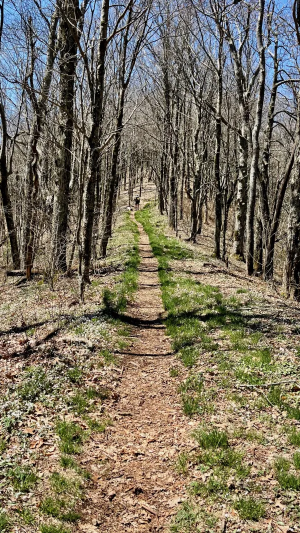
The trail follows an old farm road
After Big Butt, parts of the trail followed an old farm road that crossed Coldspring Mountain. It used to continue farther on roads, but the Carolina Mountain Club (CMC) rerouted the trail with a new section that split from the rutty old road.

A meadow on Coldspring Mountain
The trail then opened to a large meadow that stretched for more than a half-mile. Because I had hiked here four or five times in the last 20 years, I knew this section would be cruisy and we would soon get to Jerry Cabin Shelter.

Wet tents, clothing, and other gear set out to dry
As I expected, there was lots of sunshine at the shelter when we arrived at 10:15 a.m. No one was there, so Polecat and I took over the whole place. We hung nearly everything we had in our packs because it was all wet. We ate snacks and filtered water from a nearby spring while we waited for the gear to dry.
The shelter was built on the site of an old cabin. It was a home for a farmer who brought livestock up to Coldspring Mountain during the summer. When an AT shelter was built at the site of the cabin in the early 1970s, stones from the cabin's fireplace and foundation were re-used.
For many years, the shelter had a reputation for being the dirtiest on the AT. Then a man named Sam Waddle took responsibility for maintaining it, as well as a section of the trail. For nearly 26 years until he died in 2005, Waddle dedicated countless hours caring for the shelter. I remember the first time I stopped here on a day hike, there was an old, non-working phone mounted inside the shelter. This was an example of charming extra touches Waddle put in the shelter and showed his sense of humor.
A couple of hikers passed by while we waited for our gear to dry. One stopped to chat and told us his trail name was The Dawn. He tried to explain how he got that name, but I didn't understand.
The Dawn said he was section hiking after giving up on a thru-hike following a couple of bad experiences with broken bones in the Smokies. We agreed it was good to still be hiking.
The AT follows a narrow ridge
Because everything we were carrying was soaked, Polecat and I stayed at the shelter for two hours. The lengthy stay wasn't helping us make up time, but getting our stuff dried was more important. Besides, making up some of the time yesterday put us in good shape for meeting Kim tomorrow in Hot Springs, though we will probably get there a little later than planned.
Soon after leaving the shelter, we met some excited thru-hikers. They were elated because they had just passed the 300-mile point of their northbound hike. They had close to 1,900 miles to go, but this was still a reason to celebrate, and I congratulated them.
By the time thru-hikers get this far, they've made it through the Smokies. The weather is starting to improve, and they are getting used to the rhythm of daily life on the trail. Their chances of reaching Maine are now much better compared to when they first started from Springer Mountain.

Hobblebush blossoms
Wildflowers began to appear along the ridge we were walking. The sunshine probably had a lot to do with that. I couldn't miss the first flowers I saw because they were nearly hanging over the trail. They were hobblebush, a variety of the viburnum bush.
The bushes grow 3-10 feet tall and spread 4-12 feet wide. Their milky-white flowers will become red berries in the fall that attract birds, squirrels, and chipmunks.

A trail junction
After walking 45 minutes since leaving the shelter, we came to a trail junction. This was where the other bad weather trail connected to the white-blazed trail.
I used the blue-blazed trail on my thru-hike because the wind was blowing fiercely. When I arrived at Jerry Cabin Shelter, I heard stories from other hikers about how dangerous the white-blazed was to follow. The weather caused one hiker to stop in the middle of the trail in fear and sob.

The AT goes over the top of Big Firescald Knob
The blue-blazed trail was the official AT route following its construction along the Tennessee-North Carolina border. That changed when the trail was rerouted in 2003 by the Carolina Mountain Club to take advantage of spectacular views from the top of Big Firescald Knob's narrow ridge.
With pleasant sunshine and a light breeze, we had no problem to follow the white-blazed route today. This was one of my favorite sections of the AT, and I was delighted to be here in perfect weather. I'm sure I would have followed the bad weather trail if I had been here yesterday or the day before.

A view of mountains in North Carolina
At times, there were 360-degree views from the exposed trail. When I looked south, I knew that somewhere in the farthest range of mountains stood Mt. Mitchell, Craggy Dome, and other mountains.
The part of the Mountains-to-Sea Trail included in the Appalachian High Route crosses or goes near those mountains, many are above 6,000 feet in elevation.
If all goes as planned, Polecat and I will be walking along those mountains in roughly two weeks.

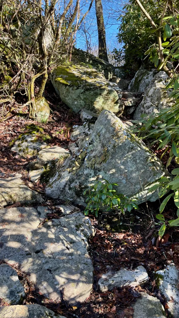
A steep climb on boulders
The route over Big Firescald Knob climbed to nearly 4,500 feet, which wasn't the highest point on today's section but offered the best views. Getting to the highest part of the ridge required following a footpath laid out in large boulders. These were carefully placed by CMC crews, requiring significant engineering to make sure each one was firmly embedded on the ridge.
It took trail crews seven years to complete the 1.5-mile rerouted section, and when you climb up here, you can see why.

A view from Howard's Rock
A bronze marker on a large boulder honored the work of Howard McDonald, who volunteered with the CMC for 30 years. He died in 2015 at the age of 89. McDonald didn't just work on the AT. He was involved in several CMC trail projects. The club maintains nearly 100 miles of the AT and about 130 miles of the MST, along with many other trails.
McDonald started his volunteer work with the CMC in 1992, a year after his wife died of ovarian cancer. He retired from trail building and maintenance just a few months before his death. At that time, he had contributed more than 9,000 volunteer hours to the CMC and had served as the club's president.

A view of Camp Creek Bald
Looking to the west from an open spot, I could see the trail's next high point, Camp Creek Bald, though the trail no longer goes over the summit. It was rerouted after some communication towers were erected on top of the mountain.
The oldest tower was built in 1929 as a fire lookout. Earl Shaffer, the first person to thru-hike the AT, wrote in his trail journal that he slept in that tower.
"Continued on to route 70 at Gap," he wrote. "Caught ride to town to get film, took 3 hrs. Went on to Camp Creek Bald Tower and stayed there overnight with Towerman."

A view of mountains from Big Firescald Knob
I wanted to stay as long as possible on Big Firescald Knob. The weather and the views were too beautiful to leave. It was also fun to see where I would be hiking after I circled around to follow the MST east and back to Burnsville.
I didn't feel like I could just stop and sit for a while, however. Our two-hour break to dry our gear had used up all of the time I thought I should give if we were going to make it to Hot Springs tomorrow.

Springbeauty flowers
After the descent from the narrow ridge and past where the blue-blazed trail reconnected with the white-blazed trail, I walked through large patches of rhododendrons. There were small breaks in these, and more wildflowers sometimes appeared. This time, they were springbeauty, which are plentiful in the Appalachian Mountains this time of year. Trout lily were nearby but hadn't bloomed yet.
The springbeauty I saw today were in small clumps. On other hikes, springbeauty was so widespread, the mountain slope looked like it was covered in snow.
While ascending the slope toward Camp Creek Bald, I passed a hiker who stopped to ask a question.
Hiker: “Did you cross a gap a ways back?”
Me: “You’ll have to be more specific. There are gaps all along this trail.”
Hiker: “One with parking spaces for cars.”
I still wasn't sure what gap he was referring to but wondered if it was Sam's Gap. He didn't seem to have any idea what he was looking for.
I met another hiker shortly after that. He said his trail name was Firewalker, and this was his second thru-hike. He told me he lost a lot of weight on the first hike, then gained most of it back.
I could relate to that.

The trail descend from Camp Creek Bald
When the trail stopped climbing toward Camp Creek Bald, it made a wide bend and began a long descent. We had only gone nine miles by this time, and there wasn't much daylight left in the day. It was becoming clear we would not make up as much time today as we did yesterday, and there was no way for us to reach our goal for today.
When I got to Flint Mountain Shelter, I talked to Polecat about our options. We agreed to look for another gravesite, which was said to be suitable for camping. Cell service was available from the shelter, so I called Kim to change the time we expected to be in Hot Springs tomorrow.
My mind was so much on the schedule and hoping we could make it to Hot Springs before the end of tomorrow, I absent-mindedly left the shelter without my trekking poles. Fortunately, I didn't get far before realizing my mistake.

A luna moth flies along the trail
A luna moth kept me amused for a couple hundred yards or more down the trail. It seemed as if it wanted to be my hiking buddy.
Farther down, I met more thru-hikers. One said his trail name was Heisenberg, the pseudonym chosen by the Walter White character in the Breaking Bad TV series.
Heisenberg was instantly likable and we talked for several minutes. He was excited to tell me that trail magic was just ahead at Log Cabin Road. "The Cookie Lady" lived there, he said. I liked the sound of that but was also disappointed. Polecat and I would miss the trail magic because we intended to stop before reaching the road.
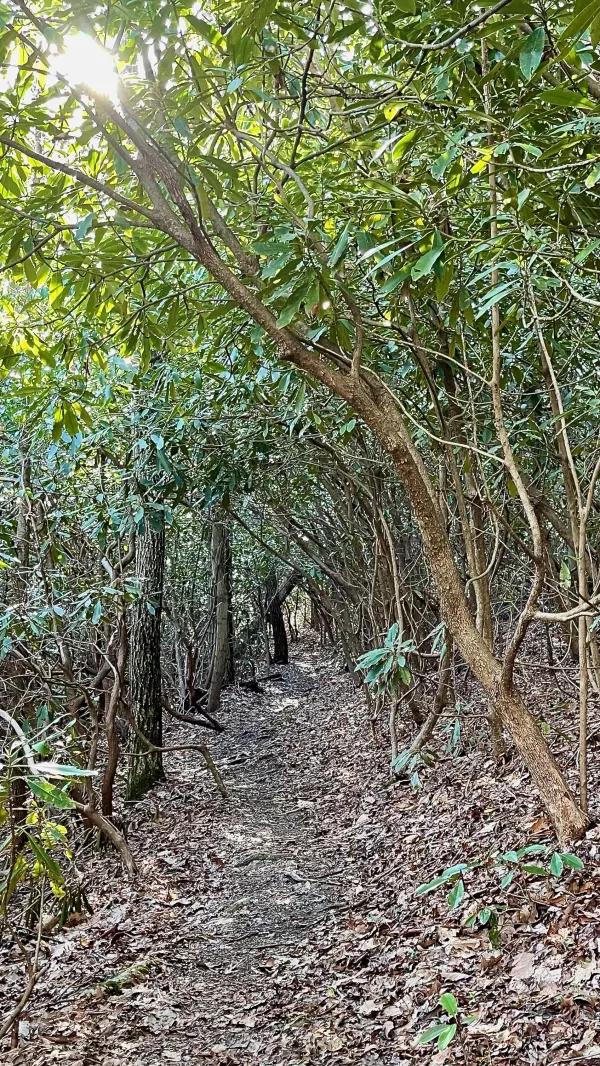
A tunnel of rhododendrons
After passing through another green tunnel of rhododendrons, I found Polecat stopped at the side of the trail. He found a couple of flat spots where we could pitch our tents. This was about a half-mile before where we agreed to stop, but I wasn't going to complain. I had been thinking that camping near another gravesite might be a little too creepy.
Unfortunately, as I started to set up my tent, I discovered my tent stakes were missing. It didn't take long to figure out I left them at Jerry Cabin Shelter. I even remembered where I left them. When I removed the tent from its stuff sack to hang it in the sun, I placed the stakes on a small stump in front of the shelter.
I wasn't going to walk back to get them, of course. And this pointed to another helpful reason for meeting Kim tomorrow. I should be able to contact her again when I have cell service and ask her to bring some spare stakes I have at home.
Polecat shared a couple of stakes he didn't need. With those and a few sticks and rocks, I was able to anchor my tent sufficiently without fear it would blow over in the night. It was nice to be warm in a dry tent.
One funny thing about the AT – well, maybe not that humorous but odd for me – is I tend to lose more items on this trail than others. I lost lip balm, sunglasses, tent stakes, and almost lost my trekking poles, and that's just on this hike. I lost my stove on the AT in 2017, and that's by far the worst item I've lost on a hike. I also lost a shirt on that trail, but I later got it back when it was miraculously returned to me by another hiker.
This trail is getting expensive.
Oddly, I don't often lose items on other trails, and when I do, they're inconsequential, like a bandana. And it's all just stuff. I hope whoever found my tent stakes could use them.
What was most disappointing about today was not meeting Cookie Lady.
I'm a loser
I'm a loser
And I'm not what I appear to be
Of all the love I have won or have lost
There is one love I should never have crossed
She was a girl in a million, my friend
I should have known she would win in the end
I'm a loser
And I lost someone who's near to me
I'm a loser
And I'm not what I appear to be
This trail report was published