500 miles written in rocks

And I would walk 500 more

Day 40, Tentsite at Maxwell Road to Horse Trail Camp

Thursday, May 2, 2019

Though I had been backpacking since I was 11 years old, I had never walked a long-distance trail until I thru-hiked the Appalachian Trail. With that hike came several new experiences.

Until then, I had never walked into a town to resupply. I had also never stayed in a hostel. After the first time, those experiences became second nature. No big deal.

Passing by a major mile marker is something different. No matter how many times I've done it, it still feels like an achievement.

The feeling I got passing mile 2,000 of the AT was just as special as reaching Albert Mountain, which marked the first 100 miles.

Weather Partly cloudy with a high temperature in the upper 60s
Trail Conditions Long and moderate climbs and descents
Today's Miles 15.2 miles
Trip Miles 509.3 miles

Because the Pacific Crest Trail is my second long-distance hike, I might have thought that passing mileage markers would also become no big deal. Been there, done that.

I’m discovering that isn’t the case. Each time I pass a marker written in rocks or sticks or on a sign, I still feel a reason to celebrate. I smile and congratulate myself for making it this far.

I also remember again the trail can’t be taken for granted. There’s no guarantee I will reach the next major mile marker.

View of Mojave Desert from Sawmill Mountain

I was the first one of our group to leave camp this morning. The air was refreshingly cool.

From our campsite, the trail began a gradual climb of about 600 feet in a little more than three miles. Along the way I was able to see the Mojave Desert. The trail will take us down there tomorrow.

Trail on side of Sawmill Mountain

I kept thinking while heading up the trail that some or all of the tramily members would soon pass me, but I didn’t see anyone.

From the top of the climb, the trail entered a wooded section. The trail passed near the top of Sawmill Mountain, then began a barely-noticeable descent.

The trees were small. Loggers had cleared the northern side of the mountain decades ago.

A fire lookout tower was erected on the peak in 1929, two years after a fire swept over a nearby mountain. That mountain is now called Burnt Peak.

Steel Belted

Finally at about 9:45 a.m., Steel Belted caught up to me. We hiked together before reaching the start of the next climb, then he pulled ahead and I lost sight of him. I still didn’t see anyone else.

Near 500 miles on the PCT

Looking at the trail profile, I thought this climb would be difficult. But just as I had done yesterday, I had over-estimated the difficulty or under-estimated my ability to power up the ascent. It wasn’t difficult at all.

On this climb I passed a hand-made 500-mile marker. The number was written in rocks.

Gravity at 500 miles

A little farther down the trail was a more official-looking marker, which was erected by trail maintainers. Its location was slightly off compared to what my navigation app said was the actual mile point.

Standing here, I was reminded of when I walked by the 500-mile marker on the AT without noticing it. That was a disappointment because I wanted to feel the accomplishment that came with seeing it.

I felt it this time.

Pacific Crest Trail

While I was there, the rest of the tramily caught up to me and we posed for photos.

As usual, I lagged behind the group as we left. From there, the trail leveled out for the next four miles.

The tramily waves hello

When I caught up the crew shortly after 1 p.m., they were all stretched out in the shade of some small trees. As was often the case, they shouted “Gravity!” when I arrived.

We stayed there for an hour or so to eat lunch and keep cool in the shade. Though the thermometer said today's temperature would only reach the upper 60s, it felt warmer under the dry and partially clear sky.

Later, we stopped to collect water at a concrete cistern. This was similar to the one we camped near yesterday, but used a different method to collect water. Instead of trapping water in a concrete pad, a metal canopy stood over the cistern to collect water. It was sloped to funnel the water into the cistern.

Someone had left for us a water scoop that had been cleverly constructed using a long stick tied to an empty water bottle with the top cut off. This made scooping water much easier than trying to crouch low to the narrow opening of the cistern.

I collected and filtered 4.5 liters. The next water source, which was near our campsite, was reported to be difficult to reach and had uncertain flow.

A park-like section of trail

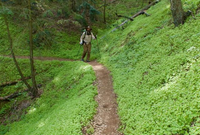
Leaving the cistern, we walked through a nice forest of oak and Douglas fir. It looked like a groomed park, which was unexpected for this area.

It would have been enjoyable if our campsite were located here, but we soon discovered we would not be camping in such a lush area.

A scattered mess of trees

The trail crested a ridge extending from Liebre Mountain, then began a long descent. Soon, the forest of large trees gave way to clutter of downed trees.

A storm a few years ago had clobbered this side of the mountain. It must have taken trail maintenance crews weeks to clear the downed trees.

Another view of the Mojave Desert

When I saw the Mojave Desert stretch out below the ridge, I took my phone out of airplane mode to see if cell service was available here. Within a minute, I got a call from my son Landon. He was just calling to check on how I was doing.

I arrived at Horse Trail Camp at 5:30 p.m. Though there was a picnic table here, the site was mostly filled with downed trees. The storm that had knocked down trees along the trail also wreaked havoc on the campsite.

The camp was reportedly a remnant of the now-defunct California Riding and Hiking Trails project. Legislation to create a 3000-mile loop in Southern California passed in 1944. The CHRT was never completed, but portions of it became part of the Pacific Crest Trail.

Passing a mileage marker today caused me to reflect on how far I’ve come, but also made me think about how much is left to go.

That was a glass-half-full, glass-half-empty feeling. It felt good to see how far I’ve walked, but the marker was also a reminder I still have a long, long way to go.

As I crossed the 500-mile point, the number of miles ahead of me on the PCT was roughly equal to the entire distance I had walked on the AT.

When I'm lonely, well I know I'm gonna be
I'm gonna be the man who's lonely without you
And when I'm dreaming, well I know I'm gonna dream
I'm gonna dream about the time when I'm with you
When I go out (when I go out) well I know I'm gonna be
I'm gonna be the man who goes along with you
And when I come home (when I come home) yes I know I'm gonna be
I'm gonna be the man who comes back home with you
I'm gonna be the man who's coming home with you
But I would walk 500 miles
And I would walk 500 more
Just to be the man who walks a thousand miles
To fall down at your door

This trail report was published on