
Day 165 Chester to Tentsite at Mile 1315.5
More from this trailI got to keep on movin' when no one knows my name
Before I finished packing and walked down the road to meet Bobby O for breakfast, I went to the lobby for the motel's free breakfast.
Two breakfasts within an hour? Absolutely!
The motel's breakfast consisted of boring cold cereal and discount store Danish pastries, but I wasn't about to pass up free food. A thru-hiker would never do that.
I met Bobby O at Kopper Kettle Café. The food was better here, and I was pleased to note the restaurant owner wisely chose not to spell café with a "k."
As we ate, we reviewed how our hikes had gone so far. Similar to my hike, Bobby O flip-flopped to avoid hiking through too much snow in the Sierra. And like me, he was now nearly finished.
Bobby O also told me a little about himself. He said he was attending law school when he fell into acting. His career took off, and he wound up on the soap opera Days of Our Lives. At first, he played an evil character named Cal Winters. Later, he switched roles and played Rev. Andrew Carpenter.
After 27 years acting in a variety of television series, including parts in St. Elsewhere, Hill Street Blues, and Babylon 5, he returned to law school to complete his degree and pass the bar. He then worked as an environmental lawyer until retiring to hike the PCT.

Trail angel Sean
Sean picked us up at the restaurant as planned at 9 a.m., and within a few minutes, we were back at the trailhead.
Sean agreed to let me take his photo, but Bobby O declined. Then again, his photos are all over the internet under his stage name, Wortham Krimmer.
Bobby O was hiking northbound, so after we thanked Sean for the ride, we headed in separate directions.

Smooth trail on a long climb
The first seven-tenths of a mile was flat. After that, the trail began a long climb. From the way the trail's profile looked in the Guthooks app, it was going to be a challenging climb. Instead, I found it to be easy. Maybe that was because of the two breakfasts.
The trail went up 2,800 feet in 8.1 miles.

A view of Lake Almanor
Near the top of the climb, I saw a glimpse of Lake Almanor. It was directly adjacent to the town of Chester.
This was a large lake, which was created in 1914 when a dam was constructed on the North Fork of the Feather River. A second dam was completed in 1927 to increase the size of the lake.
I called Kim from the top of the climb and told her it might be possible for me to finish the trail one week from today. That seemed like a stretch and maybe a little too ambitious, but I didn't tell her that. I was hopeful.
This morning's late start had already made me fall behind on my daily mileage goal. Nevertheless, I was now thinking I could trim a full day from my original plan.
I felt strong and confident after looking last night at the remaining distance to Truckee. I just needed to avoid more delays.

A marker identifying the halfway point of the PCT
A few minutes before 2 p.m., I arrived at a concrete marker posted next to the trail. It identified the midpoint of the PCT.
A hiker register was standing next to it. I leafed through some of the recent entries to see if I recognized any names.

Pages from the hiker register
Curmudgeon, the hiker Bluejay and I met on the snowy day leaving Ashland, passed here two days ago. He wrote that he had just 34 miles to go to complete the trail.
When Sunkist, Bluejay, and I were on the trail leading into Ashland before we flipped south, we met EdBeard and GinGin. They continued south from there instead of flipping as we did and passed here on September 19.
Two hikers I had not seen in many weeks were here on September 11. I last saw Blue in Oregon on Day 98. I hadn't seen Waist Deep (Quinn) since Day 82 at Trout Lake.
I was glad to see all of these people had made it at least this far. I wished I knew how they were doing now.
When I signed my name in the register, it occurred to me that no hikers behind me would recognize it and remember meeting me on the trail. Chances are, I thought, I was the last southbound thru-hiker to pass by the marker this year.

Clouds forming
When I reached an open spot with a clear view of the sky, I noticed clouds were gradually forming. It seemed like rain or possibly snow could be in my future.

A small amount of snow on the trail
Less than a mile away, I came upon a small amount of snow on the trail. This was all that remained from what had fallen the night before last.

A view of Lassen Peak
Even the snow on Lassen Peak was mostly melted by now. When I saw the mountain, there was much less of it today near the summit.
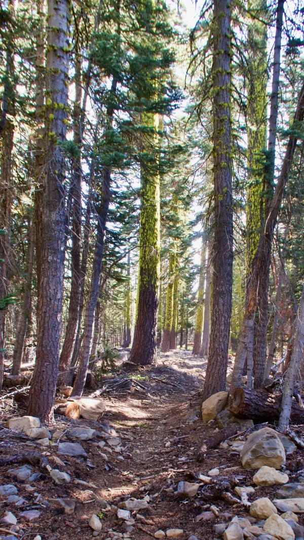
Afternoon sunlight filters through the trees
Starting from the halfway marker, the trail went mostly along the top of a ridge. There were a series of small ups and downs, which I breezed through without any difficulty.

Volcanic boulders
In the last couple hours of daylight, views from the trail began to open as the trees were more widely dispersed. The terrain became rockier, and I noticed volcanic boulders standing like large highway cones.

Clouds over Lassen Peak
The open terrain also showed clear views of Lassen Peak. Clouds were now clustering around the summit.
There were fewer clouds elsewhere, though. The sky appeared to be clearing, and I decided rain wouldn't fall after all.

Evening alpenglow
I met two northbound thru-hikers who had already stopped for the night. They told me they needed only to reach Burney Falls to be done. That was about 100 miles away.
The time was now past 5:30 p.m., and I wanted to keep going as far as I could before sunset. I said good luck to the couple and continued down the trail.

Sunset
I only got a mile farther when I found a wonderful campsite on a ledge. The setting sun was providing a dramatic show. I became so distracted by the sunset, I stopped putting up my tent to watch it.

Dusk
In the final moments of dusk, the few lingering clouds captured the purple, violet, red, and orange hues of the sun's rays.
After the colors faded and the sky began to darken, I turned my attention back to finish putting up my tent and preparing dinner.
Later, when I crawled into my tent, I left the vestibule door open to prevent condensation from forming inside. This gave me a wonderful view of the Big Dipper. It was the last thing I saw before falling asleep.
I wasn't able to hike the miles I had hoped for today. This added to the pressure I had been putting on myself to finish next Friday.
Still, I remained confident. I just hoped I wouldn't run into bad weather.
I took the blue sky and turned it into rain
I left this town in disarray
The wind keeps blowin' through a skeleton of pain
I got to keep on movin' when no one knows my name
We're only travelers on this road
I've seen enough to keep me going
Some things are simply not worth knowing
I found my peace on Cross Creek Road
This trail report was published