
Day 155 Porcupine Lake to East Fork Sulphur Creek
More from this trailLike the morning sun, you come, and like the wind, you go
I discovered in my first thru-hike how the days on the trail have a simple and repetitive rhythm. I described it as: "Wake up. Pack. Walk. Stop. Set up camp. Sleep. Repeat."
When I first wrote about this, I said, "The mental side of the trail creeps in later when you think you’ve overcome the tough part of thru-hiking."
That's what happened to me yesterday. Then I arrived at a beautiful campsite and got to talk over the day with my friend, Bluejay. My bad mood was soon erased. I forgot about my gripes and once again appreciated why I was there.
This experience shows how the trail has a self-healing effect. When it beats you up a little, there's bound to be a view or an interaction with other hikers to make it more bearable.
And now, just like hitting a "repeat" button, I was back this morning to follow the same routine.
Thankfully, I never felt the boredom I felt yesterday. I'm sure the way it started helped set the mood for the entire day.

Sunrise on the Pacific Crest Trail
Our campsite was tucked in a cirque. With my tent pitched among large boulders and small trees, it was well-sheltered from wind. The overnight temperature didn't drop below freezing, and I slept comfortably.
When I began hiking at 6:30 a.m., the sun was just about to rise. By the time I walked from the side trail leading to our campsite and returned to the PCT, the sky was a dazzling explosion of color.
I stood at the trail junction for several minutes, watching and photographing the brilliant sunrise. This spot had cell service, so I then shared a photo on social media.

Mt. Shasta
Not unexpectedly, Mt. Shasta soon came into view and was looming much larger than before. It was now less than 22 miles away.
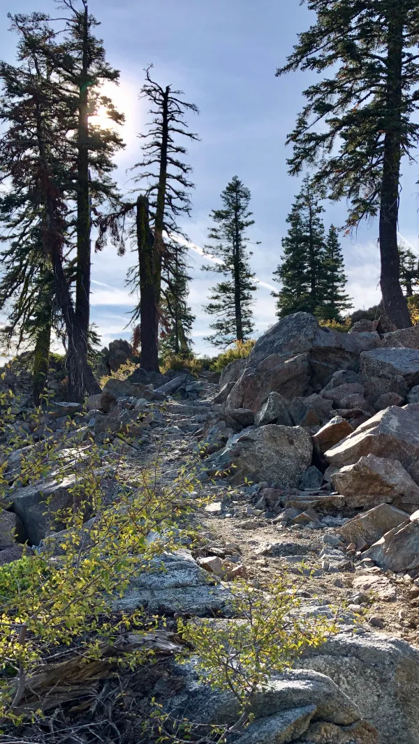
A short section of the trail made a climb
The route the trail took was mostly downhill today, but there was a little more climbing than I expected. The climbs were short, so they didn't slow me down.

The trail followed a long ridge
The trail passed in and out of forested areas as it followed the sweeping curve of a ridge. The sections with few trees had been clearcut.
The sun felt warmer in the open, clearcut sections.

A glimpse of Castle Crags
Shortly after 10 a.m., I began to see glimpses of a jagged mountain appearing behind and above a ridge that stood just ahead. I knew that the trail would take me past Castle Crags today, but I didn't expect to see that mountain formation so soon.
As it turned out, I was making much better time than I expected.

Castle Crags
Before long, I passed by another clearcut area and could now see a full view of Castle Crags.
This formation was a large, igneous intrusion called a pluton. The jagged pinnacles, spires, and domes of volcanic rock were carved by glaciers, resulting in what looked like turrets on an ancient, crumbling castle.
Early white settlers named the area Castle Crags, but it has also been known by other names. Local indigenous people called it the Abode of the Devil and Spanish explorers called it Castle del Diablo (Castle of the Devil).
The steep sidewalls are popular for rock climbers.

A view of Mt. Shasta from the PCT
The trail made a momentary climb to the top of the ridge. This offered yet another clear view of Mt. Shasta.
If the trail had gone down the north side of the ridge, it would have gone past Castle Lake and an exposed knob called Battle Rock. This was the site of the Battle of Castle Crags, a fight between white settlers and Modoc Indians.
The battle in 1855 happened after a man named Mountain Joe, who owned a trading post, spread a rumor about a lost gold mine in the area. When hundreds of prospectors descended on the area in search of the mine, they muddied streams and killed-off wildlife. Their bad behavior angered the indigenous people, who retaliated by attacking travelers and burning down Mountain Joe's trading post.
The Modocs then fled to Castle Crags, where they were pursued by U.S. Army soldiers, the Shasta County sheriff, gold miners, and a local militia. A rival tribe of Indians was also enlisted
to join the fight against the Modocs.
Two Modocs were killed and one of the sheriff's men was killed. The battle is said to be the last time Indians used only bows and arrows, spears, and other traditional weapons in a fight against white settlers.

A closer view of Castle Crags
The trail was now in Castle Crags Wilderness, which covers 10,500 acres, plus an additional roadless area of 1,732 acres.
Tomorrow, the trail will cross into an adjacent state park.

Descending past the base of Castle Crags
The final eight miles of today's section descended more steeply, dropping 3,300 feet and into a forest.
I caught up to Bluejay with less than two miles to go, and we arrived at camp just before 5:30 p.m.
It felt great to hike 24 miles and still be able to finish dinner and all of my camp chores before dark.
Bluejay and I have walked 92.5 miles in the last four days. Our reward for that will be tomorrow when we only need to walk six miles to reach our next town.
It's the same story the crow told me
It's the only one he knows
Like the morning sun, you come
And like the wind, you go
Ain't no time to hate, barely time to wait
Wo, oh, what I want to know
Where does the time go?
This trail report was published