
Day 149 Seiad Valley to Buckhorn Spring
More from this trailTheir motto is "Don't tread on me"
Many Seiad Valley residents are supporters of a movement to separate from California and form the State of Jefferson. They want to create what would be the 51st state because they feel under-represented. The rest of California has 111 elected representatives in the state legislature, they point out, while they have only nine.
It's hard to see how the separation would work for their benefit. The citizens wanting to be in the State of Jefferson live in California's poorest counties. Right now, they get more income from their current state for infrastructure than they pay in taxes.
Nevertheless, signs showing support for the separation movement were everywhere. A building next to the store and diner was painted with the "state" seal. This depicted a gold mining pan with two Xs, which signify being double-crossed by the current government. Cars and homes in the area also displayed this seal.
Our tents got wet last night from condensation, which made our quilts damp. Bluejay and I put the quilts in a dryer at the RV park and left the tents set up. We hoped they would dry while we walked next door to the diner for breakfast.
The tents weren't dry by the time we returned, but we packed them anyway because we didn't want to delay our start any longer.

Fog in Seiad Valley
The morning was cool, with patchy fog rolling off the Klamath River.
We weren't ready to begin walking until nearly 9 a.m. For the next 6.4 miles, we walked on roads. The first 1.4 miles followed California Highway 96.

A No Monument sign
While on this long road walk, I saw several more "State of Jefferson" signs.
I also saw signs that said “No Monument.” These expressed a dispute many residents had with an effort to expand Cascade-Siskiyou National Monument.
The 5,000 acres added to the national monument by the Obama Administration weren't near Seiad Valley, but residents here seemed mad about it nonetheless.
The expansion was being fought in federal court. The argument was mostly over timber rights, but I suspect many Seiad Valley residents were against it on a general principle of distrusting anything related to government.

Crossing the Klamath River
The highway crossed the Klamath River on a steel bridge. Then a short distance farther, the trail turned to follow another road.

A road walk on the PCT
This road had a paved surface at first but later was gravel. The trail followed the road as it curved along the river bank for more than two miles. The road then turned away from the river.
Only one car passed me while I walked on this road. That didn't matter, though, because I didn't want to hitchhike. The road was part of the trail, and I still intended to hike all of it.

A No Trespassing sign
There weren't many homes along the road, but there were many "no trespassing" signs. Besides being fiercely independent, Seiad Valley residents also appeared to be territorial.
One yard had a sign that showed the owner had a sense of humor, however. Or at least I hoped that was the case. It said, "No trespassing. We're tired of hiding the bodies."

A footbridge over Grider Creek
Finally, the road came to a dead end. I arrived there shortly after 11 a.m.
The trail then followed a footpath to a bridge across Grider Creek. From there, it began a long climb, starting with some switchbacks.

A blowdown over the trail
Despite a few blowdowns, the first part of the climb was mostly easy to walk. There were a few short, steep sections, but otherwise, the trail went gradually up. It climbed nearly 2,400 feet in the first eight miles as it followed the creek.
Clearing sky
The sky kept changing from cloudy to partly cloudy. By noon, it seemed that the clouds were clearing away. I thought the afternoon would be sunny.
Just as I started to think about stopping for lunch, I saw Bluejay near a stream that fed the creek. She had the same idea about lunch. Except for a couple of day hikers near the road's dead end, she was the first hiker I had seen today.
Because we weren't able to dry our tents this morning, we spread them out in the sun, then ate our lunch.
By the time we finished, the sky was becoming cloudy again.
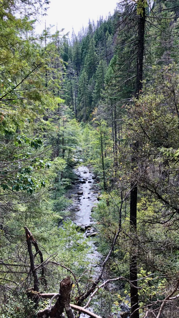
A view of Grider Creek
The trail continued to follow the creek, but sometimes it climbed high on the side of the deep valley formed by the stream. Eventually, the trail would become less steep and reach the same elevation as the creek.

A footbridge over Grider Creek
At three spots along the climb, the trail crossed a footbridge over the creek. I stopped at one of them to collect some more water.

A mule deer
Although I went a long stretch without seeing another hiker, I saw a mule deer.
Unlike white-tailed deer, which are not found in this part of the U.S., mule deer are less suspicious of humans. The one I saw today just stared at me as I walked by.
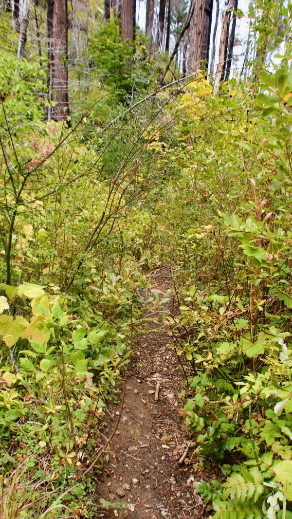
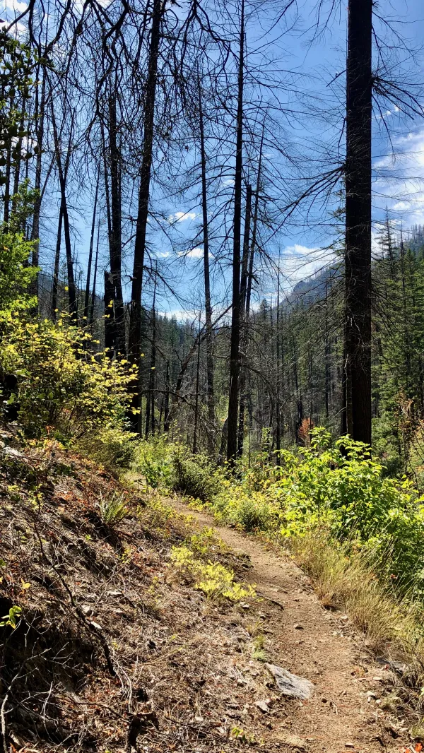
An overgrown section of trail
The last seven or eight miles of trail were steeper than before. This section wasn't difficult, except one part was annoyingly overgrown.

Climbing toward Buckhorn Mountain
The trail was climbing to pass near the top of Buckhorn Mountain. In all, I climbed more than 5,200 feet today with almost no descents.

Melting snow on the trail
In the last 90 minutes of the climb, I began to see patches of snow. This section of the forest had been burnt, so the trees were thinned out in spots.

Almost sunset in Marble Mountain Wilderness
As the trail passed Huckleberry Mountain, it entered Marble Mountain Wilderness and would remain in it for the next 32 miles.
This land has been protected by the federal government since 1931. It was one of the original wilderness areas created when the Wilderness Act was signed by President Lyndon Johnson in 1964.
I arrived at our campsite near Buckhorn Spring just before 7 p.m., right when the sun sank below the horizon.
Despite getting a late start this morning, I felt good about hiking more than 20 miles today. If I am going to finish this trail before the end of the month, I will need to hike many more days like this one.
It's a buck dancer's choice my friend
Better take my advice
You know all the rules by now
And the fire from the ice
Will you come with me?
Won't you come with me?
Wo-oh, what I want to know
Will you come with me?
Goddamn, well I declare
Have you seen the like?
Their walls are built of cannonballs
Their motto is "Don't tread on me"
Come hear Uncle John's Band
Playing to the tide
Come with me or go alone
He's come to take his children home
This trail report was published