
Day 135 Tentsite at Mile 809.6 to Rae Lakes
More from this trailOnly a fool would go so far as you have gone, my man
It's not unusual to find a number written in sticks or rocks or pinecones on the trail. They are placed there by hikers to mark the distance away from the trail's start or the remaining miles to the end.
I didn't pass a marker like that on the trail yesterday. It would have been up to me to create it because it would mark my own milestone.
I walked past the 2,000-mile point of my PCT hike yesterday. I passed the spot without realizing I had walked that far.
Then again, I rarely think about how many miles I have walked. I mostly think about how many miles I need to go before I reach my campsite for the night or the next road into a town.

Morning alpenglow on Cardinal Mountain
Our campsite for last night was at 10,990 feet. When I awoke this morning, I found frost on the inside of my tent.
Sunlight was just hitting the top of Middle Palisade, which stood 8.1 miles away on the other side of Mather Pass.
The mountain on the right side of my view was fully illuminated by the sun. It was called Cardinal Mountain. The 13,397-foot mountain was given that name because of its reddish color.
Pathfinder left camp a few minutes ahead of Bluejay and me. We left shortly before 7 a.m.
We stopped first to check on the group of fraternity brothers who were camped nearby. They told us the member who was sick yesterday was feeling a little better this morning.

Lake Marjorie
Bluejay and I had just 2.5 miles to go in our climb to reach Pinchot Pass. Along the way, the trail passed Lake Marjorie. This was a small, glacial pond nestled in the shoulder of Mt. Ickes.

Leaving Lake Marjorie and heading to Pinchot Pass
The sun had been up for more than an hour by now. Still, the temperature remained chilly, especially in the shadows of the surrounding mountains.

The sun shines over Pinchot Pass
The final 1.5 miles of the climb were the steepest, going up nearly 1,000 feet.
As I neared the top, the sun was finally rising above the ridge. I felt warmer, but that was more from my exertion on the climb than from the sun. While stopping to remove my insulated jacket, a couple of PCT northbound hikers walked by. They told me they had flip-flopped after skipping this section earlier and were excited to be almost finished.

A view from the top of Pinchot Pass
Including the stops to talk, take photos, and remove my jacket, I needed an hour and 45 minutes to reach Pinchot Pass.
When I looked from the pass down the other side, I could see Bluejay. She was far ahead of me and was soon out of sight.
The pass was 12,093 feet above sea level. It was named to honor Gifford Pinchot, who is called the "father" of American forest conservation. He served as the first chief of the U. S. Forest Service.
While I was standing at the top, a southbound hiker arrived. “Welcome to Mather Pass,” I said.
I knew he got the joke and also that he had previously hiked the AT because he replied, "I thought this was Mt. Katahdin!"

A marmot sunning itself on a large rock
The descent began with a series of switchbacks. On the way down the pass, I saw a marmot sunning itself on a large rock.

Leaving Pinchot Pass
There was no chance of me falling this time while looking at the marmot. The descent was much less steep and without a drop-off from the side.
I didn't walk far down from the pass before stopping again to take off my windshirt. The temperature never rose above 60 F today, but I was getting much warmer nonetheless.

Crater Mountain
The descent continued as it made a sweeping turn into a valley. Woods Creek flowed in the middle of the valley, with Crater Mountain on the west flank.
Though the trail descended gradually, the footpath became more tricky because it was mostly composed of loose rocks and gravel. It was like walking on sand, and I felt I was slowing down when I should have been able to go fast.

Wildflowers on Woods Creek
When I reached an easy access point to the creek, I stopped to collect and filter water.
In the higher part of the canyon, Woods Creek was a small stream gently cascading over rocks.

Woods Creek
Farther down, the creek became wider with more rocks and whitewater rapids.

A cascade on Woods Creek
With a greater volume of water, waterfalls and cascades began to appear along the creek.

A waterfall on Woods Creek
As much as I enjoyed the views along Woods Creek, the trail was making me more frustrated. I became concerned about reaching our campsite in a reasonable time. I also knew I had a long climb ahead of me, which could slow me down some more.

A view of Diamond Peak
Just before the trail turned to cross a large suspension bridge, one of the more notable mountains of this area came into view. It was 13,126-foot high Diamond Peak, which was 4.3 miles away and up another canyon. This was in the direction the trail would soon turn.
Despite my annoyance with the trail's condition, this was a beautiful area. Seeing the ever-changing creek and the stunning mountains nearby, I realized anyone who wanted to see these views would have to walk more than one day to get here. In some national parks, sights like these could be seen from your car.
I was thankful there were no hordes of tourists here. There was only me, the creek, and the mountains.

The suspension bridge over Woods Creek
When I reached the suspension bridge at 1 p.m., I decided to stop for lunch. I ended up staying for 45 minutes.
The extra time allowed me to put my tent on a rock in the sun to dry. The frosty condensation from last night had made it a little damp. I also filtered more water from the creek.
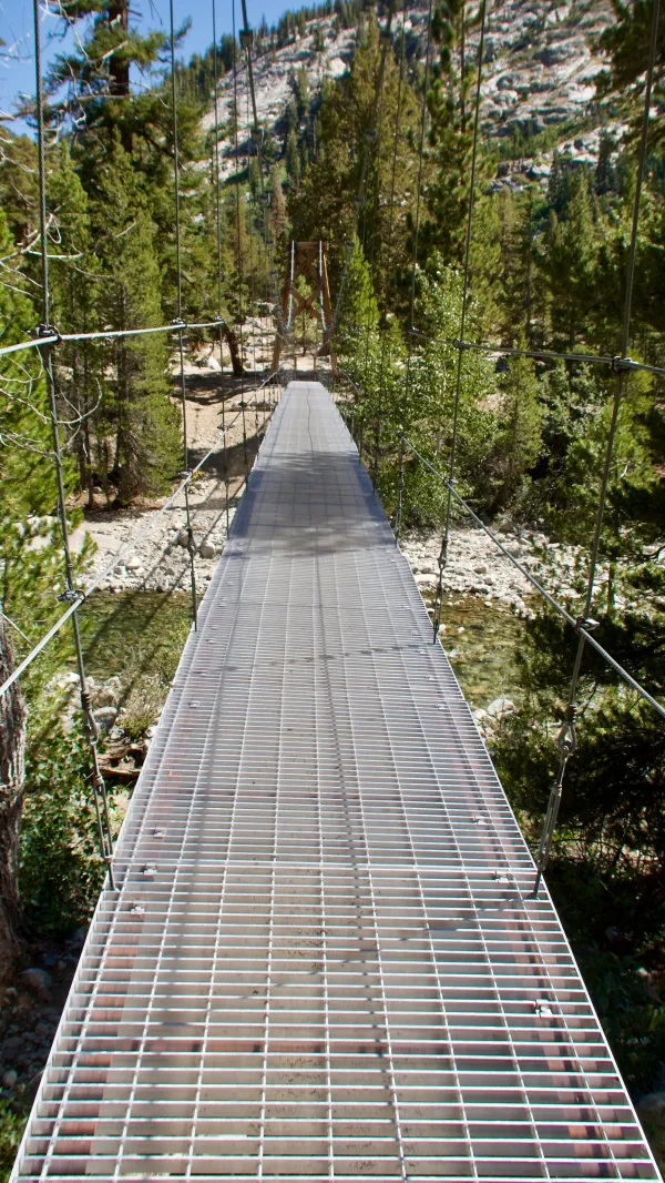
The suspension bridge over Woods Creek
After repacking my tent, I waited and watched as two hikers crossed the bridge before I crossed it. While standing at the foot of the bridge, I noticed they walked slowly and carefully. A woman seemed spooked by it. She took each step tentatively.
When they reached the other side, I started walking confidently across. Bridges like this never make me nervous, but immediately I realized why the woman ahead of me had hesitated. The bridge shook and swayed with every step.
After taking only three or four steps, I knew I needed to slow down. If I hadn't, I might have been bounced into the creek.
Baxter Creek
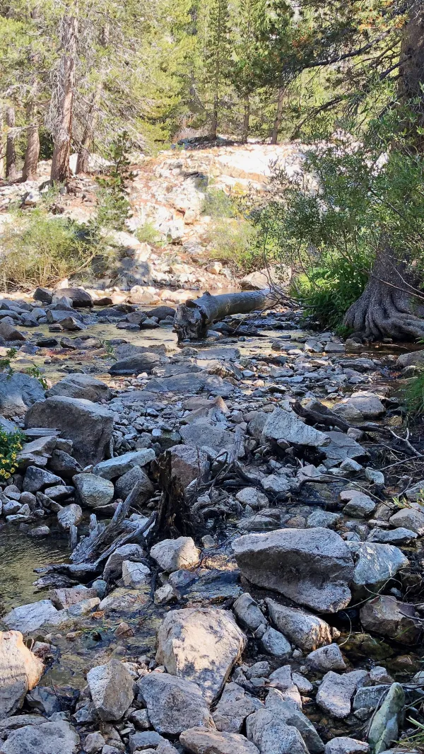
From there, the trail began a 2,100-foot climb for the next 5.5 miles as it followed the South Fork of Woods Creek. After the first 2.5 miles, I came to a tributary called Baxter Creek.
The creek seemed at first to be no more noteworthy than any other I've crossed. In fact, there were so many rocks here, I could have found many different ways to easily step across without getting my feet wet.
Then I happened to check the comments posted about this creek in the Guthooks app. I discovered one written by my Woohoo Crew friend Bookworm. He described a horrific experience at this same creek. He said one hiker nearly became swept away in the current after ignoring warnings to stay put for the night.
Bookworm, Falls, and the others in their group wisely waited until the next morning when the creek's water dropped to a safer level. Nevertheless, the near-freezing water was still above their chests when they crossed.
Once again, I was grateful for my decision to flip-flop this hike.

Climbing to Rae Lakes
Despite my earlier concern about being slowed to reach our campsite, the climb was easier than I expected. It was also beautiful.
I met a hiker near another stream crossing who tried to tell me snow was in the forecast. I said, "Okay," while knowing there was almost no chance of snow tonight.
After walking a quarter-mile farther, I met another hiker. He asked me if I had seen his friend.
"Yes," I answered, "and he tried to tell me it was going to snow tonight."
His friend laughed and said, "He doesn’t know the forecast."

Fin Dome and Mt. Rixford
The upper part of the climb entered an area of beautiful lakes and more fascinating mountains called Rae Lakes.
Bolton C. Brown was an artist who made frequent trips to the Sierra to explore and paint. His wife, Lucy, would often join him on these trips. He thought the ridge of the mountains to my right resembled a sea serpent. He gave different peaks names for parts of the serpent, but the only one still used is for the serpent's fin.
Fin Dome's unusual, rounded peak immediately caught my eye when I reached the upper part of the canyon.
Straight ahead and more than three miles away stood Mt. Rixford. It was near Glen Pass, which I would be climbing tomorrow morning.

Approaching Arrowhead Lake
The trail continued on past a string of lakes. First was Dollar Lake, then Arrowhead Lake, and finally, the three Rae lakes.

Rae Lakes
The spectacular lakes and surrounding mountains made me want to spend two or three days exploring this area.
Understandably, camping sites here are limited. A permit is required, but I was covered by my PCT thru-hiker permit.

Middle Rae Lake
Each Rae Lake was large, with mountain slopes dropping directly into the water at their shores.
As I approached Middle Rae Lake, a hiker told me a couple more hikers were camped nearby. I walked in the direction he told me and looked for Bluejay's bandanna posted as a signal she had stopped there.
This was the only spot that was marked for camping in Guthooks, so I should have known she would be here. For reasons I can't explain, I didn't spend much time looking for her and Pathfinder. Somehow, I assumed they weren't here, perhaps because I didn't see the bandana.
I left and returned to the trail, then continued walking another 1/2 mile out of my way until I was finally convinced they had to be back where I had looked before. Once I had returned there, it took me little time to find where Bluejay and Pathfinder were camped.

Two ZPacks Duoplex Tents
During my foolish wandering, I missed a confrontation they had with a difficult campsite neighbor. They told me the hiker tried to tell them they had to leave because she had gotten there first.
It was obvious she had some misguided and selfish ideas about backcountry etiquette. She apparently thought she had territorial rights.
This notion dismissed the fact that we were quiet and barely within sight of her tent. Camping in this area was severely limited, with some areas designated as no camping zones because of heavy use. Because of these limits, there was almost nowhere else we could have gone.
Pathfinder correctly compared this section of the PCT and JMT to Interstate 5. If that hiker had wanted solitude, she picked the wrong place for it.
Bluejay and I now have less than 100 miles to go to finish the Sierra. Then we will drive back to Ashland to finish the miles we skipped when we came down here.
There are still 550 miles waiting for us to finish in Northern California. That seems like a lot until I think about how many miles I've already walked.
I need to stop thinking about that before I start thinking it's too far to walk.
Only a fool could tell his friends
Of a war that just won't end
Only a fool would go so far
As you have gone, my man
This trail report was published