
Day 104 Stealth Site at Mile 1898.2 to Bradley Creek Trail
More from this trailGonna make the mountains be my home, ‘cause the sky above is gold
To say hiking in Oregon has been easy might be an exaggeration. Still, there have many stretches of trail that have been favorable for adding extra miles.
Each day now, when we talk about where we will stop to camp at the end of the day, we are looking for sites at least 20 miles away. Because of the terrain and the amount of daylight we have to hike, this isn’t a difficult goal.
Today was like many lately, with an overall elevation gain and loss of around 3,000 feet stretched over the entire day’s section of trail.
If there is a downside to this, it is that the scenery isn’t as spectacular as other parts of the trail.
Admittedly, racking up miles is a primary goal for this stage in my hike.
Without a doubt, I want to enjoy the experience and take time to appreciate the scenery. But one of the lessons I learned on the Appalachian Trail was the importance to me of hiking every mile of the trail, or at least every mile that can be safely and sensibly hiked. I don't want to shortchange the accomplishment of completing a thru-hike.
This is why I stay focused on my daily mileage. I still have more than a thousand miles to cover before winter returns.

Morning sun on Diamond Peak
We camped last night in the shadow of Diamond Peak. As we left at 6:30 this morning, the mountain glowed in deep golden hues cast by the rising sun.
Like so many of the mountains in this region, Diamond Peak is a volcano. It stands at 8,748 feet in elevation, with about 3,100 feet of prominence.
It wasn’t named for the gemstone. It was named for John Diamond, who along with William M. Macy, climbed the mountain in 1852 during their search for a shortcut for the Oregon Trail.

Dave leaves our campsite
Dave and I walked together for much of the morning. After starting with a little more than two miles of nearly flat trail, we began the first gradual descent of the day.

Dave on the trail with spruce trees
The descent would continue for the next six miles, dropping steadily for 1,500 feet.
Except for making one stop to filter water at a stream and another short break to eat a snack, there was no need to stop. The trail was as easy as expected.

Summit Lake
I did stop a couple of times to take photos, however, and in doing so I lost sight of Dave. One of the photos I took was of Summit Lake, which was by far the largest lake we passed today.
Oddly, there are seven lakes in Oregon named Summit Lake.
Near the lake was Emigrant Pass, which was part of the Free Emigrant Road. This was the route that Diamond and Macy were scouting when they climbed Diamond Peak, though at the time the pass was known as Willamette Pass.
This was the site of a near-disaster in October 1853. A group of 1,500 emigrating settlers became stranded at the pass during an early snowstorm. Fortunately for them, nearby settlers learned of their plight and saved them.
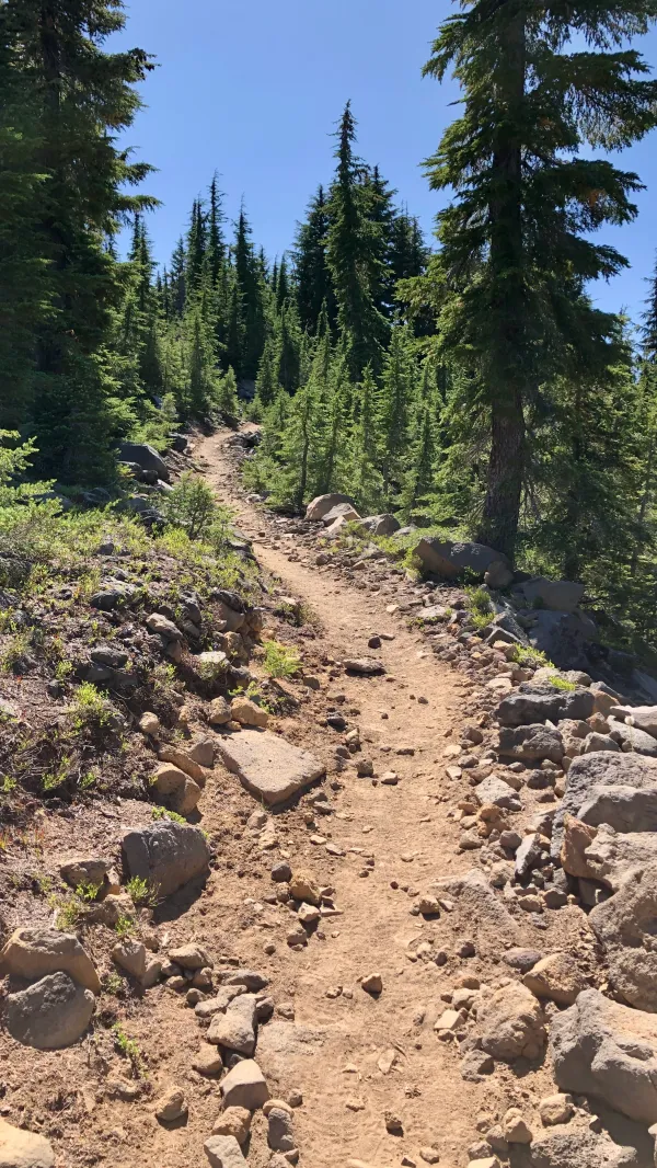
Zig-zagging trail
After leaving the lake, the trail began a long and gradual climb, ascending 1,800 feet in nearly eight miles.
At around noon, I became hungry. Assuming Dave was now far ahead of me, I stopped to eat lunch. After finishing, I continued up the trail. About 150 yards away I discovered Dave was stopped to eat his lunch.

Looking back to lakes and mountains
The uppermost part of the long climb was along the slope of Cowhorn Mountain. Its name came from a volcanic rock spire that reminded white settlers of a cow’s horn. The spire was blown down by a storm in 1911.
The trail crested about 500 feet short of the 7,664-foot mountain's top, which offered outstanding views of the surrounding lakes and mountains. To the north, I could see two of the Sisters. They were now more than 50 miles away. Mt. Bachelor could also be seen.

Looking ahead to Mt. Thielsen
On the southern descent from Cowhorn Mountain, I could see the sharply-pointed peak of Mt. Thielsen. Its distinctive horn shape made it unmistakable among the other much smaller mountains.
Following a straight line from here, Mt. Thielsen was only a little more than 16 miles away. The trail will add 12 miles to that distance and we won’t get there until late tomorrow.

Water cache at Windigo Pass
I finally caught up to Dave when I arrived at Windigo Pass at 4:15 p.m. In fact, Bluejay and Sunkist were there too. A large water cache was provided here by trail angels, which was helpful because this was in the middle of a waterless section of trail.
While filling our water bottles, we all agreed we could easily put in about four more miles, so we set our sights on the junction of Bradley Creek Trail. Our trail guide said this spot had plenty of room for tents, but there was no water source nearby.
I suggested we cook dinner here where we had easy access to water, but that idea was soon nixed when we discovered a swarm of bees.
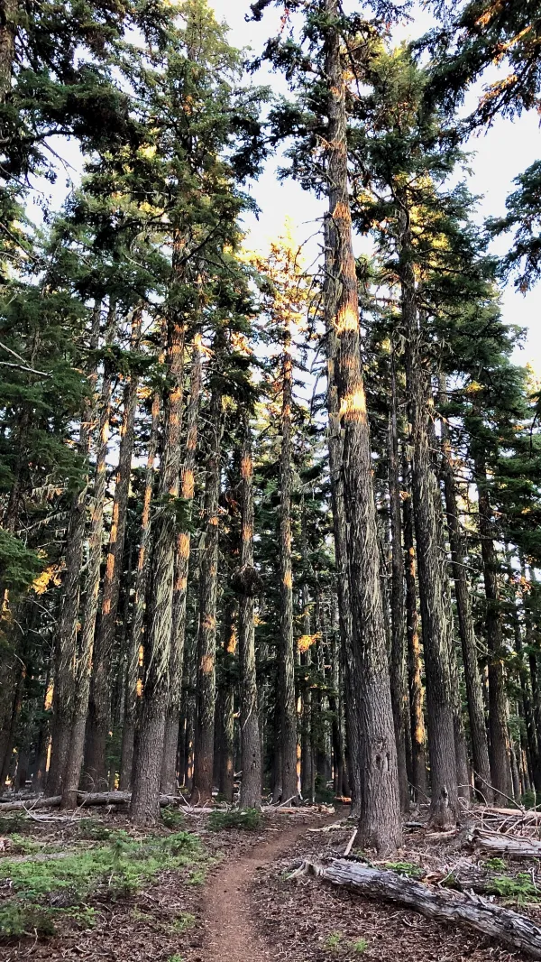
Sunlight-streaked trees
As I neared the spot where we agreed to camp, I noticed the tall Douglas firs along the trail were shimmering in gold. Streaks of the setting sun were caught among the branches and dangling moss.
I slowed down to marvel at what I was seeing.

Golden sunlight through the trees
The golden sunlight added a magical quality to the forest.
This was a good reminder to not be fixated on racking up miles. Given a chance, the trail is bound to reveal something surprising and beautiful.

Dusty feed
Perhaps it can go without saying, but I have to acknowledge that not everything about the trail is beautiful. Proof of this was revealed to me later in the evening when I took off my shoes and socks.
Although I wore liner socks as well as thick wool socks, and also had gaiters on my shoes, my feet were nearly black with trail dust.
I built a palace overlooking seven seas
I built a church upon a stone
Gonna let my pleasant pastures go to seed
Gonna let the mountain be my home
Gonna make the mountains be my home
('Cause the sky above me is gold)
Gonna make the mountains be my home
(The river is dark)
Gonna free my soul to roam
(The river is dark, down to the sea)
Gonna make the mountains be my home
('Cause the sky above is gold)
This trail report was published