
Day 9 Chestnut Ridge to Whiterock Gap
More from this trailHurrah!
The driest weather of the year in the southeast U.S. happens in late September through mid-November. A high-pressure system usually moderates the weather in the fall. Unless a tropical storm moves this way, like when I hiked the Benton MacKaye Trail, the area doesn't usually see much rainfall.
That's been true so far on this hike. I haven't seen any rain. The few clouds that formed from time to time were scattered and light. To be truthful, though, I haven't had many chances to see the sky lately. Until Polecat and I climbed to the top of Rabun Bald yesterday, we had been under a canopy of trees for most of this hike.
There would be more chances to see the sky today, and at times, I thought for sure Polecat and I were going to get wet.
Then again, I thought the weather would be chilly and possibly windy last night, but that didn't happen. The overnight temperature was comfortable.
There was no threat of rain in the scattered clouds we saw yesterday from the lookout tower on Rabun Bald. That changed this morning. When I awoke and climbed out of my tent, the sky was overcast with a thick layer of clouds.

Leaving Chestnut Ridge
Polecat and I left our campsite a few minutes before 8 a.m. Soon after we were on our way, we met a couple of day hikers. They had parked at Beegum Gap and were now following the Bartram to the tower.
The first 1.5 miles of the day continued a descent we started when we left Rabun Bald's summit yesterday. The trail went steadily down until it crossed the headwaters of Holcomb Creek.
If we were to follow the creek downstream from the trail, we would soon come to Holcomb Creek Falls, which has an impressive 120-foot drop. The Foothills Trail never seemed to miss an opportunity to pass by a waterfall, but the Bartram did not go that way.
The Bartram Trail
At the bottom of the descent were nearly two miles of mostly flat terrain. The forest was sometimes thick with rhododendrons.
I heard the high-pitched yipping of a coyote as I walked through here. Its voice echoed in this shallow valley and sounded close by. I never saw it and couldn't tell for sure where the howling was coming from.

Swirling clouds
About where the trail crossed into North Carolina, it began a short climb up a slope of Osage Mountain. Through a gap in the trees, I got my first wide view of the sky.
I saw swirls and layers of clouds. Surely this was a sky that would bring rain, I thought.

Clouds begin to clear
About 90 minutes later, I got another view of the sky and this one contradicted my assumption. Clouds were still there, but they were now scattered among clear patches of bright blue sky.

A sign points to Hurrah Ridge
After making my way down the other side of Osage Mountain, I came to a trail junction. A sign there pointed toward Hurrah Ridge. That spot must certainly have a story behind its name, but I have been unable to find it. Any place called Hurrah Ridge has to be a happy place.
Nevertheless, the sign was of no help to Bartram Trail hikers like me. Unless I knew the trail went to Hurrah Ridge, which I didn't, I had no information to guide me. I couldn't tell without looking at a map which way to turn at the junction.
I've complained about signage like this many times. It's hard for me to understand why no one questioned whether or not the sign provided useful information at the junction.
I consulted my mapping app, then turned left and didn't go in the direction of Hurrah Ridge.

N.C. Highway 106
Polecat and I arrived at N.C. Highway 106 shortly before noon. It was surprisingly busy, and we had to wait a couple of minutes before there was an opening to cross.
Although we couldn't see them from the trail, there were a couple of private residential areas nearby. The one closest to the trail was filled with million-dollar homes.

The trail makes a straight climb
After the road, the trail began a long climb, going up about 1,000 feet in the next two miles.
Polecat and I agreed to stop for lunch at the next water source. The information I downloaded to my phone showed more than one was just ahead.
When I arrived at the first of these, I didn't see Polecat. Figuring he decided it was too soon to stop and went to the next one, I continued up the trail. He wasn't at the next one, either.
As I stood there wondering what to do next, two day hikers came down the trail. They told me they hadn't seen him. Unsure if I somehow passed him on the trail, I decided to stay there and eat lunch.
Two more day hikers walked by, and they said they saw Polecat come out of the woods. He showed up a few minutes later, cut and scratched, and complaining about following a false path off the trail.

Clouds forming
When we continued walking up a slope of Scaly Mountain, there were a few openings in the trees to get another wide view of the sky. Clouds were forming again, and they looked darker than before.

Rain falling around Rabun Bald
We arrived at the top of the mountain about 20 minutes later. The trail crossed the summit over large slabs of granite, which provided openings for better views of the sky.
The highest peak we could see was Rabun Bald, where we had been two days ago. Rain was falling in that area. Was it coming our way? I couldn't tell, but it seemed widespread enough to seem likely.
I wanted to check the weather radar on my phone, but cell reception was poor on top of the mountain.

Rhododendrons
The trail made a long, gradual descent from the top of Scaly Mountain. We stopped at a nice campsite at the bottom. It was next to Tessentee Creek and had a table and a pole for hanging a lantern. The time was only 3 p.m., and we agreed that was too early to stop for the night.
The creek appeared to be our last spot to get water for several miles, so we collected enough for tonight and tomorrow morning before beginning another climb.

Rain clouds disapper
The trail went up Peggy Knob, dropped a short distance to Hickory Gap, then resumed the long climb. This section of trail was unexpectedly difficult, partly because of the steep terrain and partly because of downed trees that blocked the trail in a couple of places.
Another view of the sky at 4 p.m. changed my mind again about the chance of rain. The clouds looked like they were breaking up and I didn't see any rainfall in the distance.

Bare rock on Jones Knob
Conditions looked even better when I reached the top of the climb at 5:30. The clouds appeared to be drifting away, leaving wide gaps of clear blue sky.
Going up to Jones Knob felt like it took longer than it should. Then when I stopped to check the view, I began to chill quickly, so I didn't stay long.

The trail follows a ridge
The trail stayed close to the same elevation for the next two miles. When Polecat and I got to a trailhead about in the middle of the ridge, we briefly considered trying to find a flat place there to pitch our tents, then decided against that.
While there, we discovered we had cell reception. I checked the weather forecast, which showed a 50 percent chance of rain tomorrow instead of Thursday.
Polecat called the motel in Franklin where we intended to stay and changed our reservation. We had been making better miles than we calculated during our hike planning, and now knew we would get into town tomorrow.
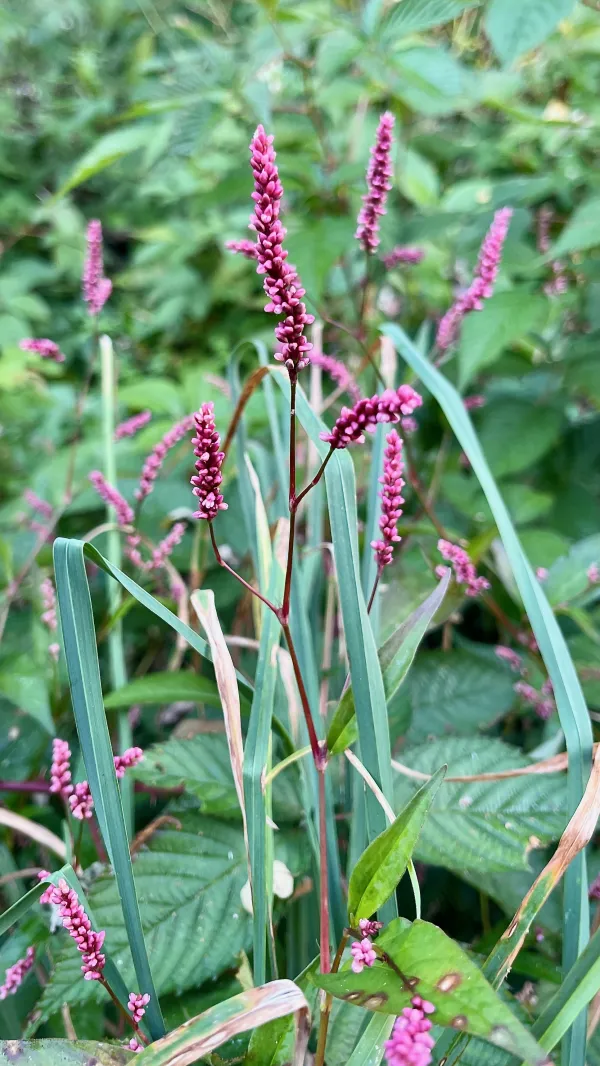
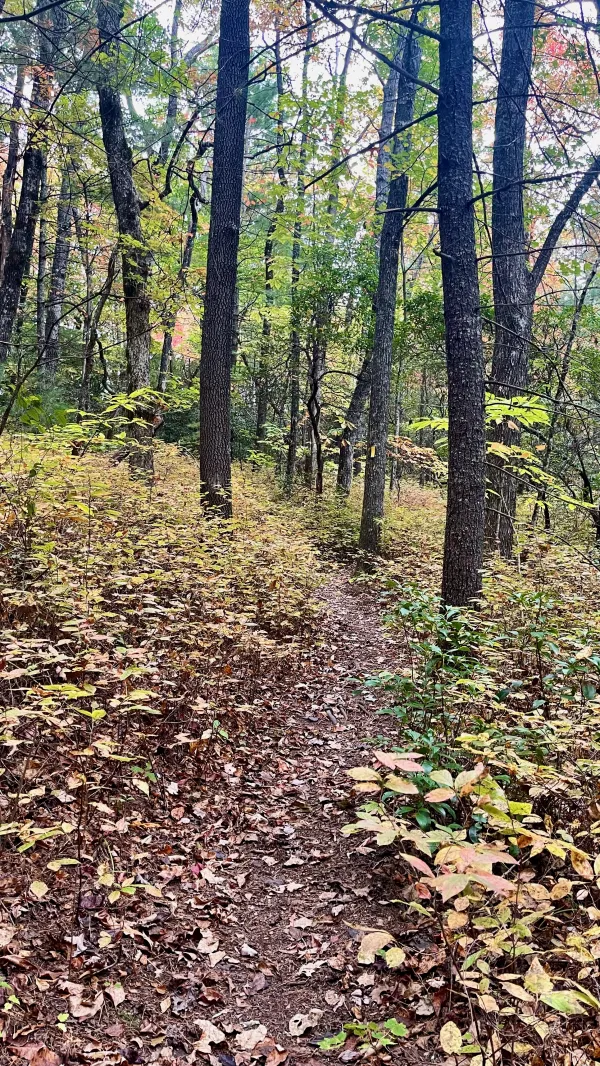
Low smartweed
After a strenuous climb, it was enjoyable to have a long stretch of easy trail along the ridge top. It passed through a meadow that was likely maintained that way as a wildlife habitat.
Some brightly colored wildflowers caught my attention in the meadow. They go by several names, including bristly lady's thumb, low smartweed, or Asiatic smartweed. The plant is not native to the U.S. but has become common throughout eastern parts of the United States and Canada.
Several species of mammals and birds eat the seeds of smartweed plants.

Mountain pepperbush
Also found along the trail was mountain pepperbush, and I was surprised to see a small sign identifying it. This tree or shrub is native to the Appalachian Mountains from northwest Georgia to southwest Pennsylvania. It is flowering, but the white blossoms only appear from June to August.

The sun begins to set
The sun was low and filtering through trees as I approached Whiterock Gap. Polecat and I decided to look for a camping spot there.

Whiterock Gap
Even after the terrain became relatively flat, I still felt as though I was moving slowly. I didn't arrive at the gap until 7 p.m.
The map showed no indication of water near here, and a hand-written note on a trail sign seemed to confirm that. "Not a creek. Don't do it," said the message written below directions to Stevens Creek.
When I pitched my tent, I made sure it was set up well in case rain fell overnight. Later and perhaps as an omen, a large frog jumped and landed next to me while I was preparing dinner.
Hurrah!
And the water will run
One come a day, the water will run,
No man will stand for things that he had done
Hurrah!
And the water will run
This trail report was published