
Day 139 MacDonald Pass/Helena to Polly Spring
More from this trailWhat was true has passed the test
Helena is not a big city. The U.S. census says it had 32,091 residents in 2020. Five cities in Montana are larger, but Helena remains notable because it is the state's capital.
The state's gold rush, which started in the 1860s, helped Helena grow quickly. It reached a population of 12,000 by 1888, the year before Montana became a state, and was home to 50 millionaires. That was said to be the world's largest concentration of millionaires per capita.
As a boom town of that era, Helena supported a prosperous red-light district. Polecat and I ate dinner in a restaurant that was reportedly the location of the city's last brothel.

Top O' starts walking as Polecat says goodbye
After a so-so breakfast at the Super 8 motel this morning, Polecat drove Top O' and me back to MacDonald Pass to resume our hike. The distance was 18 miles.
The road we took to the pass was a toll road when it was constructed in 1867 during the gold rush. At this time before statehood, Montana Territory had no funds for road construction, so the government relied on private enterprise to build necessary infrastructure. The road was managed for many years by a Canadian emigrant named Alexander "Red" MacDonald, and that's how the pass got its name.
The toll road's charter was revoked shortly after Montana became a state and could maintain it. The route today is a four-lane paved road designated as U.S. Highway 12.
We arrived at the MacDonald Pass trailhead at 8:15 a.m. Once again, Polecat chose not to hike with us. He said he would meet us again when we reached Rogers Pass, which should be in four days.

Walking on a ski trail
Before leaving Polecat, Top O' and I noticed the official trail's route went eight-tenths of a mile down the highway before it turned to go up a forest road. Much closer to the trailhead, however, was the start of a cross-country ski trail. It was maintained by a local Nordic ski club.
Because the other end of the trail connected with the CDT at the forest road, we decided to go that way. It seemed like a more sensible way to go.

Frontier Town
The ski trail passed near a tourist attraction called Frontier Town, which closed in 2001. Its owner built most of the Old West-themed town by himself.
The only Frontier Town building I could see from the trail was one of the four blockhouses that stood at the entrance. Several other buildings were at the site, including a jail, a saloon, and a post office. It was typical of many attractions that sprung up in the U.S. after World War II when small-time businesses attempted to capitalize on the increasing wealth and mobility of American families.
After the owner died in 1979, Frontier Town was not able to overcome the shifting preferences of vacationers, which can be attributed to the development of the interstate highway system. This was much the same as what I observed when I walked through Grants, New Mexico on Day 26.

Looking down into a valley and Helena, Montana
The ski trail Top O' and I followed made a steady climb up a ridge. A few openings between trees along the way provided views toward the valley and Helena.
The sky was mostly clear, though smoke from wildfires continued to linger. The haze didn't appear as bad today as it was recently.
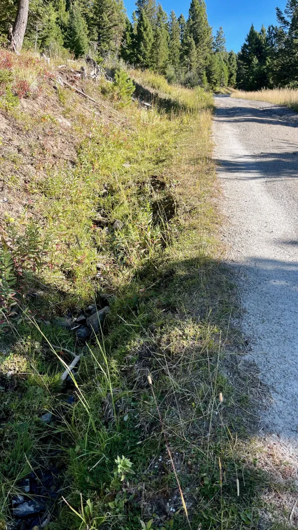
Water in a ditch next to a road
I began to wonder about my options for water on the climb. I had only walked for about 90 minutes and didn't need any yet, but I remembered this ridge was reported to be dry. Comments in the Guthook app said there were only some seasonal sources.
Then I noticed a small amount of water trickling in a ditch next to the road and decided I should collect some while I knew I could find it. I had to scoop it before filtering.
Water appeared again farther up the trail, this time dripping from a spring, and I collected some more.

A squirrel in a tree
It was a relief to find water here because now I wouldn't have to ration it. A squirrel took offense at me being there, however. It loudly berated me until I finished filtering and walked away.
I caught up to Top O' when he stopped to talk to a local man who was much friendlier than the squirrel. He was scouting with his dog for the upcoming elk hunting season and asked us several questions about our hike.

A view of MacDonald Pass
The road made some switchback curves in the last mile up the ridge. When we passed an opening for a power line, we could see down to MacDonald Pass. The gap in the trees gave a good view of a hill where a part of aviation history stood.
It was a steel tower that had been one of 1,550 airway beacons built between 1926 to 1938 to help pilots fly at night. Many of these towers were taken out of service in the 1970s, but the 91-foot tower at MacDonald Pass remains in use. It appears much like it did when it was erected in 1935.

A view of Flint Creek Range
When we got near the top of the ridge, the trees gave way to a large grass-covered slope. Some mountains more than 35 miles away were partially visible through the smokey haze.
Mount Powell (10,180 feet) was the highest one, and when I saw it I did a double take. I thought at first I saw snow on the peak. After studying the ridge for a moment, I realized it was barren. It had been a while since I had seen a mountain that stood higher than the timberline.
Mount Powell is part of the Flint Creek Range and is the highest peak in that range. It is one of at least a half-dozen mountains in the country named to honor the famed explorer, John Wesley Powell.

Approaching the top of the climb
We reached the top of the climb at 11 a.m. The road led us between some radio, cellular, and microwave transmission towers that stood at an elevation of slightly less than 7,200 feet.
Top O' and I stopped at the top for a short break before beginning the descent.

Starting to descend from the top
After climbing 850 feet from MacDonald Pass, we were about to lose nearly twice that elevation in the same distance we had just climbed.
The view from the start of the descent was deceptive. From what I could see, our route appeared to take us across a wide valley. The tall mountains I saw on the other side were more than 30 miles away. This view made me think there wouldn't be any climbs for a while.
The valley wasn't where we were heading, though, and I realized that as soon as I checked the map. After we got to the bottom of the descent, the trail would start another climb and turn west, away from the valley.

Repeat and Honey
On the way down, we met a flip-flop hiker now hiking south. His name was Repeat. We talked to him for several minutes before his son Honey caught up to join him.
Repeat filled us in on many details about the trail ahead, and included some encouraging news. He told us they left the Canadian border three weeks ago. This news gave me greater confidence we could finish in that same length of time.

The trail passes through lodgepole pines
Top O' and I didn't walk far after talking to Repeat and Honey before we decided to stop for lunch. We found a spot that was good for drying our tents, which was something we didn't get a chance to do while in Helena yesterday.
We were still close enough to the cell tower we passed before starting the descent to have a strong signal, so I called Kim to share with her the news we got from Repeat. I now had an estimated date that Kim could use for making her travel plans to meet me when I finished.

Spruce grouse
I passed another spruce grouse soon after we finished lunch. It seemed about as concerned to see me as the one I passed the day before yesterday, which was not at all.

Priest Pass
The bottom of the descent was at a road crossing Priest Pass. I had to navigate around a cow drinking from a small stream before I could cross the road.
Like the road at MacDonald Pass and another one ahead, this pass provided a way across the Continental Divide, though it didn't gain as much use as others.

The trail follows a railroad bed
The trail began a climb immediately after leaving Priest Pass. About a mile beyond the road, the trail joined a smooth path with a gentle grade. This section was obviously an old railroad bed.

The ruins of a railroad trestle
A short distance farther, I spotted the crumbling ruins of a trestle that spanned a gulch. Northern Pacific Railway trains crossed this trestle on a line running from Logan to Garrison, Montana, with a stop in Helena.

Crossing over Mullan Tunnel
The trail next climbed over a ridge. I couldn't see it, but I was walking across the top of Mullan Tunnel, which was 330 feet below me. Trains have been crossing the Continental Divide by going through this tunnel since 1883.

Freebird and Top O'
I caught up to Top O' when I reached Mullan Pass at 2:30 p.m. He was talking to Freebird.
Mullan Pass earned a spot in history in September 1911. That's when a 19-year-old aviator named Cromwell Dixon became the first person to fly an airplane over the Continental Divide. He flew from Helena and followed a route that went over this pass. He used the road here to help him navigate his way across.
Dixon won a $10,000 prize for his daring feat. When he was awarded the check, Montana Governor Edwin Norris boldly proclaimed him to be "The World's Greatest Aviator."
Dixon was only the 22nd pilot in the country to be licensed to fly. He had earned his license a few weeks before arriving in Montana. Sadly, he died just two days after his flight over Mullan Pass when he crashed during an air show in Spokane, Washington.

A train comes out of Mullan Tunnel
I walked with Freebird for a couple of miles. For the first part of our walk, we could see a train that had just passed through Mullan Tunnel.
We crossed Mullan Road, which was part of a 624-mile military road built by U.S. Army troops and civilian workers between 1859 and 1862. Their commander was Lt. John Mullan.
The road was the first inland route across the Rocky Mountains to the northwest territories. It soon fell into disuse as the Army and Congress became preoccupied with the Civil War, and no funds were appropriated to maintain it.
I didn't know much about Freebird before we started walking together. We only met briefly when Top O' and I were slackpacking our way back to Whitehall on Day 133. All I knew about him was he was nearing the end of his third Triple Crown, and Raven was his hiking companion.
While we walked together today, I had an opportunity to learn more about him. At first, I had trouble believing all that he told me.
Freebird said he graduated from Yale with honors, and soon after graduation, he was offered a job to run a mobster's "legit" business. He turned down the offer and decided to ditch his career path in economics to become a professional windsurfer in Hawaii. He was so successful at the sport, it remained his career for nearly 20 years.
His stories seemed to become more far-fetched as we walked, including when he said he lived in a cave in Utah. I started to wonder if anything he was telling me was true. And yet, the more he talked, the more his stories pieced together. It took me a while, but I gradually lost my skepticism and came to realize this guy was for real. Freebird was an extraordinary individual.
Of course, it's unlikely that anyone who has hiked the Triple Crown three times has otherwise lived a "normal" life.

Freebird rinses his shirt in a creek
When the road took us past a creek, Freebird decided to stop and rinse his shirt in it. He regretted this as soon as he did it, however. I could tell from his reaction the cattle we saw grazing in nearby fields had contributed some flavoring to the water.
I waited until we passed another stream before I refilled my water bottle. Even though I filtered the water, it didn't taste much better.

Spectators watch as a UTV drives through a creek
I soon realized cattle weren't only at fault for the water's poor quality. A mile farther up the road, I passed a road that crossed another stream. Several people had gathered there with their UTVs.
From what I could tell, they had created a spectator sport of driving a UTV as fast as possible until it hit the water and made a big splash. Everyone cheered each time a vehicle crashed into the muddy creek.

A sign warns the road goes through private property
A short distance north of the 4WD mud hole, the trail turned from the gravel road and headed down another one that was narrower. This was part of a three-mile stretch that was outside of Helena National Forest.
Several signs posted along the road warned that camping was not allowed. The time was just past 5:30 p.m. when I saw these. I knew we'd want to start looking for a campsite in the next hour, but it wasn't long before the road re-entered the national forest and there were no more signs.
When I came to a three-way intersection, I saw that Top O' had stopped to cook dinner. Freebird wasn't there, so he must have walked ahead.
We were joined a short time later by Guy Number 5 and El Dorado. Thirteen straggled in a little after that. with a hiker named Fraggles.

The road fades away
When the others began to leave, I didn't pay attention to which direction they departed from the three-way intersection. There were no markers here to point which way to go.
After a moment of confusion, I figured out the correct road to take. I lost some confidence it was the right direction, however, when the road quickly faded to a barely-worn path.
The way I was walking didn't match the route shown on the Guthook app, and I couldn't see anyone ahead of me. I had to blindly assume I was following them before I got the confirmation I needed. I found Thirteen’s pee rag lying on the ground.
And yes, I picked it up and carried it to her.
I found everyone setting up camp a few yards away from the road just before sunset. We may have been off the official route again, but we weren't far from it and will get back to it in the morning. Our campsite was near water, which wouldn't have been the case if we had followed the official route, so this undocumented alternate turned about to be the best way to go.
Remember, we were telling you
That time would stop and nations fall
Now we find the lies come true
Can you tell me, tell me, tell me
What are we to do?
Because the good old days
Those good old days are all dead and gone
Goodbye and bless them all, everyone
What was true has passed the test
Just as well forget the rest
Half of what you saw was not yours to know
Let it go
This trail report was published