
Day 114 Cub Creek Canyon to Soda Fork Meadows
More from this trailI still can't remember when or how I lost my way
If you ever took the wrong exit on a freeway and had to drive far out of your way to get back where you intended, you know what today was like for me.
If you ever showed up at a party and were embarrassed to discover you mixed up the date, you know what today was like for me.
The day started as ordinary as any other on the trail. It didn't take long to go awry, and I'm still unsure how that happened.
Last night was a little chillier than expected but was dry. We felt fortunate to find a campsite just as the sun sank below the mountains. It turned out to be a lovely spot overlooking Cub Creek Canyon.

Sunrise over Cub Creek Canyon
The sun had barely shown itself this morning when Top O' left camp. I stayed behind for an extra minute or two to take a couple of photos of the sunrise over the canyon.

Trail Creek
I had almost caught up to him about an hour later when we crossed Trail Creek. My troubles began moments later.

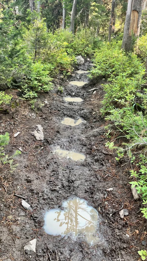
A sloppy stream crossing
I didn't think much of the slippery mud at the next stream when I crossed it. I should have. The CDT crossed a stream a mile after Trail Creek but had I paid attention, I would have realized something wasn't right about this one.

A meadow in Wyoming
I should have noted where the beautiful meadow was located when I passed it after the stream. The CDT passed meadows today, but this one wasn't one of those.
A trail eroded by horses
Later, I had to make my way over a severely eroded, muddy section of trail. Horses had turned it into a sloppy mess. This wasn't a warning flag for me, though. It was only a slight bother.

A view of Smokestack Mountain through burnt trees
After the CDT crossed Trail Creek, it made a three-mile descent, but I wasn't aware of that. I never looked at the elevation profile on the Guthook app. The trail I was on didn't descend after the creek. It climbed for three-tenths of a mile, then began to drop.
Nothing seemed amiss about where I was until I came upon some burnt trees and was able to look across a wide valley. It was here, finally, that something clicked in my head: Maybe I should check the map and see where I am.
A sickening feeling immediately hit the pit of my stomach. I wasn't on the CDT. I was on Angie Lakes Loop Trail.
Discovering I missed a turn is nothing new. It's happened to me before and I'm sure it will happen again. It probably happens to all hikers at one time or another. Knowing that didn't ease the frustration of the moment, however.
This was likely the farthest I have walked in the wrong direction on any trail. The "spidey sense" that usually alerts me to a problem failed this time. Still, that's not what I found most annoying. I walked nearly 1.5 miles in the wrong direction, and now I had to walk the same distance back.
I tried to find a route that would allow me to circle around and reconnect with the CDT, but there was none. I had no choice but to backtrack every step I just walked.

A trail junction
I was already disgusted with myself when I headed back to the trail junction I missed earlier. That's where things got worse. I somehow managed to walk past the junction again without seeing it. I didn't realize what I'd done until I arrived back at Trail Creek.
Now I was really mad at myself. When I turned around and headed up the trail again, I quickly saw this time where the CDT forked to the left. There didn't seem to be any reason for missing the junction either time I walked past it. I just did.
A couple of comments I found in the app about this junction made me feel a little better, but not much.
"Junction super easy to miss NOBO. Essentially unmarked. 0/10 for trail marking," said Medic&Bourbon on 8/8/18.
"Still not a easy junction to spot going nobo," DataHikes added on 8/7/19.
Misery loves company, I guess.

A view of Smokestack Mountain
Knowing that other hikers had the same trouble here didn't make up for the fact that I had now added three "bonus miles" to my day. Including the extra time spent trying to find an alternate way back to the trail, I wasted nearly two hours. Since leaving our campsite, I had walked only 2.6 miles of the CDT today. The time was now almost 10:30 a.m.
I guessed that Top O' would be wondering what happened to me and was probably beginning to worry. Confirmation of this came soon after I was back on the CDT and on my way down to South Buffalo Fork River.
I passed three groups of hikers from NOLS (National Outdoor Leadership School). Members of each group asked me if I was Gravity and if I was okay. I assured them I was and explained I only made a wrong turn.

Top O' waits at South Buffalo Fork River
I found Top O' waiting for me when I arrived at the river at 11:50 a.m.
He told me he waded across the water, then stopped to dry his shoes and socks while he waited for me. I had been right behind him when we crossed the creek three miles back, so it's no wonder he began to worry when I didn't arrive at the river soon after he did.
The worst part of this mess I caused was we only hiked 5.6 miles so far after being on the trail for about five hours.

A field of fireweed wildflowers
I quickly ate my lunch, and then we began hiking again. The day went much better after that.
The trail climbed from the river, going up 1,000 feet in the next 3.6 miles. The route included a section of burnt trees remaining from a large wildfire that ignited in August 2012. When it was finally contained two months later, more than 26,000 acres had been burned.
The North Buffalo Fire was one of several forest fires that year in the Greater Yellowstone area.

Nowlin Meadow and Smokestack Mountain
I saw Smokestack Mountain while hiking my bonus miles and saw it again on the descent to the river. Now we got a wide-angle view of the mountain as we crossed Nowlin Meadow.
Most of the meadow was covered in grass, though it also had patches of burnt trees. It was named after an early state game warden, D.C. Nowlin, who was instrumental in establishing Wyoming's first hunting seasons, bag limits, and other protections for fish and wildlife.

Descending a slope of fireweed wildflowers
The beautiful scenery helped me by this time to get over feeling annoyed with myself, and we were now hiking at a reasonable speed.
Top O' never got far ahead of me. I'm not sure if that was because I could keep up with him or if he didn't trust me enough to let me out of his sight. If he was angry or irritated with me, he didn't show it.
The top of the climb was on the flank of Smokestack Mountain. The trail began a long descent from there that we followed for the rest of the day.
This area has been under federal protection since 1891 when it was called the Yellowstone Timberland Reserve. It was the first federal land with that designation. Like Yellowstone National Park back then, this land was administered by the United States Army.
A couple of years after the U.S. Forest Service was established in 1905, management was transferred to that agency and it became a national forest.

Nowlin Meadow Patrol Cabin
We arrived at Nowlin Meadow Patrol Cabin a few minutes before 4 p.m. Although human-made structures are not generally allowed in wilderness areas, this was one of three cabins in Teton Wilderness maintained by the Forest Service.
Rangers don't often use the cabins as a place to stay these days. Two-way radios and other emergency equipment necessary for rescues and firefighting are stored here.

Crossing Soda Fork River
Soda Fork River was flowing a short distance from the cabin. The swiftly-moving water was only as high as our calves. We crossed it without wearing our shoes.
The trail turned after crossing the river and we followed it downstream. We walked for about two more hours before finding a spot to stop for dinner.
As we were pulling our food bags and stoves from our packs, Top O' quipped, “Hollywood should be showing up soon.” That had already happened twice around dinner time in recent days.

Hollywood
Five minutes later, we fell over with laughter when Hollywood showed up.
We haven't figured out so far how this happens. He walks past us in the evening, then we somehow pass him during the day without seeing him.
While we sat and ate our dinner, I had time to look ahead on the map and see how far we were from our first campsite in Yellowstone. I've been bothered since yesterday by how we seemed to have much more time than necessary to get there.
Finally, I figured out where we went wrong. When we sat yesterday in Lava Mountain Lodge, we worked out a plan on a paper napkin, then spent the next four hours trying to set our reservations over the phone. At no time in that ordeal did we realize we failed to include the miles we would walk later that day. We put the schedule together as if we weren't starting until today, not yesterday.
It was an astonishing screw-up but not a crippling one. We'll just need to find a way to slow down for a short mileage day. Then again, we did that in a way today, thanks to my wrong turn.
Top O' and I shrugged off the problem as simply part of long-distance hiking. We'll figure it out.
When we finished with dinner and left to look for a campsite for tonight, we found one that appeared to be promising. Then we discovered it was near a scum-filled pond. It seemed like an ideal spot for mosquitoes to breed, so we kept going to look some more.
The site we found at 7:30 p.m. was reasonably flat. Surprisingly, it was also surrounded by live trees in this otherwise mostly burnt forest. It was a nice place to end a difficult day.
Hate was just a legend
And war was never known
The people worked together
And they lifted many stones
And they carried them to the flat lands
But they died along the way
And they build up with their bare hands
What we still can't do today
And I know she's living there
And she loves me to this day
I still can't remember when
Or how I lost my way
This trail report was published