
Day 6 Double Hogpen Gap to Double Spring Gap
More from this trailAnd brave the storm to come, for it surely looks like rain
Most access points along the Benton MacKaye Trail are within a couple hours' drive from my house. I saw some advantages to this when I began planning my thru-hike attempt.
As I noted before, Tengo Hambre, Just Awesome, and I wouldn't need to hitchhike into a town to resupply. We could just run back to my house.
As we began looking at the weather forecast, another advantage of being near my house came to mind. A late-season hurricane named Zeta was predicted to make landfall in Louisiana tomorrow. As the storm tracked inland and became a tropical storm, our area was expected to see heavy rainfall.
We were already planning to return to my house tomorrow and resupply for the next week. If the weather turns out to be as bad as predicted, this will be the perfect time to take a zero day.
I was awakened twice overnight. The first time was at 1 a.m. when I thought I heard a crash near my tent. I pointed my headlamp outside to see what caused the loud noise but didn't see anything. At least my bear bag was still hanging from where I had hung it.
Later in the night, I thought I heard raindrops lightly hitting my tent. The sound must have been from falling leaves, however, because when I got up in the morning, the tent was dry.

Double Hogpen Gap
We left camp at 8:15 a.m. Our campsite was a short distance from a large meadow. We were camped in trees because camping in the field wasn't allowed. Signs were posted to identify the area as a food plot for wildlife.

Clearing sky
Although the area was foggy when we left, the sky soon cleared.
The trail started out easy and remained that way for much of the day. For the first mile-and-a-half, it was nearly flat, with just a short climb as it went over Flat Top Mountain.
The Benton MacKaye Trail descends from Flat Top Mountain
The way down from the top was long and steady, dropping 1,200 feet in the next four miles.
More often than not, the trail followed old logging roads. These offered a more moderate grade than we had found for many of the previous sections.

Just Awesome's pack
After walking for a little more than an hour, I noticed Just Awesome's pack was sitting at the side of the trail. He was gone, probably to dig a cathole.
I was tempted to hide his pack behind a tree and wait to see his reaction when he returned, but I couldn't bring myself to do it. When he returned, I told him I wasn’t sure if he was too nice or I wasn’t devious enough for that kind of prank.

Still descending from Flat Top Mountain
As the trail continued its downward path, it crossed a couple of streams. I met a hiker near one of these crossings. Her name was Tide Walker, as in Alabama Crimson Tide. She was from Huntsville, and has thru-hiked and bike-packed several other trails.
Tide Walker told me she had just completed hiking the Pinhoti Trail, so I had a few questions about that. She said there were some long road-walking sections and troublesome dogs. That sounded familiar.
There was so much road walking, though, she ended up skipping some.

Signs at the junction with the Pinhoti Trail
I arrived at the junction of the Pinhoti Trail a short distance past where I left Tide Walker. A small sign was all that was there to mark the spot as the northern terminus.
The end of the Pinhoti didn't have a dramatic setting, like the top of Mt. Katahdin, or a monument, like at the Canadian border.
From here, the Pinhoti extends 337.1 miles to Flagg Mountain in Alabama. Some people say the AT should end there instead of Springer Mountain because it is the southernmost mountain in the Appalachians.

Entering Cohutta Wilderness
A little farther down the trail, I met another hiker. He didn't have a trail name, but his name was Bobby. He told me he was hiking the BMT south to Springer Mountain, then will return to Davenport Gap by way of the AT. His hike will be a figure-8 loop of nearly 530 miles.
The trail was about to enter Cohutta Wilderness, a name which may be derived from the Cherokee name for "big frog." If true, this is fitting because the Cohutta Wilderness (37,033 acres) is adjacent to the Big Frog Wilderness (8,480 acres). Big Frog lies just to the north in Tennessee. Together, they make the largest tract of Forest Service wilderness land in the eastern U.S.

Following Tengo
We followed a road to where the trail turned and entered the wilderness area. Tengo was walking about 25 yards ahead of me, which was a good thing. He failed to see the turn and walked past it. I was able to shout out to him before he went too far in the wrong direction.

An old stone foundation in the woods
The old remains of a stone foundation stood near Mill Branch. The structure had deteriorated too far to tell what type of building had been here. Given the stream's name, however, it may have been a mill.

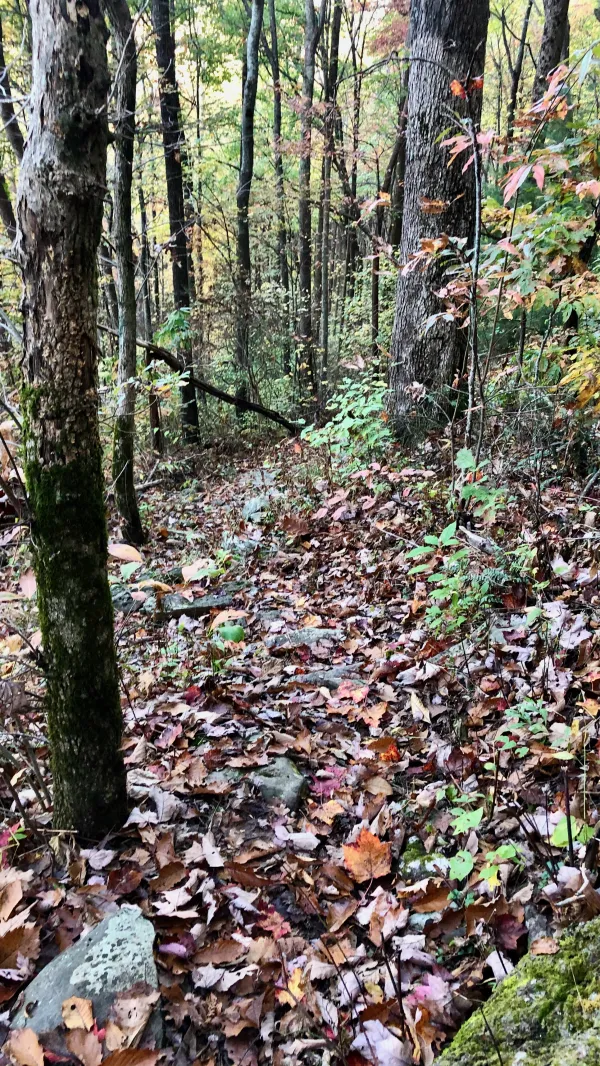
An old logging road is now a hiking trail
Though roads are not permitted within the boundaries of a wilderness area, the trail followed abandoned logging roads for most of the way. The wide footpath on a gentle slope made walking easy.
An estimated 70 percent of this forest was cleared by loggers between 1915 and 1930.

A mossy log crossing Bear Branch
JA, Tengo, and I met for lunch at Bear Branch. The moss-covered log that crossed the stream here looked a little sketchy to use as a bridge. JA had already crossed it when Tengo and I arrived, though, and he assured us the log was good to cross.

A sign at the junction of the Benton MacKaye and Jack's River trails
This section of the trail had a couple of confusing spots. In one case, it wasn't properly marked for northbound hikers. The trail joined with Jack’s River Trail for about 100 yards before splitting, but there wasn't a sign for NOBOs. A large sign was positioned to only be visible for hikers heading south.

Penitentiary Branch Trail
Another problem appeared nearly two miles farther. Here, the BMT split from the Penitentiary Branch Trail. A sign identified the other trail but didn't mention the BMT. To make matters worse, an arrow made from sticks also pointed in the direction of the Penitentiary Branch Trail.
I was afraid JA or Tengo might have followed this instead of checking their navigation app. There was no way for me to know if they were going the wrong way.

Big Frog Mountain barely visible through trees
Late in the day, I could see Big Frog Mountain through some trees. Although there wasn't an open and clear view, the 4,224-foot mountain looked massive. I could also see that clouds were moving in. I wondered if they were on the leading edge of the storm.
I was able to get a cell signal as I walked along a ridge, so I sent a text message to Kim and confirmed we would meet her tomorrow as planned. She will pick us up at Thunder Rock Campground near the Ocoee River.
When I arrived at our campsite at 5:30 p.m., I didn’t see Tengo.
“Please tell me Tengo is here,” I said to JA in a panic. He was. Neither one of them had been fooled by the arrow at the trail junction.
The forecast said rain would begin by morning and continue all day, with heavy rain at times. It was predicted to continue into Wednesday. This convinced us that taking a zero the day after tomorrow was a good plan.
It's all right, 'cause I love you
And that's not gonna change
Run me round, make me hurt again and again
But I'll still sing you love songs
Written in the letters of your name
And brave the storm to come
For it surely looks like rain
This trail report was published