
Day 26 Y Bar Basin Trail Junction to McFarland Canyon
More from this trailThere's a dragon with matches that's loose on the town
The sound of rain hitting my tent woke me up at 2 a.m. My instincts to set up the tent last night had paid off.
The rain didn't last for more than a few minutes, but it returned two or three more times. It was also falling when my alarm went off at 5:30. I decided to stay inside a little bit longer, hoping that the rain would soon stop.
While waiting for the sprinkles to quit, I looked at the trail map in the FarOut app. I calculated my remaining mileage to Payson, the next town for a resupply stop. The highway where I could hitch into town was less than 30 miles away.
Getting there tomorrow looked doable, though the distance was not as short as I hoped. The town would have been closer if I hiked more miles yesterday. I wanted to hike a few extra miles today, but that was an easy thing to say. Doing it was harder because there were factors I couldn’t control, like trail conditions and the weather.

Sunrise at Mazatzal Wilderness
After the rain turned to drizzle, it gradually tapered off while I got ready to go. It delayed my start, but I was glad to find the drizzle had quit by the time I was ready to hike.
It was a chilly morning when I started. The clouds were quickly clearing away, and the temperature was in the low-40s. I’d rather have cool weather than temperatures in the 90s and 100s, which is what I had just two weeks ago.
At this point, two weeks seemed ages ago.
The campsite I left was at the junction of the Y-Bar Trail. Following that trail would have taken me to Y-Bar Basin, a highland area historically used for grazing livestock. The name came from a cattle brand used by ranchers.

Gene, a hiker who always hikes northbound to avoid too much sun exposure
After a mile or so, I met a hiker named Gene who was hiking northbound. He was section-hiking while jumping to different sections as he pleased. He told me he only walks northbound, figuring it was a way to avoid too much sun exposure.
Gene said he’s hiking the northern parts of the trail now before the weather becomes too cold. In that way, he had a big advantage over me. He could let the weather determine when and where he hiked.
Bear Spring
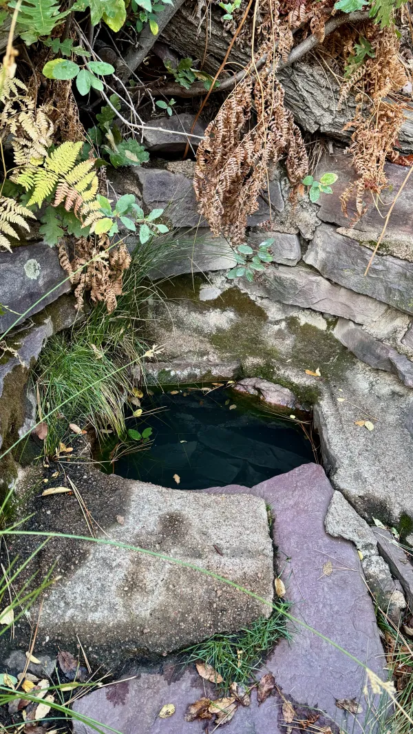
When I arrived at a side trail leading to Bear Spring, I was still carrying a good amount of water from Windsor Spring, the water source near last night’s campsite. Bear Spring was on a side trail a quarter off the AZT. Despite the distance, it seemed wise to stop and top off my water bottles. The next source was more than nine miles away.
I had created a problem for myself, however. My late start, the chat with Gene, and then a lengthy stop to filter water had burned up a lot of daylight, and I had only walked two miles. That needed to change.

A view across the Mazatzal Mountains
The elevation gain on the day's first climb wasn’t bad, but one section was troublesome. It was overgrown with locust trees. Their sharp needles clawed my bare legs and snagged my clothing.

A dead tree in Mazatzal Wilderness
When I could see through gaps in the mountains, the sky looked hazy, but I didn't think it was smoke. Far in the distance were the Four Peaks, one of Arizona’s most recognizable mountains. They stood more than 25 miles away.
The AZT will head in that direction after I leave Payson, and eventually, I will cross their foothills.

Burnt trees on a mountain ridge
The highest elevation today was 7,161 feet above sea level, and I reached that spot at 10 a.m. There, the trail passed through a small area that was burned just a few months earlier. The 100-acre fire was caused by a lightning strike in August.

A view of Four Peaks
The trail didn’t immediately descend from the high point. Instead, it crossed between three knobby, unnamed peaks. The sky was a little clearer now, and gaps between those peaks offered a better view of the Four Peaks.
The tallest of the four is Browns Peak, standing 7,655 feet high on the north end (right side from my view) of the range. Continuing south, the other peaks are Brother (7,636 feet), Sister (7,564 feet), and Amethyst (7,520 feet).

A view of Horseshoe Reservoir
Horseshoe Reservoir was also visible from here. As I did yesterday, I thought for a moment I was seeing Roosevelt Reservoir. Then I got my bearings and realized I was looking nearly due west. To see Roosevelt Reservoir, I would have to be looking southeast.
I’ll have to wait until after I leave Payson to see Roosevelt.

A tent is drying in the sun
When I stopped for lunch at noon, I found a spot where I could sit in some shade. I laid out my tent nearby in the sun to dry. The ground sheet dried in five minutes. The tent took just a little longer.

The Arizona Trail exits Mazatzal Wilderness
A gradual climb after lunch didn't slow me down as much as I thought it might. Here, the trail circled Mount Peeley (7,037 feet) and exited Mazatzal Wilderness. That was the end of a 45-mile section through the wilderness, the longest distance the AZT goes in a designated wilderness.
Past the boundary, the trail began another descent, and this one was more sustained. The next four miles steadily dropped 1,800 feet.
The time was getting close to 2 p.m., and so far, I had only hiked 8.7 miles. Sunset was less than four hours away. I needed to do better.

The trail goes around a mountain
The trail didn't help me do that. The descent included a couple of steep pitches on a narrow series of switchbacks.
The switchbacks were in an area burned in the Willow Fire. The fire was started by a lightning strike in 2004. Close to 120,000 acres were burned.
At the time, the wildfire was the third-largest in Arizona. It reached within two miles of the town of Payson. Several hundred firefighters and equipment, at a cost of $10 million, were needed to keep the fire from overtaking the town.
Sadly, the fire destroyed a stand of old-growth ponderosa pines high in the mountains.

A sign marks the distance to Utah and Mexico
Outside the wilderness, large trail signs were allowed to be posted at trail junctions. A sign at the Cornucopia Trail claimed I was 396 miles from Utah and 404 miles from Mexico. These numbers didn't line up with my mileage calculations. Still, they were a reminder that I was almost halfway done with the AZT.
From the Willow Fire burn area, the trail moved to another burn area, the third of the day. This wildfire was more noteworthy than the others, not because of its size but because of the utter stupidity that caused it.
The Sunflower Fire started on the morning of May 12, 2012. That's when Craig Shiflet, who was camping with friends for a bachelor party, decided it would be fun to shoot at an empty cardboard box.
What he loaded in his 12-gauge shotgun, however, wasn’t just any ordinary ammo. Shiflet fired an incendiary Fiocchi shell, often called a Dragon’s Breath. The box of shells was clearly labeled with a warning, "Shoots 100 feet of fire, setting everything in its path ablaze. Warning: Extreme FIRE HAZARD." He ignored that.
The warning was horrifyingly accurate. The single blast from the Dragon’s Breath shell set off a massive fire, burning everything in its path. Shiflet and his friends tried to put out the fire, but it was already too big for them to control. In a panic, they called 911 and were advised to leave the area immediately.
Because of this man's foolishness, 17,446 acres were burned. It took Forest Service firefighters several days to suppress the fire, resulting in a cost of $4.4 million.
At a court appearance nearly a year later, Shiflet avoided jail time and was sentenced to two years of probation. He was also ordered to pay a $2,000 fine and serve 200 hours of community service with the Forest Service.
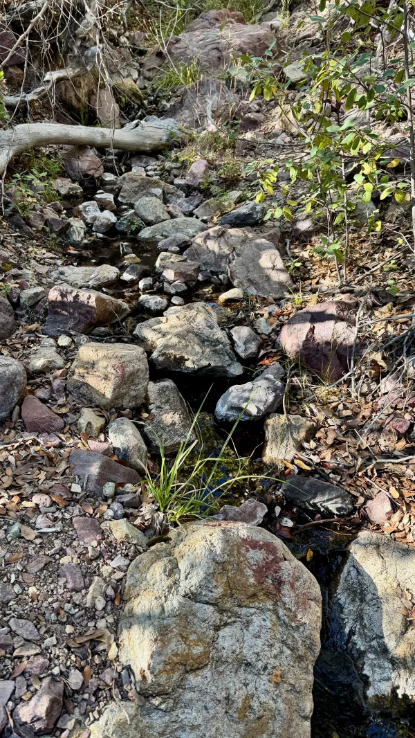
Water flows from a spring
Except for a couple of mini-breaks, I didn’t stop walking until I reached Thicket Spring at 3:30 p.m. While I was there, I researched a spot to stop for the night. A campsite was about 3.5 miles away. This late in the afternoon, that appeared to be about as far as I could get in the remaining daylight.
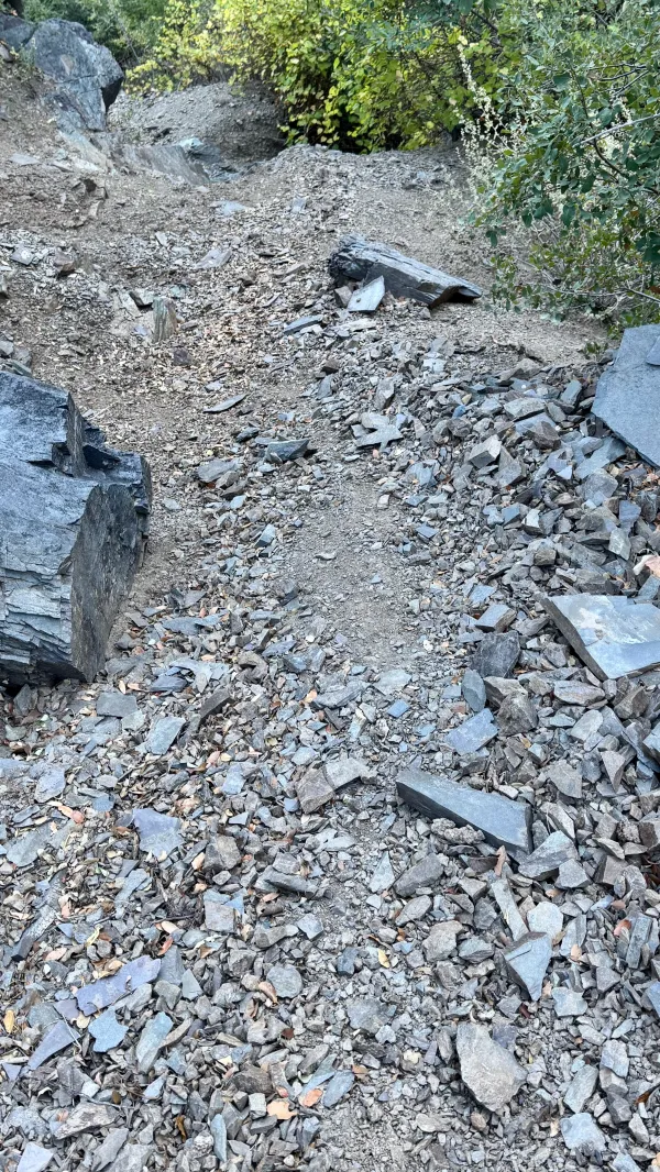
Rocks scattered on the trail
What I didn’t count on was the condition of the trail to worsen. The footpath was covered in thin, broken shards of rock. The worn soles of my shoes slipped several times, though I'm glad to say I never fell.
The terrain and trail conditions had made this a high-effort, low-speed day, and this section was among the worst of that.

The sun hangs low over the Mazatzals
In the years since Sunflower Fire and the others, the chaparral mountain slopes have had time to heal. Fortunately, the dense groves of manzanita and occasional scrub oak return and adapt after a high-intensity wildfire.
Unfortunately, non-native invasive grasses sometimes take over after a wildfire. There were patches of grass between some of the shrubs in the area burned in the Sunflower Fire.

The Four Peaks lit by the setting sun
About a half-mile from my intended destination, I got another quick view of the Four Peaks. The sun was now minutes away from setting, and the mountain range glowed in the last rays of sunshine.

The trail enters Mazatzal Wilderness
Shortly before I reached my campsite, the trail re-entered Mazatzal Wilderness. Near here, it looked like a trail crew had done some maintenance recently. I wondered if I would find the crew camped where I was heading.
The campsite was in McFarland Canyon, situated on the northwest slope of Saddle Mountain (6,335 feet). When I arrived about 15 minutes after sunset, no one was there.
I set up again for cowboy camping. After this morning's rain, the sky gradually cleared and remained that way all afternoon. There didn’t seem to be much chance of rain tonight.
This had been a tiring day. I would have expected any day with 3,200 feet of descending and less than half as much ascending would be easy, but this one wasn’t. Because of that and my late start, I failed to reach my mileage goal for the day.
Still, I felt positive about my chances of reaching Payson at a reasonable time tomorrow afternoon. The trail profile showed the route would be even more continuously downhill than today. I know that's no guarantee I'll be able to hike fast, but I'm always hopeful.
Long-distance runner, what you standin' there for?
Get up, get out, get out of the door
You're playin' cold music on the barroom floor
Drowned in your laughter and dead to the core
There's a dragon with matches that's loose on the town
Takes a whole pail of water just to cool him down
Fire! Fire on the mountain
Fire! Fire on the mountain
Fire! Fire on the mountain
Fire! Fire on the mountain
This trail report was published