
Day 153 Gentian Pond Shelter to Full Goose Shelter
More from this trailDon't waste your breath to save your face
When I started hiking this morning I knew I’d soon enter Maine, the last of the 14 states traversed by northbound hikers on the Appalachian Trail. Because of what I’ve read and have been told, I was expecting the trail would include several long and steep ascents and descents, lots of rocks and roots, and the potential for extreme weather.
This probably sounds a lot like the White Mountains in New Hampshire, but some people will tell you Maine isn’t the same. It’s more difficult.
Honestly, I don’t think hiking in Maine can be more difficult than it was in the Whites, but I have never hiked in this state before, so I will just have to experience it and find out.
To be sure, Maine includes the same challenges found in New Hampshire and throws in a few extras, like being located much more remotely from civilization.
It doesn’t hurt to remember, though, that if these mountains were impossible to climb, the AT wouldn’t be running over them.
Knowing this and knowing I have already gotten myself this far, I’m finally able to stop questioning my stamina and durability. I’m trying to accept I am a slow hiker and it takes me longer to get to a destination than some of the other hikers.
Leaving Gentian Pond Shelter
As I noted yesterday, there were a lot of hikers at Gentian Pond Shelter last night, many of whom I knew. I had known one hiker, Uncle Puck, since Day 8.
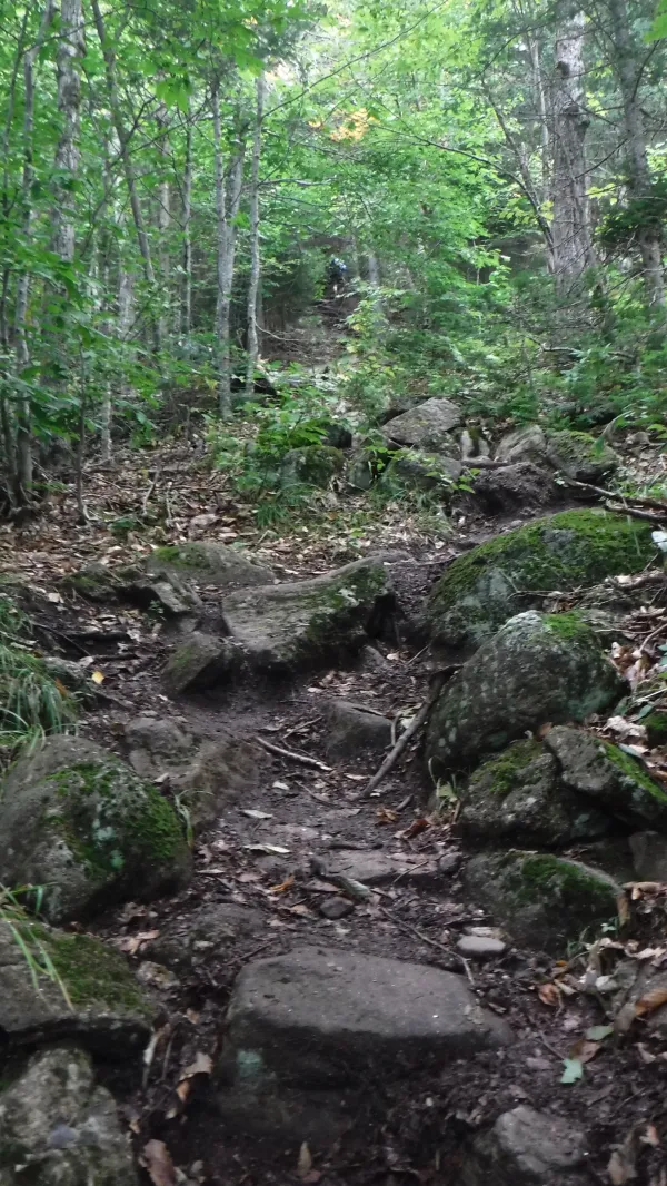
The other hikers and I quickly dispersed this morning as we left the shelter. One reason for that was the steep ascent that started immediately as we left the shelter.

Stick on the trail
The forest was dense, and as usual, the trail included a lot of curves, so even if there were hikers just ahead of me or right behind me, I usually didn’t know that until one of us stopped.
Right from the beginning of the day, I mostly walked alone.

View from Mt. Success
At the top of the first big climb I reached Mt. Success, the last mountain the trail goes over in New Hampshire.
The name of the mountain isn't directly attributed to an actual “success." It's named for the township of Success, NH, where the mountain is located.
The township was founded in 1773, the same year of the Boston Tea Party and the repeal of the Stamp Act. One or both of those historical events may be the origin of the name, but historians aren’t sure.
Near the summit was the site of a DC3 plane crash, but I didn’t see any sign of it.
Northeast Airlines Flight 792 was on its way to Berlin and Laconia, New Hampshire on November 30, 1954 when it crashed. Four crew members and three passengers were aboard. All survived the crash, but two crew members died from their injuries while awaiting a rescue, which didn't happen until three days later.
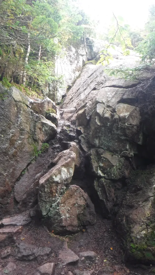
Crack in the rock
The last section of hiking in New Hampshire included another one of "those spots.” By that, I mean the trail continues up what is barely more than a crack in the rocks. In these places you look up and wonder how you’re going to get up and over it. There are no obvious steps and not many handholds.
Somehow, though, you just find a way to climb up without catastrophic injury.

Sign at New Hampshire/Maine border
At about 1:30 p.m. I reached the Maine state line. I was surprised to find Frodo and Gimli were there when I arrived. I hadn’t realized they were walking just ahead of me.
They told me that several hikers had left only a couple minutes earlier.
Gimli took my photo. After Frodo and he left I stayed behind a little longer to take some more photos and post them to social media.
Crossing into Maine was a big moment for me. To this point, I had walked 1,888.8 miles and now had just 301 miles to complete a hike of every mile of the Appalachian Trail.
As I stood on this spot I felt that completing the trail was much more likely to happen, but still, I didn’t dare think it was a certainty.
Climb up to Carlo Col
My first steps in Maine immediately began with a steep climb up Mt. Carlo, which included a rock ledge and a spot called Carlo Col.

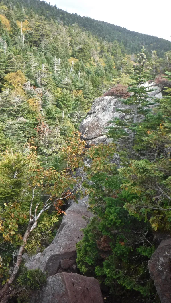
View of Goose Eye Mountain
Once I reached the top of Mt. Carlo I got a clear view of where the trail was headed, the three peaks of Goose Eye Mountain.

View from summit of Goose Eye Mountain
The views along the ridge that connected Goose Eye’s summits were spectacular. The trail remained above treeline for long stretches.
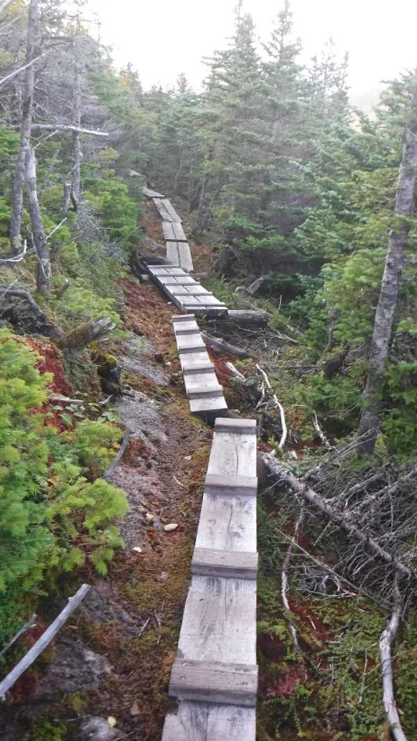
Descent from one of the Goose Eye peaks
When the trail dropped below treeline, the trees were scrubby and dense. I crossed a few bogs along the way.
Not wanting to cause problems with my ankle, I remained cautious as I went up and down these peaks, taking my time when I needed to be extra careful.

View from ridge near summit of Goose Eye North Peak
The sun was beginning to fade at 6:30 p.m. during the last climb, which was over the north peak of Goose Eye Mountain.
The setting sun gave the view from here a wonderful golden hue. I wished I could have stayed here longer, but I knew the sun would be setting soon and I didn’t want to spend more time than necessary walking in the dark.
The sun did set in the final .7-mile descent to Full Goose Shelter. I was struggling a little here because of the fading light. along with the rocks and roots on the trail.
Seemingly out of no where a hiker appeared behind me. He recognized me immediately, but it took me a moment to remember him.
It was Paul. I hadn’t seen him since the Smokies. I had first met him during my first week on the trail.
I was happy to see him and wondered how his hike had gone to this point, but we had little time to talk. I was taking this section especially slow and cautious, and we both needed to get to camp soon.
I didn’t arrive at the shelter until 8:15 p.m. Many hikers were already in their tents, and the only person getting ready to sleep in the shelter was Tengo Hambre.
I knew tomorrow was going to be a difficult day, which required an early start, so I decided to sleep in the shelter too.
I have not normally wanted to sleep in a shelter, except when I could save time by not setting up and taking down my tent. Considering what lay ahead, tonight seemed like a good night to do that. Tomorrow we will go through one of the most legendary sections of the trail, Mahoosuc Notch.
The night was cold and windy, and I needed my quilt and sleeping bag layered together to stay warm.
Sleep came quickly, but in the few minutes before, I thought about seeing Paul on the trail. After so many miles since I last saw him, seeing him was like seeing a ghost from my past.
I was reminded of how far I’ve come and how much I’ve accomplished.
Call it confidence or call it acceptance, but I think I have finally figured out this was my hike. I didn’t need to depend on other hikers, nor should I feel they are slowed by me.
It took me almost 1,900 miles of hiking to come to this understanding.
I don’t need to apologize to anyone, and especially not to myself.
Don't waste your breath to save your face
When you have done your best
And even more is asked of you
Fate will decide the rest
This trail report was published