
Day 17 Taylor Ridge to Narrows Picnic Area
More from this trailThe fields of Eden are full of trash
Even though we changed time zones two days ago, I still haven't gotten used to the sun rising an hour later than before. Admittedly, last night was the first time I slept in my tent on the trail since we crossed into Georgia.
The time change threw off my camp routine this morning, and it took me longer to pack and get ready to go. Tengo Hambre and I didn't leave our campsite until 8:20 a.m., which was notably late.
When I identify the location of a campsite to use in the title of these blog posts, I try to be precise. Many of my posts about previous hikes used a trail mileage number, such as "Campsite at Mile 1262.2 to Campsite at Mile 1276.9."
Lately, I've tried to get away from writing titles like that. Trail mile numbers change, which means they may not be relevant in the future. What's more, the names aren't descriptive, making them almost meaningless.
When I write blog posts now, I try to find a landmark on a map that's near my location, and I'll use the name in the title of that day's post. That practice didn't work well when I wrote about last night's campsite, even though it's true we camped on Taylor Ridge.
The ridge runs from High Point, where we made a long climb at the end of yesterday's hike, all the way to Chattanooga, Tennessee. That's a distance of nearly 65 miles. So clearly, Taylor Ridge was an imprecise choice for naming our location. Unfortunately, there were no other place names to be found near our campsite.
In my research, I learned Richard Taylor, an assistant chief of the Cherokee tribe, lived on the edge of the ridge that now bears his name. He owned a 150-acre plantation where Ringgold, Georgia is today.
Taylor and thousands of his tribe were forced from their homes in 1838 when they followed the Trail of Tears to Oklahoma.

An ATV road
Tengo and I only recently figured out our hiking plan for today. When we got to Mack White Gap, we could have hitchhiked into the town of Summerville, which was just four miles north of the trail. In my initial planning for this hike, I considered that for a potential overnight stay. Cave Spring looked like a better option for that, which turned out to be true.
Instead of going into Summerville, we decided to hitch a ride from the gap going in the opposite direction. A couple of gas stations and a Dollar General store were just 1.5 miles away that way. We didn't need to pick up much food, but stopping there would ensure we had enough for the walk to Dalton, the next town on the trail.
Getting to Mack White Gap was straightforward. Most of the route took us on the same ATV road we found yesterday when we reached the top of Taylor Ridge. We followed the trail for 6.6 miles to the gap.

A campsite at Jenkins Gap
After walking the first 1.3 miles, we came to Jenkins Gap. Though this spot wasn't labeled as a campsite on the FarOut app, it was definitely used as one, even though it was in the middle of the trail. There was plenty of room here for tents.
The site might have made a better place to camp than where we were last night. Still, I didn't have any regrets for stopping when we did. Neither site had access to water.

An overgrown section of trail
The trail didn't always follow the ATV road. Where it changed to a single-track footpath, it was overgrown with tall grass.

A gravel road leading to Mack White Gap
The trail switched to a gravel road less than a mile before Mack White Gap. The road was used by maintenance crews to reach three communications towers.

A discarded pile of furniture
The road was also used by local residents for dumping old furniture and other garbage. Seeing a pile of trash by the side of the road annoyed me, yet I had no idea this was only a small sample of trash piles to come.

Tengo Hambre walks on U.S. Highway 27
The Pinhoti Trail crossed U.S. Highway 27 at Mack White Gap. As I said, our plan was to hitch from the gap a short distance to a couple of gas stations and a Dollar General store.
There was a hiker parking lot at the gap, which I thought would make this an advantageous spot for getting a ride. That didn't turn out to be true. The curve and slope of the road, plus the speed of the traffic, prevented drivers from seeing us soon enough to pull over.
Then again, maybe we didn't get picked up because Tengo and I looked like a couple of vagrants.
After putting our thumbs out for about 30 minutes, we gave up hope for a ride and walked the 1.5 miles to the stores. The route was all downhill, and the road's shoulder was mostly wide enough to make us feel we weren't risking our lives.
I bought a cheeseburger, chips, and a drink at one of the gas stations, then walked across the highway to Dollar General to buy some trail food.
An older man stopped to talk to me outside the store while Tengo continued to shop inside. He knew about the Pinhoti Trail and asked if we had seen any snakes. I would have tried to yogi a ride from him back to the trail, but Tengo needed more time.
Soon after Tengo finished, a woman came out of the store and we struck up a conversation. She didn't seem to pick up on the idea we were ready to go back to the trail, so we asked her if she would drive us back. She hesitated momentarily before agreeing. We offered her gas money, but she wouldn't take it.

Tengo Hambre on the trail near Mack White Gap
Tengo and I were back on the trail by 1:30 p.m. From Mack White Gap, we continued our hike northward with a climb up the next part of Taylor Ridge. The trail on this side of the gap wasn't as steep because it didn't climb to the top of the ridge.
Instead, the trail went below the ridgetop on the southeast-facing slope. As before, the trail also went on a road.

A truck loaded with logs
Not much time passed before we discovered the trail was now also a logging road. That realization came when we saw a large truck driving toward us. Wisely, the driver stopped when he saw us approach.
There was just enough room on this narrow road for us to walk around his truck.

A truck loaded with logs
We saw two more trucks soon after passing the first one. The drivers must have been aware that their road was also a hiking trail because each one stopped and allowed us to pass by.
The drivers were friendly and seemed to enjoy chatting with us.

Tengo Hambre waits as a truck approaches
We walked past where the trail made a turn because of a truck. It was stopped at a junction, which looked more like a side parking area than another road. I presumed the driver was waiting for another truck to drive by before continuing, and that may have been true. There wasn't enough room for two trucks to go in opposite directions.
We walked a short distance before deciding we should check FarOut. That's when we discovered the truck was stopped on the road where we needed to turn.
FarOut was invaluable for navigating today. The trail varied between poorly marked and not marked at all. Because several hikers had commented on the app about missing one turn or another, we knew to check it frequently.

Longleaf pine trees
A sign next to the trail explained efforts by the U.S. Forest Service to restore a longleaf pine forest. This was one of two isolated pockets of relic longleaf pines on the ridge. The sign said the project began in 2015, but planning for it started in 2009.
The project involved harvesting part of the overstory to remove Virginia pine and hardwoods, conducting prescribed burns every 3-5 years, and planting longleaf seedlings.
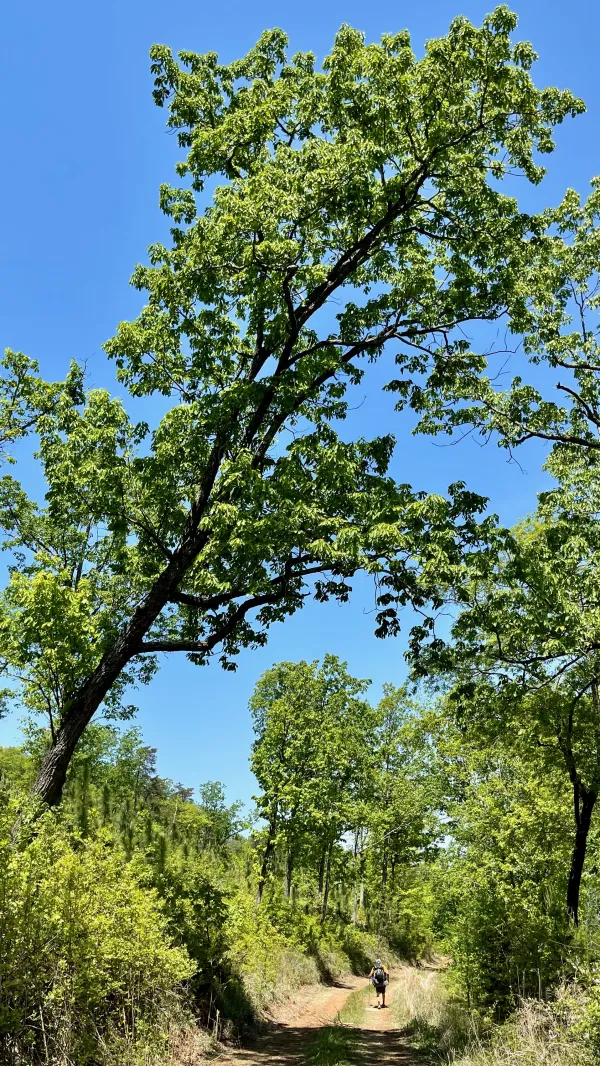
A leaning oak tree
Longleaf pines require many years to establish themselves. Most of the trees in this part of the forest were not tall. A few oak trees and others that had been selectively allowed to grow were the tallest.

A distant view from Taylor Ridge
Despite the lumber trucks on the trail, we never saw where trees were being cut. That was even true when we came to one of the few open views on the trail.

A crawdad or crayfish or crawfish
We stopped to collect and filter some water at 3:25 p.m. While drawing water from the stream, Tengo found a crawdad (or crayfish or crawfish, they're all the same). We jokingly agreed we had plenty of food and wouldn't need it for dinner.

A TV dumped next to the trail
In the next 30 minutes, we began to pass small trash dumps on the side of the trail. More than one had a discarded TV. A full box of laundry detergent, with its contents spilled on the ground, was at another.
Some FarOut commenters claimed meth had been made at one spot. I didn't attempt to verify the claim.

A prescribed burn area
When we passed an area where a controlled burn happened recently, I hoped we had seen the last of the garbage piles. Perhaps, I thought wishfully, the burn cleared all of the trash that had been left on the trail ahead.

Another garbage dump
That wasn't the case. We passed more garbage on the other side of the burn zone. Some of the piles were large and spread out. The nauseating smell of a decomposing animal came from one.

Single-track trail
Seeing all of this garbage was shocking and infuriating. I kept asking myself, "Why was this allowed to happen? Why doesn't someone clean it up?"
The trail narrowed to become more like a single-track than the two-track road we'd been walking, and again, I thought we had walked past the last of the garbage dumps. This gave me time to get over my anger.

Gravity's tent
It was a short-lived reprieve. When we found where we intended to camp, trash and junk were scattered there too. We had to look for several minutes to find a place to pitch our tents that wasn't near garbage.
A fast food bag filled with trash was in a fire pit. A broken office chair lay on its side nearby. A large pile of garbage was on the other side of the stream that flowed through this area. When I collected water, I made sure I was upstream from there.
There was still plenty of daylight remaining when we arrived, and I'm sure we would have kept walking if we could. Unfortunately, this was the last identifiable camping spot and the last water source that wasn't in a cow pasture for several miles.

A stone wall
A couple of short stone walls stood in this area. I couldn't figure out why they were there or how long they had been there. Perhaps they were the ruins of an old mill, I thought at first. I decided later that wasn't likely because the stream was too shallow for a mill.
Later, I researched this area while trying to find a place name for this spot. FarOut and topo maps weren't much help, except for a name given for the road we walked. It was called The Narrows Picnic Road. That name led me to discover the story behind this area and what happened to it in later years. The information also provided some insight into why this part of the national forest has been so abused by local residents.
The rock walls near our campsite were constructed by the Civilian Conservation Corps (CCC) in the early 1940s. This was the site of Narrows Picnic Area, one of two picnic areas they built on Taylor Ridge. The U.S. Forest Service closed the picnic grounds in the late 1960s because of destructive vandalism.
This is why we can't have nice things.
The fields of Eden
Are full of trash
And if we beg and we borrow and steal
We'll never get it back
People are hungry
They crowd around
And the city gets bigger as the country comes begging to town
We're stuck between a rock
And a hard place
Between a rock, yeah, and a hard place
This trail report was published