
Day 95 Jude Lake to Tentsite at Mile 2029.9
More from this trailNow there's three cigarettes in the ashtray
Let’s face it. When you’re hiking a 2,650-mile trail, every mile isn’t going to have spectacular scenery. I said yesterday’s section could be described as monotonous, but that may have been a little unfair.
The trail contained many long stretches through a forest of similar character, but repetitious might have been a better word to describe it. For much of the day, the trail lacked views beyond the surrounding trees. That didn’t necessarily make it boring.
In contrast, today’s section was varied. It seemed that a different kind of trail was encountered with every turn.
The terrain today changed from low and flat to steep and rocky. The weather was all over the place, changing from a misty morning to occasional periods of bright sun to a late afternoon thunderstorm.
For the nearly 20 miles of hiking, the trail ascended 3,600 feet and descended 3,400 feet. Between the beginning and the end were many lakes, a stop at a lake resort for snacks, and even trail magic. It crossed streams and burnt forests. I followed it above the tree line and across patches of snow.
In other words, this day had just about all Oregon could dish out.

A misty view of power lines
Though the day started in a gloomy mist, the sky gradually brightened as I began walking. The trail started nearly flat before gradually climbing. After walking 1.3 miles to where the trail passed under a collection of power lines, it had only climbed 75 feet.
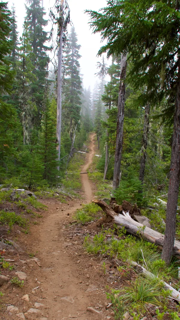
A nearly-straight section of trail
The trail was unusually straight for much of this section. Other than trees, there wasn’t much that the trail needed to navigate around.

Olallie Lake Resort
After walking less than four miles, I took a short side trail to a small resort at Olallie Lake. The resort has been here since 1932 and still retains an old, mountain fishing camp feel with no modern conveniences like WiFi. The guest cabins are heated with wood and lit with kerosene.

Olallie Lake and a view of Mt. Jefferson
Motorized boats are not allowed on the lake.
From a dock on the lake, Mt. Jefferson was beginning to come into view as the misty low clouds continued to lift. In a straight line from the lake, the mountain was 9.7 miles away. We would be walking closer to it all day long.
Although I arrived at the resort just after 8 a.m., the general store was already open. Only a few basic items were sold here and no hot food, but I bought a fruit pie and a Gatorade to give me a calorie boost for the day.

Mt. Jefferson
Sunkist, Bluejay, and I remained at the resort for nearly an hour, then we took the 1/10th-mile side trail back to the PCT and resumed our hike.
The trail immediately began a climb that was much steeper than before. More views of Mt. Jefferson could be seen from a few vantage points. Now that the clouds had lifted, it stood out brilliantly in the morning sun.
The peak of Mt. Jefferson is 10,502 feet above sea level, making it the second-highest mountain in Oregon. There are no other mountains nearby that stand nearly as high, so there is no mistaking this one.
The mountain is about in the middle of what is known as the Cascade Volcanic Arc. That range stretches from Mt. Baker and Glacier Peak in northern Washington to Mt. Shasta and Lassen Peak in California. The PCT runs near almost all of these volcanoes.
Mt. Jefferson was called Seekseekqua by Native Americans in the area, but was renamed by members of the Lewis and Clark Expedition to honor U.S. President Thomas Jefferson.
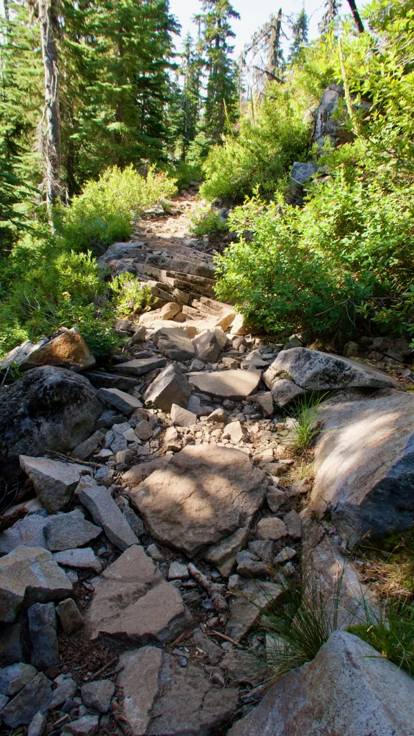
Rocky trail
The climb became more difficult when the trail became rocky. The footpath wasn’t AT-level rocky, but it was more challenging than most PCT sections.

Cigar Lake
Along the way, we passed several small ponds and lakes, including Cigar Lake.

Upper Lake
The last lake during this part of the climb was called Upper Lake.
About this time, several northbound hikers stopped to tell me to expect trail magic ahead.

A view of Mt. Jefferson from a meadow
After the lakes, the trail went around the first of two large, flat meadows it would pass today. This offered another good view of Mt. Jefferson.

Flowers in a burn area
Near the top of the first climb, the trail circled an unnamed mountain at just above 5,700 feet. The area had suffered a forest fire and was just now beginning to show signs that nature was in a process of renewal.

Another view of Mt. Jefferson
Before descending, I saw Mt. Jefferson once again. It wasn’t possible to become bored with this view.

trail magic
Finally, the trail dropped down toward some ponds near Breitenbush Lake. A road and campground were located here and that’s where I found the trail magic.

Apricots (left) and Psycho
Two of the hosts of this hiker feed were Apricots and Psycho, who had completed a PCT thru-hike in 2010. They wore Hawaiian shirts, which I recognized as a nod to the supreme trail angels, Terrie and Joe Anderson of Casa de Luna.
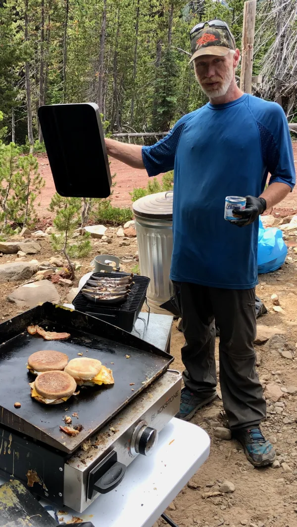
Oh Gee
More food was provided by a man name Oh Gee. He prepared large, hiker-sized Egg McMuffins and grilled bananas with marshmallows and chocolate chips.
The timing of this trail magic could not have been better. I had arrived at noon, so this became my lunch.

Fitbit (left) and Air Bud
While I was here, two northbound hikers said they recognized me. I confessed that I didn’t recognize them.
Their trail names were Fitbit and Air Bud, and though they mostly remembered meeting Stick in the Woods on the Appalachian Trail in 2017 (this should not be surprising to anyone who has met him), they said they also remembered me.
At any rate, our meeting on the AT must have been a brief encounter because they couldn’t remember exactly where on the trail we met.

Patches of snow appear ahead
I was glad to have the extra calories from the trail magic because the next 3.6 miles were all going up. The trail climbed 1,460 feet, going to nearly 7,000 feet and above the timberline.

The PCT goes over a small patch of snow
Near the top, the trail went over small patches of snow. These were a little surprising to see, considering how late into August the date was.

A look back at Mt. Hood
The top of the climb was called Park Ridge, which was also the boundary between Mt. Hood National Forest and Willamette National Forest.
From there I could look back to Mt. Hood, which was 45 miles away, and see the terrain I had walked for the last three days.

The PCT heading to Mt. Jefferson
The trail continued across the ridge before beginning a steep, 1,200-foot descent. Mt. Jefferson was now dominating the view ahead, standing just 3.4 miles away.
This was a pristine wilderness. There are no paved roads within 4 miles of the mountain.
I slipped a couple of times on the gravel-covered, nearly-treeless terrain, but I didn’t fall or twist an ankle.
On the descent, I stopped to get water at a stream. During the break I took a couple of ibuprofen because my feet were beginning to hurt. I wasn’t sure if this was because of the rough terrain today or the 26.4 miles I walked yesterday.
I also sent a text message through my Garmin InReach to Sunkist, confessing that I could not remember where we had agreed to stop. I didn’t want to risk walking past it.

Whitewater Creek
Farther down the trail, it crossed a couple more streams. The first was Whitewater Creek, which was milky white with minerals and silt. Seeing that made me glad I had collected and filtered water at the previous stream, which was much more clear.

A sign warns of a burn area ahead
Signs were posted nearby to warn that the trail was about to enter a burn area.
Months and years after a forest fire, several dangers can remain. In addition to the obvious danger of falling trees, the ground can be unstable. There’s an increased risk of the trail being washed out by flash flooding during storms.

Trees burned in the Whitewater Fire of 2017
The damage from the Whitewater Fire in the spring of 2017 was severe.

Russell Creek
Some passing hikers warned that the next stream crossing would be difficult.
When I reached Russell Creek I saw it was a rocky area, but the water wasn’t high. By spending a little time surveying my options, I found an easy route across and had no problems.
The next steam was Jeff Creek and I stopped there to top off my water bottles. I thought I was getting near the campsite we had selected but I wasn’t sure of that until I received a reply from Sunkist a couple of minutes later.
Soon after that, rain began to fall.

Three tents pitched among burnt trees
I arrived at the campsite at 6:15 p.m. as the rain continued to fall. This might have been a pleasant spot to camp before the 2017 fire. A small pond was located nearby.
Today, however, it was like setting up my tent in an ashtray. The smell of burnt wood remained strong.
Bluejay and Sunkist were already in their tents, but Sunkist told me that she had received a message on her Garmin from Dave. He was back on the trail and was about 26.5 miles behind us. He probably won’t be able to catch up to us for a few more days.
After setting up my tent in the rain I crawled in. I was glad to have eaten a good-sized lunch at our trail magic stop. That meant I still had the lunch I was carrying for today, so I ate that in my tent instead of cooking a dinner.
Rain continued to fall for about two more hours, then started again at 11:15 p.m. This time it was lighter, and so far, my worn tent was staying dry inside.
Two cigarettes in an ashtray
My love and I, in a small cafe
Then a stranger came along
And everything went wrong
Now there's three cigarettes in the ashtray
This trail report was published