
Day 85 Crest Camp to Trout Creek
More from this trailAre you what you are or what?
You can tell the group of hikers you're with is becoming a tramily when you begin to make plans together. The first sign of that is consulting each other about where to camp at the end of the day. Sunkist, Bluejay, Dave, and I quickly reached that point.
Today’s hiking goal was to walk about 21 miles and camp near Trout Creek. We could tell this would be an easy day. The climbs ahead would be short and the long descent would not be steep.
The same as yesterday, Bluejay and Sunkist left camp 30 minutes before Dave and I did. We weren’t intentionally giving them a head start, we just weren't as efficient as they were for packing and leaving.

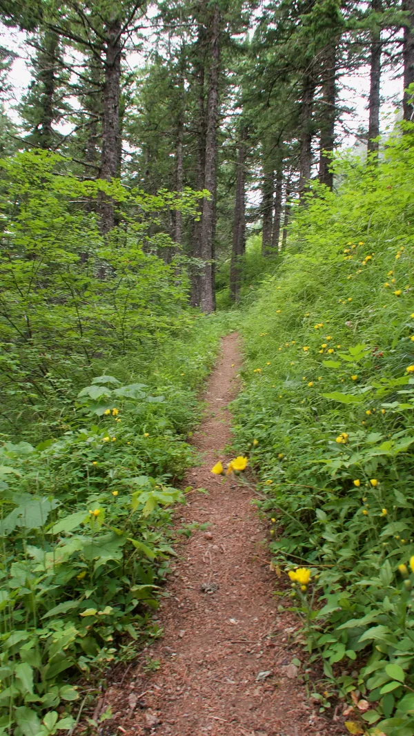
No view available in the thick forest
For much of the day, the trail led me through a thick forest. Most of my hiking on the PCT has been over smooth and easy trail, and today was a good example of that.
After walking about an hour I reached a spring. My first opportunity to collect water today could not have been more convenient. The water flowed from a pipe, providing an effortless way to collect it for filtering.
A smooth section of the PCT as it climbed Big Huckleberry Mountain
Leaving the spring, the trail began a 1,000-foot climb in just under four miles. The trail went up a ridge that extended from the slopes of Big Huckleberry Mountain.

A cloudy view from Big Huckleberry Mountain
The higher the trail took me, the less I could see. There were occasional gaps between the trees but nothing to see between them. I was climbing into a low cover of clouds.
The trail ascended near but not quite to the summit of the 4,202-foot mountain.

A view of Mt. Hood and the Columbia River Gorge
Once the trail crested the climb and began to descend, the sky became clearer. I could see Mt. Hood in the distance, now a little closer than yesterday. At this point, the mountain was about 33 miles away and was easily identifiable despite a few low clouds.
Mt. Hood is in Oregon, and from where I stood on Big Huckleberry Mountain I could see a wall of mountains in front of it. They formed the Oregon side of the Columbia River Gorge, but I could not see the river.
Continuing down the mountain, I saw Muffy and Carrot, and a little farther I saw that Dave. He had stopped for lunch, so I stopped with him.

A wooden bridge over Wind River
By 3:45 p.m. I reached a bridge that crossed the Wind River, which is a tributary of the Columbia River. I was now only about three miles from my destination.

The shallow Wind River
The bridge seemed over-built for this spot because the water was shallow. It would have been easy to ford without getting more than my ankles wet.
The bridge may have been built with a high arc over the water because some in the area have been washed away by flash flooding.
After going over the river, the trail crossed a road and then followed a curving route around Bunker Hill, which geologically has been identified as an igneous volcanic plug or neck. Several years ago, a fire lookout tower stood at the summit.

A flat, wide meadow near Bunker Hill
On the other side of Bunker Hill, the trail traversed a wide, flat and grassy meadow before entering a scrubby section of low trees.
As I follwed the trail into this section I saw Bluejay walking toward me. She told me the campsite where we planned to stop was not a good place and she was looking for an alternative. A description of the site in the trail guide made it sound ideal for us, but Bluejay said there weren’t enough flat spaces for our tents and the site was a little trashy.
A road was nearby, so we figured locals had used the site on the banks of Trout Creek for weekend parties.
Dave was just ahead of me on the trail, and when I caught up to him we decided to also scout for camping options.
After a short time searching we found a wide, flat area. There was plenty of room for our tents, but it was near the road.
It was a rough, gravel road with little traffic, however, and also because today wasn’t a weekend, we decided this spot would be suitable. Besides, the time was now 5:00 and no one was interested in hiking to the next possible site, which was several miles away.
Our campsite wasn’t the most scenic spot on the trail. It was like a cul de sac extending from the gravel road. The spot appeared to have been a gathering spot for hunters. A log had been lashed to a couple of trees, probably for field-dressing deer.
After setting up our tents, Dave and I walked to the creek to collect water. Soon after we returned, a large pickup truck slowly and hesitantly entered the area where we were camped.
We all stopped what we were doing to watch the truck slowly move forward. Was the driver lost? Delivering trail magic? Checking a spot for a future hunting trip? Or was he a serial killer looking for easy prey?
Inching forward, he showed no indication of why he was there or what he was looking for. When he stopped, he didn’t leave the truck. He just sat there for several minutes.
This felt a little creepy. Then I noticed the driver had a child with him. If he were a serial killer, I thought, he probably wouldn't have brought his kid along.
Eventually, he turned his truck around and left.
Dave, Bluejay, Sunkist, and I just turned to each other and shrugged.
I'm not aware of too many things
I know what I know, if you know what I mean
I'm not aware of too many things
I know what I know, if you know what I mean
Philosophy is the talk on a cereal box
Religion is the smile on a dog
I'm not aware of too many things
I know what I know, if you know what I mean, do doo yeah
Shove me in the shallow waters
Before I get too deep
What I am is what I am
Are you what you are or what?
What I am is what I am
Are you what you are, or?
This trail report was published