
Day 75 Forest Road at Mile 2376.0 to Green Pass
More from this trailWe're rollin' Rainier and the jealous want to get some
One of the defining icons of Washington is the state’s tallest mountain, Mt. Rainier. On clear days, it can be seen from many locations in the state, including the Seattle-Tacoma metropolitan area, which is about 60 miles away.
The mountain stands at 14,411 feet above sea level and is an active volcano. Much like Mt. St. Helens, it remains at risk of erupting at any time.
Mt. Rainier is considered to be one of the most dangerous volcanoes in the world because more than 80,000 people live in the immediate area.
The snow-covered peak was a dominating feature of my hike today. Thanks to bright, sunny weather, I was able to see it clearly several times, even though it was many miles away.
The trail doesn’t go near the mountain and barely enters the boundaries of Mt. Rainier National Park, but I’m expecting to see similar grand views in the days to come.

A hazy morning view from my campsite
The morning sky didn’t start clear, however. When I awoke, it was hazy.
The walls of my tent were wet from condensation because I didn’t set it up under any trees. As a result, my quilt was damp, and was even soaked a little where it had touched the sides of the tent.

Mt. Rainier seen through a power line
After walking only a mile from my campsite, I got my first view of Mt. Rainier. The upper-most part of its snowy prominence could be seen from where a large swath of the forest had been cut for a power line.
Rainier was 35 miles away, but I was still awed by its massive size.

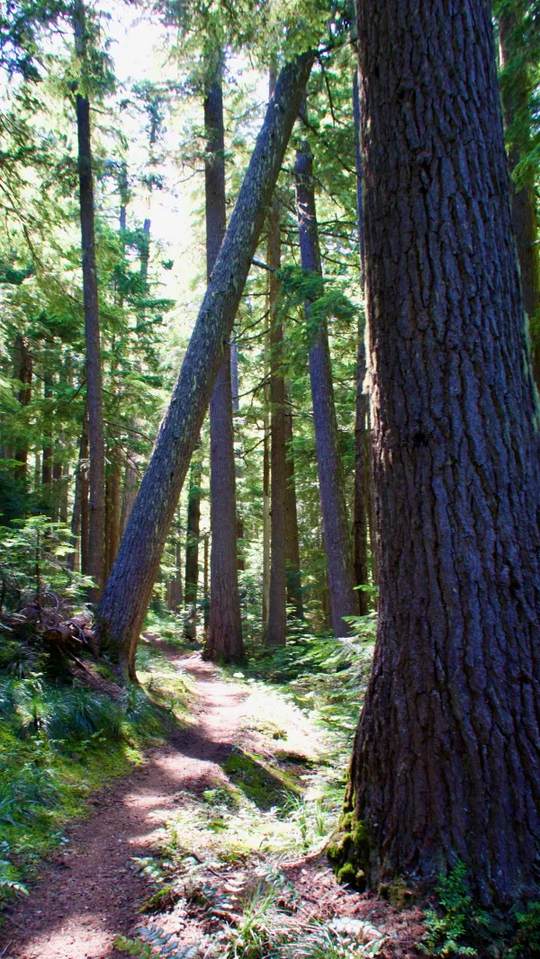
The PCT through a forest with many trees
I lost my view of the mountain immediately when I re-entered the forest on the other side of the power cut, but I knew there would be plenty more views ahead.

Crossing another power line cut
In fact, there were two more power line cuts just ahead, and each one offered a better glimpse of the mountain.
Another hiker passed me and we both remarked about the view we were seeing.

Looking back to the Norther Cascades
Looking behind me, I could get some of my last views of the Northern Cascades. The mountains I had frequently viewed in the last few days, such as Chimney Rock and Mt. Daniel, were visible but barely identifiable.

Beargrass and lupines on the trail
A few small, grassy areas opened along the trail. When I reached one that was large enough to expose a good amount of sunlight, I stopped to lay out my tent and quilt to dry. I also ate my second breakfast with coffee.
A spring was nearby, but it was a little difficult to see because of the surrounding grass. I had to follow a small trickle of water upstream to find it.
While I was there to collect water, Compass and Blender came by. They didn’t seem to notice the spring, so I told them where it was. The next available water was 7.5 miles away, and I figured they probably didn’t want to skip this one.

Another, better view of Mt. Rainier
Better views of Mt. Rainier began to appear later in the morning as the trail moved a few miles closer. The mountain was always easy to pick out in the small openings between trees. It stood out brightly against a deep blue sky.
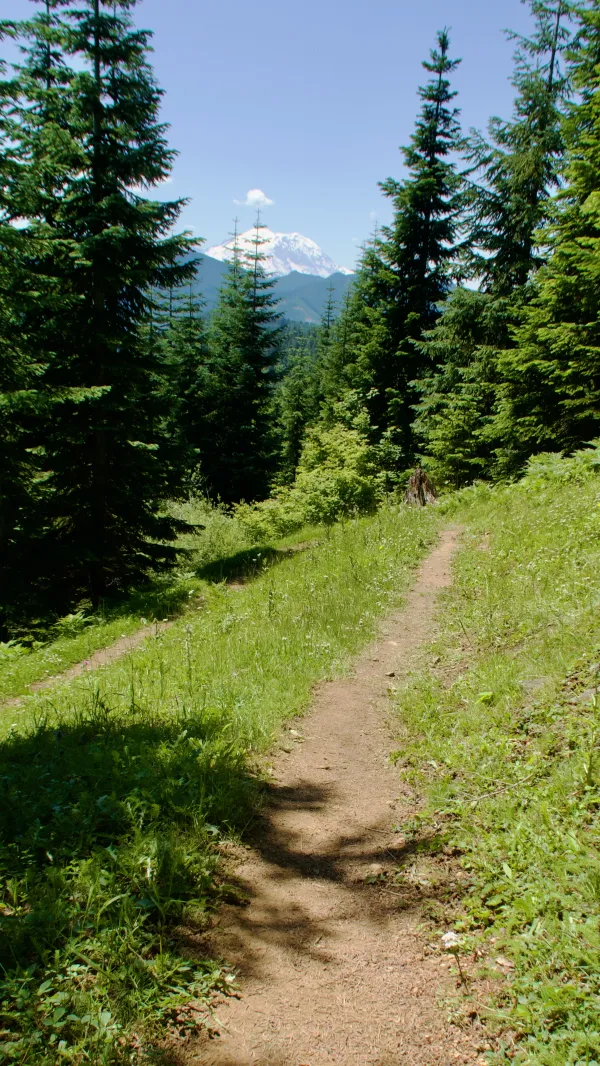
Mt. Rainier appears ahead on the trail
The trail rounded a knob called Bearpaw Butte, then dropped to a lower elevation where no views of Rainier were possible.
I found a large log lying next to the trail, so I stopped there for lunch. By then, the time as 1 p.m. and I was hungry.
A flat section of trail through the trees
After continuing to descend through the cool and pleasant forest, the trail reached a spot called Tacoma Pass. From there it began a long and sometimes steep climb. For the next 6.6 miles, I would be ascending 2,600 feet.
Along the way, I passed another small spring without seeing it. I still had a little more than a liter of water with me, so I wasn’t concerned about running out.
I try to be aware of where the water sources are and make short, small refill stops so I don’t have to carry more than necessary.

The trail climbs Blowout Mountain
As the trail neared the top of the climb, it ran along a ridge that had been clearcut. The climb crested just below the peak of Blowout Mountain, then finally began to descend toward Green Pass.
When I reached the pass, I saw that Ricky Bobby was camped there. He was with a hiker named Jinx.
I had originally planned to camp at a spot that was another 1.7 miles up the trail, but there was plenty of room for me, so I decided to stop for the night.
Later, after I crawled into my tent for the night, I spent some time looking for and patching holes in the ceiling. I kept finding more, and it seemed my tent was quickly nearing the end of its lifespan. I was beginning to doubt it would hold together in one piece through the end of this hike.
The opportunities to see Mt. Rainier today were remarkable. The sky remained clear all day and the trail offered many open views.
Washington weather can be fickle. Residents will tell you the mountain is often only visible for short periods of time and rarely all day long. Seeing it so clearly and frequently today was special.
I'm callin up my posse its time to get rippin
I'm freakin each sunroof to keep you suckas trippin
Everybody's lookin if ya jealous turn around
The AMG kip keeps us closa to the ground
We're gettin' good grip from the 50 series tires
The Alpine's bumpin but I need the volume higher
'Cause the 808 kick drum makes the girlies get dumb
We're rollin' Rainier and the jealous want to get some
This trail report was published