
Day 71 Tentsite at Mile 2433.8 to Tentsite near Lemah Creek
More from this trailBut it ain't me, babe
When I awoke this morning, my tent was soaking wet, though no rain fell last night. The reason was condensation.
If the breeze that kept mosquitoes away last evening had continued through the night, my tent would probably have remained dry. The breeze died, so damp air settled and condensation formed inside the tent.
Bluejay and Sunkist left camp while I was packing, but Val was still here. He was in his tent and only poked his head outside as I was about to leave.
He said this slow start was typical for him. He took his time getting up in the morning and wouldn't usually leave camp before 9 a.m. He said he could make up time by hiking fast all day.
I have no idea how that is done, but I suppose it has something to do with being close to 40 years younger than me.
As for me, I began to run out of energy after hiking only an hour, and that was with a trail that mostly went downhill the whole way.
I stopped for breakfast and coffee at 8 a.m. when I reached Spinola Creek Trail junction. I hoped this spot would be suitable for drying my gear, but not enough sunlight was filtering through the tall trees.
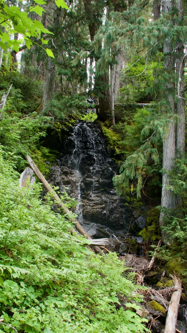
A small waterfall
A mile past my breakfast spot, a nice, trickling waterfall was just to the side of the trail and the stream flowed across the trail.
When I stopped there briefly to collect some water, I unintentionally startled a deer walking down the trail. It seemed intent on also getting a drink from the stream and didn't see me until it was within 20 feet of me.

A bridge over Spade Creek
About another mile farther, the trail crossed Spade Creek. It was gushing with water that came from a couple of lakes high up the mountain.

Waptus River
Not far downstream, Spade Creek flowed into Waptus River. Before long, the trail crossed the river on another substantial wooden bridge.
Fueled by my second breakfast and coffee, and assisted by a mostly-flat trail, I was able to cruise fast through this section.

Gilmore and Turkey
It wasn’t long before I came to another stop, however. I met Gilmore and Turkey, two flip-flop thru-hikers from Charleston, S.C. heading northbound. Turkey told me he grew up in Murfreesboro, Tenn., which is not far from where I live.
Since I started hiking in Washington, it has usually been easy to pick out flip-floppers from other hikers. They look leaner and their gear looks a little more worn than SOBOs and section hikers. The most telling feature, however, is seeing men with bushy beards.

Bears Breast Mountain
A short distance past the river, the trail began a long, steady climb. For the next 7.6 miles, it would lead me more than 2,500 feet up to an area known as Waptus Burn.
Along the way, views began to open to show more of the valley where the river I had just crossed flowed into Waptus Lake. At the western end of the valley stood the jagged peaks of 7,201-foot tall Bears Breast Mountain.
It was an impressive mountain to see, and it’s been said the mountain is so isolated it cannot be seen from any road.

Rain falling over Waptus Lake
Higher up the climb, the lake came into view. In that direction, I could see rain was falling. Soon after, rain began to fall on me just as I reached a spot that would have been a good spot to dry my tent and quilt.

Clouds over Bears Breast Mountain
The mountains surrounding me seemed to be controlling the weather at this elevation. The sky was constantly changing, sometimes dark and menacing, with brief periods of rain.
Bears Breast Mountain was only letting the highest clouds pass by.

Flowers along the trail
After the trail made a few more switchbacks and made another turn to resume going south, sun rays began to pierce the clouds and make the air noticeably warmer.
It probably would have been possible to stop here to dry out my gear, but by now the time was 2:30 p.m. I still had more climbing to do and more than eight miles of hiking to go for the day, so I decided it was best to not stop.

A small pond at Waptus Burn
At the highest parts of the trail, the terrain was very alpine-like, though the elevation was only slightly above 5,500 feet. The trees were short and scrubby. This may have been partially due to the altitude, but it was becoming apparent why this area had been named Waptus Burn.

Burnt trees in Waptus Burn
The name became more obvious the farther I walked across the mountaintop. Some trees were blackened by fire, while others stood like gray ghosts.
I only saw a couple more hikers after I met Gilmore and Turkey, which was surprising to me. I expected there would be more because this was such a beautiful area.
It was a fragile area, however, and had seen too much human activity in the past. To help protect it, signs were posted to say camping was prohibited for the next two miles.

A view of distant mountains
After crossing the high section, the trail began a descent with many switchbacks. A few parts of the trail were a little rocky and one short section was eroded, but it wasn’t difficult to make my way down the mountain.

Rain falling on nearby mountains
Once again, rain clouds appeared over nearby peaks, but no rain fell on me this time.

Moss hanging from Douglas fir trees
As the trail neared the bottom of the descent, it crossed a forest of tall, thin Douglas fir trees. They seemed to be dripping with stringy moss.

View of Chimney Rock Falls
From the forest, I could see across the valley to Chimney Rock Falls, which was tumbling from the side of Chimney Rock. The mountain’s peak was hidden from view by clouds, as was the summit of its nearest neighbor, Summit Chief Mountain.
The time was now past 6 p.m., so once I reached the bottom of the valley floor, I began to keep an eye open for a possible campsite. The area was called Lemah Meadow and was mostly flat.
The trail guide identified a couple of camping spots, but finding them wasn’t easy. The valley was thickly covered with shrubs and trees. It wasn't grassy, as you would expect for a meadow.
My campsite search was interrupted when I met a section hiker. He told me I looked like Harvey Manning.
I didn't know who that was, but I assured him I was definitely not Manning. Then his buddy walked up. The first man pointed to me and said, “Doesn’t he look like Harvey Manning?”
The second man heartily agreed. They explained Manning was a local hiking legend.
They neglected to mention he died in 2006. Perhaps they didn’t know that.
Anyway, I repeated that I wasn’t him and then politely said goodbye.

A shallow stream crosses the trail
A short distance farther, my search for a campsite was interrupted again when I reached a creek. I thought I would need to wade across it, but then realized I could step on a log to get across. The log wasn’t ideally placed, but I made it work.
Soon after I made it across, Val finally caught up to me. We worked together to look for a campsite.
I was ready to stop and did so at the first campsite I found that seemed suitable. Val wasn't satisfied with it and said he wanted to continue looking.
He soon returned, saying he found two more spots, but one was already occupied and the other was used by horses. He then set up his tent near mine.
Later, we were joined by two section hikers, a father hiking with his adult-aged son.
Today had been a day of beautiful views, changing but not unpleasant weather, and mostly-easy trail. I decided to focus on these things and not that I apparently look like someone who has been dead for more than a dozen years.
You say you're looking for someone
Who'll pick you up each time you fall
To gather flowers constantly
And to come each time you call
A lover for your life and nothing more
But it ain't me, babe
No, no, no, it ain't me, babe
It ain't me you're lookin' for, babe
This trail report was published