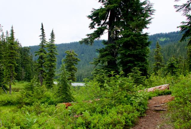
Ralph walking through a foggy meadow near the summit of Grizzly Peak

'Cause you gotta have friends

Day 67, Wenatchee Pass to Stevens Pass

Friday, July 12, 2019

I have described before "a romantic ideal of the trail.” That is, the false notion that a thru-hike is somehow an expression of individualism, granting you the freedom to go it alone and do as you wish.

It’s true that thru-hiking can be a freeing adventure, but the freedom is limited by practicality. To finish a complete thru-hike, you will still be tied to a schedule, you will still have basic needs that must be met.

Weather Cloudy to partly cloudy with a high temperature in the low 70s
Trail Conditions Some short sections of rocks or roots, later smoothing to easy, flat trail
Today's Miles 17.2 miles
Trip Miles 925.1 miles

While you might be able to accomplish these needs and stay on your schedule alone, it's unlikely. And more to the point, why would you want to? This is where your friends become an integral part of your hike.

Just one example of this is hiking with my long-time friend, Ralph. He’s intelligent and has a good sense of humor. He also shares his kindness with everyone he meets. He's a good friend to have on the trail.

Ralph begins the climb from Wenatchee Pass

Ralph and I were the only campers last night in Wenatchee Pass. We left our campsite at 6:45 a.m. in a light fog.

The trail started immediately with a long climb up Grizzly Peak.

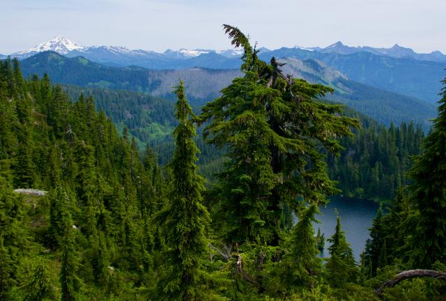
A view of Glacier Peak

Along the way, we were treated to an outstanding view of Glacier Peak. Thanks to the weather, this was the best view of the mountain in three days. I had walked much closer to it during that time, but thick clouds obscured my views.

Foggy morning near Grizzly Peak

As the climb went higher, we entered a layer of clouds. We had limited visibility as we crossed a meadow near the summit of Grizzly Peak.

The mountain stands at 5,597 feet in elevation and is one of few mountain summits that the PCT crosses. This is unlike the AT, where the trail seems to crest every mountaintop, knob, and boulder.

The clouds remained low when we reached the top, but there wasn’t much to see there anyway. It was covered with trees.

I saw a tent several yards off the trail. I guessed it was Bummpo’s tent, but couldn't tell for sure.

A view of Heather Lake and Shoofly Mountain

The trail then followed across the top of an adjacent ridge.

With occasional open views, we could see Heather Lake and Shoofly Mountain. The mountain showed the scars of a forest fire that burned 160 acres after a lightning strike in 2014.

We couldn’t see Glacier Peak again, however, because an adjacent peak called Grizzly's Hump was blocking our view.

Ralph enjoys his morning coffee

We stopped at 9 a.m. to make some coffee. Ralph often takes a coffee break and lately, I've begun to get in the habit of this mid-morning break.

It makes more sense than making coffee first thing in the morning and is a good way to boost my energy at a time when I often need it.

A view that now includes Glacier Peak

The trail continued along the top of the ridge that jutted from Grizzly Peak. Eventually, we were far enough beyond Grizzly's Hump that it no longer blocked our view of Glacier Peak.

The trail descends from Grizzly Peak

The trail then dropped about 1000 feet in a little more than 1.5 miles. Bummpo passed us on this section and he confirmed that was his tent I saw on Grizzly Peak.

The trail continues to descend

The descent plunged deep into a thick forest of tall Douglas firs. This species typically grows between 40 and 70 feet in height and is common in this area.

The trail goes near Lake Janus

Lake Janus was at the bottom of that descent.

The trail passed between two minor mountains, Union Peak and Mt. McCausland, then headed to Lake Vahalla.

A view of Lake Vahalla

This section of trail and the connecting trails around Lake Vahalla were popular for day hikers coming from Stevens Pass and we soon began to see many of them.

Three day hikers share their last cookie

Soon after I passed the lake I was met by three ladies who were finishing their day hike. They had many questions about my thru-hike attempt.

One lady said she wanted to do something for me, so she gave me her last chocolate chip cookie.

A view of U.S. Highway 2

The remaining part of the hike seemed to drag on, but after two hours I saw U.S. Highway 2 and knew we were getting close to Stevens Pass.

Though this section wasn’t difficult, I began to lose energy. The rest of the way was flat and easy, but I was ready for it to be done.

Arriving at Stevens Pass

We finally arrived at Stevens Pass at 5:15 p.m. The area was a ski resort in winter and a popular place to mountain bike in the summer. We had to dodge more than one mountain biker before reaching Ralph’s truck.

The chocolate cookie I was given earlier today wasn’t the only trail magic I received. Ralph had a beer waiting for me in his cooler.

Ralph had made arrangements for us to stay tonight at the home of mutual friends, Tracey and Kirk. They used to live near us and had recently moved to Leavenworth when Tracey took a new job.

They could not have been more welcoming and hospitable, despite the fact that they had only moved into their home a couple of weeks earlier.

Kirk treated us to a delicious dinner he prepared, which included roast beef, mashed potatoes, and salad. It was a wonderful evening.

Today was a day of friends lending a hand to make my hike easier. Ralph, Tracey, and Kirk helped tremendously, of course, but I also can’t forget the help from my brief encounter with day hikers and the cookie one of them shared.

It's not necessary to single out this day, however. because I get help from my friends every day. The impact of their assistance should not be dismissed or downplayed.

If you’ve ever thought how freeing it is to walk a long-distance trail, please know that I’m not doing this by myself. I couldn't.

And I'm standing at the end of a real long road
And I'm waiting for my new friends to come.
I don't care if I'm hungry or freezin' cold,
I'm gonna get me some of them.
'Cause you gotta have friends,
That's right, friends, friends.

This trail report was published on