
Day 20 Whitewater River to Mission Creek
More from this trailIt's that wrong way feelin’
If you were to look at the elevation profile of the trail segment I walked today you would see that it involved climbing more than 4,600 feet.
You might presume that made for a tiring day. Indeed, it was tiring, but not because of the climb.
The height of the climb wasn’t especially noticeable because it was spread over a distance of 16 miles.
What made the day tiring was the terrain the trail covered. Or to put it more accurately, the day was physically and mentally exhausting because of where the trail disappeared.

Morning start
The cloud cover that moved in yesterday had left by morning. The sky was nearly clear when we left camp at 7 a.m.

Whitewater River
After just six tenths of a mile from our campsite, the trail turned to cross the Whitewater River. I expected the water would be cold, but when I forded the stream it wasn’t. The water was shallow and easy to cross.

Rocks on Whitewater River
As I noted yesterday, the riverbed was much wider than the river's stream. Crossing the remainder of the riverbed wasn’t fun because the trail went over a jumble of large rocks and sand.

Climbing Pacific Crest Trail
Once I made it across the riverbed, the trail smoothed out and began a climb up the other side, then over a ridge.
Looking ahead, I could see the summit of San Gorgonio Mountain, which was covered in snow.

View of San Jacinto Mountain and Fuller Ridge
While I was enjoying the view I turned around and saw behind me San Jacinto Mountain and Fuller Ridge. This was inspiring to see because it helped me appreciate the challenges of going over that section of trail.
“I walked over those mountains,” I thought with a small measure of pride.

Descent to Mission Creek
It took me a little more than two hours to complete the climb and begin walking down the other side of the ridge. From here, the trail dropped down to Mission Creek.
There’s a bit of a mystery to how the creek got its name. There was no Spanish mission located along the stream.
A Serrano Indian village was once located at the end of the creek near where it feeds into Whitewater River. Native Americans in Southern California were sometimes referred to as Mission Indians, but it’s not clear why a generic name like that was used for this creek.

Captain crosses Mission Creek
Reaching the bottom, the trail made the first of several crossings of the creek. This one was straightforward, but few other crossings were as easy.

Tengo Hambre on ascending trail
For a time after the first crossing the trail climbed a ridge above the creek. It was well defined and easy to walk. Had it remained high on the ridge, all would have been fine. Unfortunately, that wasn’t the case.

Mission Creek
The trail dipped back down to the creek, where it made another crossing. This was a pattern that was often repeated. Usually, when the trail was near the creek it was severely eroded. It had been badly damaged by February’s heavy rains.
Sometimes, the damage was limited to washed out but walkable segments.
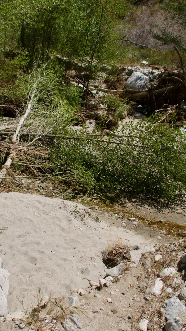
Damaged trail crossing Mission Creek
At other times the trail was a chaotic mess of rocks and downed trees or was completely gone. Too often we weren't just walking over obstacles, we were trying to figure out where the trail was supposed to be.
I don’t envy the maintenance crews that will have to repair the trail along the creek. All of the damaged trail was in San Gorgonio Wilderness Area. Regulations for wilderness areas prohibit the use of mechanical equipment. Even wheelbarrows are prohibited.
It seems like it would be smart to move some of of the trail away from the creek.

Smooth trail
Just when these difficulties were becoming frustrating, though, the trail would veer away from the creek and smooth out.
Along one of the easier trail segments Tengo and I met a hiker named Simple Man. He told us he had just walked about four miles out of his way while trying to find the trail, and he wasn’t a novice hiker. He had completed the Appalachian Trail the year before us.

Heading back to Mission Creek
Once again, the smooth trail didn’t last long. It returned to the creek and another washed out crossing.

Another crossing of Mission Creek
Sometimes when the trail disappeared, we just had to make our own trail. This became more efficient than trying to figure out where it was supposed to be or inadvertently going the wrong way. We knew that if we kept moving upstream we’d eventually find the trail again.
When we stopped for lunch at 1:45 p.m., we had only 5.3 miles to go to where we planned to camp. That should have been only two or two-and-a-half hours to go to get there, but it took much longer.

Simple Man and Tengo Hambrea
A big reason for the extended time was a couple crossings involved scrambling and clawing our way up walls of dirt and rocks. Time was also wasted trying to find the trail or a reasonable alternative track until we could find it.
Too often this was not hiking. It was bushwhacking.
Later in the day, Tengo, Simple Man and I met a hiker named Jeff. It was good to have him with us because four was better than three for figuring out where the trail went.

Mission Creek with cottonwood trees
Eventually, the trail became more normal. There had been less damage because there was less erosion from runoff at the higher elevation during February's rainstorm.
When I reached our campsite at 6:15 p.m. I changed my normal camp routine. Usually, I set up my tent first, then collect water and complete other camp chores before preparing dinner.
My priorities were different this evening. A full day of trying to figure out where the trail went, and climbing over rocks and trees when we couldn’t find it, was exhausting. I needed to recover enough energy to just do the other chores, so I fixed dinner first.
This day had been the toughest so far.
I’m seeing a trend and it’s not what I expected. I thought this trail was supposed to be easier than the AT.
It's that wrong way feelin'
Wrong way feelin'
Go back says the sign way back in my mind
But I can't get away from you
No I can't get away from you
No, no I can't get away from you
No, no
This trail report was published