
Day 111 Spur to Piped Spring to Tentsite at Mile 1730.1
More from this trailA thousand miles can lead so many ways
I still have a little more than 1000 miles to go to finish the PCT. That number may be hard for me to grasp. I’ve walked more than 1,600 miles, yet I’m still a long way from being done.
Perhaps I could take a moment to appreciate how far I've walked already. That would be better than feeling anxious about how much of the hike remains.
Instead, I'm trying to do neither. Mostly, I’m just focusing on the next few days while remaining confident about my ability to finish.
Admittedly, I haven't always felt self-assured about this hike. I had a brief moment of doubt a couple weeks ago. But I was able to shove those negative thoughts aside and have kept them away since.

A bridge over Grizzly Creek near an aqueduct
The temperature yesterday afternoon was especially warm. Today looked to be even warmer, so I decided to skip breakfast this morning and leave earlier than normal. I hoped to put in a few hours before the sun rose high in the sky.
About an hour after leaving camp, I passed a handmade marker written in sticks indicating that point was 900 miles from the Canadian border.
Another hour later, I reached a bridge that crossed Grizzly Creek and decided to stop there to eat breakfast.

An aqueduct near Grizzly Creek
A shallow, concrete aqueduct ran roughly parallel to the creek. The water in the aqueduct flowed from Howard Prairie Lake, a dam-controlled reservoir.
The Guthooks trail guide app warned that hikers should avoid the aqueduct’s water because it was likely to contain chemical run-off from nearby farms.
I wasn’t sure how that water would be much different than the creek because they seemed to run in the same direction, but I collected water from the creek and filtered it.

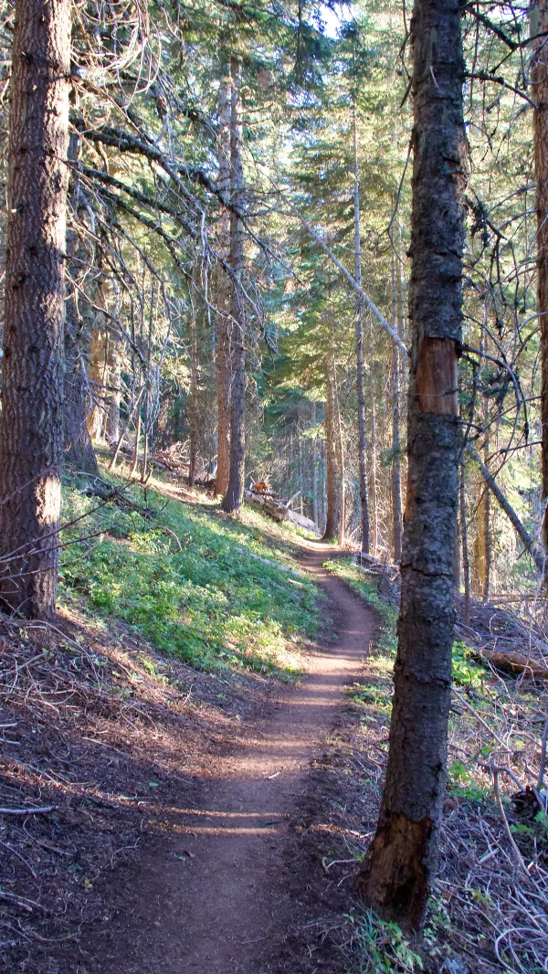
The PCT with a trail marker
The farther south I've hiked in Oregon, the more the terrain has become like a high desert. These conditions, with grassy flat sections and rolling hills, are what I'm expecting to find in Northern California.
There have also been many more road crossings than there were in previous parts of the state, though most were dirt roads.
I discovered I had some cell service, so I stopped to get online and reschedule the pickup date for the rental car I reserved. When I reserved it during our stay in Bend, I was only able to guess when we'd arrive in Ashland. Now that we were just a day away, I could put a better time on the reservation.

Rolling, grassy terrain near Hyatt Reservoir
The trail passed a side trail leading to a campground at Hyatt Reservoir. This might have been a good spot for lunch because there were picnic tables and a water spigot here. I felt it was a little too early to stop, however, so I kept going.

A footbridge at Little Hyatt Reservoir
Instead, I stopped when I reached a dam at Little Hyatt Reservoir at 1 p.m. I found a shady spot across a footbridge where I could get out of the sun.
Just as I was finishing lunch, I received a text message from Sunkist on my Garmin InReach. She wanted me to know Bluejay and she planned to take a short detour off the trail and stop at a restaurant called Green Springs Inn. Two hikers I met yesterday, GinGin and EdBeard, were also stopping there.
At that point, I was about 5.6 miles from the road. While it was feasible for me to get there, I feared I would arrive just as they were finishing their meal, so I told her I'd just meet everyone at the campsite.

A trail cairn on the PCT
The trail continued across rolling, grassy hills and through patchy sections of forest. The exposure to the sun made the sunny day feel much warmer.

A view that includes Interestate 5 between Medford and Ashland
The trail made a gradual climb across the slope of Green Springs Mountain and then curved around it.
From this higher elevation, I could see across a valley to Interstate 5. When we reach Ashland tomorrow, we will need to hire an Uber to drive us up that highway to pick up our rental car in Medford.
A climb toward Soda Mountain
When I reached the road to Green Springs Inn, I gave a second thought to heading there and probably would have done it if I thought I could have gotten a quick hitch. There was no traffic on the road, so I stayed on the trail.
From there, the trail went up and down a short hill before beginning a steep climb. The next 4.5 miles to our campsite went up nearly 1,200 feet, with most of the ascent in the first 2.4 miles.
The campsite was located on a slope of Soda Mountain and included a spring with plenty of water. I got there at 7:15 p.m. The others arrived as the sun was setting.
As I said before, I’m walking with a resolve to finish what I started in March. There's no denying that something bad could happen in the remaining 1000 miles to end my hike, but I've put that out of my head.
I'm only thinking of the adventures to come.
A thousand pictures can be drawn from one word
Only who is the artist?
We gotta agree
A thousand miles can lead so many ways
Just to know who is driving
What a help it would be
So if you want this world of yours to turn about you
And you can see exactly what to do, please tell me
I'm just a singer in a rock and roll band
This trail report was published