
Day 94 Windy Peak to Razor Creek
More from this trailHurt so good
A hiker once told me that a thru-hike is like being in an abusive relationship. He added that he was a psychologist, so presumably, he was qualified to make such a diagnosis.
I'm sure he wasn't intentionally making fun of abuse, which isn't a laughing matter. But he's right after all, because hiking day after day will hurt you. If you keep going back for more pain, that implies your relationship with the trail is dysfunctional.
Still, that doesn't fully describe the relationship. Instead of just accepting abuse to stay in it, I think we tolerate the pain because we like it. Perhaps put more accurately, we like the aching reminder that we've worked hard for the rewards of being in nature. So in that sense, we are the abuser and the abused.
If you read my post for Day 1 of my Appalachian Trail thru-hike, you will remember I repeated a phrase often spoken by AT thru-hikers: "No rain. No pain. No Maine."
Accepting the pain is the only way to see what we see and experience what we feel. There's no shortcut to avoid discomfort when we're hiking. We have to keep going, even when it hurts. And we gladly go back for more.

Colorado sunrise
The trail served up an extra dose of pain today. It started without much wind, though the temperature dropped lower than I expected. I was glad it didn't go below freezing because I hadn't done anything to protect my water filter.
The ground was still wet from yesterday's rain. Because of that and the cold air, a lot of condensation formed overnight inside my tent. Everything was damp.

Low clouds
The moisture and cold air were also the reason for some beautiful weather effects I saw when I crawled out of my tent. I watched for several minutes as low clouds pushed over a ridge. Sunlight filtered through the trees, which glistened off the water drops still clinging after the rain.
I might have stayed longer to view the unfolding weather, but OldTimer and Top O' had already left. I didn't want to fall too far behind them. If I wanted to finish Colorado this week, I couldn't spend all of my time looking at mountains and clouds.

A long view from near Windy Peak
Thankfully, the show put on by the sunlight and clouds didn't end when I left our campsite. Yesterday's rain appeared to have flushed most of the smoke from the sky. A breeze had begun to pick up, and that might have also helped clear the smoke.
The sky wasn't crystal clear, but at least it was improved for now. I didn't know it this morning, but the views of distant mountains I could see were just about the only ones available for most of the day. The rest of the time, many trees usually blocked any views.
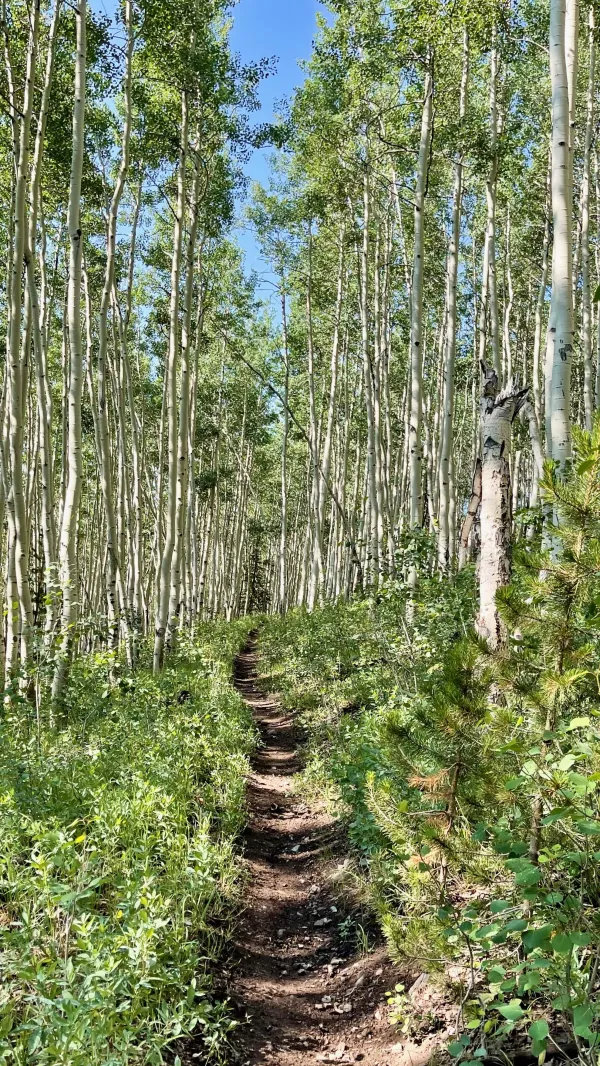
The CDT and CT pass through tall aspens
I didn't walk far before I began to have some difficulty. I quickly felt worn down, but the problem was more than just the morning sluggishness I'd been feeling lately. The weight of my pack didn't sit right on my shoulders. It was off-balance, and that was dragging me down.
Slowly, I began to realize the problem was probably caused by the food I was carrying. I stopped to shift where the weight was positioned.
That didn't seem to help much. I was still feeling dragged down, so I stopped again about 20 minutes later and made a few more adjustments.

Parry's bellflower in Colorado
While I made one of the stops, I noticed a small patch of Parry's bellflowers. This plant is not the only one named to honor naturalist and explorer Charles Christopher Parry. It isn't even the first I have seen on this hike. I saw some Parry's agave in New Mexico on Day 10 and Parry's Townsend daisies in Wyoming on Day 57.
Parry has been called "King of Colorado Botany," and it's no wonder. He identified about 100 previously-unknown species in the state, and dozens of them are named after him.

Tank Seven Creek
The trail today covered a long stretch of the Cochetopa Hills, which lie on the southern end of the Sawatch Range. Calling these "hills" can be a little deceptive. The peaks are between 11,000 and 12,000 feet in elevation, but the distinction is made because they are relatively lower than most mountains in the Sawatch Range.
Much of the route this morning followed the spine of the Continental Divide, just as it did for most of yesterday. When it first left the divide, it dropped 260 feet to Tank Seven Creek.
This was only one of many ups and downs on the trail today. They were also contributing to my weariness.

Top O' and OldTimer stop for a yard sale
I met a northbound CT hiker at 10:30 a.m. named Bamboo. He told me OT and Top O' were stopped just ahead. They had both known him from previous hikes. Top O' met Bamboo in 2017 on the PCT, and OT met him on AT in 2016.
I found the two of them in a meadow a couple of minutes later. They were setting up for a yard sale. That is, they were laying out their gear to dry in the sun. I did the same thing.
I ate a second breakfast while we were stopped, and that helped to revive me when we resumed hiking.

Storm clouds forming in the distance
With the trail remaining mostly below the treeline, the decimation by mountain pine beetles was especially noticeable.
When the trail passed through a meadow, a wider view of the sky could be seen. That is always a good place to look when hiking in Colorado in the summer.
I saw a large formation of clouds building in the distance at around 12:30 p.m., so I made a mental note to keep track of them. Nothing came from the clouds, though. They stayed far enough away that we never saw a storm.
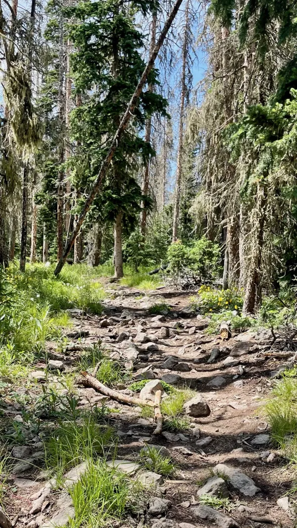
Rocky trail
I didn't want to stop for lunch because I assumed I would catch up to OT and Top O' when they stopped. By 1:25 p.m., however, I was getting hungry. I was about to say to myself, "I hope they stop soon for lunch," when I made a turn and saw them.
The trail became much rockier after lunch, and it remained that way for most of the afternoon. I started to struggle as the footpath began to make me weary again.
When we stopped to take another break, I decided to stay put a little longer. I was more interested in regaining some energy than trying to keep up with my friends.

Crossing a meadow late in the afternoon
Late in the day, the trail crossed another broad meadow. This was at least the third, maybe fourth, time the trail did that today. The meadows deceptively gave an impression that the trail was flat and easy, belying a continuous pattern of ups and downs. The Cochetopa Hills may have been a little lower than the mountains to the north, but their rolling changes meant there was never really a flat stretch.
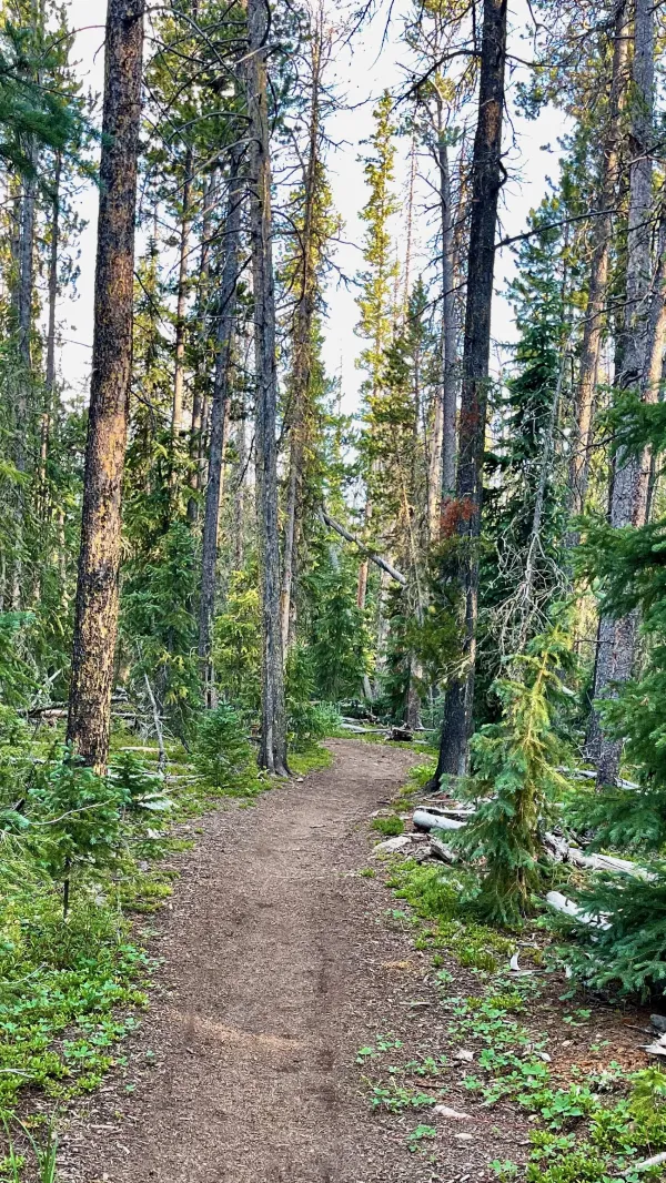
The trail near Razor Creek
As the sunlight began to take on a golden tint of early evening, the trail entered what had been a thick forest. Now, many of the trees were dead, and several had fallen over. Fortunately, the trail had been cleared of most downed trees.
We were a little apprehensive about camping in these woods. Comments in the Guthook app warned that dead trees standing among the few camping spots made them dangerous places to pitch a tent.
Knowing we might not find a safe camping spot near Razor Creek, I collected three liters when I first crossed it. I then carried the water for nearly a mile before coming to the campsite Top O' and OT had found. It turned out to be a safe spot because most of the down trees around it had been cut down.
When I stopped, the time was nearly 7:30 p.m. and I was exhausted. This had been a long day, with about 13 hours of walking.
Looking at a profile of the trail, it didn't appear to be difficult. In that stretch, however, the trail ascended 4,300 feet and descended 3,600 feet. There weren't any steep sections, and that may be why it was so tiring. It was a day of relentless ups and downs.
I could say, "No rain. No pain. No Canada." That expression would certainly apply today. It may not have quite the same ring to it as the expression used on the AT, but it has the same meaning.
And yes, though it may have been a painful day, I also enjoyed it.
Hurt so good
Come on, baby, make it hurt so good
Sometimes love don't feel like it should
You make it hurt so good
Hurt so good (Come on baby, now)
Come on, baby, make it hurt so good
Sometimes love don't feel like it should
You make it hurt so good
This trail report was published