
Day 78 Bill Moore Lake to Berthoud Pass
More from this trailYou thought you was the cool fool
After a 23.9-mile day a week ago, Top O', OldTimer, and I followed that by walking just 8.7 miles, 14.9 miles, 9.2 miles, and 8.3 miles per day. Yesterday's hike was only 11.3 miles.
I complained a couple days ago about how we were hiking so many short mileage days. Our miles-per-day average has been taking a hit from the weather and trail conditions.
Today was more of the same, except the reason for our short mileage was different. We were only going to walk 6.2 miles before stopping at Berthoud Pass.
We were stopping early today because of a change in plans. Our original intention was to continue walking to Interstate 70, then leave the trail to resupply in the area of Dillon, Frisco, and Silverthorne. The reason we changed plans was also why I'm not complaining about hiking another short-mileage day.
Sasquatch offered to drive from his home north of Denver and pick us up at Berthoud Pass. He said we could stay the night at his house. We could resupply there, then he would take us back to the trail tomorrow.
You can't turn down trail angel generosity like that!

Sunrise view from Bill Moore Lake
The sun wasn't yet above a nearby ridge when I woke up this morning at 5:30.
Despite the dark clouds forming overhead yesterday, we didn't get any precipitation overnight. My tent had some condensation inside, however. That was because we had camped in a valley near a stream and a lake.

Alpenglow
As the sun began to rise above the ridge, it made the ridge on the opposite side of the valley glow in brilliant orange. This side was at the bottom of Breckenridge Peak's slope. We began climbing that as soon as we left camp.

A hazy morning sky
Top O' and OldTimer started hiking at 6:30 a.m., and I left two or three minutes later.
In one sense, it was unfortunate today would be a short-mileage day. All the low, dark clouds of the last couple of days had moved out. The clouds in their place today were mostly high and wispy, the kind that won't produce much rain.
Arrows drawn in the snow
I hadn't gone far before I noticed some arrows drawn on a patch of snow. OldTimer and Top O' left those for me, and I'm glad I saw them. I might have otherwise missed where the trail made an unexpected turn.

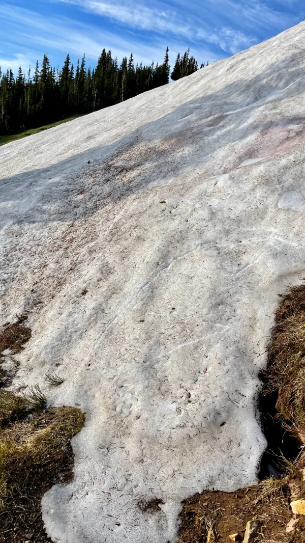
Snow and talus
The climb became steeper and was soon crossing a talus slope. Fortunately, the trail mostly steered away from the snow.
The farther up the climb I went, the clearer the sky became. This was turning into a magnificent weather day.
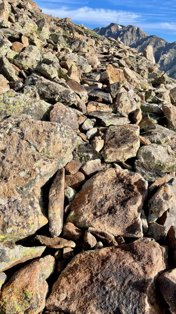
A trail cutting across a talus slope
I am normally not a fan of walking across a talus slope. The rocks can be unstable. This talus, however, had been much easier to climb because an industrious trail crew had created a footpath with flat stones. That was easy to follow, and the small rocks used to fill gaps kept everything in place. The amount of work put into this section of the trail was impressive.

A view of the top of Breckenridge Peak
It took more than an hour of climbing before the top of Breckenridge Peak came into view. Although it would not have been difficult to reach the top, the trail didn't go that way. Instead, it curved around the north side and stayed a couple hundred feet or so below the summit.

Walking around the top of Breckenridge Peak
After making a wide turn around the side of Breckenridge, Mt. Flora came into view. The trail was heading to the top of that mountain.
I saw OldTimer ahead of me when I got to the side. He wasn't as far ahead of me as I assumed. I never caught up to him, though.

A view of Mt. Flora
The trail from Breckenridge to the top of Mt. Flora was relatively easy, and the perfect weather only made it better. The summit stood at 13,146 feet.
I met a couple of NOBO hikers, Threshold and Nibbles, on the way up and chatted with them briefly before continuing the climb to the top.

Looking back from near the top of Mt. Flora
It didn't take me long to reach the top. As I looked back to see the trail I had just followed, it was obvious to see why I got there quickly. The trail was nearly a straight line all the way up.
To the left, I could see the valley where we had camped last night.

Wildflower and Kidnapper
Soon after I reached the top, I was delighted to discover that Wildflower and Kidnapper were here. Except for their dog Muir, the rest of the Bennett family didn't join them. The parents told me their kids were taking a day off to spend with grandparents.

Gravity, Wildflower, Kidnapper, and OldTimer
I hadn't seen the Bennetts since we were in New Mexico and was glad for the chance to catch up with Wildflower and Kidnapper. They are hiking northbound, so if OT, Top O', and I see them again, it won't be until after we finish our southbound hike through Colorado.

OldTimer begins to repack his gear
OT, Top O', and I spread out our gear to dry, then spent our time talking to other hikers. Besides Wildflower and Kidnapper, a NOBO thru-hiker named Wild Turkey and three day hikers from Chicago were at the summit.
We spent nearly an hour at the top and could have stayed longer. We knew we had plenty of time before Sasquatch was scheduled to pick us up there, but we wanted to make sure we didn't keep him waiting.

Looking toward mountains we will climb tomorrow
There was another reason besides socializing and drying our gear for wanting to linger at the top. The views were gorgeous. This was the kind of day you try to savor when you're on a mountaintop. The weather doesn't always give you this opportunity.
Included in my view was a long range of mountains called the Vasquez Mountains. We will be walking across those tomorrow. Beyond them and to the left stood two 14ers, Torrey Peak and Grays Peak. The CDT goes over the top of Grays Peak.

Descending from Mt. Flora
When we finally decided to leave and start the descent to Berthoud Pass, we began to see more hikers making the climb. Some were day hikers, but a couple of them were NOBO thru-hikers I had not met before.
One was Tapeworm. He told me he got his trail name after shocking some people with how much he ate, including their leftovers. The other thru-hiker was Red Stripe. She earned her trail name on the AT when she failed to put on sunblock.

A view of U.S. Highway 40 near Berthoud Pass
The trail to Berthoud Pass dropped 1,800 feet in three miles.
The first view of U.S. Highway 40, the road that went through the pass, made it look as if we had much farther to go down than we did. That's because the road had to make a steep climb just to reach the pass.

Berthoud Pass
Soon after we arrived at Berthoud Pass, I received a message from Sasquatch. He said he was stuck in traffic on the interstate and would be arriving late. We dropped our packs near a sign in the parking area at the pass.
Light rain and a little sleet fell for a short time, and we took shelter in a building that provides a safe spot for motorists if snow closes the pass.

Talking to tourists
We weren't there long before a large group of tourists stopped to stretch their legs. When they saw us, they were curious about our packs and had many questions about our hike.
Later, they decided they wanted to take a group photo at the Berthoud Pass sign. When I went over to move my pack out of the way, one of them told me I should leave it there. “It makes us look cooler,” he said.

OT and Top O' join Sasquatch on his porch
After Sasquatch picked us up, we made the 90-minute drive back to his house. Before we even took time for a shower, we walked down the street to get lunch at a taco truck. Hiker hunger was not going to wait for a shower.
After cleaning up and doing laundry, Sasquatch took us to Walmart so we could resupply. OT also bought a new phone battery, which solved the problems he had been having with his phone.

Top O', Old Timer, Gravity, and Sasquatch
Later, we walked to The Post Chicken and Beer for dinner. Sasquatch’s girlfriend Lisa joined us.
Hiking just 6.2 miles when you need to complete well over 2,800 miles doesn't feel right on most days. It feels like I'm sacrificing miles I won't be able to make up later.
I'll never complain about that on a day like today, though. I'll gladly give up some miles for a chance to enjoy a delicious dinner and beer with good friends.
You thought you was the cool fool
And never would do no wrong
You had everything sewed up tight
How come you lay awake all night long
This trail report was published