
Day 71 saddle between Haystack and Parkview mountains to Willow Creek
More from this trailSure don't know what I'm goin' for, but I'm gonna go for it for sure
To describe today, at least the way it started, I might use the infamous words of Donald Rumsfeld.
"As we know, there are known knowns; there are things we know we know," said the secretary of defense in the George W. Bush years. "We also know there are known unknowns; that is to say we know there are some things we do not know. But there are also unknown unknowns; the ones we don't know we don't know."
Rumsfeld's words may be inartful, but they succinctly explain our day.
Top O', OldTimer, and I started this morning with a hike over Parkview Mountain. That was a known known. The rest of the day was unknown, of both the known and unknown kind.
A known unknown for us was what we would find after we reached the other side of the mountain. We understood the National Forest Service had closed the trail beyond Willow Creek Pass, about 4.5 miles from the top of Parkview. It was closed because of unsafe conditions left by the East Troublesome Fire, but was that still the case? We didn't know.
There were plenty of unknown unknowns. Was there an alternate route if we couldn't continue on the CDT? Where would we go? Where would we camp? We knew nothing to answer these questions.
We would have to figure out the answers when we got to Willow Creek Pass.
One thing was certain. We weren't going to hitchhike around the closed section. All three of us started this walk from Mexico to Canada intending to make the whole distance a continuous footpath. We weren't about to change that now.

Blowdowns on the trail
OldTimer and Top O' left our campsite a few minutes before I did. I said goodbye to Sunshine before leaving, though I was certain he would be passing me soon on the trail.
As soon as I began walking, I ran into some nasty blowdowns. More than one downed tree blocked the trail, and each one was full of twisted branches. Fortunately, I didn't have to climb through many of these before the trail began to clear.

A view of Parkview Mountain
From our campsite, the trail followed a long ridge that extended from the summit of Parkview Mountain. The distance to the top was about 3.8 miles. Nearly all of the path was climbing, with a total ascent of 2,290 feet and a descent in the middle of 450 feet.
I found my first view of the mountain about 30 minutes into the climb. From that spot, the mountain seemed huge and distant. As I sometimes do, I wondered, "How am I ever going to get over the top of that?"
Of course, I have always managed to reach the top of climbs like this and didn't doubt I could today. For reasons I'll never understand, seeing a mountain this way makes it appear more daunting to climb than it really is.

Sunshine climbs Parkview Mountain
As expected, Sunshine passed by me less than an hour into the climb. Granted, he had a couple of advantages over me, and I didn't resent him for them. He was at least 30 years younger than me, and he was used to being at higher elevations because he lived in Colorado.

A steep slope on the north side of Parkview Mountain
We were just coming to the treeline when Sunshine passed me. From there, the trail wrapped around the north slope of the ridge as it steadily went up.

A view of the ridge leading to Parkview Mountain
The trail was climbing to the top of the ridge. Once there, it stayed on top the rest of the way up the mountain.
Sunshine was already nearly out of sight 10 minutes after he walked by me.

Looking back to Haystack Mountain
When I took a look behind me, I could see the whole ridge back to Haystack Mountain and down to the saddle where we camped last night. I could also see some of the burned terrain on the side of Haystack, which caused us so much trouble yesterday.

Rocky Mountain sticky cinquefoil and sky pilot
Two kinds of wildflowers appeared on the ridge where it dipped before making another climb. They were Rocky Mountain sticky cinquefoil and sky pilot. Otherwise, the ridge was barren, covered only by rocks, short grasses, and lichen.
I was glad for a chance to stop and catch my breath when I met a northbound hiker named Solo. He told me he walked through the burn area between Grand Lake and Willow Creek Pass. The trail was in bad condition, he said, and he didn’t recommend trying to go through it the way he did.
This was helpful to know, though it didn't answer the question about how to get around the burned area. Then a thought came to me. If I could get a cell signal on top of the mountain, I might be able to find an alternate route using Google Maps. That is how I found a way to the trail when Top O' and I were stuck on a highway in Wyoming on Day 54.

A view of Parkview Mountain
The route to the summit wasn't marked except for one or two CDT emblems mounted on posts. There wasn't a visible footpath for most of the way, nor were there any cairns. That didn't matter, however. The route was obvious.
I climbed for nearly 2.5 hours before I was close enough to see a small building at the summit. This was a fire lookout building made of concrete. It was constructed in 1916 and remained in use during fire seasons until 1948.
I wondered at first if the mountain got its name because it was possible to see Rocky Mountain National Park from the summit, but that didn't make a lot of sense. Later, I learned its name came from its position between North Park and Middle Park, two large basins that stretch down the western side of Colorado's Front Range.
North Park extends from here to Wyoming.

OldTimer, Sunshine, Top O', and Gravity
Without a doubt, it was slow going for me to reach the top. Including the time I spent chatting with Solo, I needed nearly an hour more than it would normally take me to walk 3.8 miles.
I was surprised to find Sunshine, Old Timer, and Top O' were still at the top when I got there. They had waited for me inside the fire lookout building. It had been restored in 1972, and though small, it was a good place to get out of the wind.

A chipmunk on Parkview Mountain
A chipmunk was also there with us, and that was unexpected as well. I wondered how a little animal like that could survive at 12,296 feet. The nuts and seeds that chipmunks usually eat wouldn't be here. Other than feasting on what a thru-hiker or mountain climber might drop, this chipmunk probably had to subsist on lichen.

Looking east from Parkview Mountain
The view from Parkview's summit offered a better idea of how far the burn area extended.
While I ate a snack bar, I looked at Google Maps on my phone and found a way to make our own alternate route around the closed trail beyond Willow Creek Pass. I discovered if we walked south on Colorado Highway 125, which went through the pass, we could reach a Forest Service road that could take us in the direction of Grand Lake. That was where we wanted to resupply, and we could pick up the CDT there. The trail goes through the town.
Solo had told me the trail was closed because dead trees posed a danger of falling on hikers. I figured walking on a Forest Service road would be safer from that risk.
My alternate route seemed to be the only way to reconnect with the trail without walking a longer distance entirely on highways. I shared the idea with the other guys, and they agreed this appeared to be our best option.

Leaving Parkview Mountain on the wrong trail
When we were ready to leave the summit, we headed off in the direction of a trail that went south. There were no signs or CDT emblems here, but there was a footpath.
Barely a minute later, we realized this wasn't the trail we needed. We had to backtrack to the fire lookout, then found the CDT on a trail behind the building.

Going down Parkview Mountain the right way
Soon after heading down the correct trail, I slipped and fell, landing hard. My right arm and wrist slammed against rocks as I tried to catch my fall.
The top of a 12,000-foot mountain was no place to get injured, and fortunately, I didn't.

Descending from Parkview Mountain's summit
A trail on the route down was sometimes obvious, and sometimes it disappeared. Still mindful of my recent fall, I took extra care and walked slowly where it crossed loose scree.

Snow across the trail
There were a few pockets of snow after we got below the treeline. They were at least a foot deep and soft enough to cause some post-holing.
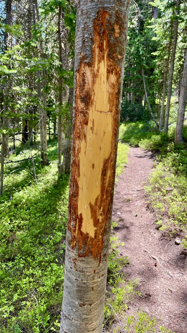
A tree with bark scratched off by a bear
A tree caught my attention farther down the long descent. From the look of the bark, it seemed a large bear lived nearby. I also saw some scat later, but never a bear.

A view of Colorado Highway 125
We didn't have many views after the trail dropped below the treeline. The trail descended on the north side of a ridge extending from the mountain, and that was good for us.
When the East Troublesome Fire exploded to engulf acres and acres of trees, this ridge acted as a natural barrier. The fire didn't cross it.

A trail closed sign
We stopped for lunch just before reaching the highway at Willow Creek Pass. In all, we descended 2,667 feet from Parkview's summit.
When we got to the road, we found a large sign blocking the trail on the other side. From the size of the sign, it looked like the Forest Service was serious about the closure. Oddly, when Solo told me about the closed section, he mentioned the other end didn't have a sign like that, which is why he walked through.

Walking on Colorado Highway 125
Solo may have made it through, but we decided to take his advice to avoid that section. We turned to walk along Highway 125.
We were now in Middle Park, which extends southwestward to the vicinity of Berthoud Pass. The CDT will take us in that direction on the mountains bordering the east side of the park.
We didn't get far down the road before seeing more burned trees. They appeared on both sides of the road. Firefighters knew the East Troublesome Fire was taking a turn for the worse when it jumped the highway.
The highway didn't have a shoulder that was flat and wide enough to walk on. We didn't see much traffic at first, though it gradually increased later in the afternoon.

A volcanic seam that looks like a castle wall
We passed a geologic feature that looked like an ancient, crumbling castle wall. It was a volcanic seam.
Later, I found this seam in a satellite view on Google Maps and measured how far it extended. It was visible above the surface for nearly two miles.

Parkview Mountain
Looking across Middle Park to the west, I could now see the full prominence of Parkview Mountain. I wasn't able to see the ridge I followed to the top this morning, but the ridge I walked down was visible.

Top O' reads a sign
After walking 4.6 miles on Highway 125, we arrived at the Forest Service road I had found on Google Maps. We discovered our supposed alternate route around the closed trail was also posted as closed.
Top O', OldTimer, and I were stunned to see this. Would we be subject to arrest if we walked beyond the sign, or was there even still a safety concern?
I have seen signs in similar situations on other trails. On the PCT, for instance, the trail was rerouted in Washington after a fire. When I arrived there, a warning sign was still nailed to a tree, though the danger was long over, and the trail was officially open.
Maybe the Forest Service was just slow in taking down this sign, I suggested without knowing what else to say.
We debated our options before concluding the Forest Service road was still our best choice. It would be safer to walk on this road than on a highway without a shoulder. If we stayed on the highway, we would have 34 more miles to Grand Lake. No one was keen on walking that far on asphalt, especially when we had no idea where we might find a place to camp.

Forest Service Road 4
Maybe we were now outlaws on the run. I felt that way as we followed the Forest Service road. It was gravel and didn't appear to be any worse off from the fire.
I didn't expect to see any green trees, but a few stood among burnt, dead ones, at least at first.

Walking past green trees
Indeed, we even passed through a section that was somehow unscathed by last year's fire. This was not an indication of conditions to come, however.

Walking past burnt trees
We didn't have to walk far before finding destruction everywhere. This gave us a better picture of the devastation from the East Troublesome Fire.
The fire damaged or destroyed 366 homes, plus another 214 man-made structures. At its height, 35,000 people were under mandatory evacuation orders. Amazingly, only two people died.
The East Troublesome Fire was the second-largest wildfire in Colorado’s recorded history. The state's largest, the Cameron Peak Fire, was burning at the same time. Authorities feared the two fires might merge into one, but thankfully, they didn't.
What is most notable about the East Troublesome Fire is how quickly it became a cataclysm. The fire exploded to triple its size in just four hours, making it the fastest wildfire in U.S. history. Many beetle-killed trees were the fuel, with high winds and dry conditions providing the catalysts for this unprecedented inferno.

Tarptent Aeon Li
We were by now too far from the CDT for our Guthook apps to be of any use in navigation. Its basemaps didn't extend far from the trail, so we didn't have regular map features to judge where we were.
At first, navigating by Google Maps worked for us despite being without cell service. The map was cached on my phone when I viewed it at the top of Parkview Mountain. Top O' and OT didn't have the cache on their phones, however. They had to rely on me to make sure they were going the right way.
There were some discrepancies in what Google Maps showed compared to what we saw on the ground. In this confusion, I remembered I also had maps on my phone that were produced by a photographer named Jonathan Ley. These gave some additional detail we didn't have from Google Maps.
Ley annotates his maps of the CDT and marks several alternate routes. Regretfully, no alternate routes were available for this area, so we were on our own to make up one.
We decided to stop shortly after 6 p.m. when we found a flat spot next to the road. It was near a stream and far enough away from dead trees.
Camping around so many burnt trees might have been a little depressing, but at least I had little risk of being crushed to death overnight by one falling on my tent.
We all felt good about our alternate route. Still, we had more than 20 miles to walk tomorrow before reaching Grand Lake. That was a long way to go for three desperadoes on the lam from the law.
Well I never know now
Just don't ever know, no, no
Sure don't know what I'm goin' for
But I'm gonna go for it for sure
Sure don't know what I'm goin' for
But I'm gonna go for it for sure
This trail report was published