
Day 155 Morning Star Lake Campsite to Red Eagle Lake Head Campsite
More from this trailThere's another avenue beckoning, the great divide
With 2,300 miles already completed, hiking in Glacier National Park feels a little too easy. Thanks to the camping permit Top O' and I obtained for our hike through the park, we don't have to wonder where we will stay each night.
And once we arrive in camp, we don't have to search for what we need. It's all laid out for us. Each site includes a flat spot for our tents, a designated area for cooking, and another one nearby for hanging our food. We don't even have to dig a cathole because a privy isn't far away.
True, we still have to hike the miles to the next campsite, and those miles aren't always easy. There are steep climbs to get over mountain passes. Nevertheless, the campsites are evenly spaced between 13 and 15 miles apart. Those distances are well under what we typically hiked each day to get here.
What's more, the elevations in Glacier are not nearly as high as passes we've had to climb in Colorado and Wyoming. That makes the air a lot easier to breathe.
These hiking conditions give me more time to soak in the scenery of an area I've never visited before. And because the weather continues to be favorable, I don't feel a need to make a desperate dash to the border before fall turns to winter.

The eating and cooking area of a campsite
Today was another opportunity to sleep a little longer than usual. Our preset mileage for the day gave us that luxury. After slowly waking up, I walked to the bear bag area, retrieved my food, and enjoyed a leisurely breakfast. The eating area of our campsite was nicely appointed with log benches.
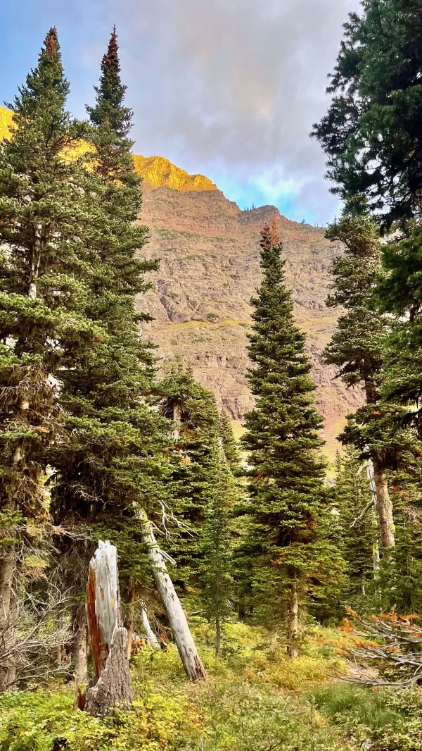
Morning sun hits the side of a mountain
The sun was still below the surrounding mountains at 7:30 a.m., resulting in an alpenglow effect on the top of the steep rock face on the other side of Morning Star Lake.
The mountain goats I saw scaling the rocks last evening were there again. I attempted to take photos of them, but they were too far away to get clear shots.
Elk were also in the area, though I didn't see them. I only heard them bugling last night.

Top' O walks near Morning Star Lake
The time was nearly 8:15 a.m. before Top O' and I left our campsite to begin hiking to the next one.

The trail crosses a meadow
The temperature wasn't as chilly this morning as it has been lately, but was cool enough that I kept my wind shirt on for a little extra warmth. The valley remained in shade for a long distance, and I didn't stop to remove the wind shirt until sunshine finally fell on the trail.

A waterfall on Atlantic Creek
After 2.6 miles, the trail crossed Atlantic Creek and passed a small waterfall. A short distance after that, it turned to follow the creek upstream. This wasn't the same Atlantic Creek, of course, that we walked next to in Yellowstone National Park on days 115 and 116. The creeks were named for the same reason, however.
The sources of these creeks were near the Continental Divide, and the water that flows in them continues to the Missouri River and then the Mississippi River. The water eventually reaches the Gulf of Mexico and the Atlantic Ocean.

The trail climbs toward Triple Divide Pass
Where the trail made a turn after the creek crossing was the start of the only steep climb of the day. The next 3.3 miles would ascend 2,000 feet.
After the first mile, I began to see a rock wall ahead. I knew I was climbing to a pass, but I couldn't tell where that was. I could only see a steep-sided wall ahead, and I wondered if I would have to go up it like a mountain goat.

Getting closer to Triple Divide Pass
That didn't turn out to be the case. I eventually realized the trail continued up a slope that wasn't nearly as vertical as I first feared.
Along the way up, I came upon a maintenance crew moving large boulders to repair a washed-out section of the trail. I don't think they saw me coming because they dropped a heavy boulder into place just as I arrived. One of the workers nodded to me sheepishly to apologize.

A view of Medicine Grizzly Lake and Medicine Grizzly Peak
The last approach to the top of the pass revealed a broad view of the valley I just left. The large lake I could see was Medicine Grizzly Lake. Above and behind it was a shelf with a much smaller, unnamed lake. Medicine Grizzly Peak (8,315 feet) rose from behind the shelf.
Walter McClintock tells in his book The Old North Trail the story of a bear named Medicine Grizzly. The bear saved the life of a young Indian chief. According to this legend, the Blackfeet will never kill a hibernating bear.

Triple Divide Pass
The wind was gusty and cold near the top of the pass. I stopped to put my wind shirt back on and wore it until I was far down the other side.
The pass is called Triple Divide Pass because it's adjacent to Triple Divide Peak (8,020 feet). The mountain is unique among those that straddle the Continental Divide in the U.S.
As I noted earlier, I reached the pass by following Atlantic Creek, where water makes its way to the Atlantic Ocean. To the west of the peak is the source of Pacific Creek, and as you would assume, snowmelt and rainfall on that side flow to the creek and eventually to the Columbia River and the Pacific Ocean.
What's unusual is the north side of the mountain. Hudson Bay Creek flows here. It is so named because its water reaches Hudson Bay in Canada. Some hydrologists say the bay is part of the Arctic Ocean. Thus, Triple Divide Peak is a hydrological apex, a spot where water flows to reach three separate oceans.
Other hydrologists debate this, saying that Hudson Bay is part of the Atlantic Ocean. Still, it's fun to think I was standing in one of the few spots in the world said to be connected to three of the world's seven seas.

Triple Divide Pass
The other side of Triple Divide Pass – you might call it the Arctic Ocean side – looked notably different to me than the Atlantic side I came from. Ice age glaciers had indelibly left their mark here. Sharply jagged peaks thrust to the sky. They didn't have as much weathering to round off the edges.

A shelf below Triple Divide Peak
Gravel and ice piled on a shelf on the west side of the valley, which was just one obvious sign that glaciers carved into Triple Divide Peak and Norris Mountain (8,882 feet). Small ponds were left behind by the glaciers when they receded.

Waterfalls seen from the trail
I didn't get far down the other side before I caught up to Top O'. He stopped for lunch on the side of the trail with a view of a tall series of cascades pouring from the shelf.
Two women stopped by on their way up to the pass. They told us they were out for a day hike and were camping at Red Eagle Lake. That was where we were heading, so we told them we would see them again this evening.

Hudson Bay Creek Valley
The rest of the way down the valley was a gentle slope. I knew I had only completed about half the day's distance, but there was plenty of time to hike the rest.

Waterfalls
Hudson Bay Creek was at first a narrow ribbon running through the wide valley. A short distance down the trail, a cascade pouring from a steep ledge of another shelf joined the creek and made it a little wider.

waterfall
A third cascade appeared later. The water from this one seemed to flow out of the rock wall because I couldn't see its source. When I looked at a map, I could see that the stream flowed from a small lake, like the previous two waterfalls.
In this case, the stream flowed from a basin at the base of Split Mountain (8,792 feet). I was too far down into the valley to see the mountain.

Pearly everlasting and dead trees
The last two hours before reaching the campsite went through an expanse of dead trees. A wildfire swept through this area after igniting on July 28, 2006. About 34,000 acres of forest burned during the Red Eagle Fire. It was one of the worst fires in Glacier National Park's recent history,
High winds and trees already killed by the mountain pine beetle helped the fire spread quickly. Before the fire was finally contained, it also burned 19,000 acres of the Blackfeet Nation's reservation.
The National Park Service was unable to determine a cause for the Red Eagle Fire.

pearly everlasting
The forest still has a long way to go to restore itself after the devastating fire 15 years ago. Small pine trees are beginning to take hold. In the meantime, the extra sunshine allows wildflowers like pearly everlasting to thrive.
This plant is a member of the family Asteraceae, which includes asters, daisies, and sunflowers, though it's hard to see the resemblance.

Rain in the distance
The farther down the valley I went, the wider it spread between the mountains. A side valley soon appeared to my left. I could only see a small portion of how far and wide it stretched. I saw enough for a rainstorm to catch my attention.
I couldn't tell if the rain clouds at the end of the valley were heading in my direction. Seeing them made me wonder about the weather forecast for the coming days.

A footbridge over Red Eagle Creek
The trail crossed two suspension footbridges in the last mile to the campsite. They went over Red Eagle Creek. Signs posted on both ends said the load limit was one hiker. The reason for that warning was apparent as soon as I started across the first bridge.
Every step I took made the bridge violently bob and sway. If I had tried to walk faster, the bridge would likely have thrown me over the side.
I paused when I approached the second bridge because I wondered if I might have cell service there. This seemed possible because there weren't any tall peaks between me and the small village of St. Mary at the park's border.
My guess was correct, so I checked in with Kim. She was preparing to fly to Montana in three days, and I wanted to let her know I was still on track for finishing on time.

Lone Wolf, Thirteen, Guy Number 5, Top O' and Beer Goddess
There were two campsites on Red Eagle Lake. The one our permit assigned us to was called the Head site. It was on the inlet of Red Eagle Creek at the south end of the lake.
I arrived at our campsite at 4:30 p.m. Fire investigators say this area was the epicenter of the Red Eagle Fire, so it was surprising to see some mature trees nearby.
About 90 minutes later, some thru-hikers started to trickle in. They were all assigned to the Foot campsite, but they stopped at ours for a short visit. Before long, Guy Number 5, Fraggles, Butters, Thirteen, Beer Goddess, Lone Wolf, and El Dorado were circled around our campsite's eating area.
Top O' and I also spoke again with the women we met earlier near Triple Divide Pass, and we talked to another hiker camped at our site. She was from Kentucky and said she hoped to be a thru-hiker someday.
When I stopped late this afternoon to text Kim, I also got a look at an updated weather forecast. It called for a chance of rain each day, but the chances were less than 50 percent. Daytime highs were predicted to be in the mid-60s, and lows weren't expected to drop below freezing.
Seeing this forecast was happy news. I couldn't have picked a better time or location to finish this long hike, I thought to myself.
Then after nightfall, the wind became gusty, and I could feel the temperature drop. Rain began to fall at 11:15 p.m. Did the forecasters get the weather all wrong?
There isn't much I haven't shared
With you along the road
And through it all there'd always be
Tomorrow's episode
Suddenly that isn't true
There's another avenue
Beckoning, the great divide
Ask no questions, take no side
Who's to say, who's right or wrong
Whose course is braver run
Still we are, have always been
Will ever be, as one
This trail report was published