
Day 122 Hellroaring Creek Campsite to Lava Creek Campsite
More from this trailThe law come to get you if you don't walk right
Yesterday was a long day, but it wasn't as bad as I expected. I didn't feel as tired as I do most days when I walk more than 20 miles.
Still, I was glad to have another short-mileage day. When I took a look at today's route before we left, I didn't see any difficult terrain ahead to our next campsite.
Top O' and I took advantage of the apparent ease of our route by sleeping a little later than usual. That was an advantage of knowing exactly how far we needed to walk today.
Although the day didn't end up as easy as anticipated, the problems that slowed me down were minor.

Butters, Beer Goddess, and Top O' pack before leaving
Beer Goddess and Butters were the only other campers at our site last night. We took our time packing this morning and spent as much time chatting as we did taking down our tents.
We don't have the same campsite reservations for the rest of the way through Yellowstone, so we won't be camping with them tonight or tomorrow.

Top O', Butters, and Beer Goddess
Nevertheless, I knew we would likely see Butters and Beer Goddess again on the trail before we reached Canada. We have about 600 miles to go to get there.
We didn't leave our campsite until nearly 7:45 a.m.

Hellroaring Creek
After walking less than a mile, we came to where the trail crossed Hellroaring Creek, the same stream we camped next to last night.
I spent several minutes trying to find a route across that would keep me from getting my feet wet. There were so many boulders in the stream, it seemed like this should have been doable.
It was a wasted effort, however. I eventually gave up and forded the stream.

Yellowstone River Trail
The next couple of miles made a gradual and easy climb across a large meadow. We were following the Yellowstone River Trail, though the river was nowhere in sight at first.
This trail is reported to be sparsely traveled, and that was the case today. We never passed another hiker while on this trail.
I lost track of my friends and was alone for four or five miles after I stopped to filter some water from a spring.

A view of Yellowstone River
The river came into view after the trail crossed Little Cottonwood Creek. This was at the upstream end of Black Canyon, which we also saw yesterday.
In many parts of the canyon, the walls rise more than 1,000 feet from the water.

Yellowstone River
The Yellowstone River is the longest river without a dam in the lower 48 U.S. states. This would be a prime location for whitewater kayaking, but all boating has been prohibited on the river since the 1950s. Efforts have been made in the last decade to convince the National Park Service to lift the ban, but park officials have been steadfast.
Fifteen minutes after the river first came into view, I arrived at the river's edge. The time was now 10:30 a.m., and the temperature was rising. I was hot and needed a break. I stopped without realizing my friends were stopped not far ahead of me.

Ranger Brian and Ranger Kim
I learned where they were when two park rangers on horseback showed up.
“Are you Gravity? We’ve been looking for you,” Ranger Brian said. Ranger Kim could barely conceal her grin when he said that.
The rangers told me they had just talked to Top O', Beer Goddess, and Butters, who were less than a quarter mile away. The park rangers didn't ask to see my camping permit because they had already done that when they talked to the others.
Ranger Brian asked if I was wearing earbuds to listen to music on the trail. Although I often did that while hiking, I was glad to report I stopped wearing them when I entered grizzly country. I knew it was unwise.
When I want to hear a podcast or music now, I listen from my phone's speaker instead. I figure it not only allows me to hear if a bear is nearby, the sound is also a deterrent.
The rangers wished me well and said they were on their way to check on some campsites.

columnar jointing
A rock wall caught my eye as I approached Cottonwood Creek. It looked like a row of fence posts capped by a pile of mud. The formation was a columnar jointing, which was formed when flowing basalt lava cools. Hexagonal cracks form during periods of freezing and thawing, causing the rock to contract into columns.
This wasn't the first time I had seen columnar jointing on a hike. I walked past Devil's Postpile in California on the PCT, a famous example of this type of geologic formation.

Top O', Beer Goddess, and Butters walk ahead
I caught up to Top O', Beer Goddess, and Butters where they were still resting in some shade near the river. We started hiking together after that.

a steel suspension bridge over Yellowstone River
We reached a steel suspension bridge at noon. It has stood here to help hikers and horse riders safely cross the Yellowstone River since 1936.

Yellowstone River
The bridge was located near the river's confluence with Blacktail Deer Creek. President Teddy Roosevelt camped here in 1903 when he was traveling with naturalist John Burroughs, a leading conservationist at the time.
The president's tour of Yellowstone was organized by Major John Pitcher, who was serving as park superintendent. This was when national parks were still under military administration.
"It was a very pleasant camp," Roosevelt wrote about this spot on the river. "Where our tents were pitched the bottom of the valley was narrow, the mountains rising steep and cliff-broken on either side."
A steep climb from the river
Leaving the river, we followed Blacktail Deer Creek Trail. It started with a steep climb out of the canyon. Walking up the barren slope was hot and tiring, and I gradually fell behind again.
I caught up to Top O' when he stopped under some spruce trees next to Blacktail Deer Creek to collect some water. We decided to eat lunch there. Beer Goddess and Butters had already continued up the trail.
The horseback park rangers returned while we were there. They were heading back to the park headquarters at Mammoth Hot Springs.

A wide meadow
After we completed the climb along the creek, the trail crossed a mile-long meadow. I met a day hiker walking in the other direction without a shirt. I was hot on this warm and sunny day, and seeing him like this bothered me. The sun was so bright I hoped for his sake he was wearing sufficient sunscreen.

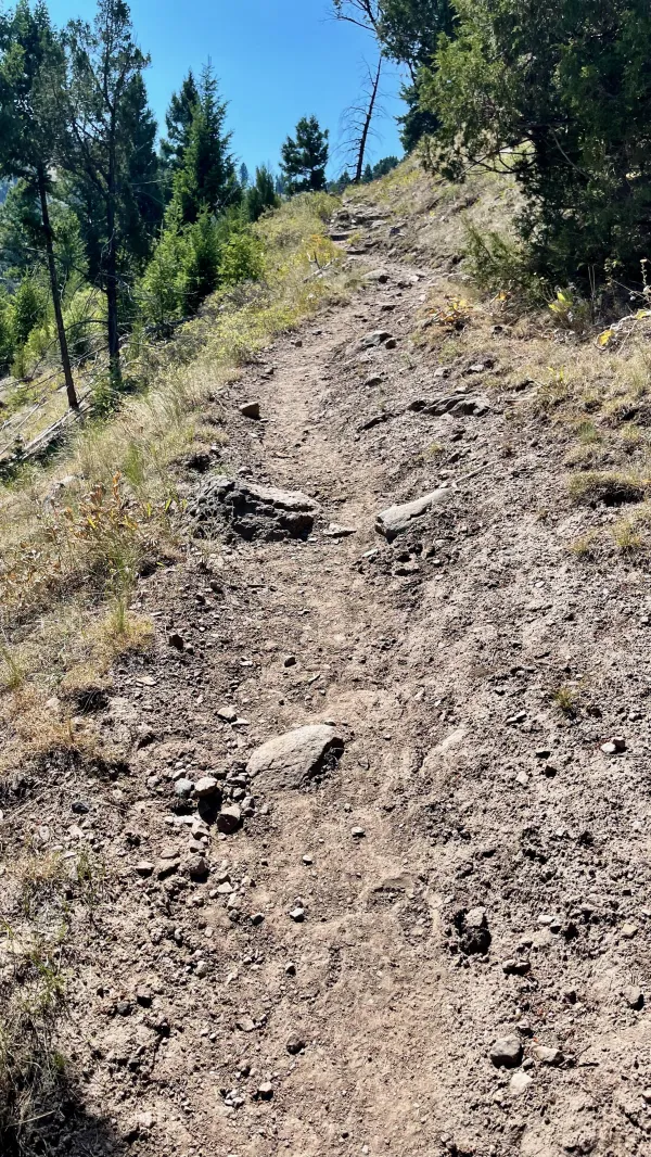
The trail disappears
The trail dropped a short distance to another sagebrush meadow. This one was two miles long. I had already lost track of Top O' again.
Though a trail appeared on the Gaia app, the footpath disappeared under my feet. I attempted to follow what was supposed to be the route, but the ground was so uneven I began to get frustrated.
After stopping to get water from a narrow stream, I gave up trying to walk on the non-existent trail and decided to head toward Grand Loop Road about a quarter-mile away.

Grand Loop Road
I saw on the map that the road would take me in the direction I needed to go. Walking on it was easier than bushwhacking across the meadow and I would eventually get close enough to reconnect with the trail.
Grand Loop Road was the first road planned for Yellowstone in the early years after it became a park. There was no shoulder on the road, so I had to step off the road from time to time when cars came by.

Lava Creek Trail
When I found my way back to the trail, my right foot began to hurt in my heel and ankle. The pain was bad enough that I had to stop and take a couple of ibuprofen. They soon relieved most of the pain, but I never did figure out what caused it.

Lava Creek Valley and a view of Sepulcher Mountain
The last stretch of today's hike was a descent into a valley where Lava Creek flowed. Before starting down, I could see nearly the entire length of the valley, and could almost make out where Mammoth Hot Springs was located at the confluence of the creek and Gardner River. Sepulcher Mountain (9,646 feet) rose high above at the other end. Behind it was Electric Peak (10,969 feet).
I didn't have to go far to reach our campsite on the creek. I arrived there at 5 p.m., which was about an hour later than I had anticipated. It was a lovely, small, and shaded place to camp. We were the only hikers there.
The campsite was in sight of communication towers located above Mammoth Hot Springs, so we had the rare luxury of cell service. I called my wife, and later I touched base with my friend Polecat (Ralph).
Polecat has hiked sections of the AT and PCT with me, and he is now on his way to join me again. Figuring out the best place to meet was easier this time because Top O' and I are following a schedule set by our camping reservations. I told Polecat to look for us when we reach the west boundary of the park the day after tomorrow.
Drink all day and rock all night
The law come to get you if you don't walk right
Got a letter this morning, baby, and all it read
You better head back to Tennessee Jed
This trail report was published