
Day 9 Beech Gap to Rock Gap
More from this trailIf the horse don't pull, you got to carry the load
"The trail provides" is a phrase frequently uttered by thru-hikers.
It speaks of an uncanny likelihood that, at any particular moment when you are in desperate need of something, your need will be fulfilled. This usually happens in an unexpected way.
Today I learned the truth of that phrase.
I wanted to put in some decent mileage to help me get back what I missed on day 7 when I cut short my day.
There was only one short section of today's route that would be a challenge, the climb up Albert Mountain.
I had hiked most of this section of the trail before, so I knew the trail was flat in several long sections and, other than Albert, the remaining few climbs would be short and easy.

Beech Gap
The morning at Beech Gap started with a bright, clear sky. I got packed up quickly and was on the trail before 9:00.
Bluestem left about the same time, so as we did yesterday we walked together for much of the day.

Brown tunnel
Again we walked through some burned areas. One particularly startling section was where the trail went though a large clump of rhododendron bushes. This would normally be another green tunnel, but instead it was a brown and black, lifeless tunnel.
Bluestem and I walked past a barefooted hiker. He walked very gingerly and slowly. Not surprising, he seemed to be in some pain.

Betty Creek Gap
We stopped briefly at Betty Creek Gap.
The creek is named for Little Betty, a Native American woman who applied for land ownership under a provision of the Treaty of the Cherokee Agency, which was signed in 1817 by Andrew Jackson (12 years before he became president) and Cherokee leaders from five different states. Most Cherokee opposed the agreement.
The treaty granted a square mile of land to every Native American family east of the Mississippi River if they became U.S. citizens and gave up their status in their tribe. Whether it was because land ownership was a foreign idea to Native Americans or because they refused to relinquish their identities as Cherokee, only about 311 Cherokee people applied for land under the treaty.
Few of those who applied actually got some land, and almost all eventually lost what they were given.

Climbing Albert Mountain
From the gap the trail made a mostly gradual ascent until it came to within a couple hundred feet of the summit of Albert Mountain. This is where things got interesting.
Albert stands 5,200 feet in elevation, with a steep, rocky climb when you approach it from the south
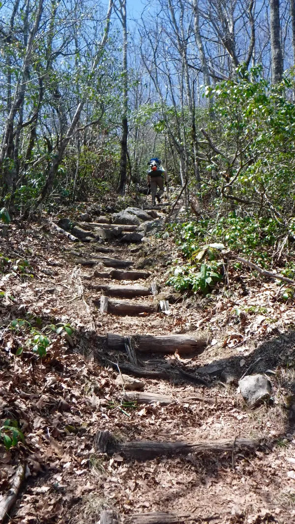
Steps
On the approach there are a couple places where steps are provided, but for the most part the trail simply goes straight up over large rocks.

Rocks near the summit
The mountain is named after Albert Siler, who lived in the area from 1829 to 1904.

View from Albert
A steel fire tower at the top of the mountain provided a broad view of the surrounding mountains and valleys.

Ian, Bluestem, Radio and Leanne
We climbed the tower, but the top level was locked, so we couldn't go to the top.
Pictured here from left to right are Ian, Bluestem, Dave (who today acquired the trail name Radio), and Leanne.

Smoke seen in the distance
From the tower we could see smoke rising from a ridge to the north. We later learned the fire creating this smoke was in the vicinity of the AT, just north of Winding Stair Gap.
Authorities closed the trail in that section, but fortunately, it was re-opened by the time we reached it in a couple days.

100 miles
The tower acts as a milestone to mark the first 100 miles of my hike from Springer Mountain. The actual spot of the 100 miles is about three tenths of a mile to the north. Still, it was a good place to celebrate this accomplishment.

With Uncle Puck
While here, Pat McMenamin, known for a while as El Fuego and now as Uncle Puck, and I took a photo together. Pat is blogging about his hike at https://trekwithpat.com.

Taking a break at Albert
After taking in the views we ate a snack before heading to our intended destination for the night.
Leaving Albert Mountain, I had planned to go 5.7 more miles to Rock Gap Shelter. This shelter is near a pickup point for hikers going into Franklin, N.C. Getting there today would allow for an easy early exit from the trail tomorrow.
Almost right away, though, I started to feel a sharp pain in my left kneecap. The pain didn’t come with every step, but over the next two miles of walking it seemed to get worse.
Before long, I was certain my knee was telling me it needed me to stop at Long Branch Shelter, rather than continue on to Rock Gap Shelter.
I was willing to agree with my knee’s decision.
When I reached the side trail leading to the shelter I saw there was a stream. Not wanting to hobble back to this point later to collect water, I decided to stop here now before going to the shelter.
As I started to unpack my water filter Radio came by. He had gone on to the shelter to check it out.
Radio said the camping spots around the shelter were all taken, but there was still some room in the shelter.
I’m not a fan of sleeping in shelters, so now I had a dilemma: stay here in this shelter, or continue hiking on my knee that had already decided enough hiking had been done for the day.
I knew it would not appreciate going 3.4 more miles to Rock Gap Shelter.
Just as I stood at the stream trying to decide what to do, Leanne came by. When I told her about my dilemma, she had an immediate solution. She asked if I would like to borrow her knee brace. It seemed to be worth a try.
Leanne left to get the brace, and when she returned she also brought me some Icy Hot cream and Ibuprofen.
In just a few moments I went from slow and painful walking to full stride, brisk hiking toward Rock Gap.
With the added help of a Snickers bar I cruised down the trail. The 3.4 miles flew by without pain.

Glassmine Gap
As I mentioned before, I've hiked this section of the trail a couple times before. One of the locations I was curious about was Glassmine Gap. I wondered where the name came from.
Researching this I discovered the “glass” is actually isinglass, a form of the mineral mica, which was once mined in this area.
Isinglass is thin transparent sheets of mica. It was valued because of its resistance to extreme temperatures. It could be used wherever heat would likely shatter glass, such as lanterns and boilers.

Hiking to Rock Gap Shelter
From Glassmine Gap the trail continued to descend to Rock Gap Shelter.
Thanks to Leanne's offer of help, I reached my preferred destination with ease. Now I was ready for a nero (near-zero miles hiking day) tomorrow in Franklin.
I spent a little time on the mountain
Spent a little time on the hill
I saw things getting out of hand
I guess they always will
Now, I don't know but I've been told
If the horse don't pull, you got to carry the load
I don't know whose back's that strong
Maybe find out before too long
One way or another
One way or another
One way or another
This darkness got to give
This trail report was published