
Day 70 Pinefield Hut to South River Fire Road
More from this trailBe careful what you ask for
I complained about the weather yesterday. It has been hotter each day.
Today was as if the weather gods heard me and decided to answer, “Not happy with that? Then how about this?!"
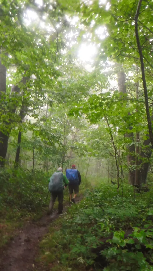
The day began the same way yesterday ended, warm and humid. The brief rain shower that passed through while we were stopped at Loft Mountain Wayside left behind more humidity.
That was especially noticeable this morning as we left Pinefield Hut at 7:45 a.m.

Skyline Drive at Pinefield Gap
The trail was flat to Pinefield Gap, but because the air was thick with moisture I knew this would be a day of sweating.
It didn’t take long for the character of the trail to change and prove me right. It began making a series of long climbs, each with a greater elevation change than the one before.
The temperature rose with each climb, and soon I was soaked in my own sweat.

900 miles
After about two-and-a-half hours of this I passed another mileage marker. Even though these tick by at regular intervals, there’s no way I will tire of them or take them for granted.

Threatening clouds
At the top of each climb I was able to get a new view of the sky, and with each view the sky looked darker and more menacing.
There were several day hikers and section hikers on the trail today. They were suffering from the heat too, but they didn’t smell as bad as I did.
On the way down from the second climb I stopped, took off my pack and sat on a rock. Ostensibly the purpose of this stop was to eat lunch, but in reality it was to cool down.
On the way up the third climb, which was accurately named Hightop Mountain, I chose to walk past a side trail that led to Hightop Hut and a spring.
I was counting on the accuracy of the Guthooks app. It reported a spring was located on the trail and less than a half mile farther up the mountain.
The app was correct and there was plenty of water there. I filtered two liters of water and drank nearly another liter.
Opie was there, relaxing and trying to cool off. By now, his uncle was heading south.

Rain coming in
I left Opie at the spring and continued on to the top of the mountain. As I was standing at the top, checking out the still-menacing clouds, Stick and Mike arrived. This surprised me, because I thought I was behind them.
They told me they had stopped for water at the hut I passed by.
Before leaving the summit, the clouds were no longer just menacing, they were beginning to drop rain. It hadn’t reached us yet, but seeing this, it was our cue to depart from the summit.

Rain on the trail
We stopped on our hastened descent to put on rain gear. It took a little longer for me to pull mine out and put it on, so Mike and Stick left before I did.
At that moment, the rain stopped being a shower and became a torrent. Lightning flashed repeatedly.
I continued down the trail, which was quickly becoming a swollen stream of gushing water. I put my head down and continued on, splashing with each step.

Stick and Mike in the pouring rain
Then, when I turned a corner, I saw Stick and Mike standing and waiting.
They told me they stopped for me because they thought with the lightning it was safer for us to hang together.
The heavy rain continued for about an hour, then let up just before we reached Swift Run Gap. There were two highways to cross here, U.S. 33 and Skyline Drive.
Stick and Mike on rainy trail
Before long, the rain returned, but this time it wasn’t as heavy and only lasted about 30 minutes.

Mike and Stick at the South River Picnic Area
When we reached South River Picnic Area at about 5 p.m. we decided to stop and cook dinner. The air had turned chilly after the storm had passed through, so we kept our rain jackets on.
The picnic tables, running water and rest room made this a good place to stop.
A hiker named Orphan Andy arrived later and joined us for dinner.
Although it’s permissible to camp nearly everywhere along the trail, tents are not allowed in picnic areas, so after dinner we had to move on.
According to the Guthook app, a fire road about a half-mile away had a spot for two tents. Stick and I had tents, and Mike had a large tarp, so we weren’t sure we’d find enough room, but decided to head for the fire road anyway.

Tents pitched on the fire road
Calling it a road was a bit of a stretch. It was a narrow, rocky path just wide enough for a jeep. Pitching our tents on the road wasn't much of an option because the ground was packed firm and rocky.
Except for one spot, there was no clearing on either side of the road, but we were able to make do with the space we had.
We hung our bear bags from a tree farther down the road.
From humid heat to chilly rain, we experienced enough weather to make today a more challenging day than expected.
On balance, though, it was a good day. That’s all I want each day to be.
No guess who's around
Be careful what you ask for
This isn't what I ask for
Be careful what you ask for
This isn't what I wanted to see
Be careful what you ask for
This isn't what I asked for
Be careful what you ask for
This trail report was published