
Day 29 Curley Maple Gap Shelter to Cherry Gap Shelter
More from this trailI see you got your list out, say your piece and get out
At the end of my sixth day on the trail I was given some advice by trail angel Miss Janet.
"Throw away your spreadsheet," she said.
She thought I was too focused on miles. My drive to stick to a schedule, she feared, would burn me out or wear me down.
It was wise advice and I tried to follow it.
For a few days.
It's not like I haven't tried to go easy, but I still have places to be and a limited time to get there.
My goal now is to get to Damascus, Va., or preferably beyond that to Partnership Shelter, by the Friday of Trail Days weekend. My wife Kim and I have made plans for her to meet me so that we can attend Trail Days together.
That kind of goal can't be met without putting in sufficient miles each day. So now I remain focused on my schedule, kept in a spreadsheet.
That's not been a problem so far. I'm not worn out. The miles are coming without much difficulty and I don't feel I've been pushing too hard.
So I've decided I will stop feeling guilty about my spreadsheet and my intention to stick with a schedule.
A steady rain fell overnight, and though it ended around dawn, the weather made for a cold and wet morning. That gave me a good excuse to pack up slowly and take my time to get back on the trail.
Before I left I chatted with a L.A.S.H. hiker who goes by the name Zen I Am.
A hiker who doesn't intend to hike the whole trail at once, but hopes to eventually hike all of the trail, is called a section hiker. A section hiker who hikes long sections at a time is sometimes called a L.A.S.H. hiker, as in Long Ass Section Hike.
Zen I Am said she was a Lazy Ass Section Hiker. She likes to make frequent stops and just enjoy the moment.

Cabin foundation
Leaving the shelter I soon passed what is said to be the foundation of an old house. If that was the remnant of a house, it was very tiny. It may have been from a fire warden cabin, rather than a proper house.

Gray day
Though no more rain fell, it was a damp and gray day. It might just as well be a rainy day. For much of the morning, at least, trees continued to drip water.

LASH hiker
As I crossed a stream I met up again with Zen I Am. She decided to stop here to enjoy the view and sounds of the running water.
After I departed I thought about her point of view, about how she took time to absorb her surroundings. It seemed admirable, but it wasn't for me. Yes, it's true I'm not taking as much time as she is to sit and reflect. All the same, I remain aware of my surroundings, and appreciate what I see, hear and smell.

Rhododendron blossom
I was especially mindful this morning of rhododendron, which were blooming in greater frequency. The rain seemed to heighten the brilliant magenta color of the blossoms.

Indian Grave Gap
The trail was making a slow and steady climb, and after almost four miles it crossed Indian Grave Gap. From here the ascent became a bit more steep as it headed to Beauty Spot.
At the highway a gravel forest road branched off on its own path to the top of the mountain. The trail ran parallel to the road for much of the distance and crossed it a couple times.
The road makes this area popular for day hiking. Even today, a weekday with lousy weather, I passed a couple day hikers.

Approaching Beaty Spot
Beauty Spot was a large, open and grassy mountain, but was ringed by trees. As the trail continued to climb, I expected and kept looking for a view. It took a while before I reached the top and found an opening in the trees.

Skittles
Skittles and Jeff caught up with me near the top of the mountain.

View from Beauty Spot
Because of the gray weather the view was not spectacular. It was clear enough, though, to see distant mountains. I stopped to enjoy the view. Perhaps I didn't stay as long as Zen I Am might, but I took time nonetheless.

Continuing over Beauty Spot
Continuing on from the summit, the trail remained in the open field for a long way.
Near here I met Van Man, who was hiking southbound. He tried to explain he was hiking with his son, Darren, who was hiking northbound. I didn't quite understand his explanation of how that worked.

Climbing Unaka Mountain
A mile-and-a-half beyond Beauty Spot the character of the trail began to make a dramatic shift. It was not only climbing more steeply, there were fewer deciduous trees and many more fir and spruce trees.

Unaka Mountain
After a climb of nearly 1,100 feet in 1.7 miles the trail reached the top of Unaka Mountain. At 5,180 feet above sea level, it was the highest peak the trail crossed since the Smokies.
Walking in the misty forest of red spruce trees and carpet of moss I kept expecting to see either Little Red Riding Hood or the Big Bad Wolf.

Descending Unaka Mountain
After the trail crested the top the weather finally began to improve. There was no longer a thick blanket of clouds in the sky, and with a brighter sky came warmer temperatures.
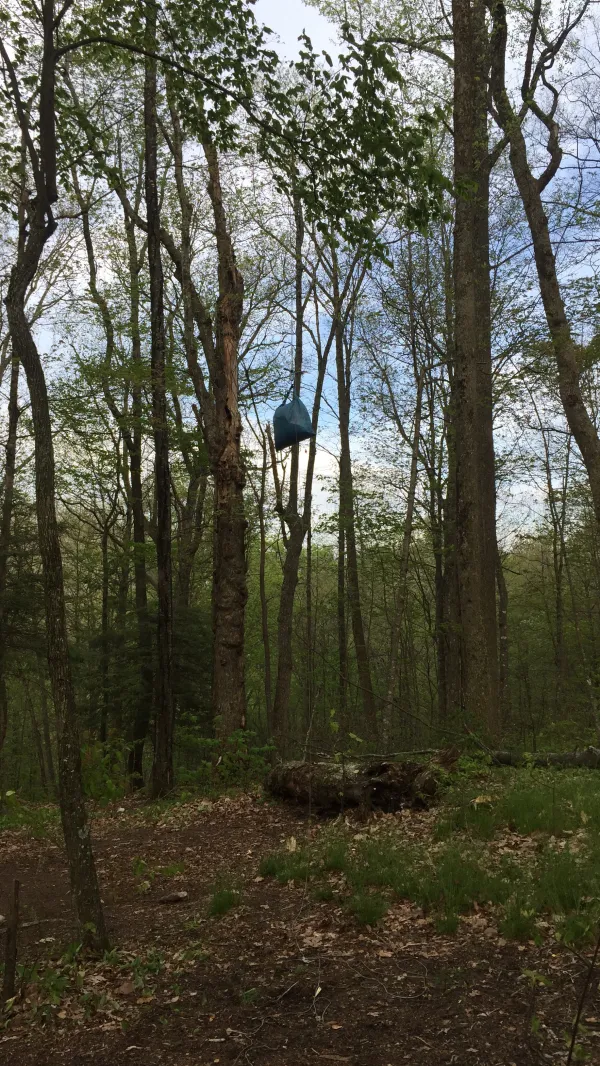
Bear bag at Cherry Gap Shelter
By the time I reached Cherry Gap Shelter the weather was much more pleasant. The area near the shelter was flat and spacious, so I found a spot to pitch my tent well away from the shelter. As was the case at the last couple shelters, bear cables were not provided here to hang food, so I had to throw a rope over a branch for my bear bag.
Camped in the shelter or nearby in tents tonight were Hobbes, Silvertoes, Skittles and Jeff, and two hikers I had not met before, Turtle and Twisted.
I see you got your list out
Say your piece and get out
Yes I got the gist of it
But it's alright
Sorry that you feel that way
The only thing there is to say
Every silver lining's got a
Touch of grey
I will get by
I will get by
I will get by
I will survive
This trail report was published