
Day 121 Sherman Brook Campsite to Bennington
More from this trailIt's been a long time coming; it's going to be a long time gone
When I started this hike more than four months ago, I hoped to complete it in five months. I knew a more realistic timeframe would be at least five-and-a-half months.
If I stay on my current pace, I can meet that goal. Yet this is the big question. Can I keep the same pace?
Only three states remain, but the trail covers many rugged miles in each. For Vermont, the state I entered today, the trail is 150 miles long. New Hampshire has about 161 trail miles, and more than 280 miles of the AT are in Maine.
Many hikers say these miles are more difficult than all of the miles to the south. That’s especially true for the White Mountains New Hampshire. The southern part of Maine is also extremely rugged. The trail in those two states is so difficult, nearly all hikers decrease their average miles per day.
To be sure, I still have a long way to go before I know if I'm able to stay at the same hiking pace.

Duct tape repair of pack
Before leaving our campsite this morning, I spent some time trying again to repair my pack. The bottle caps I added several days ago in New York, which were intended to keep the frame from poking through webbing that held the pack in shape, were not holding in place. I tried adding some duct tape, hoping that would keep the bottle caps from slipping.
I began to fear my relationship with this pack was not going to end well.
I also noticed my water filter was not working as well. It was taking longer to filter a liter, though this wasn't unexpected. All filters eventually clog, even when they are regularly flushed with clean water. Mine wasn’t slow enough yet to be a serious problem, but I decided begin to look for a replacement when I was in town.
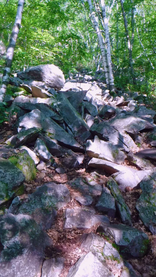
Rocky climb up East Mountain
When I finally left camp, the trail continued the climb up East Mountain that I began yesterday. It was often rocky and steep.

Entering Vermont and the Long Trail
Near the highest point in the ascent, the trail crossed the state line into Vermont. This spot was also where the 272-mile Long Trail began. It runs north to the Canadian border and shares the same footpath as the AT for the next 100 miles.
The Long Trail is the oldest long-distance foottrail in the U.S. and was the inspiration for Benton MacKaye when he conceived the Appalachian Trail.
While I was stopped at the state line, I received a message from Felix. He said his plan to meet me in Manchester Center was not going to work, but he would continue to figure out a time and place to meet me.
In the meantime, Stick and I cemented our plan to take a zero day in Bennington. Earlier, we considered stopping a few miles short today and then go into town tomorrow. Instead, we decided to hike the few extra miles that will put us in town today.

Vermud
The footpath continued the AT's ups and downs, but now with a new feature: Vermont’s famous mud. The state is known to hikers as "Vermud," and now I was seeing why.
Vermont can get so muddy, it even has a mud season. In March, April and often into May, the ground frequently freezes and thaws. The soil a few inches below the surface usually remains frozen when the upper part thaws. Whenever rain falls during this time, the water is trapped on the surface by the frozen layer and cannot seep deeper into the soil.
The result is a thick layer of goo, and that's a mess for hikers to battle until the ground sufficiently thaws and dries out. In some shady and low-lying areas, the mud never dries.
To be fair, Vermont isn't the only place with a mud season. It can be a problem at any high elevation. Unfortunately for AT hikers, it happens where the trail goes.
Still, I was here in August, and it seem like I was walking on an extraordinary amount of mud.

View of Bennington from Harmon Hill
After many ups and downs over the next 12.5 miles, I arrived at Harmon Hill. Stick and I agreed to stop there because we were told it was a good place for cell reception. We wanted to call for a ride into Bennington, and that's why we agreed to meet here.
When I arrived, Stick said he hadn't been waiting long. We called the Catamount Motel and arranged for a pickup at Vermont Route 9, about two miles away.
Harmon Hill provided a limited, hazy view of Bennington. Parts of the descent to the highway were extremely steep and treacherous, and it was nearly dark when we reached the highway. Still we made it in plenty of time to be picked up at our scheduled time.
Homeward Bound was already at the motel when we arrived. He agreed to share his room with us, and even said he wanted to pay for it.
Stick and I protested for a moment until we remembered it was okay to accept kindnesses when it was offered on the trail.
Later, we paid for the pizza and salads that we had delivered to the motel.
It's been a long time coming
It's going to be a long time gone
And it appears to be a long
Appears to be a long
Appears to be a long time
It's a long, long, long, long time
Before the dawn
This trail report was published