
Shakedown Day 5, Woods Hole to Whitley Gap
More from this trailI went down to those dusty streets, blood was on my mind
It wasn't 4 a.m. when we left camp today, but it was early enough. We hit the trail shortly after 7 a.m.
We left early because we wanted to allow plenty of time to make the long climb over Blood Mountain, with a goal of reaching Neel Gap by 11:00.
Blood Mountain is the highest point on the Georgia portion of the Appalachian Trail. It has a reputation for being a monster that chews up and spits out thru-hikers.
It's said that 25 percent of northbound thru-hikers to quit once they reach Neel Gap on the other side, and if that's true this mountain is surely responsible for many of those ended hikes.

Going up Blood Mountain
But the mountain didn't chew us up. Even the boy who just the morning before was whimpering and unable to walk more than 10 minutes at a time was able to hike straight up the mountain without stopping.
He powered up that mountain like he owned it.

Stone steps
In a few places we were aided in the ascent by steps constructed of stones. This was just one example of the excellent job of maintaining the AT that is done by the Georgia Appalachian Trail Club. Their efforts were appreciated throughout our trip.

Shelter at Blood Mountain
A stone, two-room shelter is located at the top. It's an interesting building, but on this morning with low clouds it seemed like a dank and dreary place to stay.

On Blood Mountain
We hung out at the top for a while, but the low clouds made the view poor.

Leaving Blood Mountain
A day hiker took a group photo for us and then it was time to head down the mountain for our resupply stop at Neel Gap.

Rocky trail
The hike going down the other side of the mountain wasn't bad either, but it was very rocky. I can see how the trip would be treacherous in wet or icy conditions.
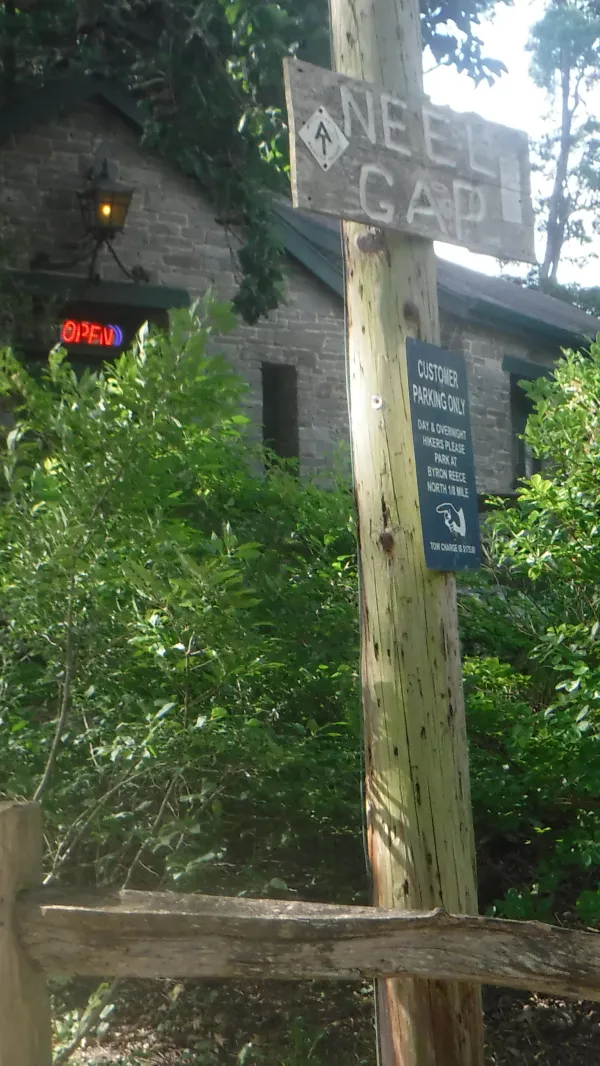
Neel Gap
Mountain Crossings at Walassi-yi, an outdoor gear and hiker resupply store, is located at Neel Gap. We arrived about 90 minutes before Jeff and Cam, two troop leaders who were bringing a lunch and to resupply us for the remainder of the trip.

Mountain Crossings
To wait out the time I wandered the store while charging my phone at an outlet strip provided as a customer service for that purpose.
As I was looking at the hiking shoes and boots, a store employee approached me and offered some tips on selecting shoes. I mentioned to him I was feeling as though my feet were being pounded a bit too hard, which I thought was because of the flexible construction of the sole. He demonstrated how to look for that problem in shoes by pressing his finger into the center of the sole. One shoe he showed had considerable give, while another did not.
He let me try on a pair of Oboz boots, even though I warned first that my socks were sweaty and stinky. Though they were a half size larger than I normally wear the fit was good.
I appreciate the time he spent with me and the information he shared.
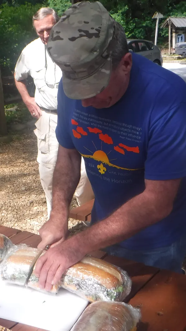
Lunch
Jeff and Cam arrived with giant sub sandwiches and other lunch items. Once we had finished the meal and repacked with our food for the remainder of the hike we hit the trail.

Leaving Neel Gap
Cam and Jeff then joined us for the portion of the trail that climbs out of Neel Gap. After we left them behind we continued a good distance on easy terrain.

Continuing on to Whitley Gap
The rest of day became hot and humid, as one would expect for Georgia in June.
Day hikers warned us water was scarce in this section, and we found that to be true. After Neel Gap we passed four places where the Guthook app indicated was a water source, but all of them were dry. We realized that all of them were above 3500 feet in elevation, and this then posed a problem.
The next best place to camp would be at Whitley Gap Shelter, but getting there required taking an extra 1.2-mile side trail. If we hiked all the way there and found the spring was dry, we would have to then double back to the trail and continue another .2 miles down a steep descent to Hogpen Gap, where we had heard there was a flowing spring.
We elected to take the safer choice, which was to continue on to Hogpen Gap, collect water, and then hike back up the mountain to Whitley Gap. Although the climb back with an extra load of water was not fun, it seemed like the smart thing to do. At least adding .4 miles would would mean we could avoid adding another 2.4 miles to our day.
As it turned out, all of that fuss was unnecessary. The spring at Whitely Gap was flowing nicely.
And then a man rode in to town, some thought he was the law
Billie Jean was waiting when he came
She told me he would take her if I didn't use my gun
And I'd have no one but myself to blame
I went down to those dusty streets, blood was on my mind
I guess that stranger hadn't heard the news
'Cause I shot first and killed him, Lord he didn't even draw
And he made me trade the gallows for the Mexicali blues.
This trail report was published